Skip to content

Next Storm/Next Snow Forecast Discussion from the Cherrywood Observatory – February 12, 2019

This content was originally published by the Longmont Observer and is licensed under a Creative Commons license.

Forecast Discussion:

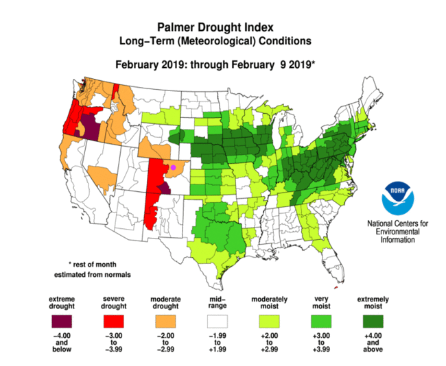
Before we look our drying forecast, let's look at our drying land. Figure 1 is the long term drought analysis. We are now in moderate drought. The Western U.S. has the drier land, but it will be receiving rainfall/snowfall for the next month or more.

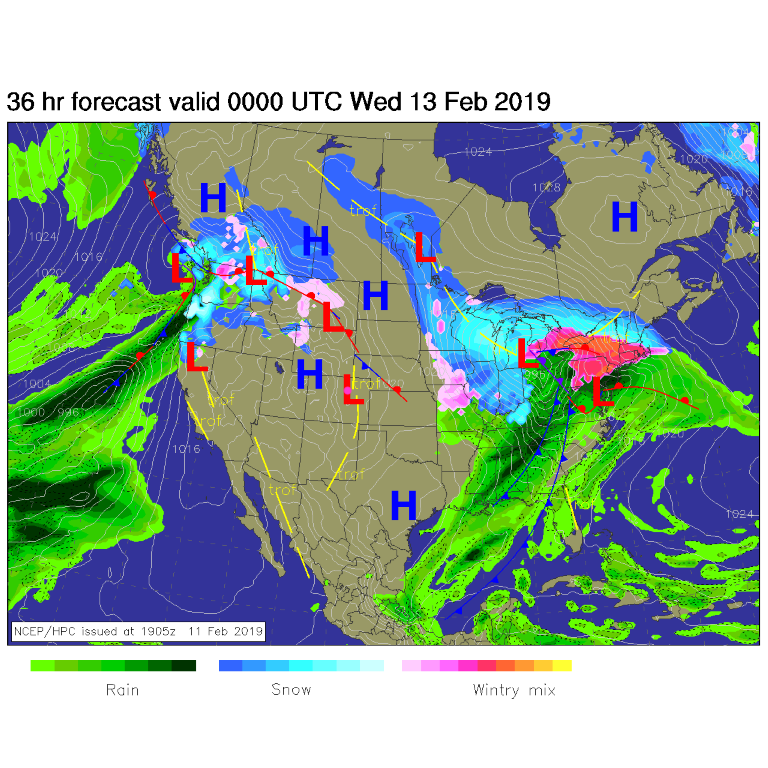
Figure 2 is the surface map for today, and it IS still dry here. And warming up.

The longer range forecast:

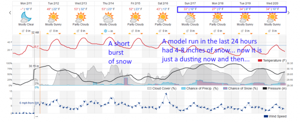
Our next front comes in Thursday PM into Friday AM, but precipitation amounts seem to be in the coating to a dusting level (Figure 3).

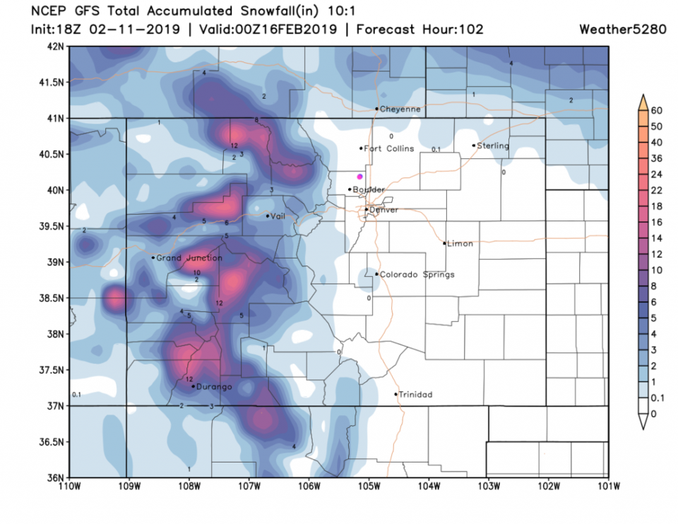
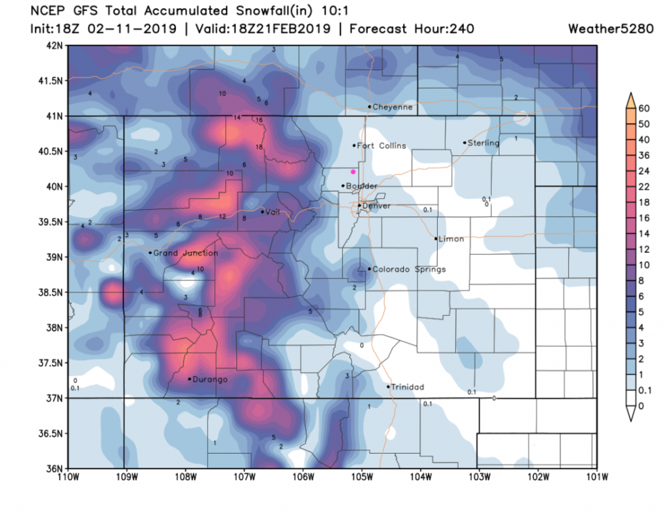
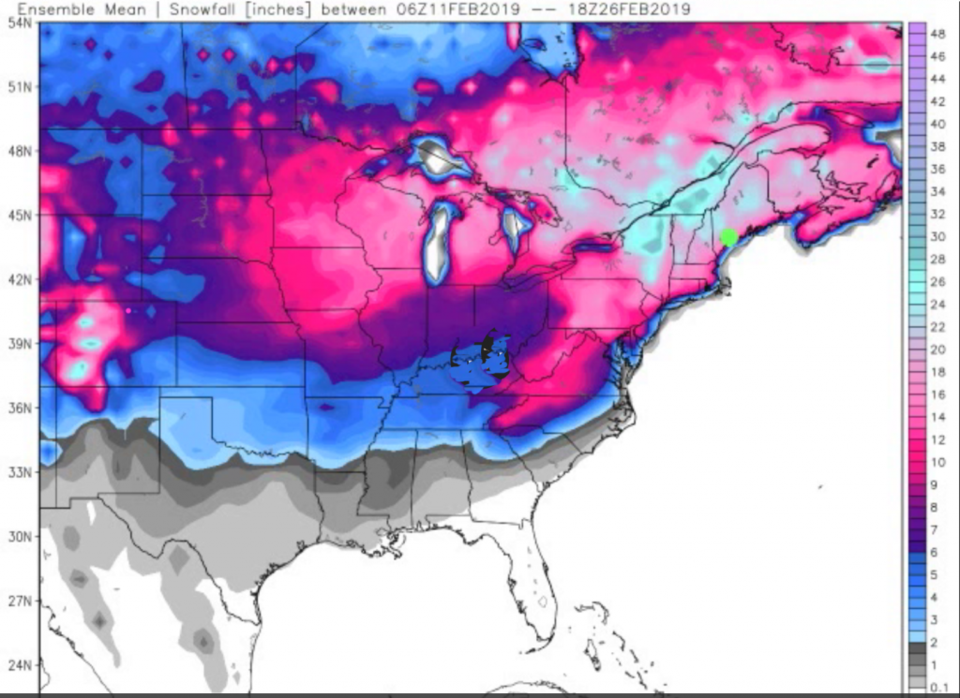
The GFS in Figure 4 doesn't give Longmont measurable snow through Friday PM. Earlier today, this model gave us 6-8 inches of snow through the next 10 days, but the 10 day forecast in Figure 5 is now under 1 inch. Similarly, the long range for the snow after the weekend on Figure 3 was in the 4-8 inch region, now it is small amounts of daily snow for a while. Obviously, the models don't have this system figured out yet.

The longer range European hints at 8-9 inches falling here by the end of the month, but we'll take that one storm at a time.

Figure 1: The Palmer long-term drought conditions from NOAA.
Figure 2: The forecast surface map for Tuesday PM. From NCEP.
Figure 3: the graphical forecast for the next 10 days for Longmont, CO from weatherunderground.com
Figure 4: the forecast accumulated snow map from the GFS and weather5280.com for Colorado, through Friday PM.
Figure 5: the forecast accumulated snow map from the GFS and weather5280.com for Colorado, through the next 10 days.
Figure 6: The European model snowfall accumulation through the end of February from weatherbell.com

Current Weather

Mostly sunny

Mostly sunny

76°F

UV Index
8 Very High
Pressure
29.75 Falling
Visibility
9 miles
Dewpoint
26 °F
Humidity
16%
Wind
WSW 5.8 mph
Gust
15.7 mph
Wind Chill
76 °F

Hourly Forecast

Today
3 PM
74°F
Mostly cloudy
Today
4 PM
70°F
Partly sunny
Today
5 PM
65°F
Partly sunny
Today
6 PM
60°F
Partly sunny
Today
7 PM
55°F
Partly sunny
Today
8 PM
52°F
Partly cloudy
Today
9 PM
49°F
Partly cloudy
Today
10 PM
47°F
Partly cloudy
Today
11 PM
44°F
Partly cloudy
Tomorrow
12 AM
43°F
Partly cloudy
Tomorrow
1 AM
42°F
Partly cloudy
Tomorrow
2 AM
41°F
Partly cloudy w/ showers

7 Day Forecast

Partly sunny w/ showers

Friday

76 °F

Partial sunshine; breezy with a shower this afternoon


Partly cloudy w/ showers

Friday Night

37 °F

Partly cloudy with a couple of showers late


Partly sunny

Saturday

66 °F

Sun and some clouds


Mostly clear

Saturday Night

40 °F

Clear to partly cloudy


Mostly cloudy

Sunday

76 °F

Mostly cloudy and warmer; breezy in the afternoon


Mostly cloudy

Sunday Night

51 °F

Rather cloudy; windy late


Windy

Monday

60 °F

Winds gusting past 40 mph; cloudy and cooler


Intermittent clouds

Monday Night

43 °F

Breezy in the evening; otherwise, partly cloudy


Intermittent clouds

Tuesday

62 °F

Times of clouds and sun; windy in the afternoon


Intermittent clouds

Tuesday Night

36 °F

Clearing


Sunrise and Sunset

Sunrise
5:57 AM
Sunset
7:58 PM

Based on AccuWeather data