This content was originally published by the Longmont Observer and is licensed under a Creative Commons license.
In Brief:
With hit after hit of snow past us now, we have a quiet and warm (overall) weekend ahead of us. Our next stormy period runs from Monday morning to Wednesday morning when we may pick up an couple inches or a bit more of snow. Then we return to quiet conditions again beyond that!
Update 2/16 9pm:
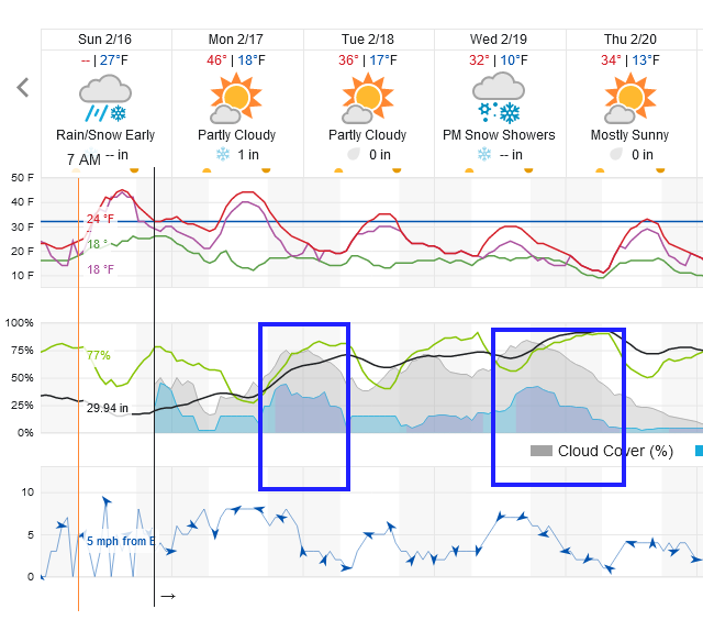
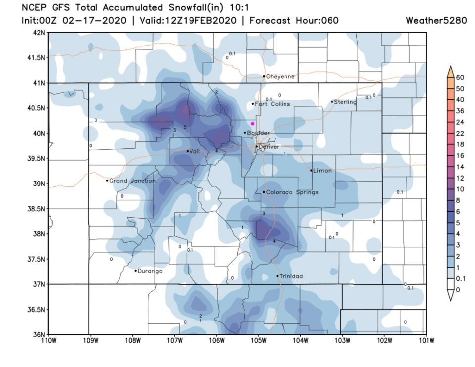
The chilly weather returns as does more moisture. This doesn't look like a LOT of snow coming, but some rain showers early Monday will change to snow later on. Accumulations of 1-2 inches is most likely in town with a possible 2-3 inches nearby to the west. Things will remain unsettled Monday morning through late Wednesday night. There are a couple of better snow chances in the blue box time frames in Figure 2 update. The GFS still gives us only a coating to 1 inch across town (Figure 3 update). More to come tomorrow!
End update 2/16 9pm.
Update 2/15 5pm:
We are still on track for temperatures around 50F for Sunday and 2-3 inches of snow for Monday/Tuesday. I'm posting the weekend video forecast discussion in Figure 1 update.
End update 2/15 5pm.
Forecast Discussion:
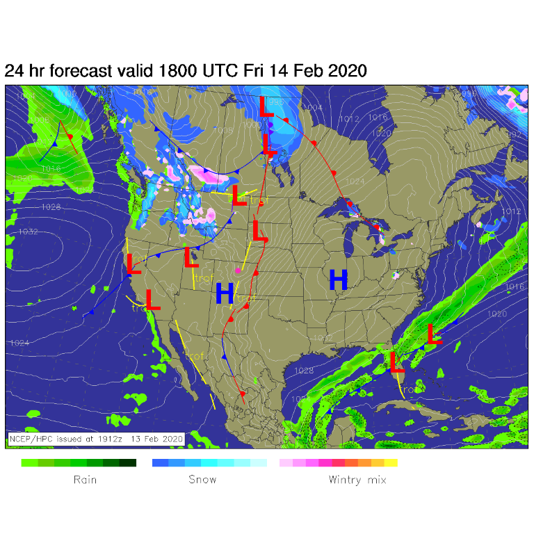
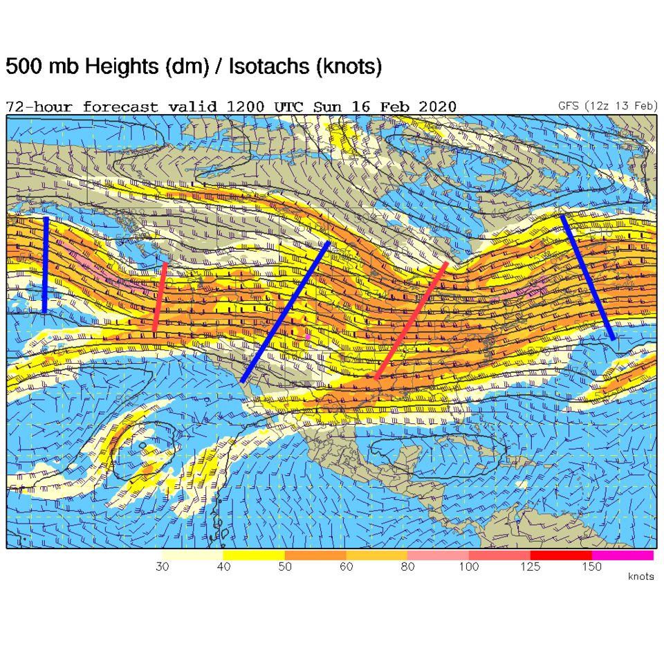
A warm front drifts past us on Friday taking us back to the 50'sF (Figure 1). Watch out for falling icicles. This warm up is brought on by more westerly air flow across the state giving us some down slope warming. There are shallow ridges (and a trough for Saturday) that will also help with the warming (Figure 2).
Oh, and Happy Valentines Day! (I almost forgot!)
The Longer Range Forecast:
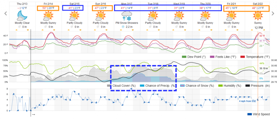
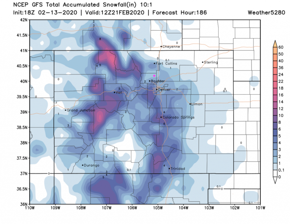
Our next storm doesn't roll in until very early Monday (Figure 3). Hurray, another potentially icy Monday commute. Right now it looks like 2-3 inches spread out over 2 1/2 days. Temperatures will be above normal Friday and Sunday and below normal Saturday then Monday through Thursday (blue and orange boxes). The GFS (Figure 4) gives us about 1-2 inches from this storm, but SW Denver and the foothills down I-25 to the south may see up to 10 inches in places. The mountains- again- get another foot or more in spots.
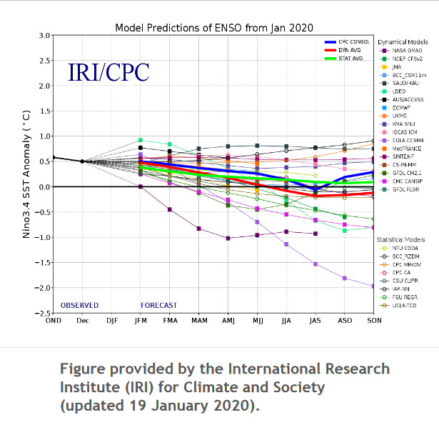
Just for fun, I thought we'd check in on the state of El Nino (or ENSO - El Nino Southern Oscillation - Figure 5). The ENSO index is trending towards neutral right now. The southern Pacific isn't perturbing our weather currently.