Skip to content

Next Storm/Next Snow Forecast Discussion from the Cherrywood Observatory – February 14, 2019

This content was originally published by the Longmont Observer and is licensed under a Creative Commons license.

Forecast Discussion:

Happy Valentines Day everyone!

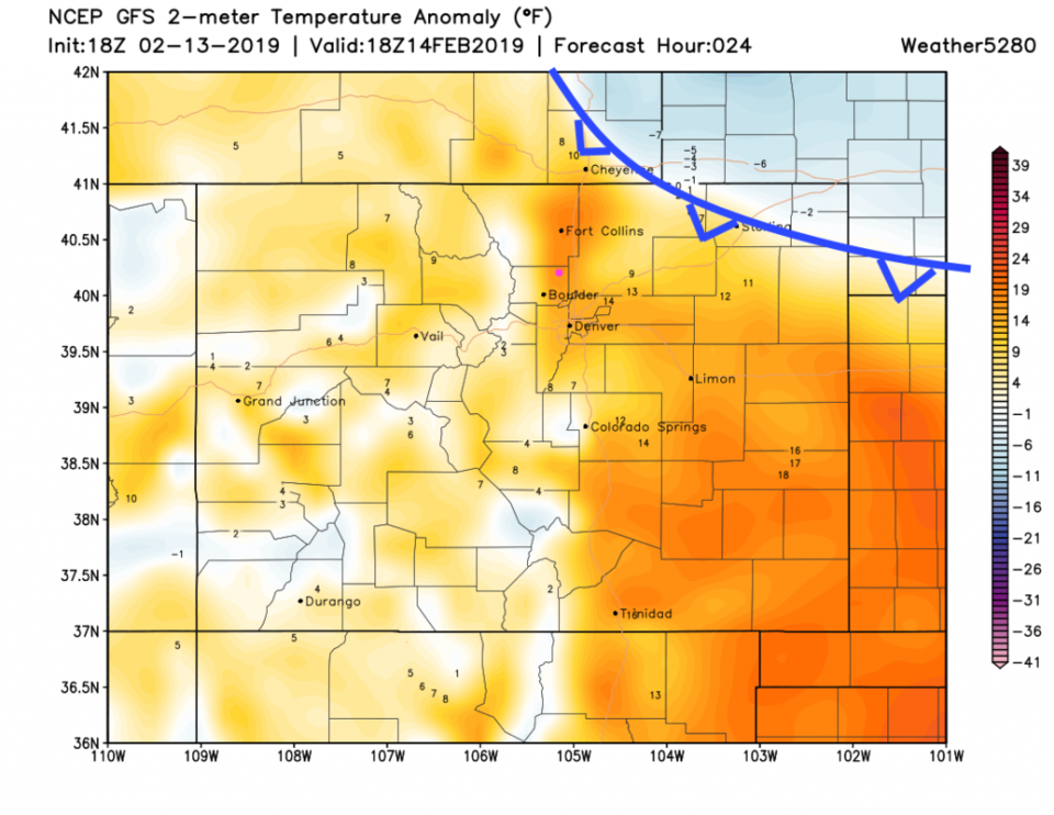
We warm to mid 50'sF again today with some more down slope winds and compression ahead of a weak cold front slipping in from the northeast (Figure 1). This front will make it back to the lower foothills tonight before pulling away tomorrow.

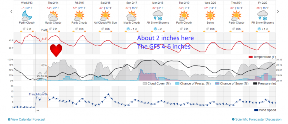
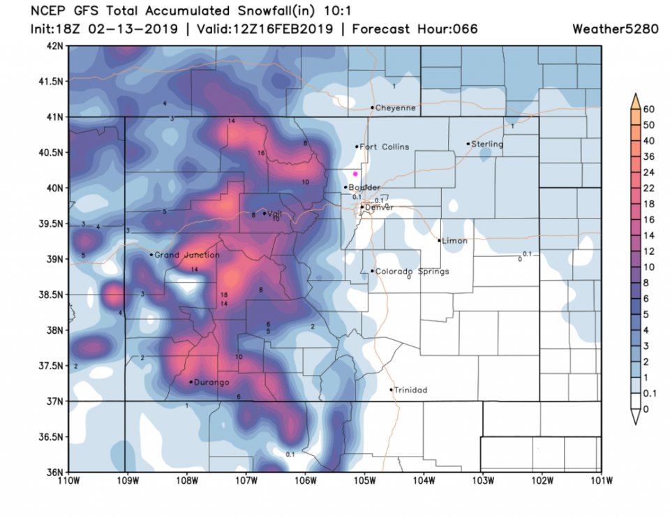
With this front, we'll see clouds increase and a chance of showers (snow) this evening (Figure 2). The snowfall through Saturday noon is minimal here in town, but quite impressive in the nearby mountains (1.5 feet in many places - Figure 3).

The Valentines Night forecast:  Breezy, with snow flurries possible. temperatures just above freezing at dinnertime and dropping to freezing before midnight. Cloudy skies (not much of a romantic moon out, but it will be up just past 1st quarter). 

The longer range forecast:

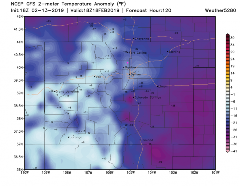
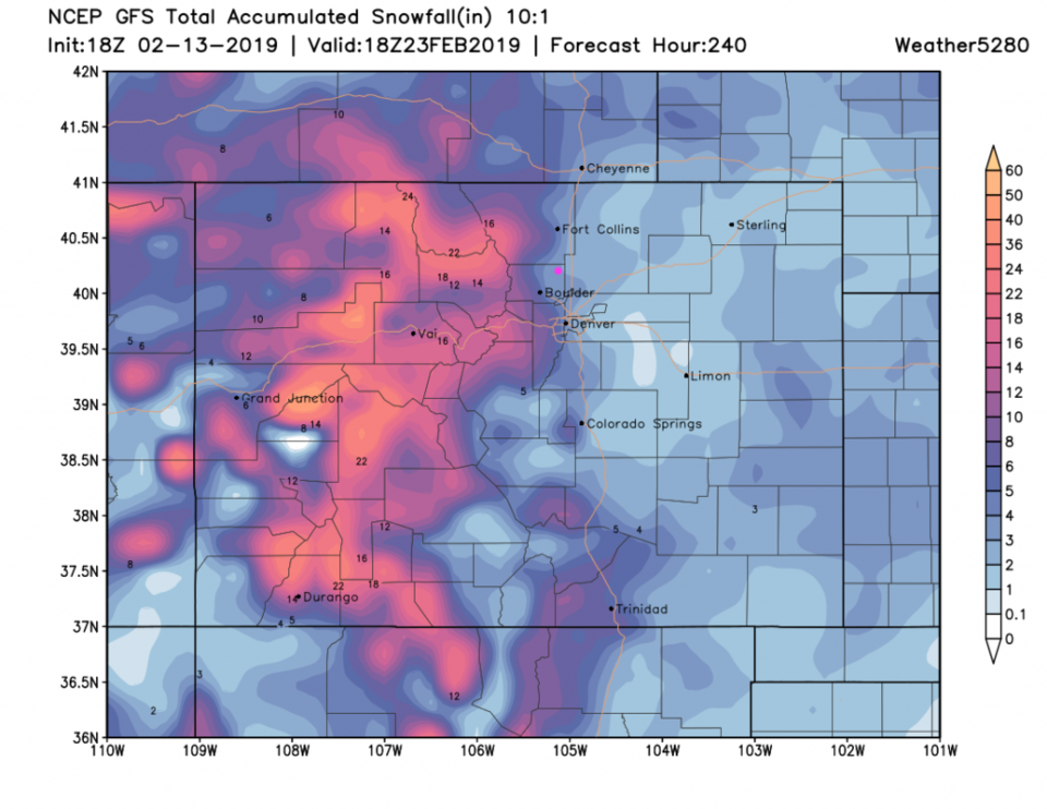
We return to the 50'sF on Friday but a much stronger series of cold fronts begin to hit Saturday PM. By Monday morning we are cold enough to stay below freezing all day and are about 15F below normal (Figure 4). Amazingly cold air is sitting out just east of us. The 10 day snowfall is now sitting at 3-4 inches from the GFS (Figure 5).

Figure 1: The forecast temperature departure from normal map from the GFS and weather5280.com for Colorado, Thursday noon.
Figure 2: the graphical forecast for the next 10 days for Longmont, CO from weatherunderground.com
Figure 3: the forecast accumulated snow map from the GFS and weather5280.com for Colorado, through Saturday noon.
Figure 4: The forecast temperature departure from normal map from the GFS and weather5280.com for Colorado, Monday noon.
Figure 5: the forecast accumulated snow map from the GFS and weather5280.com for Colorado, through the next 10 days.

Current Weather

Mostly cloudy

Mostly cloudy

50°F

UV Index
0 Low
Pressure
29.57 Steady
Visibility
8 miles
Dewpoint
24 °F
Humidity
37%
Wind
W 5.5 mph
Gust
14.4 mph
Wind Chill
48 °F

Hourly Forecast

Today
9 PM
51°F
Showers
Today
10 PM
49°F
Intermittent clouds
Today
11 PM
49°F
Partly cloudy
Tomorrow
12 AM
48°F
Mostly clear
Tomorrow
1 AM
47°F
Mostly clear
Tomorrow
2 AM
46°F
Mostly clear
Tomorrow
3 AM
44°F
Mostly clear
Tomorrow
4 AM
43°F
Partly cloudy
Tomorrow
5 AM
43°F
Intermittent clouds
Tomorrow
6 AM
42°F
Mostly cloudy
Tomorrow
7 AM
44°F
Cloudy
Tomorrow
8 AM
48°F
Mostly cloudy w/ showers

7 Day Forecast

Showers

Monday

57 °F

A few showers this morning; otherwise, mostly cloudy, breezy and cooler


Intermittent clouds

Monday Night

42 °F

An evening shower in spots; otherwise, partly cloudy and breezy


Partly sunny w/ showers

Tuesday

60 °F

A couple of showers in the morning; otherwise, windy with times of clouds and sun


Partly cloudy

Tuesday Night

33 °F

Partly cloudy


Intermittent clouds

Wednesday

58 °F

Cool with times of clouds and sun


Mostly cloudy

Wednesday Night

35 °F

Increasing clouds


Partly sunny w/ showers

Thursday

56 °F

Times of clouds and sun with a couple of showers; cool


Cloudy

Thursday Night

43 °F

Cloudy


Mostly cloudy

Friday

62 °F

Mostly cloudy and warmer


Mostly clear

Friday Night

40 °F

Mainly clear


Sunrise and Sunset

Sunrise
5:53 AM
Sunset
8:01 PM

Based on AccuWeather data