Skip to content

Next Storm/Next Snow Forecast Discussion from the Cherrywood Observatory – February 15, 2019

This content was originally published by the Longmont Observer and is licensed under a Creative Commons license.

Forecast Discussion:

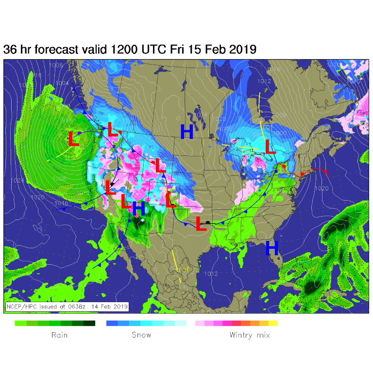
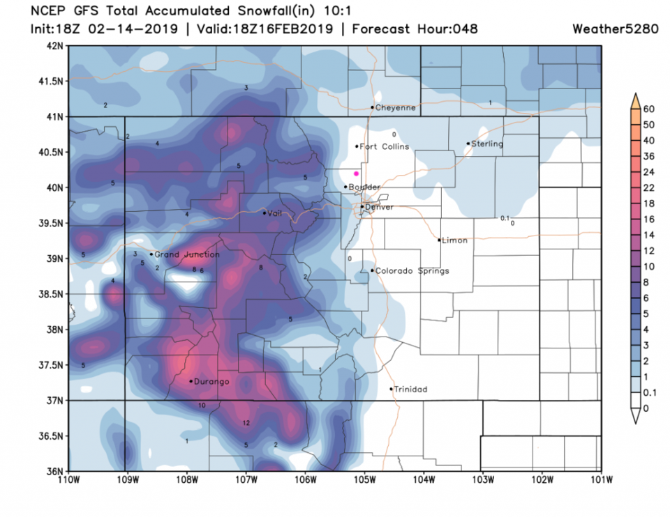
The 'storm' is underway this Valentine's evening (the temperatures dropped 20 degrees F between late morning and 7 pm). The weather map for Friday am is very bullish on precipitation covering all of the state (Figure 1). When we get into the finer details, it really looks like not much happens here in town (the mountains get BURIED though).

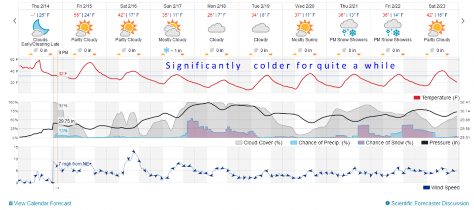
The chance of rain/snow is, at best, 20% through Friday am (Figure 2). We still climb to the 50's F Friday.

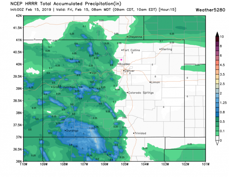
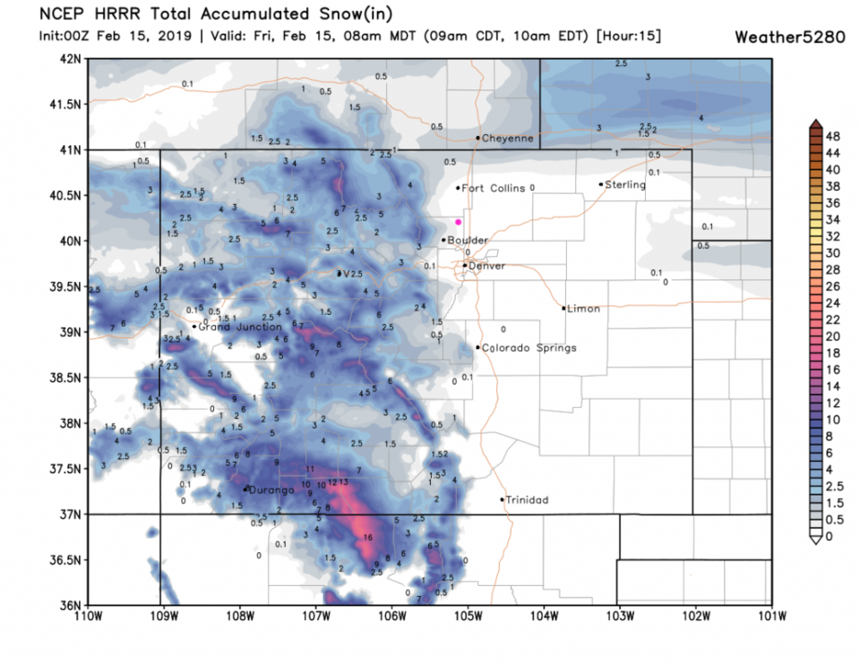
The HRRR model, only through 8 am Friday, shows water of some kind (measurable liquid equivalent) coming down to just west of Longmont (Figure 3) and no further. The very light snow dusting seems to make it to Main Street (Figure 4). The show, from the GFS, through Saturday also skips Longmont (Figure 5).

The longer range forecast:

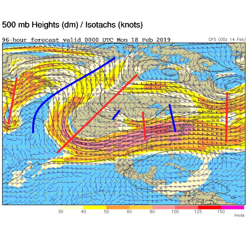
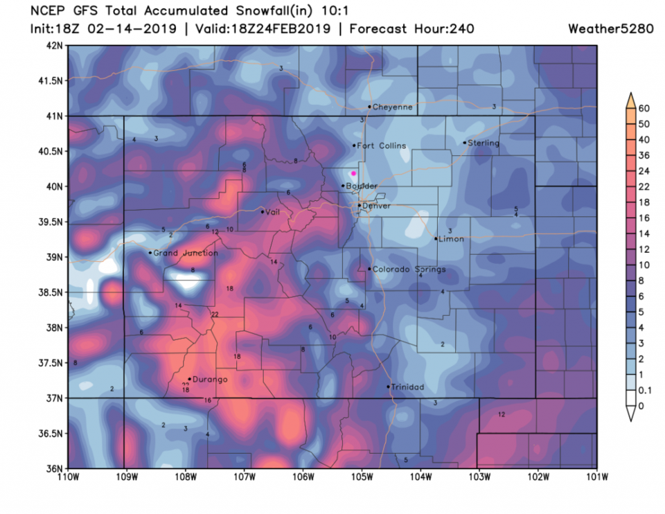
By Sunday, a big trough moves in and sits over the western U.S. (red line to our west in Figure 6). Starting Sunday, with this upper-air pattern in place, we cool to highs in the 30's F for the foreseeable future. There seems to be a snow storm at the start of the week, but we will be lucky to get an inch or two at this point. The GFS for the next 10 days (Figure 7) puts Longmont in a down-slope-flow-snow-hole with just an inch or so.

Figure 1: The forecast surface map for Friday AM. From NCEP.
Figure 2: the graphical forecast for the next 10 days for Longmont, CO from weatherunderground.com
Figure 3: the forecast accumulated precipitation map from the HRRR and weather5280.com for Colorado, through Friday 8am.
Figure 4: the forecast accumulated snow map from the HRRR and weather5280.com for Colorado, through Friday 8am.
Figure 5: the forecast accumulated snow map from the GFS and weather5280.com for Colorado, through Saturday noon.
Figure 6: The 500mb forecast upper air analysis for Sunday PM. Pink dot is Longmont. Red lines are troughs, blue lines are ridges.
Figure 7: the forecast accumulated snow map from the GFS and weather5280.com for Colorado, for the next 10 days.

Current Weather

Mostly cloudy

Mostly cloudy

59°F

UV Index
4 Moderate
Pressure
29.79 Rising
Visibility
7 miles
Dewpoint
19 °F
Humidity
21%
Wind
WNW 6.6 mph
Gust
13.9 mph
Wind Chill
59 °F

Hourly Forecast

Today
3 PM
60°F
Intermittent clouds
Today
4 PM
60°F
Intermittent clouds
Today
5 PM
58°F
Intermittent clouds
Today
6 PM
57°F
Intermittent clouds
Today
7 PM
56°F
Intermittent clouds
Today
8 PM
53°F
Intermittent clouds
Today
9 PM
50°F
Intermittent clouds
Today
10 PM
48°F
Intermittent clouds
Today
11 PM
45°F
Intermittent clouds
Tomorrow
12 AM
44°F
Intermittent clouds
Tomorrow
1 AM
43°F
Intermittent clouds
Tomorrow
2 AM
42°F
Cloudy

7 Day Forecast

Intermittent clouds

Wednesday

60 °F

A shower in spots late this morning; otherwise, turning cloudy and cool


Mostly cloudy

Wednesday Night

40 °F

Partly to mostly cloudy


Partly sunny w/ showers

Thursday

53 °F

Times of clouds and sun with a couple of showers; cooler


Partly cloudy

Thursday Night

41 °F

Partly cloudy


Mostly cloudy

Friday

57 °F

Mostly cloudy


Partly cloudy

Friday Night

39 °F

Partly cloudy


Mostly sunny

Saturday

66 °F

Mostly sunny and warmer


Mostly cloudy w/ t-storms

Saturday Night

43 °F

Mostly cloudy with showers and thunderstorms late


Mostly cloudy

Sunday

64 °F

Mostly cloudy with a thunderstorm in spots in the afternoon


Intermittent clouds

Sunday Night

44 °F

A thunderstorm in the evening; otherwise, becoming clear


Sunrise and Sunset

Sunrise
5:51 AM
Sunset
8:03 PM

Based on AccuWeather data