This content was originally published by the Longmont Observer and is licensed under a Creative Commons license.
In Brief:
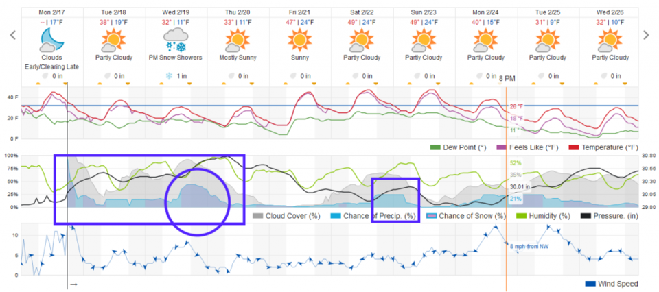
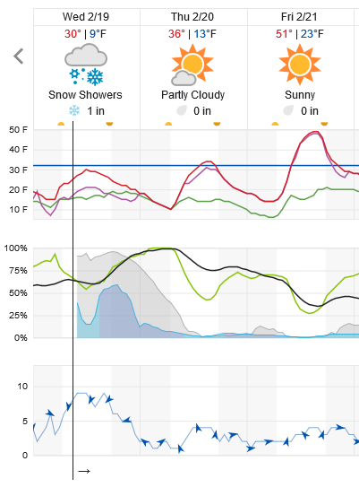
With a quasi-stationary trough in the west and variable amounts of up slope flow on the Plains, we'll have rain showers when it is warm and snow showers when it is colder through Thursday early morning. The best shot of snow comes Wednesday PM, but total snow amounts should remain +/- 1 inch. We see 'warmth' at the end of the week and weekend with another shot of showers possible Sunday AM.
Video Discussion addition:
Just a quick post of the latest Longmont Public Media forecast discussion video.
2/19 9am update:
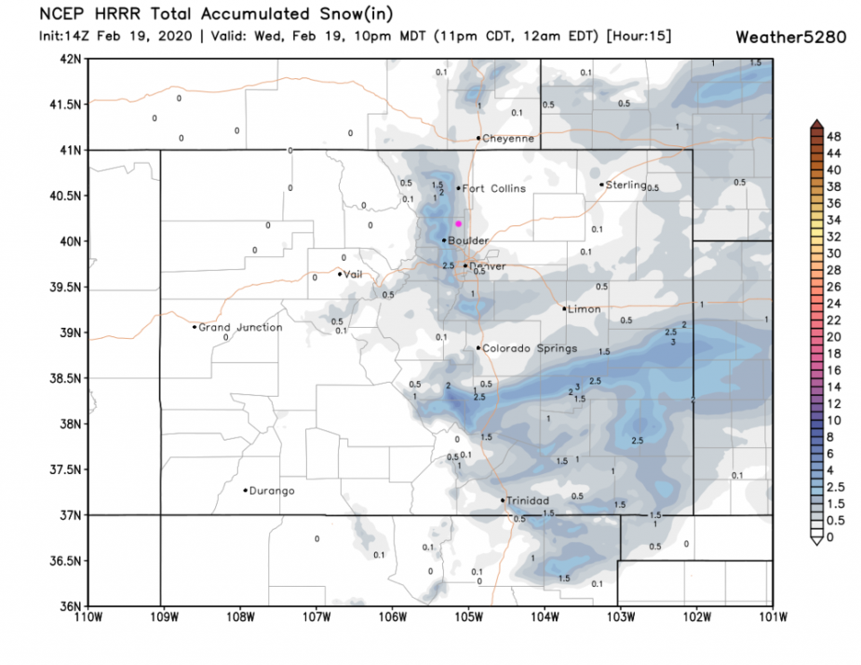
Very light snow is falling this morning in a very narrow strip along highway 287 and over to I-25 in places south of Ft. Collins to Longmont and over to Boulder. At most, one inch (maybe 2 inches in spots) is expected to fall in Longmont by midnight tonight - when the system clears out (Figure 1 update). The HRRR, before 10pm, gives us 1/2 to 1 inch in town. Boulder almost gets 2 inches (Figure 2 update). It will be quite cold today and winds will pick up as a front approaches from the north. Be ready with the heavier coats.
End 2/19 89am update.
2/19 8pm update:
Just jumping in with an interesting observation - there is a "Longmont anticyclone" set up over our town this Monday evening. The air is swirling around us in a clockwise fashion and creating sinking air locally. There is snow all around the edges of this thing but noting really notable in Longmont at this time. Fascinating!
End 2/17 8:00pm update.
Forecast Discussion:
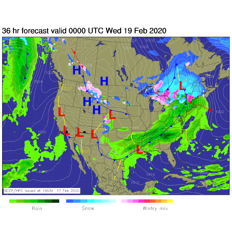
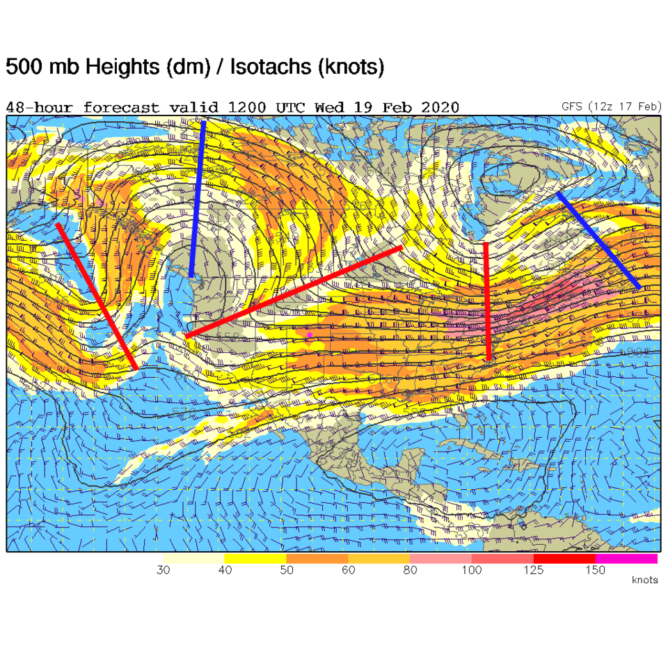
The upper air pattern is the main driver of events right now. The surface map shows a front to the distant south of the state Tuesday with up slope flow making rain/snow occur on the Plains (Figure 1). This interesting pattern aloft is a big ridge anchored on the West Coast for a while and a trough downstream of it just to the west of our state (Figure 2). This stagnant pattern means 3 days of unsettled conditions, rain showers in in the day Tuesday and snow showers Tuesday PM to Wednesday PM (Figure 4). It won't amount to much, it seems.
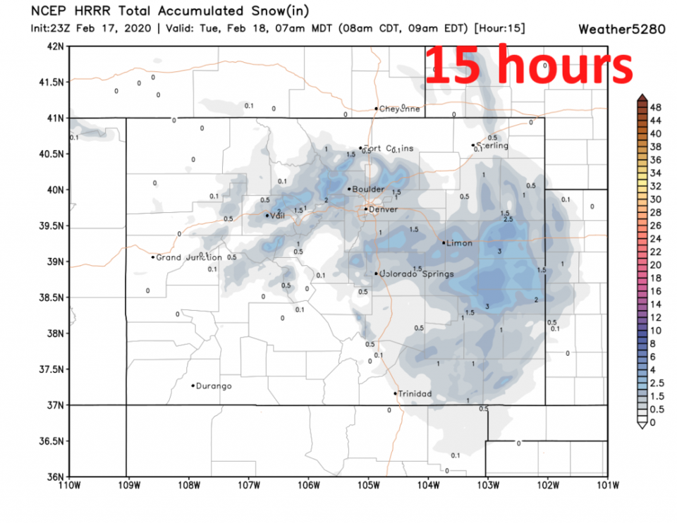
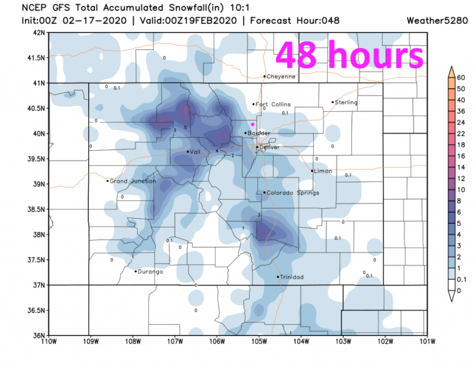
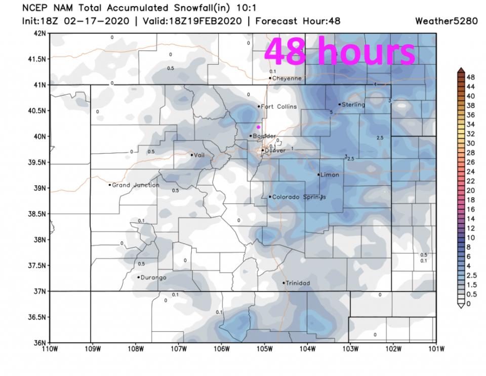
For the next 15 hours - Monday evening through 7am Tuesday, the HRRR gives Longmont about 1/2 to 1 1/2 inches of snow (Figure 3). Over the next 48 hours, the GFS (Figure 5) only gives us a coating of snow to an inch max. The NAM, also over the next 48 hours, similarly gives us 1/2 to 1 inch (Figure 6).
Interesting to note - compare figure 5 and 6 for the same 48 hour period. the GFS has snow up in the mountains and not on the Plains. The NAM has snow on the Plains and not in the mountains. Since this should be a shallow up slope flow event, the NAM probably has a better handle on the situation this time.
The Longer Range Forecast:
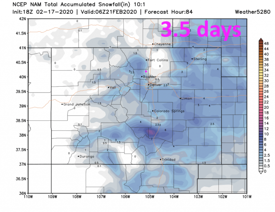
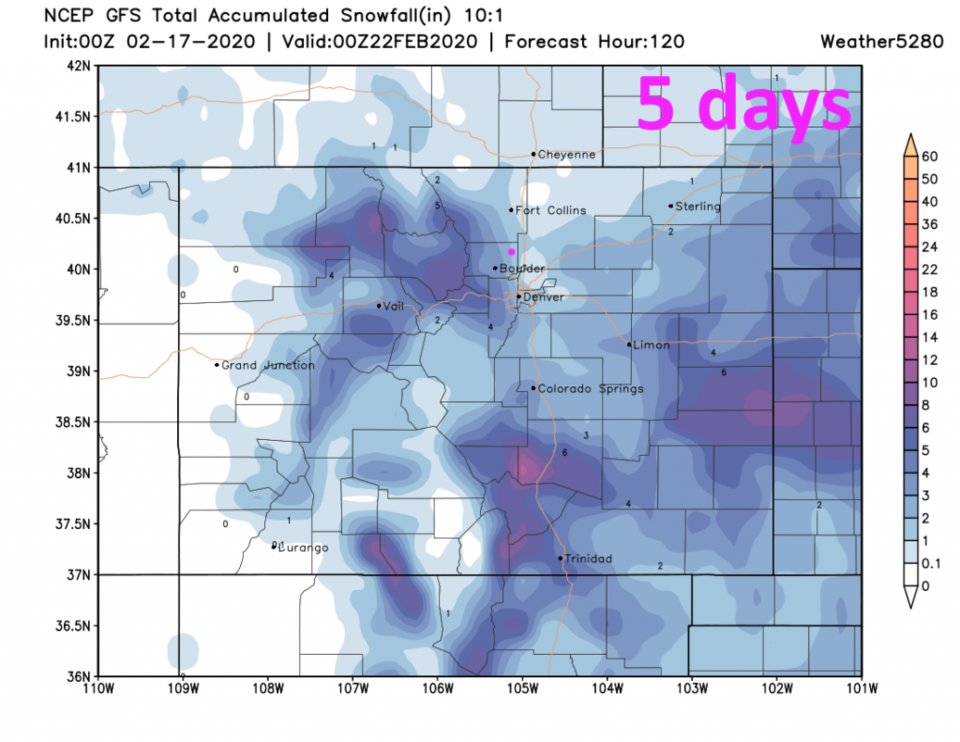
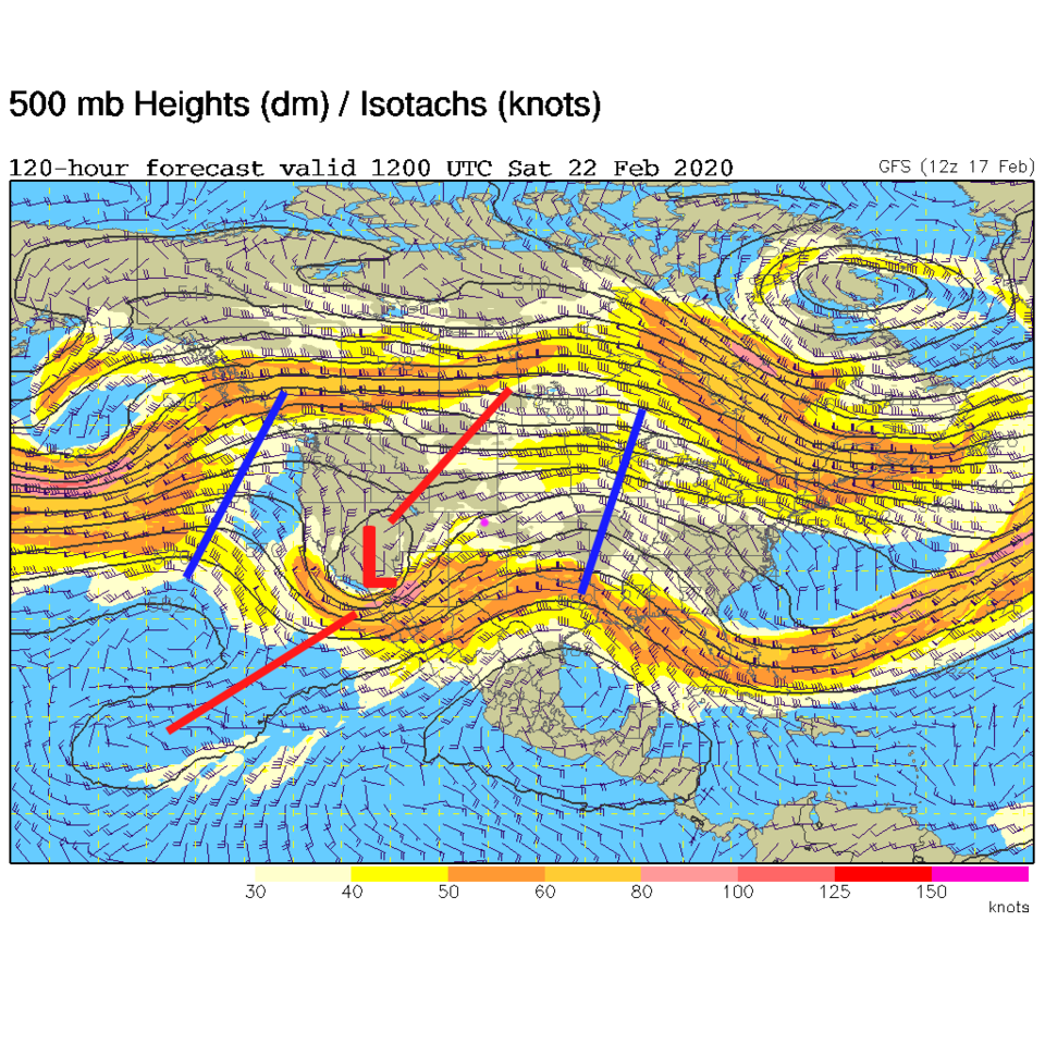
The trough passes Wednesday/Thursday before the ridge arrives on Friday giving us a better shot of snow Wednesday PM to Thursday AM (Figure 4). The NAM, over the next 3.5 days (Figure 7), gives us 1-2 inches of snow. The GFS, over the next 5 days (Figure 8) gives us 2-3 inches of snow.
Once the ridge arrives, we warm to near 50F for Friday/Saturday (Figure 4), then a cutoff low rolls through the flow giving us a chance of rain Saturday PM (Figure 9). Notice how this strange pattern in Figure 9 seems to be trying to do two things at once (northern half of the map vs. the southern half). This could be a sign of a "gear change" in the flow that means a warmer, drier, and more boring end of February for us.