Skip to content

Next Storm/Next Snow Forecast Discussion from the Cherrywood Observatory – February 19, 2019

This content was originally published by the Longmont Observer and is licensed under a Creative Commons license.

Forecast Discussion:

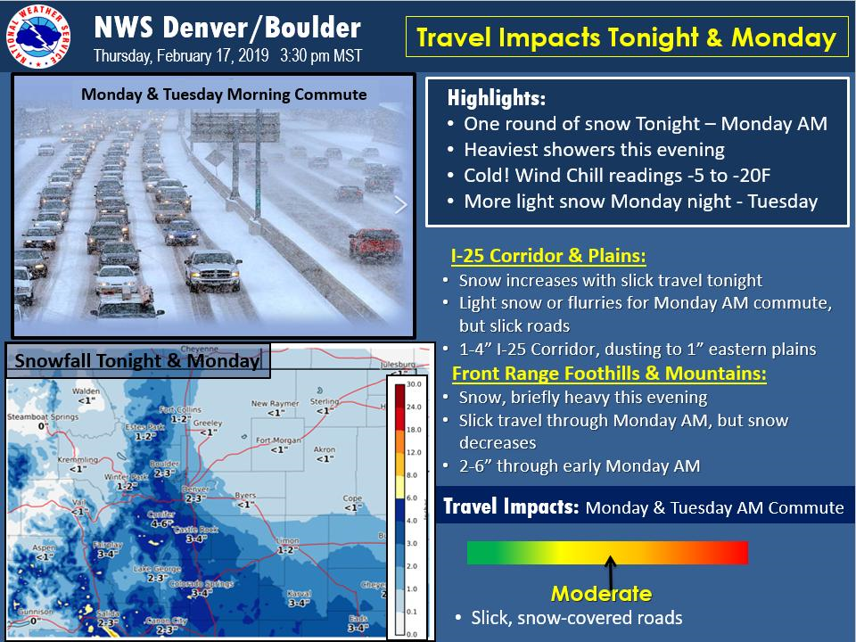
(Posting early again...) Some parts of the Front Range have received many inches of snow, but in town, we've only received about 1/4 to 1/2 inch. The NWS has a bulletin issued concerning the cold and snow around the Denver Metro for the next 48 hours (Figure 1).

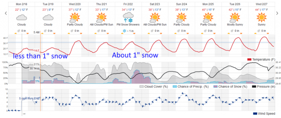
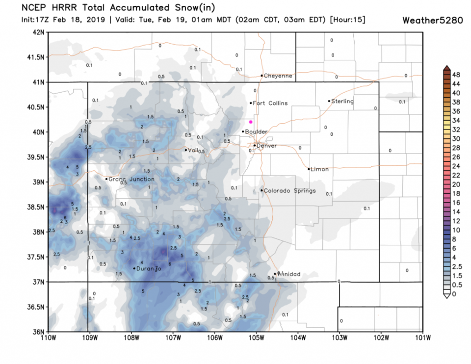
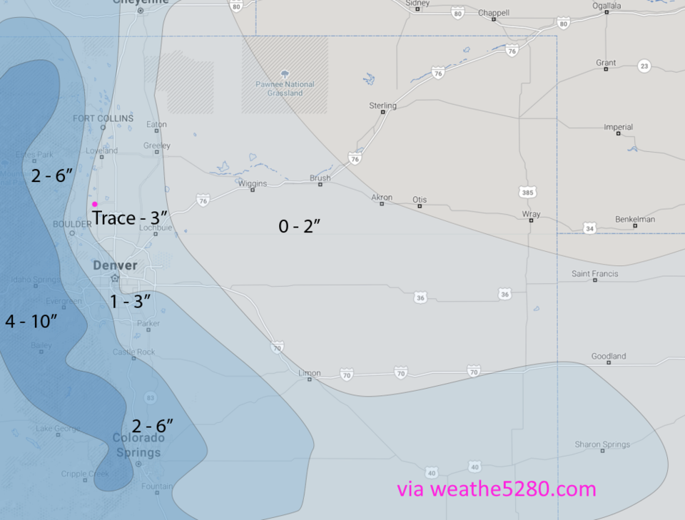
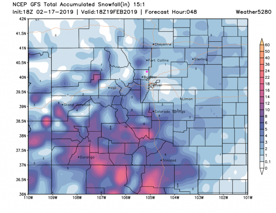
The temperatures are still too high on Figure 2 (from weatherunderground.com) we are only at 15F at 1pm. The HRRR (Figure 3) through 1am tonight shows virtually no snow at all, but models show that another surge of snow will move up the front range tonight. For the next 24 hours (Figure 4) the weather5280.com forecasters still give us a trace to 3" (the low end is more likely). The GFS in Figure 5 has Longmont in a snow-hole (as always) from down slope flow. The GFS has us in the trace to 1 inch zone for the next 48 hours

The longer range forecast:

Figure 2 snows another inch of snow coming in Friday/Saturday with temperatures staying around freezing each day. A nice period of winter!


Figure 1: weather highlights from the NWS Boulder
Figure 2: the graphical forecast for the next 10 days for Longmont, CO from weatherunderground.com
Figure 3: the forecast accumulated snow map from the HRRR and weather5280.com for Colorado, through Tuesday 1am.
Figure 4: The hand drawn 24 hour snow forecast from the forecasters at weather5280.com published on the public post Monday afternoon.
Figure 5: the forecast accumulated snow map from the GFS and weather5280.com for Colorado, through Tuesday PM.

Current Weather

Partly cloudy

Partly cloudy

47°F

UV Index
0 Low
Pressure
29.61 Rising
Visibility
8 miles
Dewpoint
22 °F
Humidity
37%
Wind
WSW 4.9 mph
Gust
13.6 mph
Wind Chill
45 °F

Hourly Forecast

Today
5 AM
43°F
Intermittent clouds
Today
6 AM
42°F
Mostly cloudy
Today
7 AM
43°F
Cloudy
Today
8 AM
47°F
Partly sunny w/ showers
Today
9 AM
51°F
Partly sunny
Today
10 AM
54°F
Intermittent clouds
Today
11 AM
56°F
Intermittent clouds
Today
12 PM
58°F
Mostly cloudy
Today
1 PM
59°F
Showers
Today
2 PM
61°F
Intermittent clouds
Today
3 PM
60°F
Intermittent clouds
Today
4 PM
59°F
Intermittent clouds

7 Day Forecast

Partly sunny w/ showers

Tuesday

61 °F

Very windy; a couple of showers this morning; otherwise, times of clouds and sun


Partly cloudy

Tuesday Night

34 °F

Partly cloudy


Intermittent clouds

Wednesday

57 °F

Cool with times of clouds and sun


Mostly cloudy

Wednesday Night

39 °F

Increasing clouds


Partly sunny w/ showers

Thursday

56 °F

Times of clouds and sun with a couple of showers; cool


Cloudy

Thursday Night

40 °F

Cloudy


Mostly cloudy

Friday

66 °F

Mostly cloudy and warmer


Mostly clear

Friday Night

40 °F

Mainly clear


Intermittent clouds

Saturday

74 °F

Pleasant and warmer with periods of clouds and sun


Mostly clear

Saturday Night

43 °F

Mainly clear


Sunrise and Sunset

Sunrise
5:52 AM
Sunset
8:02 PM

Based on AccuWeather data