This content was originally published by the Longmont Observer and is licensed under a Creative Commons license.
In Brief:
A storm is moving into Colorado Sunday. That is all we know for sure. How much snow this means for the state...? Oh boy. You can find a model that will tell you whatever you want to hear. We also see a cold front hit Tuesday with TV stations and some models bringing in more snow - other models only see cold dry air for a day. Beyond that we warm up nicely. Oh the confusion.
And there won't be a video update today - I have a flu-like thing going on (I DID have the flu shot though) - I don't think you want to hear/see me right now.
Update 2/24 8:30am:
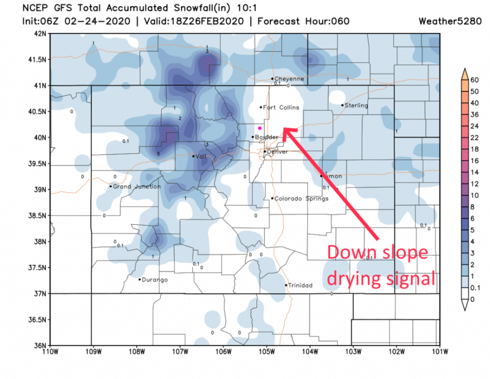
An upper level trough is passing the state Monday morning creating a snow squall that is sweeping down the I-25 corridor. What is funny is that this feature is creating more snow (we have a coating already) than our "big storm" Sunday did. Still, it will pass quickly and highs in the 40'sF today will melt this snow. Winds will pick up later today as well with down slope flow. Tomorrow, a brisk (but mostly dry) cold front will sweep down the Plains. This could create periods of light snow now and then - more out on the eastern Plains than along I-25. The I-25 corridor will see the drying effects of air sinking as it passes over the Rockies and returns to lower elevations (Figure 1 update).
End 2/24 8:30am update.
Update 2/23 10:30am:
All models are finally coming into agreement (mostly) on the storm today. And the Longmont verdict is: virtually no snow. Temperatures are going to be too high (maybe 43F this afternoon), dry air is eating up snow that is falling this morning, and down slope flow will kick on with gusty winds that will dry everything out later today. I'm sorry if you were hoping for a big storm. I'll be lucky if we even make it to my low end 1 inch.
End 2/23 10:30am update.
`Forecast Discussion:
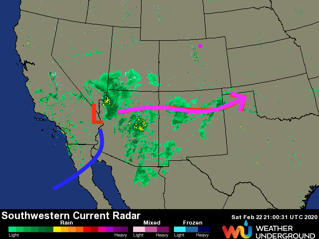
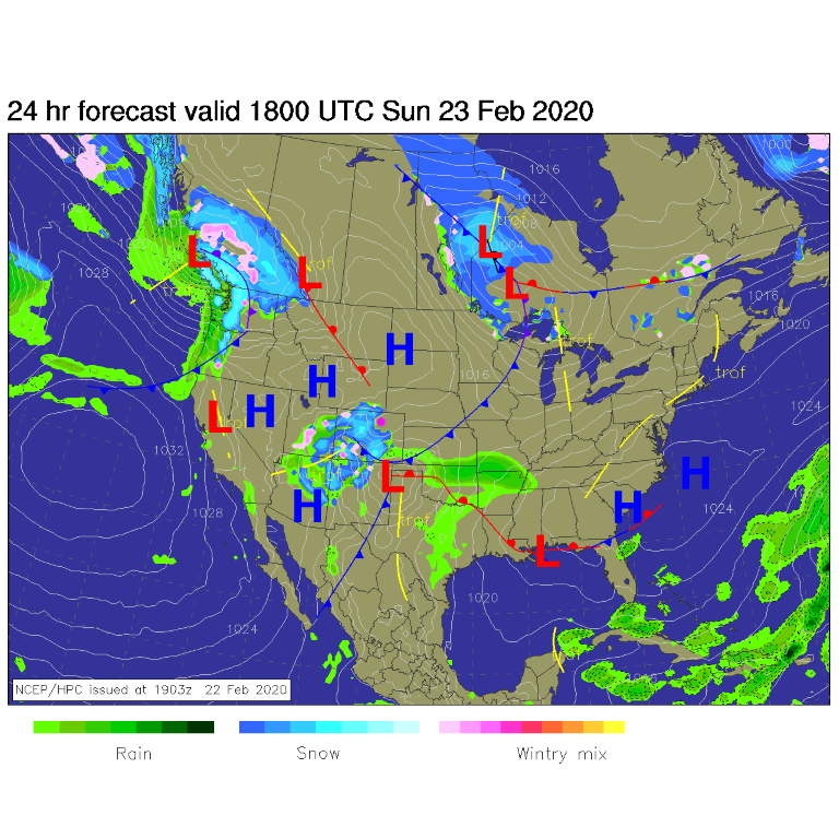
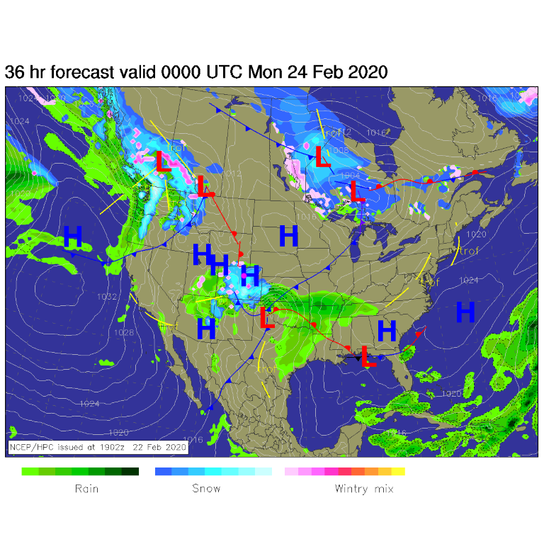
The surface low associated with our system is rolling over Las Vegas right now with an expected track just south of the Colorado border (Figure 1). Midday Sunday, the low is near Clayton, NM with a cold front forming to the north of the low (Figure 2). According to NCEP, we have widespread snow Sunday evening across almost all of Colorado (Figure 3). The low is around Tulsa, OK early morning Monday with precipitation decreasing over the state. Another push is coming in from the northwest around Tuesday with its own forecast troubles (Figure 4).
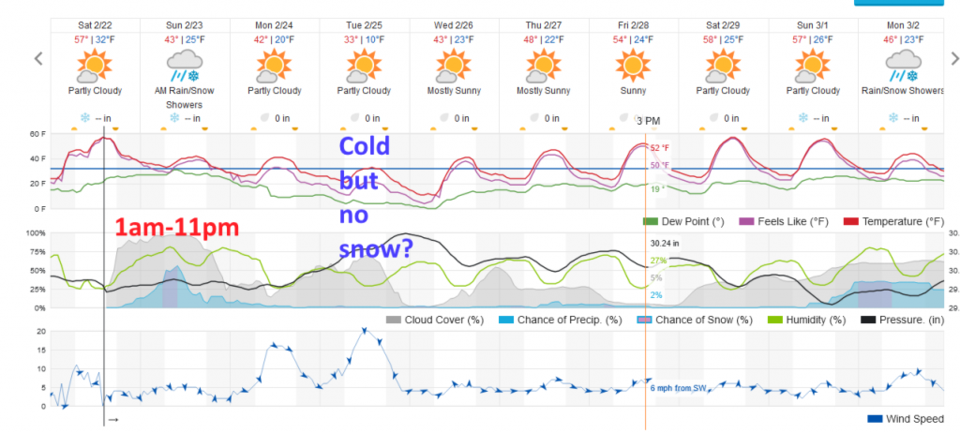
The weatherunderground.com model has precipitation from 1am Sunday through 11pm Sunday (with light showers possible into Monday early morning (Figure 5).
As I stated in the "In Brief" section - there is a forecast for everyone out there. This is still a mess.
Snowfall Roundup:
The weatherunderground.com model basically says a dusting/coating is in store for Longmont (Figure 5).
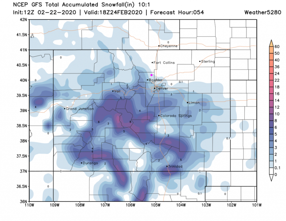
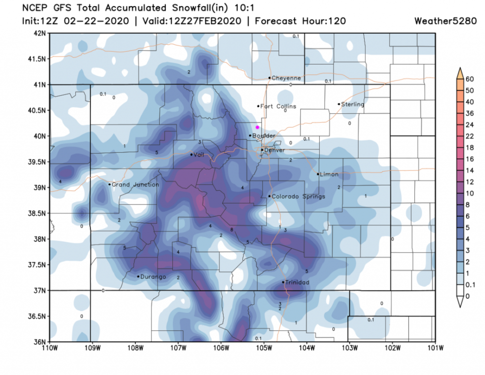
The GFS (Figure 6) has a dusting to a coating as well.
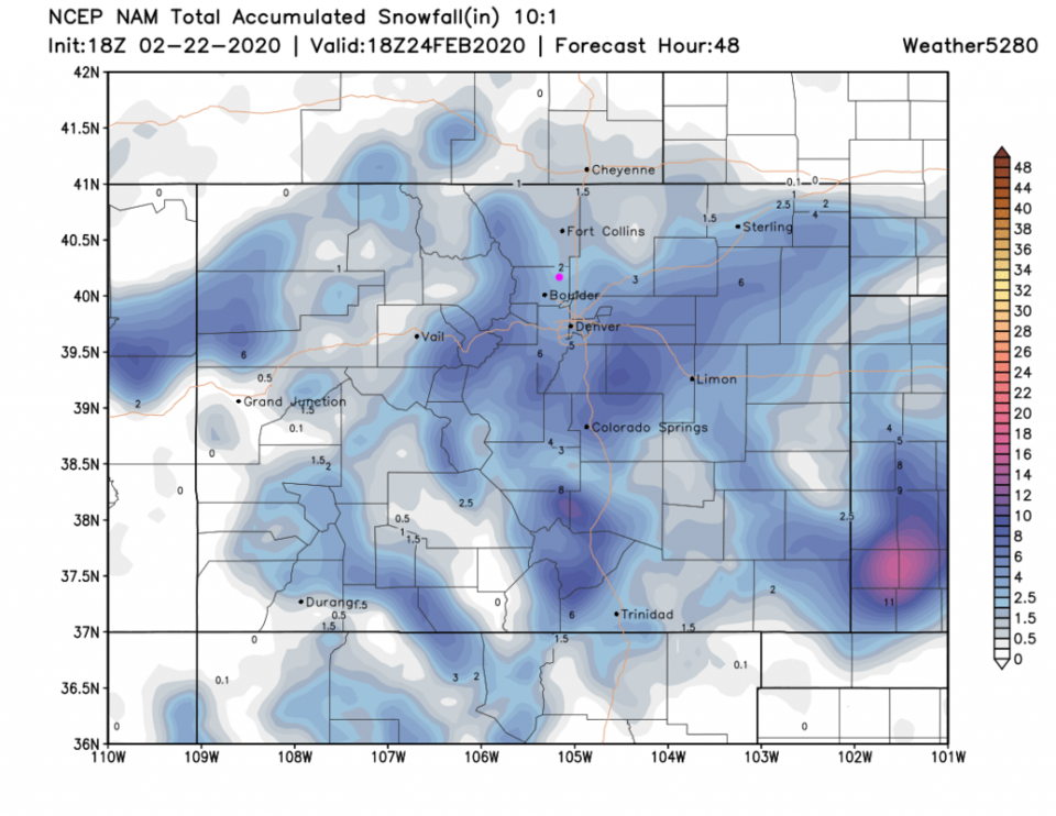
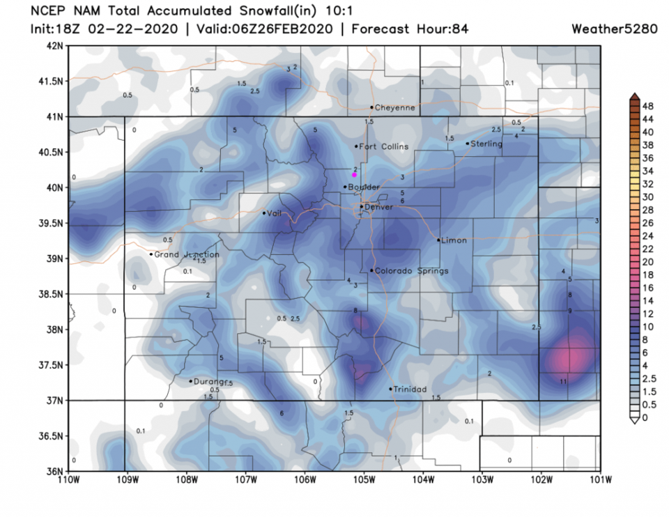
The NAM (18z run - Figure 7) gives us 2-3 inches.
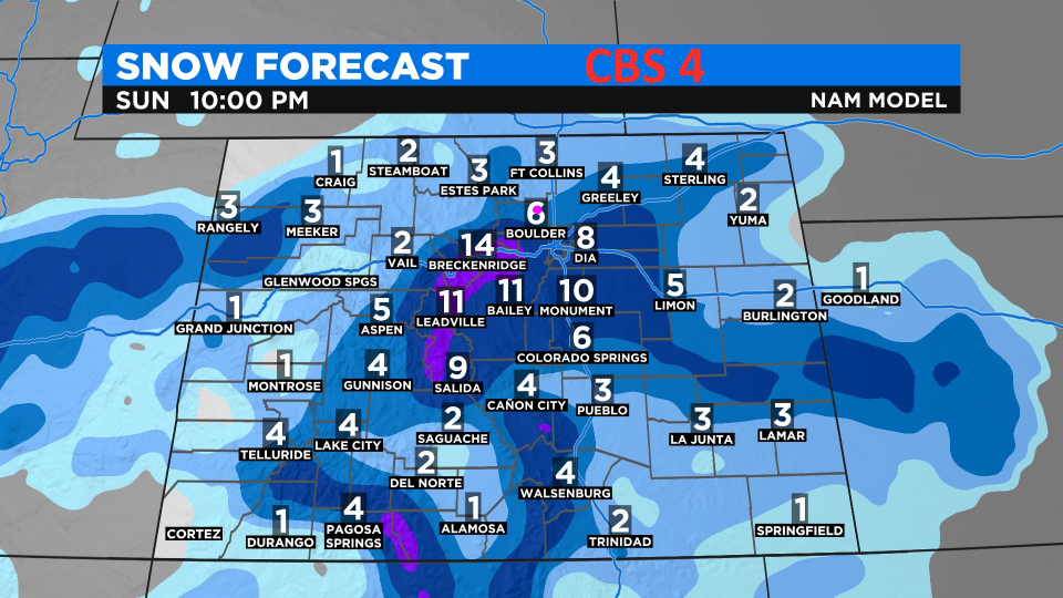
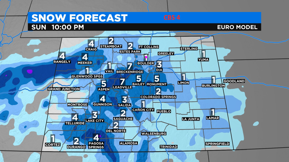
The NAM via CBS 4 (an earlier run? Figure 8) gives us 4-6 inches.
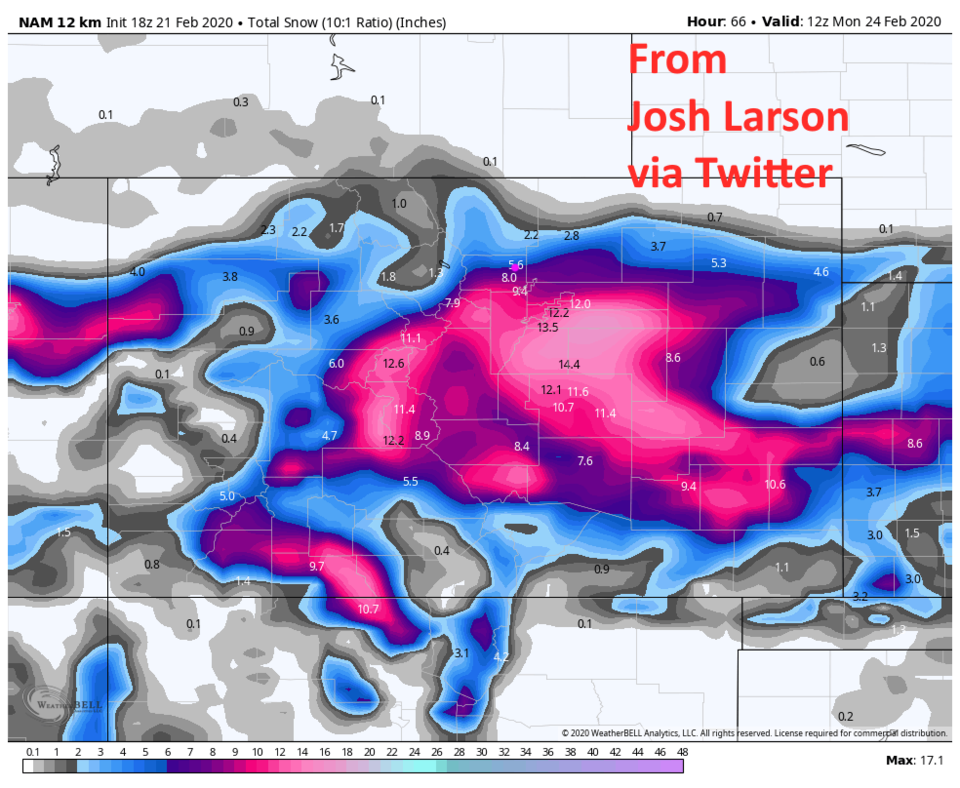
The 12km resolution NAM at 18z Feb 21 (Figure 9) went nuts with 5-6 inches in Longmont (but Elsa's eternal winter of Frozen I over the central mountains and central eastern plains).
The European model (seldom seen here - from CBS 4 Figure 10) gives us 1-2 inches.
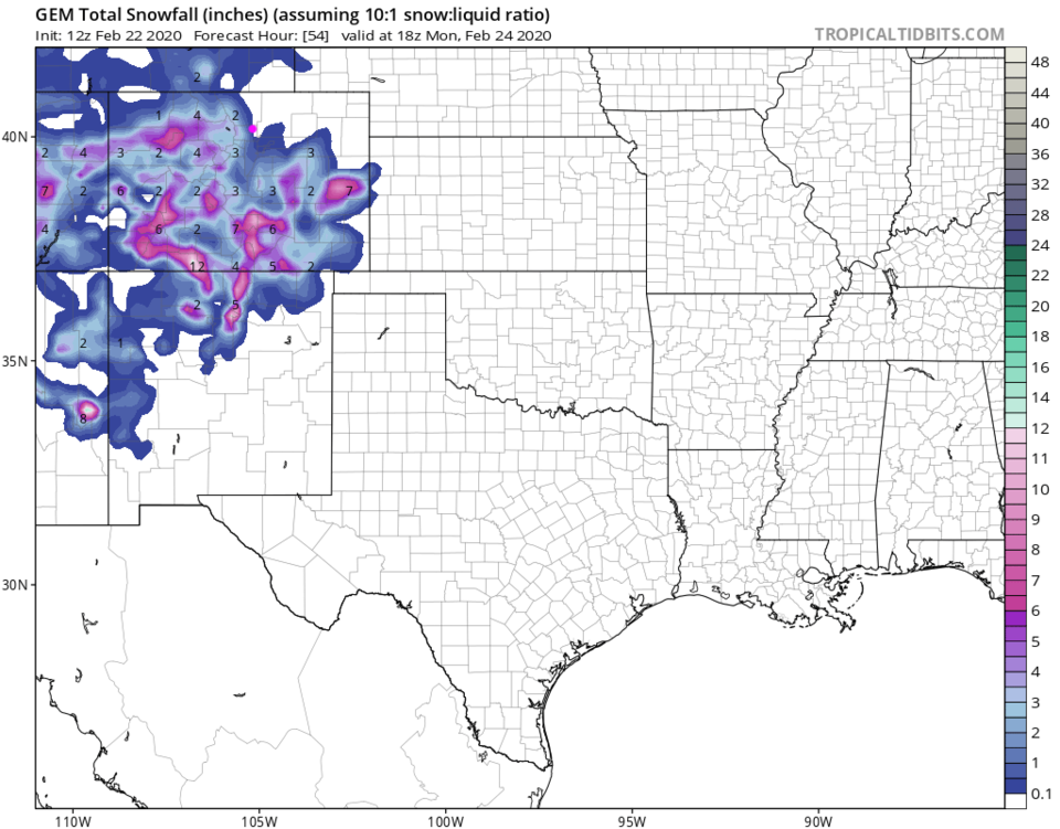
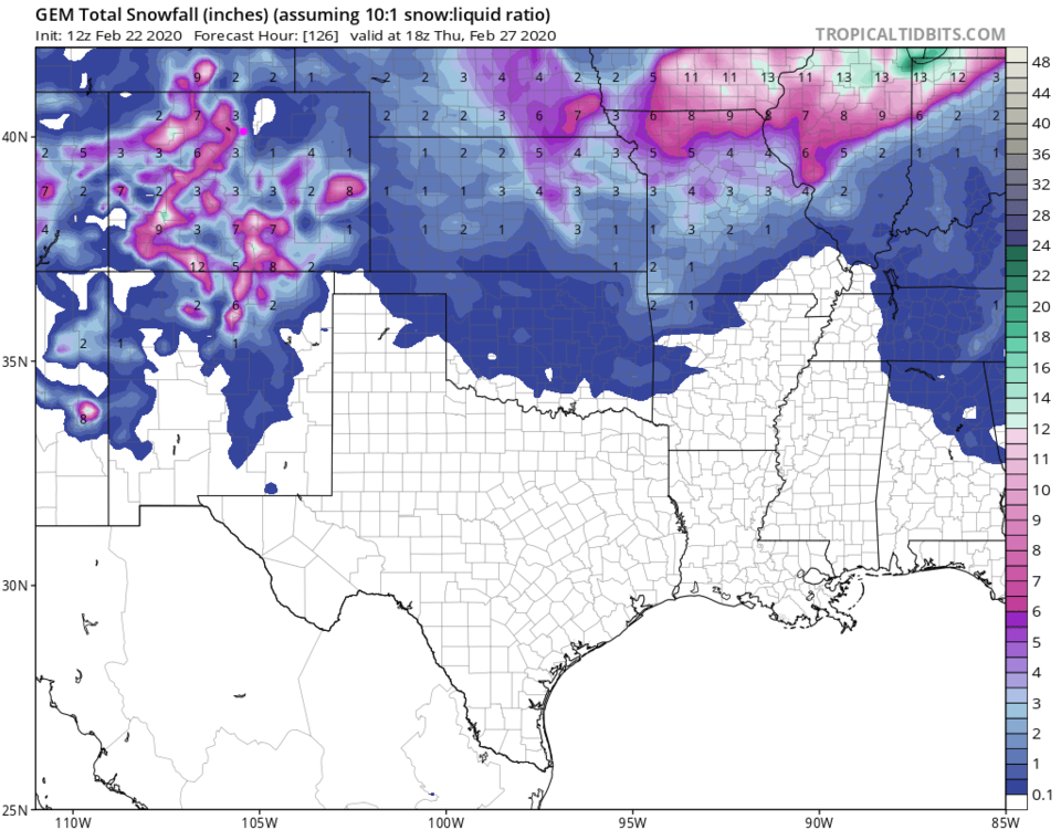
And finally, the GEM gives us a dusting to 1 inch (Figure 11).
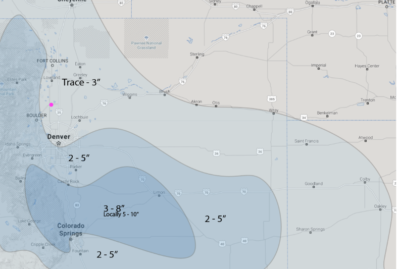
We have a late entry from the forecasters at weathe5280.com - Figure 15 shows us in their Trace to 3 inches band.
I'm going to call for 1-4 inches for Longmont but anything could still happen!
The Longer Range Forecast:
There is another system sweeping down for Tuesday from the Pacific Northwest. The weatherunderground model give us no notable snow (Figure 5). The GEM also gives us no additional snow (Figure 12). The NAM (Figure 13) gives us no additional snow. The GEM gives us 1-3 inches of new snow Tuesday (Figure 14). The models are a real mess right now. Cutoff lows CAN be difficult to handle (see earlier discussions).