This content was originally published by the Longmont Observer and is licensed under a Creative Commons license.
Forecast Discussion:
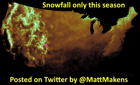
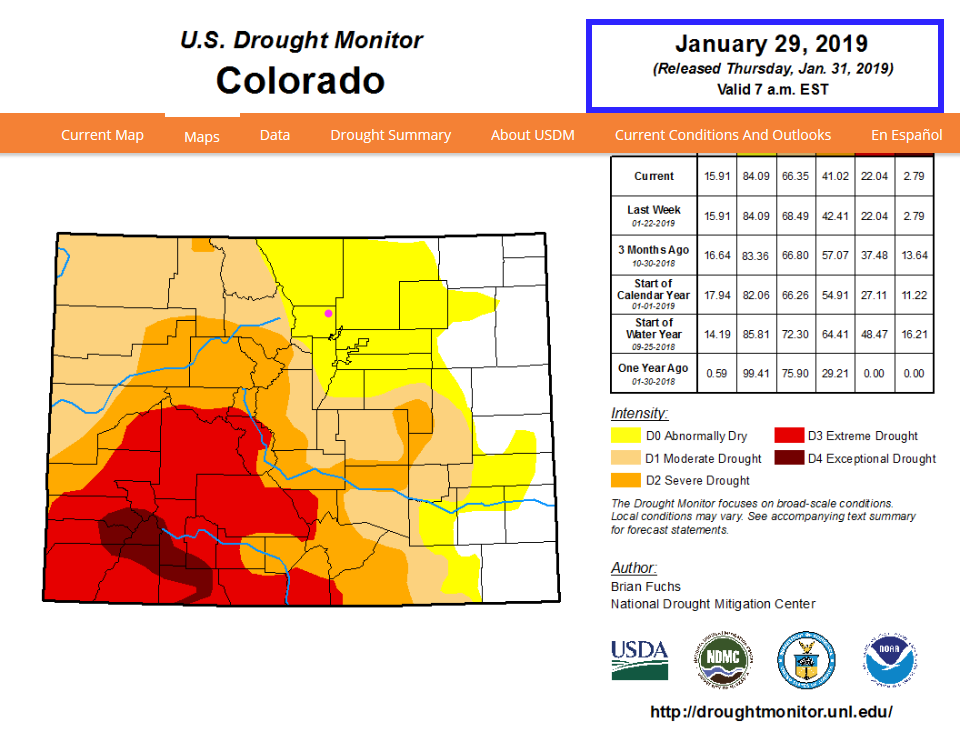
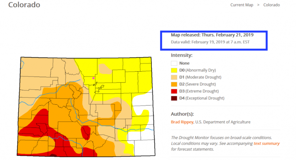
Before we look at the winter-cliff we are about to fall off of (again), let's look backwards. Matt Makens posted this interesting image of total snowfall (and nothing else) for the U.S. this season (Figure 1). Our state is somewhere around 120% normal so far - with much more to come. This has also helped with our drought conditions. Figure 2 is the drought index a month ago with large areas of Extreme and Exceptional drought in the southwestern parts of our state. For this week (Figure 3), you can see the western and southwestern Colorado regions are much better off. We are just a touch drier in the northeastern parts of the state; nothing to panic about.
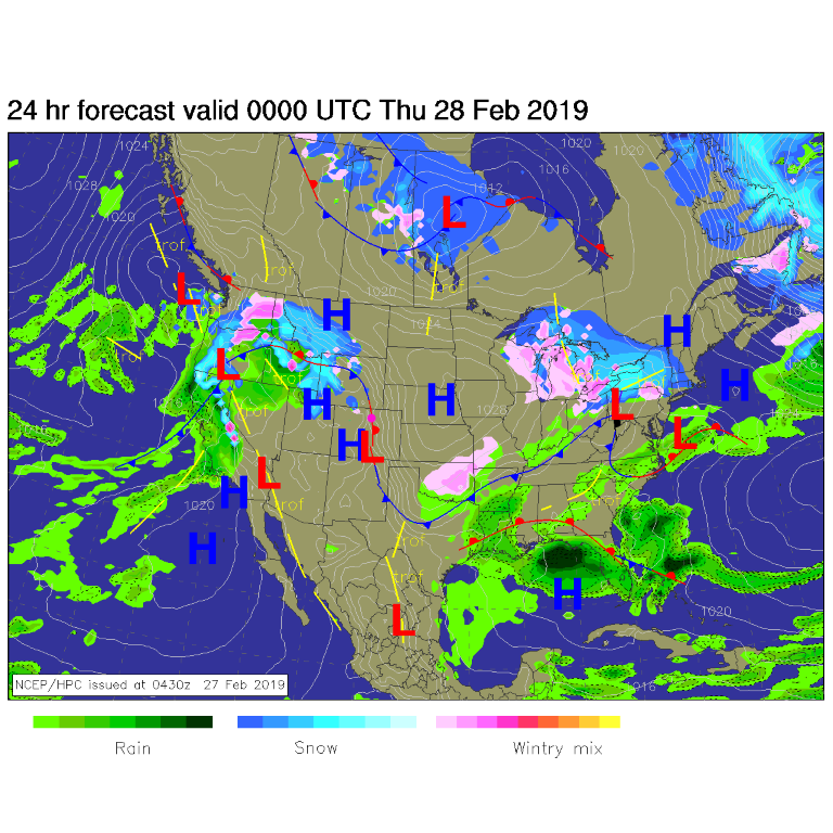
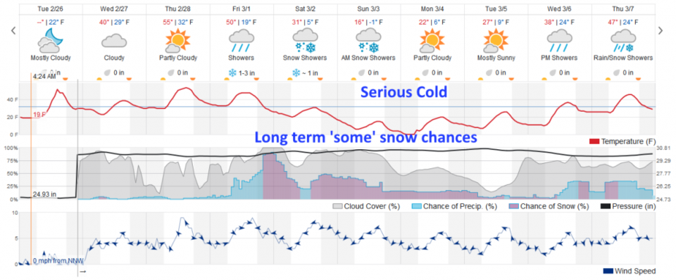
Today we are still dry (unless that front draped just east of I-25 wiggles back and coats us with freezing fog and icing on windshields again) and parked between systems (Figure 4). That front will get reinforced with some western cool air dropping us to the 40'sF today before we return to the 50'sF Thursday and Friday (Figure 5).
The longer range forecast:
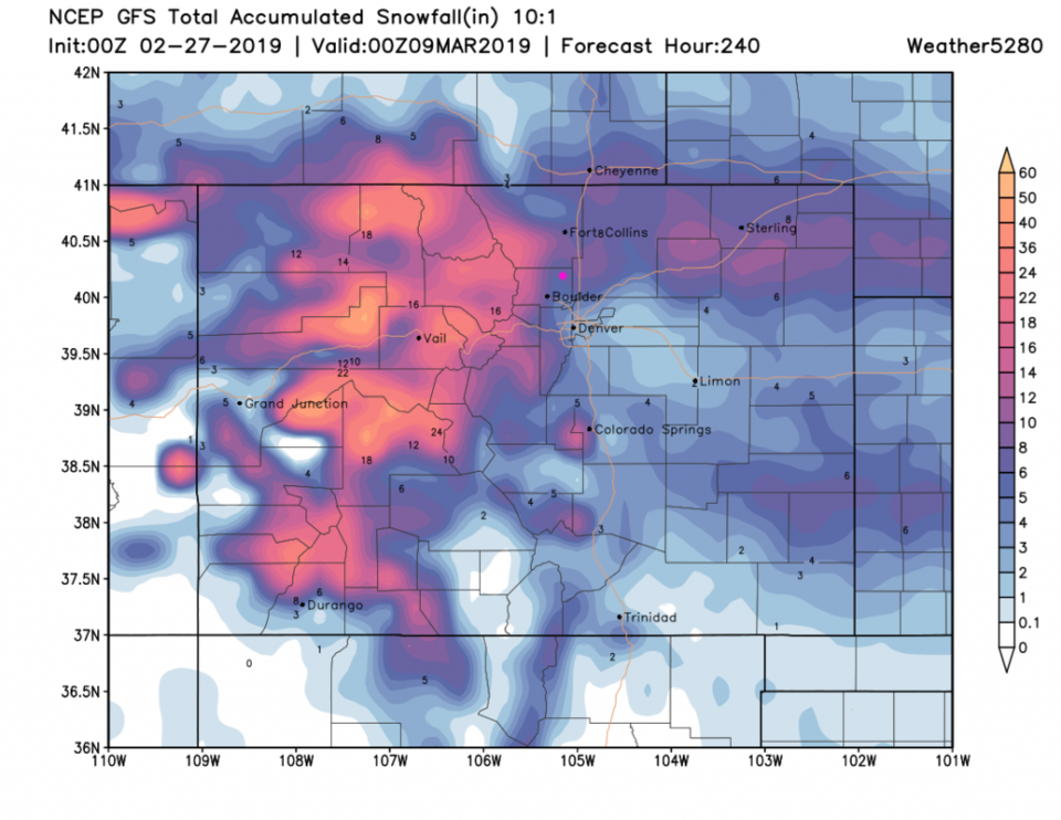
An arctic blast hits the inter-mountain west Friday and we say goodby to warm air for about a week (Figure 5). This model gives us 1-3 inches of snow Friday night followed by another inch of snow Saturday. Sunday will be very notably cold with teens for highs and a dip below zero F at night. That is all from the weatherunderground model. The GFS, for this same period (10 days - Figure 6) dumps 5-8 inches of snow on Longmont over the next 10 days. This has always backed off on previous storms, but - maybe THIS time?