This content was originally published by the Longmont Observer and is licensed under a Creative Commons license.
Forecast Discussion:
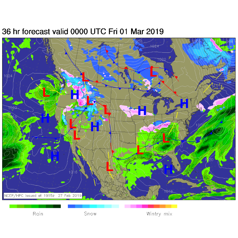
We just have a couple of days of 'warm' weather to enjoy before the CHANGE. Our stationary front on the Plains is still close by and has wandered west, responding to small passing upper air short waves, overnight the past couple of nights. It has delivered clouds, freezing fog, and bits of snow (Figure 1). It could happen again today.
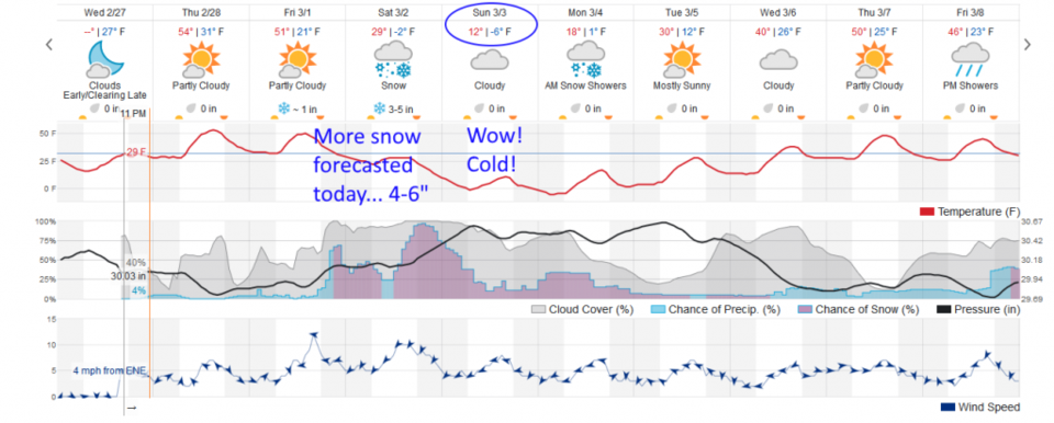
Figure 2 - we enjoy 50'sF after the morning fog burns off (if it wanders west). All the action happens in the longer range forecast.
The longer range forecast:
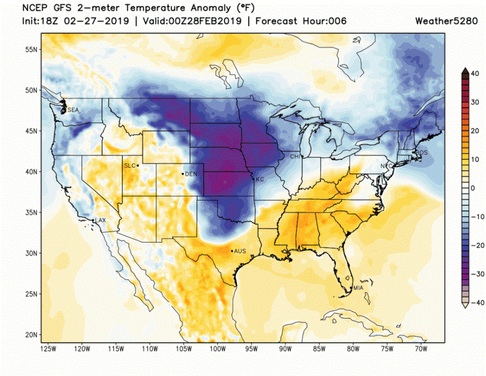
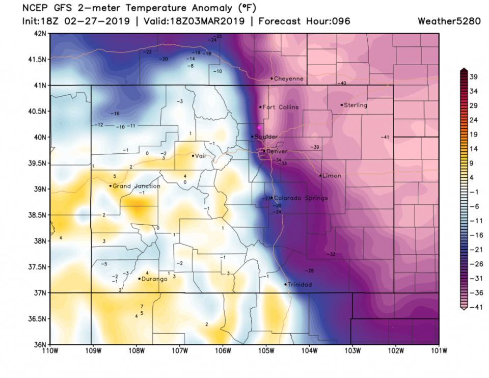
The weatherunderground model (Figure 2) has jumped on the snowy bandwagon now with 4-6" over the weekend and maybe another inch or so on Monday. You can watch the animation of the slosh and pulses of very cold air moving down past the Front Range over the next 10 days in Figure 3. To zoom in in time and space (Figure 4) - the coldest air is in place Sunday afternoon when we are some 30 to 35 degrees F below normal Notice that the neighboring mountains are near normal due to the VERY shallow nature of this extremely cold air.
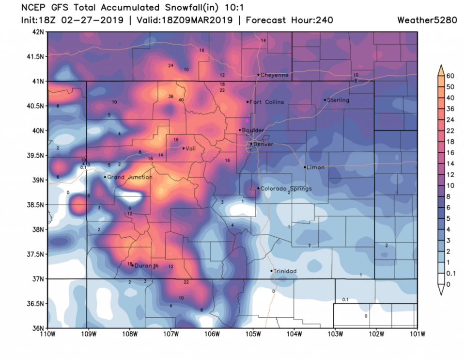
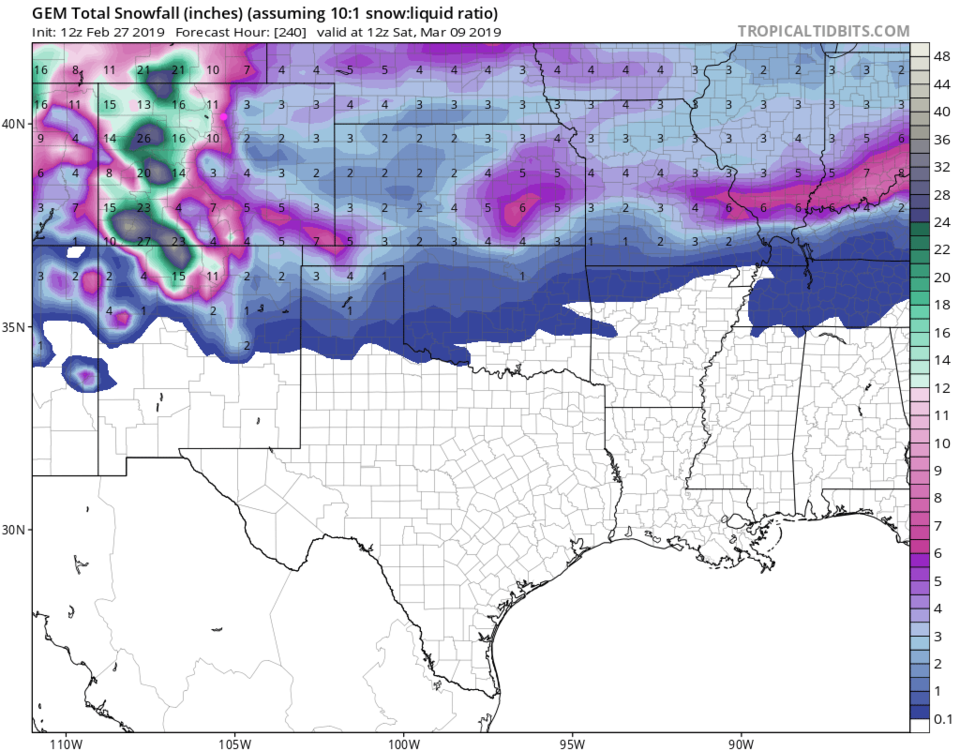
The GFS has increased the 10 day snow total to around 10 inches (Figure 5). The GEM 10 day total is around 6-8 inches. Note that both models give the higher mountains over a yard of snow. This might be the Winter we have been waiting for!