Skip to content

Next Storm/Next Snow Forecast Discussion from the Cherrywood Observatory – February 3, 2019

This content was originally published by the Longmont Observer and is licensed under a Creative Commons license.

Forecast Discussion:

Groundhog update! To quote the CNN headline: "Groundhog predicts an early spring. Don't get too excited, he's usually wrong."

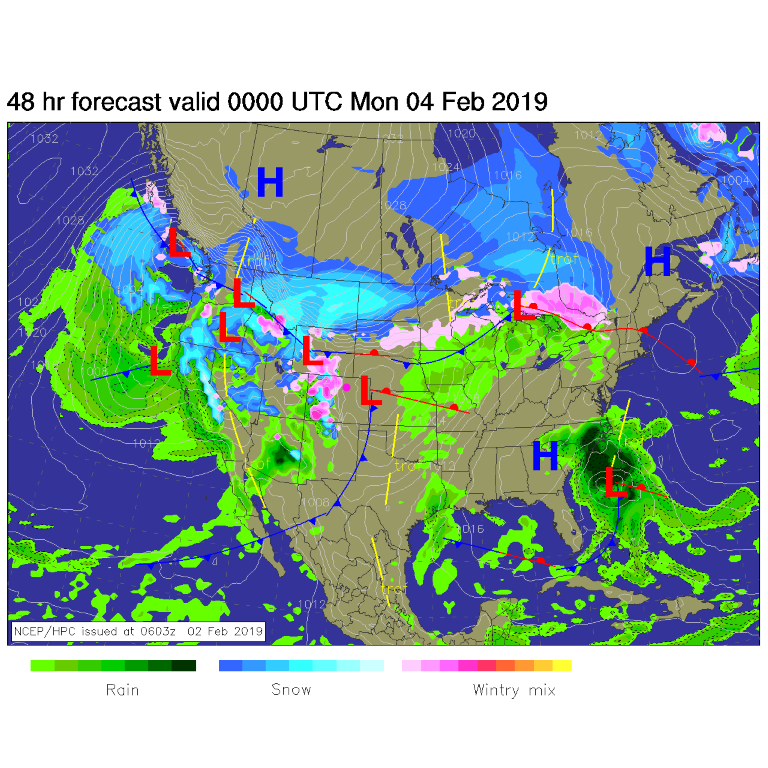
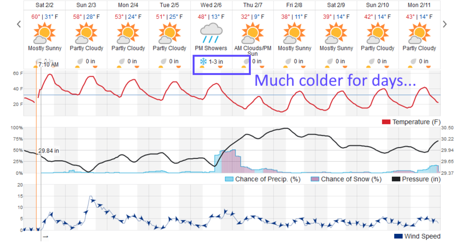
Locally, it was sunny and abnormally warm in Longmont. Today, a Pacific cold/cool front sweeps in with precipitation all across the west, but we'll see down-slope winds and not much of a cool down and no precipitation (Figure 1). You can see the pressure drop Sunday midday in the black line stretching across the middle of the graphic of Figure 2.

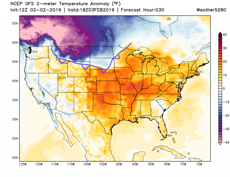
The harbinger of change is up in Canada right now. Figure 3 shows the next blast of fantastic cold much further west than the one that hit Chicago and the Midwest. I've drawn in a cold front (pretty bad artwork) on the margin of this invasion.

The longer range forecast:

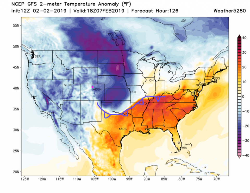
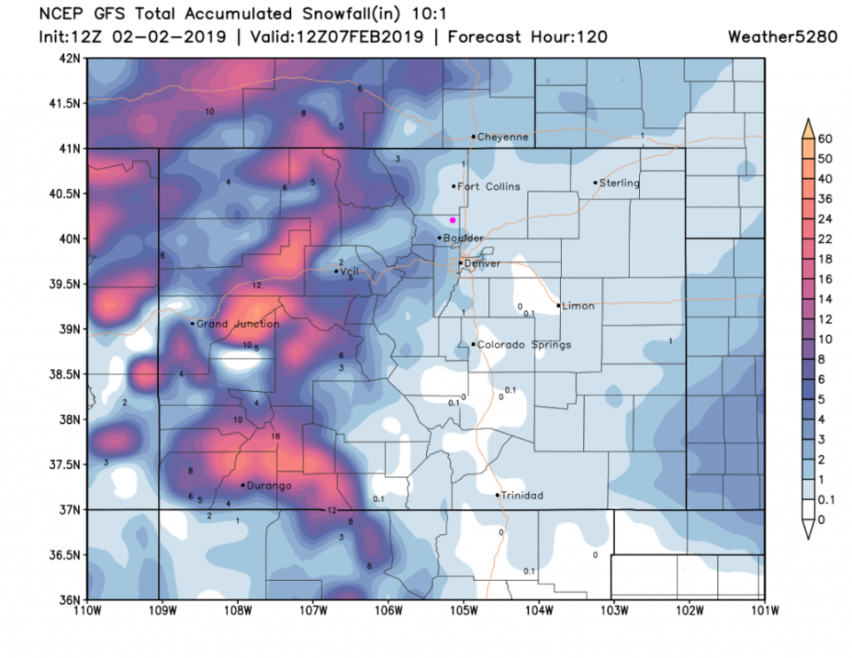
In Figure 4, the cold air (not as extreme as what we saw the last week out east of us) is flowing over us and invading New Mexico, Texas and Oklahoma on Wednesday/Thursday.  We'll be some 20 to 25° F below normal. With that invasion, we'll have a period of cold up-slope flow and snow, then colder temperatures for a while. Weatherunderground (Figure 2) gives us 1-3 inches. The GFS (Figure 5) gives us a coating to 1 inch. It is too soon to really say. You'll have to come back for more!

Figure 1: The forecast surface map for Sunday night. From NCEP.

Figure 2: the graphical forecast for the next 10 days for Longmont, CO from weatherunderground.com

Figure 3: The forecast temperature departure from normal map from the GFS and weather5280.com for Colorado, Sunday noon.

Figure 4: The forecast temperature departure from normal map from the GFS and weather5280.com for Colorado, Thursday noon.

Figure 5: the forecast accumulated snow map from the GFS and weather5280.com for Colorado, through Thursday morning.

Current Weather

Light rain

Light rain

40°F

UV Index
0 Low
Pressure
29.98 Rising
Visibility
7 miles
Dewpoint
38 °F
Humidity
93%
Wind
N 2.7 mph
Gust
5.5 mph
Wind Chill
38 °F

Hourly Forecast

Today
10 PM
41°F
Rain
Today
11 PM
41°F
Showers
Tomorrow
12 AM
41°F
Rain
Tomorrow
1 AM
40°F
Rain
Tomorrow
2 AM
39°F
Rain
Tomorrow
3 AM
39°F
Rain
Tomorrow
4 AM
38°F
Cloudy
Tomorrow
5 AM
37°F
Cloudy
Tomorrow
6 AM
37°F
Cloudy
Tomorrow
7 AM
38°F
Cloudy
Tomorrow
8 AM
40°F
Cloudy
Tomorrow
9 AM
44°F
Cloudy

7 Day Forecast

Rain and snow

Saturday

43 °F

Chilly with a mix of snow and rain; travel in the foothills and mountains will be slippery due to snow


Rain and snow

Saturday Night

37 °F

Cloudy with rain, mixed with a little snow late; travel in the foothills and mountains will be slippery due to snow


Thunderstorms

Sunday

61 °F

Mostly cloudy and warmer; a thundershower in spots in the afternoon


Partly cloudy w/ t-storms

Sunday Night

37 °F

A thunderstorm in spots in the evening; otherwise, partly cloudy


Partly sunny

Monday

71 °F

Partly sunny, pleasant and warmer


Intermittent clouds

Monday Night

42 °F

Partly cloudy


Mostly sunny

Tuesday

73 °F

Mostly sunny and pleasant


Mostly cloudy

Tuesday Night

43 °F

Mostly cloudy


Intermittent clouds

Wednesday

65 °F

Times of sun and clouds with a passing shower in the afternoon


Rain

Wednesday Night

42 °F

Mainly clear


Sunrise and Sunset

Sunrise
6:04 AM
Sunset
7:52 PM

Based on AccuWeather data