This content was originally published by the Longmont Observer and is licensed under a Creative Commons license.
In Brief:
A winter storm warning is in place for much of Colorado (see text in the discussion). Amazing heat over the weekend will be replaced by amazing cold in just 36-48 hours. We will drop maybe as much as 70F (highs to lows) with strong north winds at times. Wind chills will be dangerous. Freezing drizzle will form (falling on warm ground at first) pre-dawn Monday. Eventually snow will begin falling later Monday into Tuesday with 5-10 inches possible. Once this storm leaves, we remain cold and more snow comes later in the week.
Update 10am 2/3:
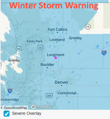
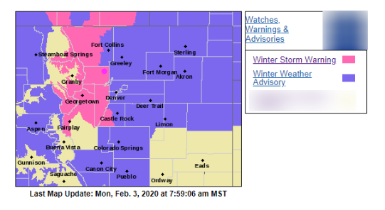
Ice coated cars and bridges (and driveways) this morning. Precipitation changed to snow around 7am as the cold air deepened. Longmont is included in the winter storm warning region with most of the rest of the state under a winter weather advisory (Figure 1 update). With wind, snow, and dropping temperatures today, the heaviest snow fall period is expected to occur this evening between about 4pm and 10pm. We may see 1-2 inches of snow an hour. Light snow will continue through 9am. Snow flurries will occur the rest of Tuesday with another period of somewhat heavier snow Tuesday afternoon.
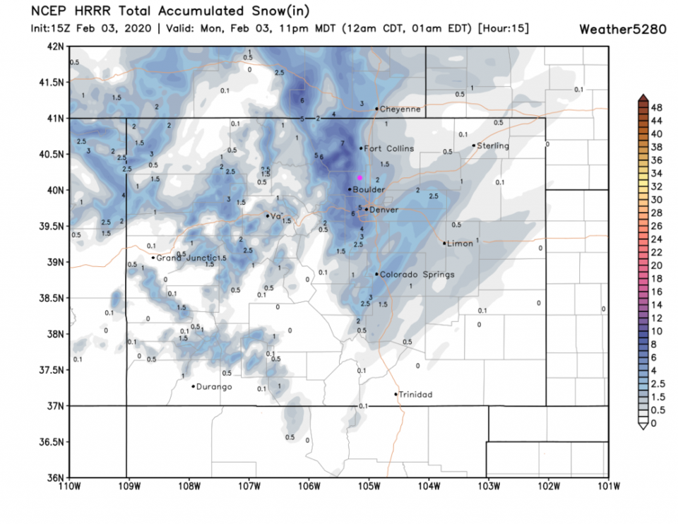
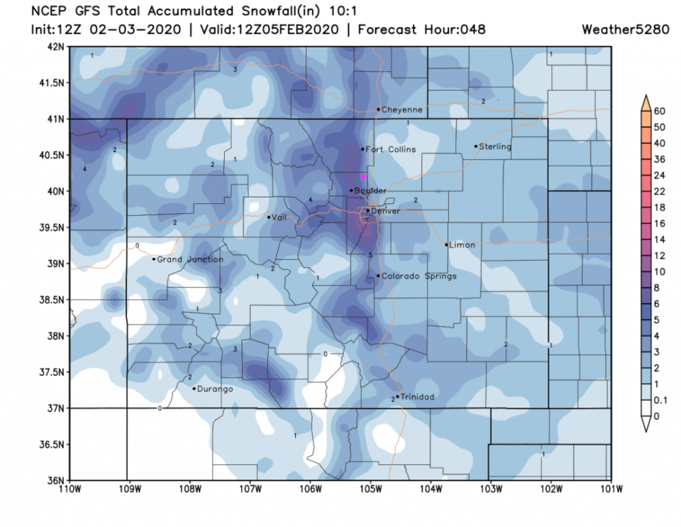
The HRRR through 11pm tonight give us about 3-4 inches on top of the approximately 1 inch that has already fallen (Figure 2 update). The GFS gives us an additional 5-7 inches (east to west) across Longmont on top of the 1 inch we've received so far (Figure 3 update).
Our late Thursday to early Saturday next-storm is looking better now - 1-3 inches of snow seems likely with that storm. And then there is another on Sunday...
End 10am 2/3 update.
Forecast Discussion:
Let's start with the NWS statements:
Winter Storm Warning Issued: 3:45 PM Feb. 2, 2020 – National Weather Service
...WINTER STORM WARNING IN EFFECT FROM 6 AM MONDAY TO 6 AM MST
TUESDAY...Figure 1

* WHAT...Heavy snow expected. Total snow accumulations of 6 to 10
inches. A light glaze of ice will be possible Monday morning.

* WHERE...Boulder and the western suburbs of Denver.

* WHEN...From 6 AM Monday to 6 AM MST Tuesday.

* IMPACTS...Travel could be difficult. The hazardous conditions
will impact the Monday evening commute and the Tuesday morning
commute.

PRECAUTIONARY/PREPAREDNESS ACTIONS...

Slow down and use caution while traveling.

The latest road conditions for the state you are calling from can
be obtained by calling 5 1 1.
Hazardous Weather Outlook
Hazardous Weather Outlook
National Weather Service Denver/Boulder CO
1038 AM MST Sun Feb 2 2020

COZ030>051-031745-

1038 AM MST Sun Feb 2 2020

This hazardous weather outlook is for northeast and north central
Colorado.

.DAY ONE...Today and Tonight

It will be warm and dry today with temperatures well above
seasonal normals. The fire danger will be elevated where breezy
winds develop. A cold front will sweep south across Colorado
tonight. Freezing drizzle will possible over the plains and lower
foothills just before dawn on Monday morning.

.DAYS TWO THROUGH SEVEN...Monday through Saturday

The next storm will bring a much colder airmass to the forecast
area Monday and Tuesday. Precipitation from this storm will begin
as light freezing drizzle over the plains and urban corridor
Monday morning. Snow will become widespread Monday afternoon
through Tuesday. There may be a period of heavier snow in the late
afternoon and evening Monday, especially along the Front Range
foothills, then snow will be light into Tuesday with temperatures
mainly in the teens.

Some moderation in temperatures is expected for the rest of the
week. Another weather system will bring snow to the northern
mountains late Wednesday through Friday, and a chance of rain or
snow to the plains Friday.

.SPOTTER INFORMATION STATEMENT...

Spotter activation will not be needed today or tonight.
The forecast from a few days ago is still holding pretty well. But first - the moist important news - Punxsutawney Phil did not see its shadow, so there will be an early Spring according to the rodent. Yep, we'll see.
Second we tied a record high at DIA of 74F which was last set in Denver in 1934. Longmont hit 72F today. Spoiler alert - we might be at -5F Tuesday morning, which will be a 77F drop in temperatures in about 36 hours. Crazy scary cold.
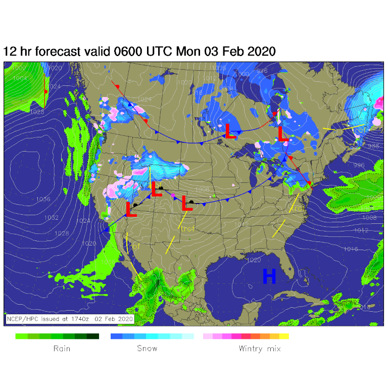
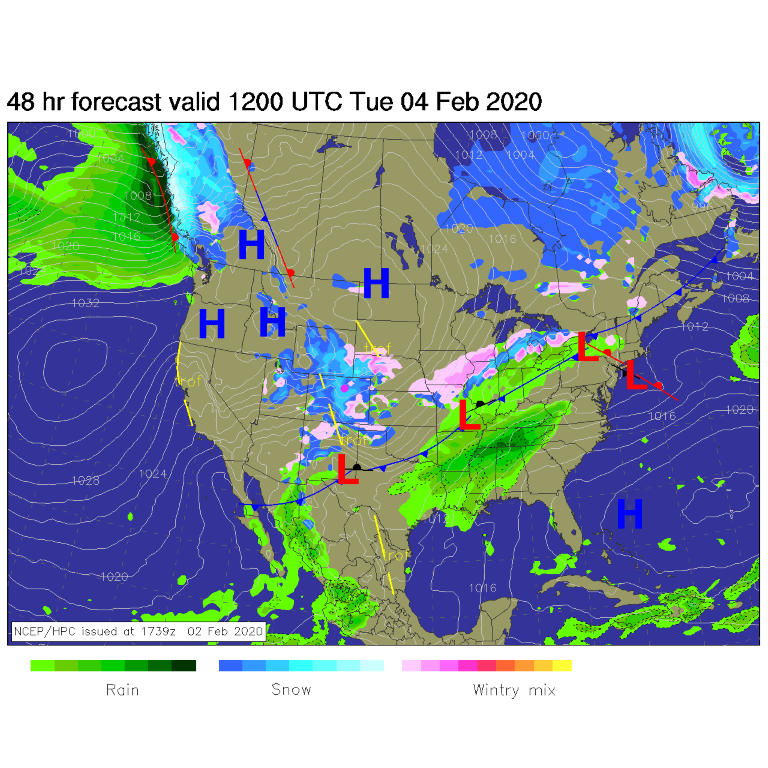
The wind shift has already passed Longmont around 9pm Sunday. The first surge of cold north air will hit around midnight (Figure 2). That cold front will be down into Texas by Tuesday morning with widespread snow across the state (Figure 3).
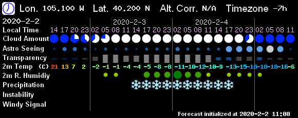
The precipitation should start around 3am Monday - and will probably fall as freezing drizzle. The ground is quite warm so mainly cars and bridges will have trouble with the ice (Figure 4). This will change to snow later in the day Monday as we only have a high temperature between 28F and 31F. For timing, precipitation will be falling 3am Monday and 9am Tuesday with flurries possible into Tuesday night according to the weatherunderground.com model. The GFS based 7timer! model has the bulk of the precipitation occurring between 1pm Monday and 5pm Tuesday (Figure 5).
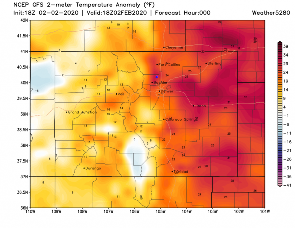
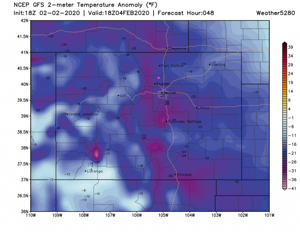
Returning to the temperature drop: the highs Sunday (Figure 6) and noon time temperatures Tuesday (Figure 8) show us going from about 28F above normal to 30F below normal. Strong winds will be part of the equation as well - wind chills will be very low. You'll need every warm clothing article you own.
Snowfall Roundup:
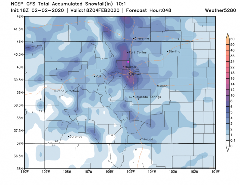
The GFS gives us about 5-6 inches of snow (Figure 8).
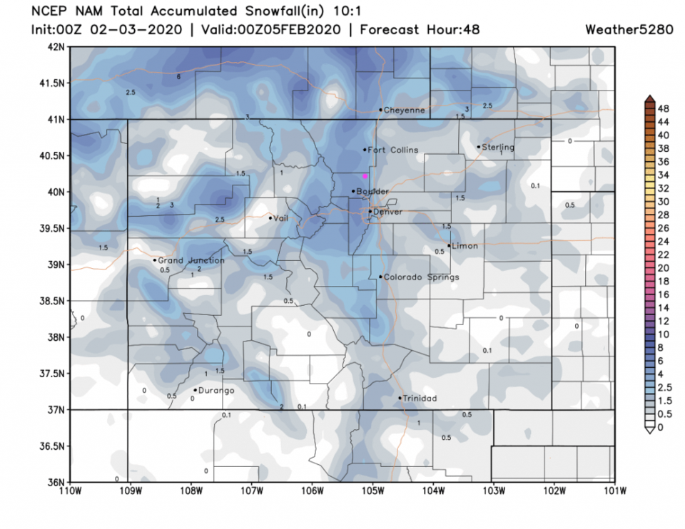
The NAM gives us about 3-4 inches (Figure 9).
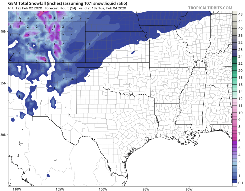
The GEM gives us 4-6 inches of snow (Figure 10).
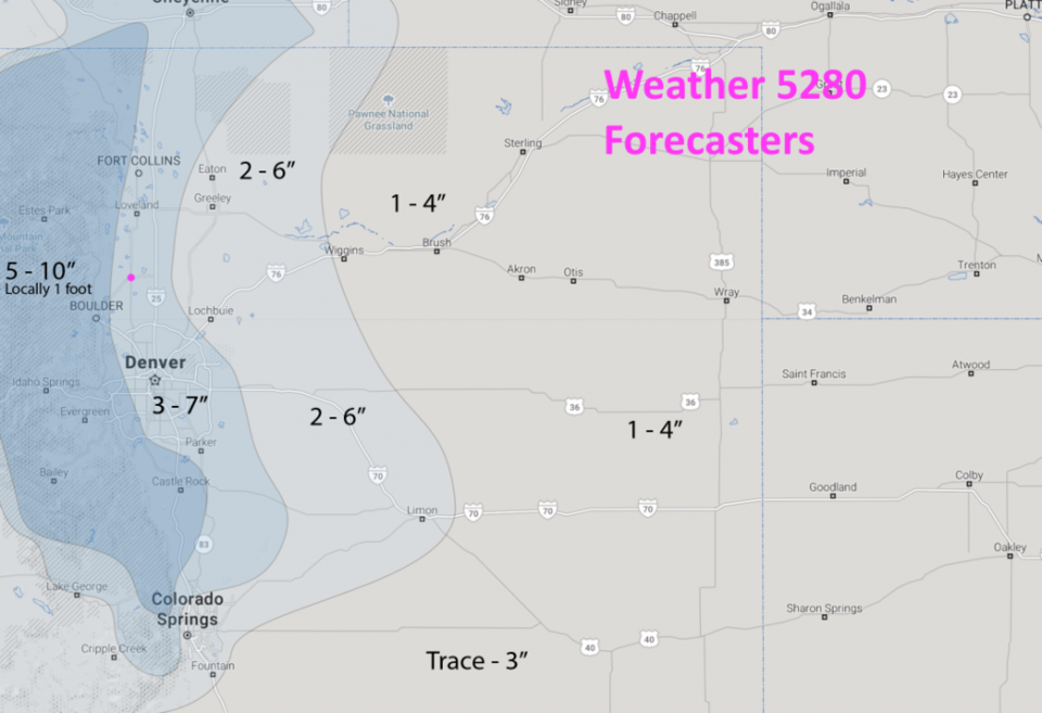
The weather5080 folks give us 3-7 inches (extrapolating - 5-6 inches - Figure 11).
Channel 7 printed out 7.3 inches on their 10pm TV cast.
The NWS has 6-10 inches in their warning text above.
The Longer Range Forecast:
We do NOT really warm up after this storm. After dropping to below zero values Tuesday morning, we remain below normal for the rest of the week with maybe three additional shots of snow Friday, Sunday and Tuesday. We'll look at those in detail in the days to come.