This content was originally published by the Longmont Observer and is licensed under a Creative Commons license.
In Brief:
We are mid-storm as this post goes up. Bands of snow are setting up (jet stream influence). Some will see a good deal more snow than neighborhoods just a few miles away by the time morning comes Tuesday. Snowfall rates decrease to flurries after 9am but are possible all day Tuesday. Another burst of snow is possible Tuesday evening before this storm comes to an end. The Thursday/Friday storm is now shaping up to deliver 6 inches or more new snow. Yet another storm comes in Sunday night into Monday. Be ready for sub zero temperatures Wednesday morning.
Update 2/4 10:30am:
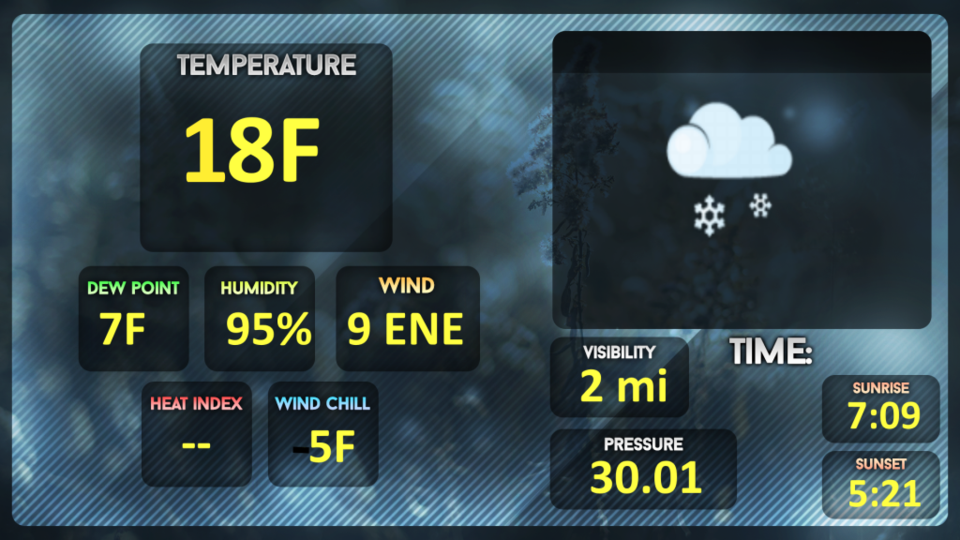
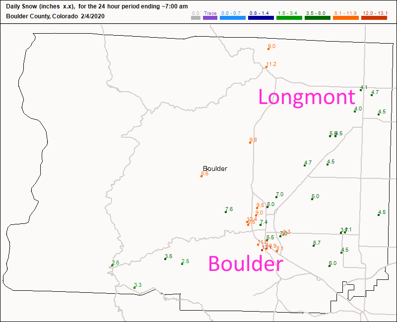
It is still snowing very lightly and temperatures are hovering in the mid teens. Brrrr. Longmont has received about 4-5 inches across town (Figure 1 update) while Boulder has seen 6-10 inches. Light snow (maybe a bit heavier than just light around sunset) will fade out after 9pm. The winter storm warning has been canceled by the NWS.
End 2/4 10:30am udpate.
Forecast Discussion:
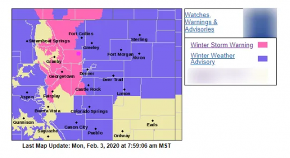
Starting with the NWS and the winter storm warning still in effect:
Winter Storm Warning Issued: 3:21 PM Feb. 3, 2020 – National Weather Service
...WINTER STORM WARNING REMAINS IN EFFECT UNTIL 6 AM MST
TUESDAY... Figure 2

* WHAT...Snow, moderate to heavy at times overnight. Additional
snow accumulations of 6 to 12 inches. Winds gusting as high as
40 mph near the Wyoming border.

* WHERE...The Southern Front Range Foothills, The Northern Front
Range Foothills and Boulder and the western suburbs of Denver.

* WHEN...Until 6 AM MST Tuesday. The heaviest snow will be this
evening through about 2 AM.

* IMPACTS...Travel could be very difficult through the evening
commute and again Tuesday morning.

PRECAUTIONARY/PREPAREDNESS ACTIONS...

Consider alternate plans for travel this evening and overnight.
If you must travel, keep an extra flashlight, food, and water in
your vehicle in case of an emergency.

The latest road conditions can be obtained by calling 5 1 1 or
visiting www.cotrip.org.
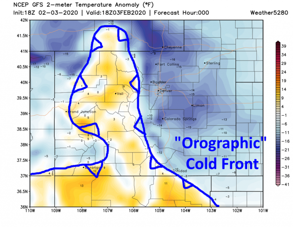
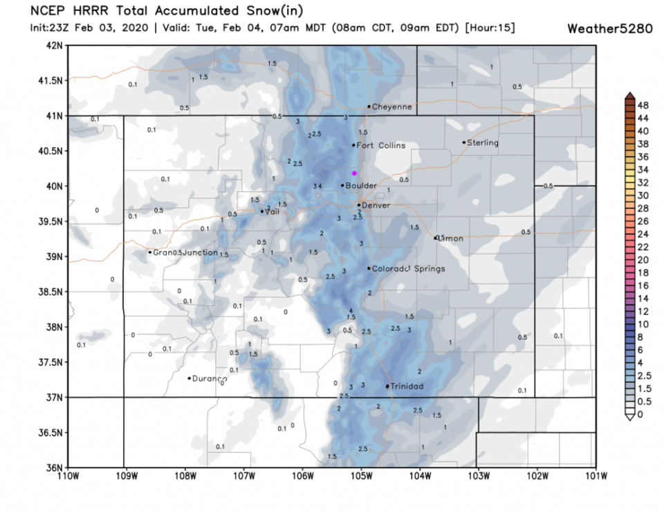
The current conditions at time of post are in Figure 1 (new graphics!). This initial cold air is very shallow. You can see it surrounding the Rockies at low elevations with a topography (orographic) created cold front (Figure 3). The HRRR gives us about 2-3 inches more snow created by the mountains and this strange frontal boundary (Figure 4).
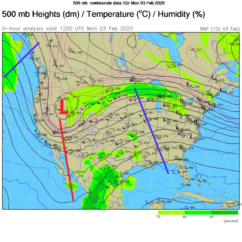
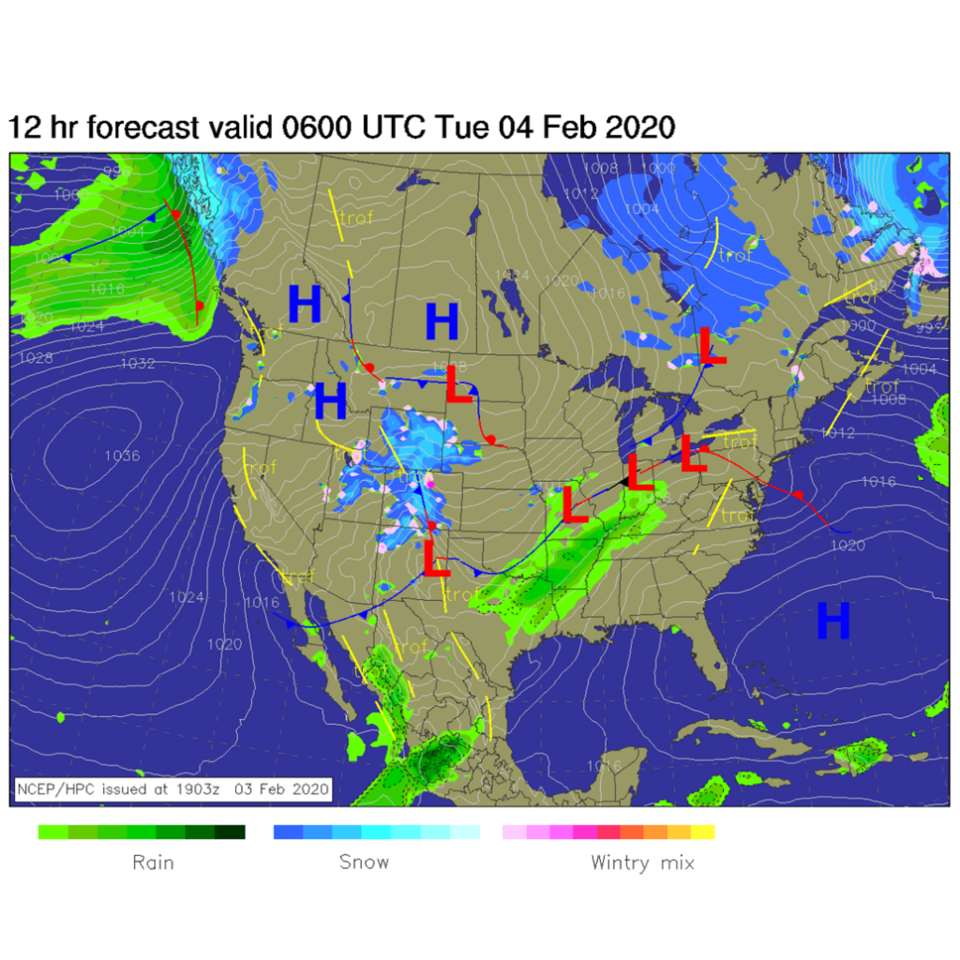
At the upper layers, the closed off low to our west is tracking this direction. We are on the uphill (stormy) side of the trough to our west (Figure 5) for the rest of Monday night into Tuesday morning. Later tonight, the snow continues near the mountains (Longmont is close enough to get snow, but the Plains miss out - Figure 6).
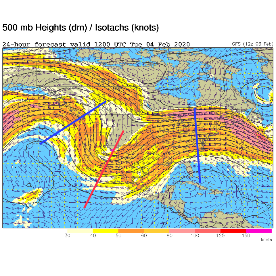
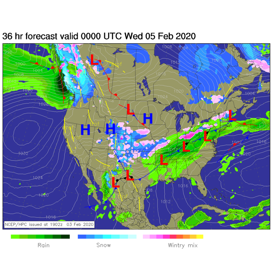
By Tuesday morning, the trough will be overhead (Figure 7). As the trough axis passes (red line), we will see less upper level support for any heavy snow. Light snow is still possible over the entire state (Figure 8).
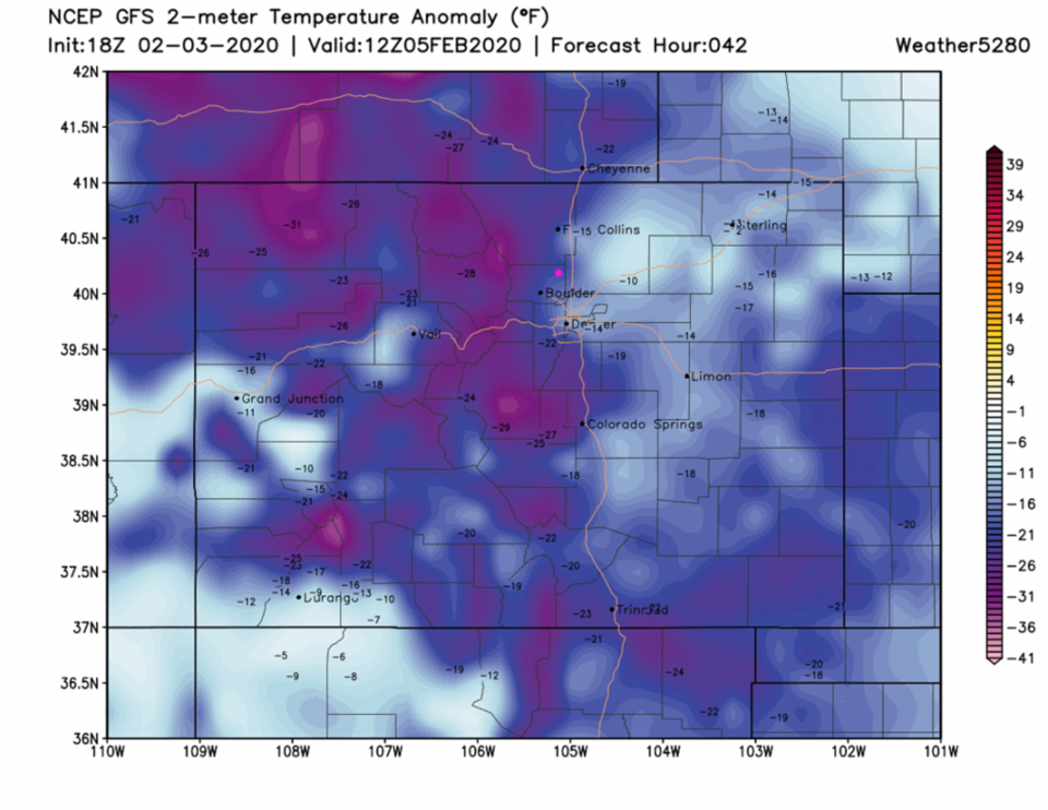
Early Wednesday morning we'll see that the cold air is finally deep enough to cover even the highest mountains. Temperatures will be about 25F below normal in town (Figure 9).
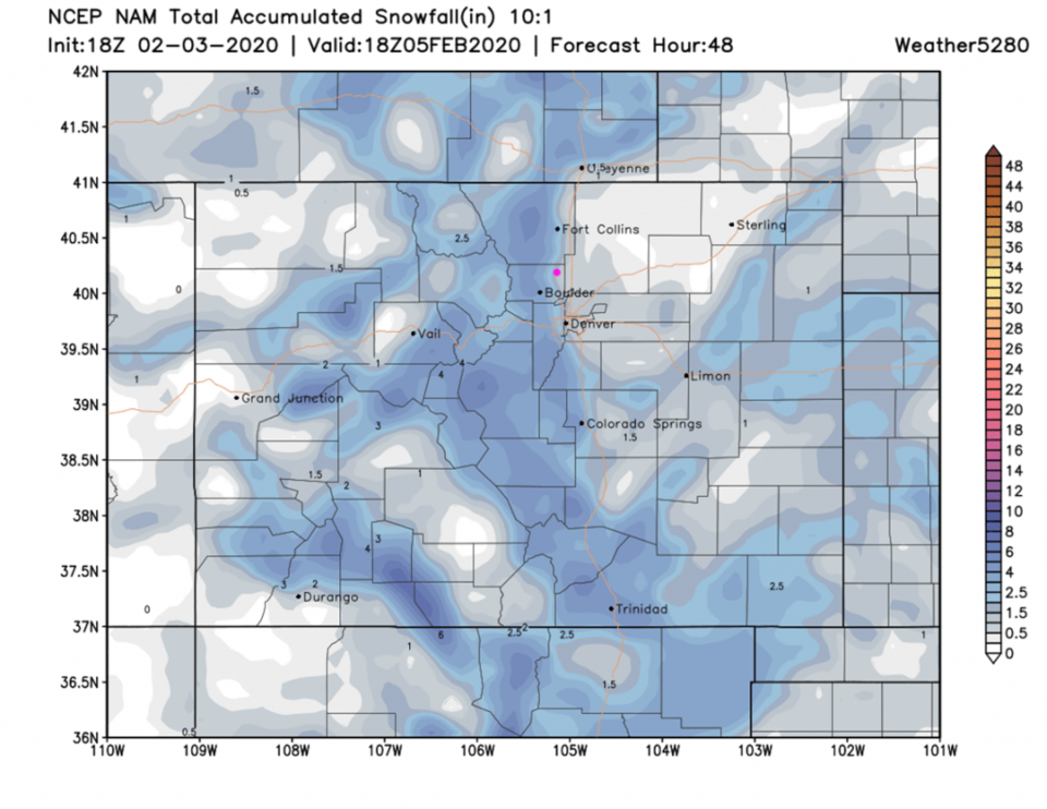
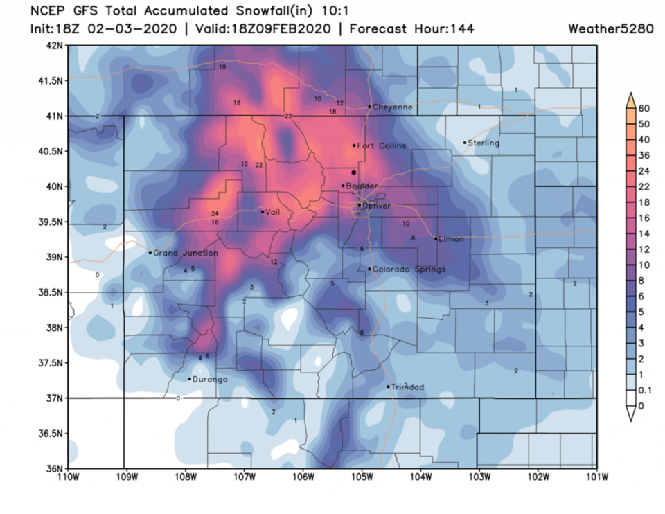
The GFS's take on the snow for the next 48 hours is an additional 2-4 inches east to west across Longmont (Figure 10).
The Longer Range Forecast:
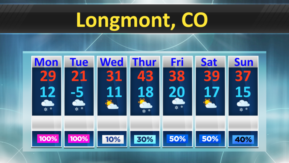
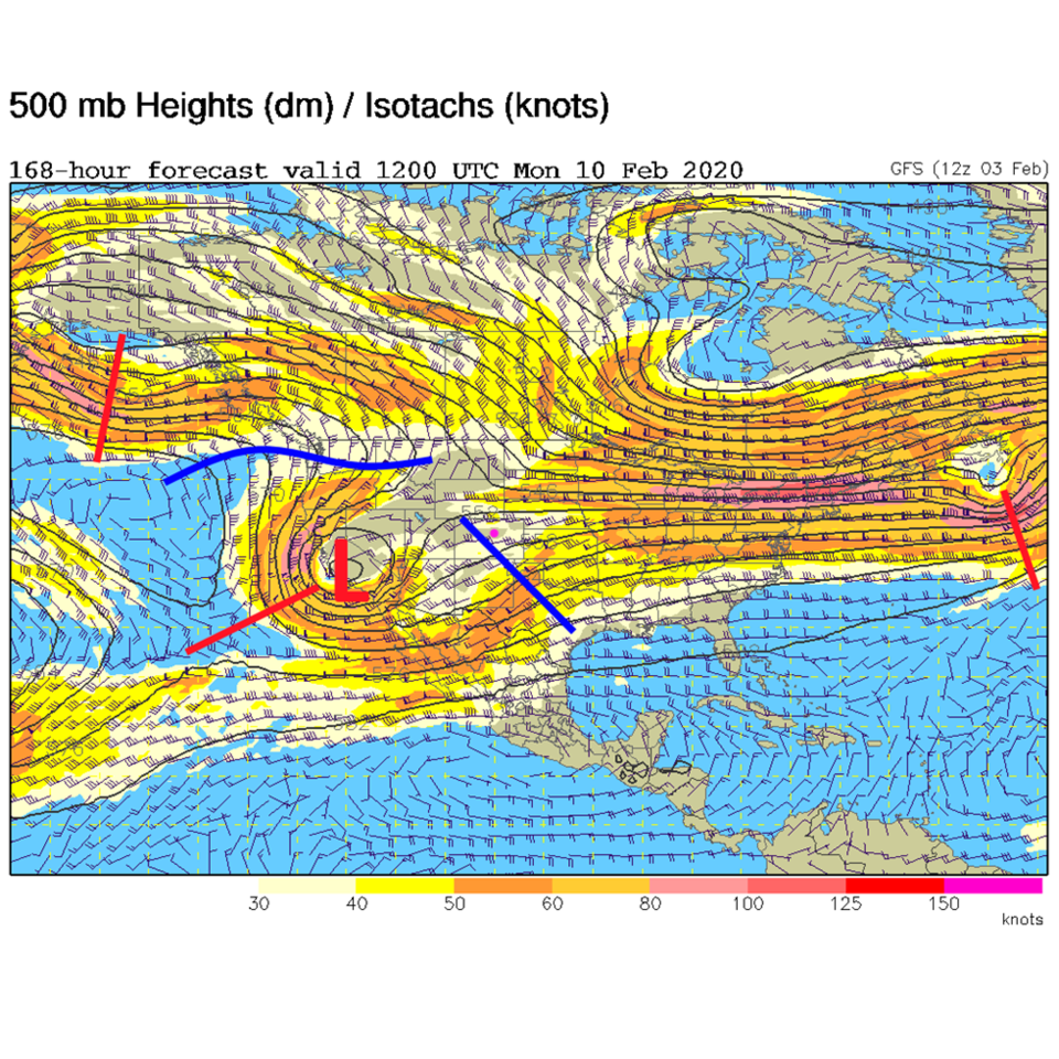
More new graphics for the long range forecast shows temperatures stay seasonably chilly starting Thursday with below normal high temperatures for the rest of the week (Figure 11). There are good snow chances Tuesday and again Thursday/Friday. Snow picks up again Sunday night. The Sunday storm is in response to a deep upper level low tracking more to our south (Figure 12). It may be crazy, but the rest of this storm, the week-end storm, and the storm at the start next may add up to more than 18 inches if the GFS is correct (Figure 13). We'll keep an eye on it together.