This content was originally published by the Longmont Observer and is licensed under a Creative Commons license.
Forecast Discussion:
10am Update:
A quick update on snow banding... Figure 1 update shows the GFS is still drawing banded features in with snow amounts topping a foot up in the bands in the mountains. Comparing to yesterday's model run (Figure 5), the pattern is remarkably stable. There is a band that is hanging out over Boulder county in this model. This will be interesting to watch.
End 10am Update.
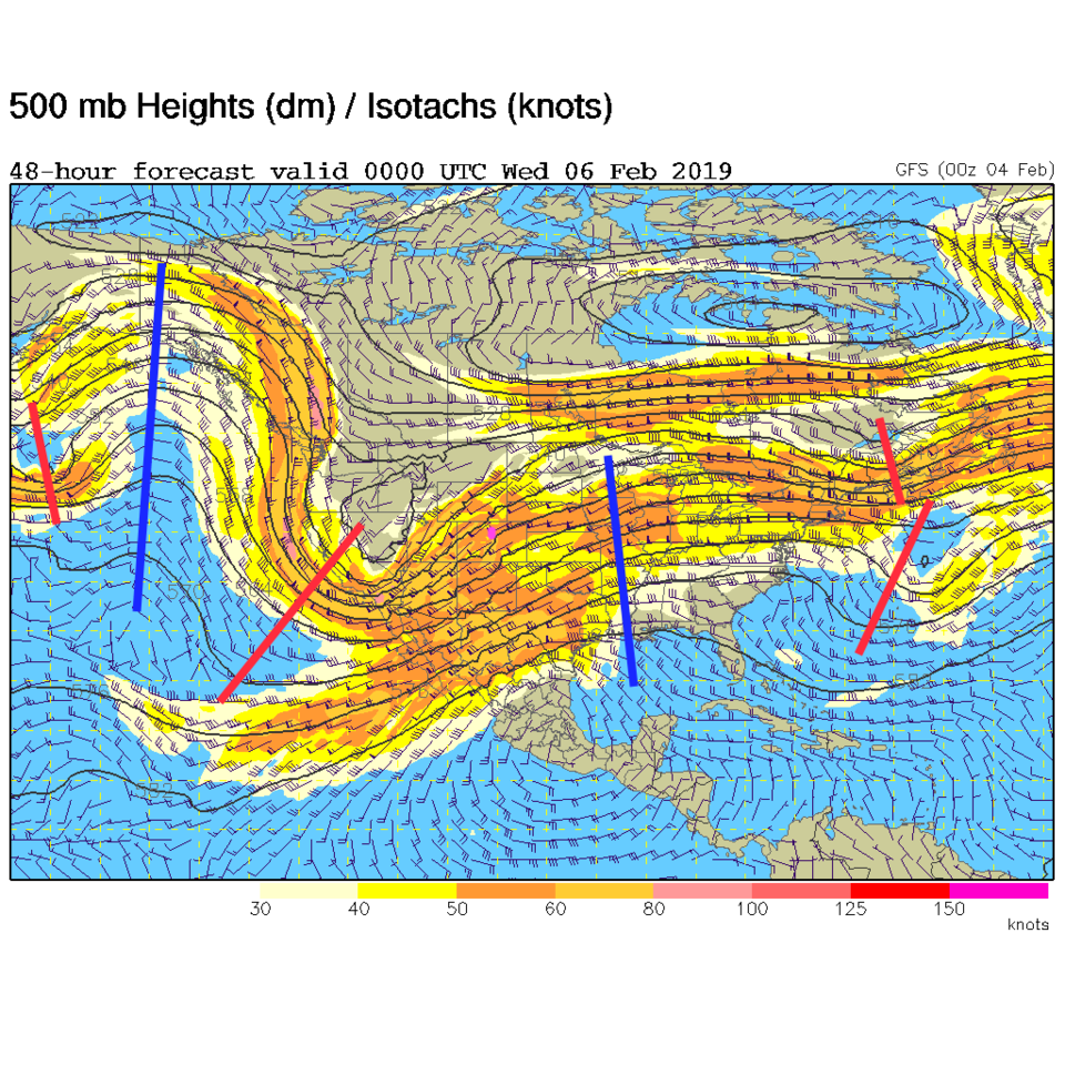
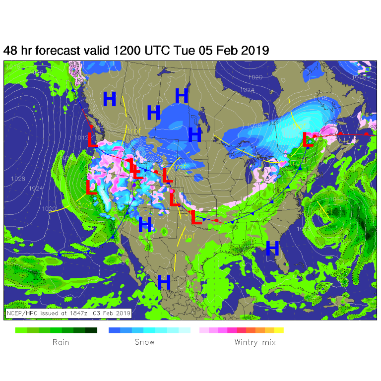
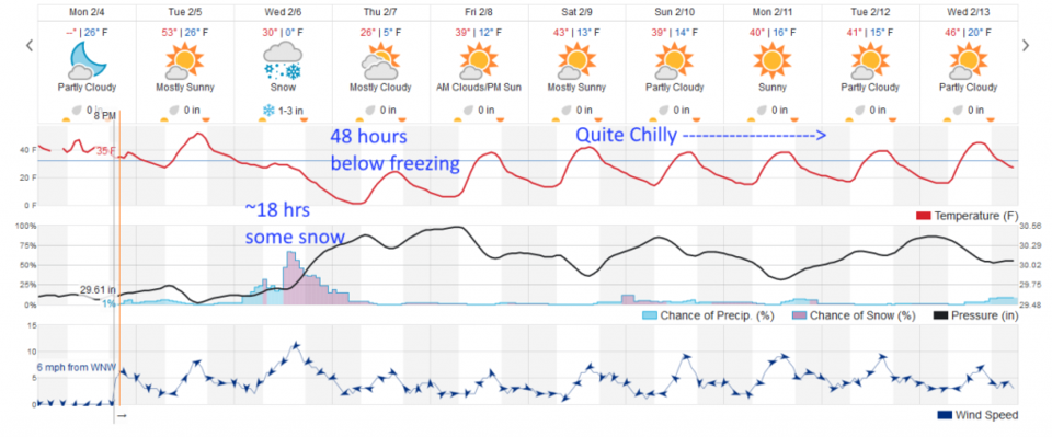
Soak up the warm weather while you can. We'll look at temperatures in a bit, but the big news is the storm coming in tomorrow (Wednesday). The upper air map for tonight (Tuesday PM) shows the deep trough forming over the Southwestern U.S. (Figure 1). The surface map for this morning (Tuesday AM) shows a big wet/sloppy/snowy mess effecting 11 states including Colorado. We make it to mid 50'sF today before the pacific front moves in around 4pm today cooling us a bit (Figure 3). The arctic flow hits with another front around 11am Wednesday and any rain showers that begin will quickly change to snow that lasts until near dawn on Thursday (timing from weatherunderground's model).
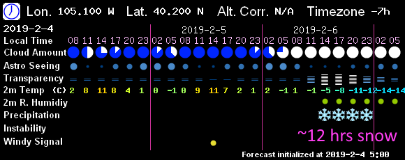
The 7! Timer model (GFS) limits snow to roughly noon to midnight Wednesday (Figure 4).
How much snow? The forecasters at weather5280 noted the banding effects showing up in the models with this storm. That means the entire region gets some snow, but due to jet stream dynamics and extra surface convergence -upper air lift/divergence will create relatively thin lines of extra heavy snow amounts (not as severe as our last storm in northern Denver, but similar).
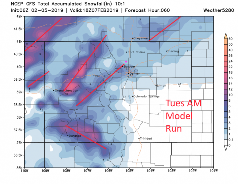
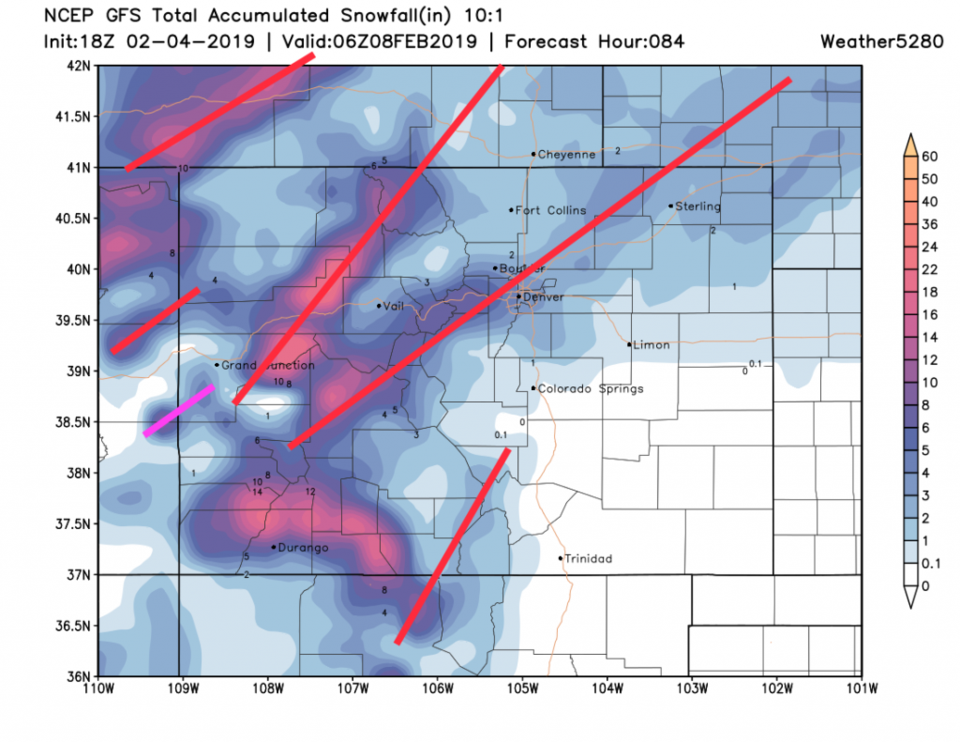
Figure 5, the GFS, shows its noon Monday run's idea of where those bands will fall (I drew rough red lines to highlight them). These change position run to run. Longmont sees 1-2 inches unless banding sets up then it could be up to 6 inches.
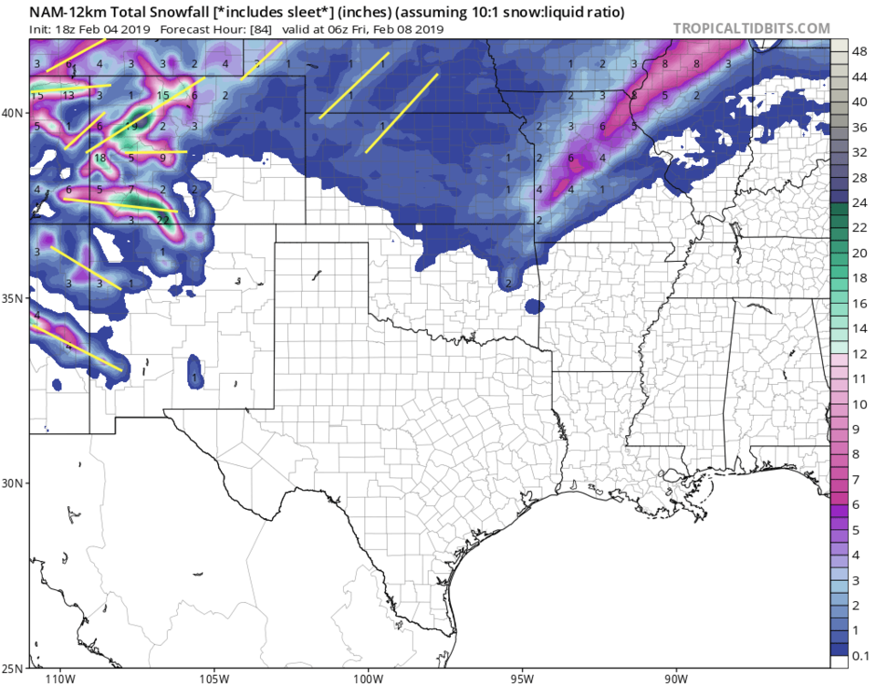
Figure 6, the NAM, has similar banding features (I highlighted approximate locations in yellow this time). Here Longmont receives 2-4 inches with up to 8 inches under lucky banding.
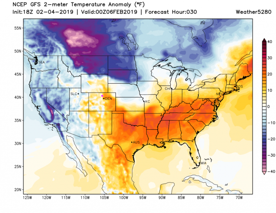
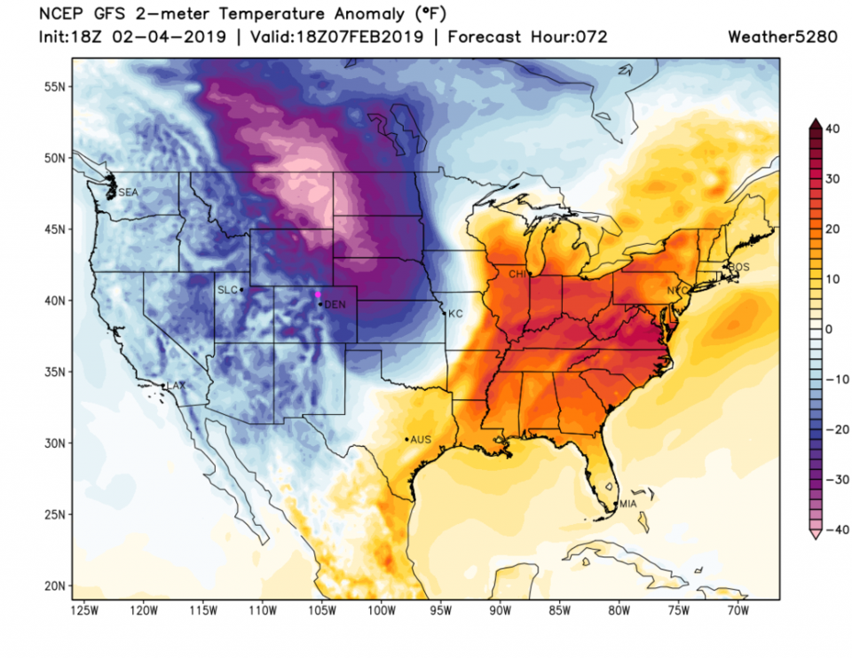
Another important feature of this weather event is the temperature change. For this evening, we are some 15-18 F above normal (Figure 7). By noon Thursday, we are about 25F below normal (Figure 8). Over two days, we'll see an almost 40F drop in temperatures.
The longer range forecast:
Back on Figure 3, you'll see that we remain in the upper 30'sF to mid 40'sF through the middle of next week with no significant new storm visible. Dry and cold.