Skip to content

Next Storm/Next Snow Forecast Discussion from the Cherrywood Observatory – February 8, 2019

This content was originally published by the Longmont Observer and is licensed under a Creative Commons license.

Forecast Discussion:

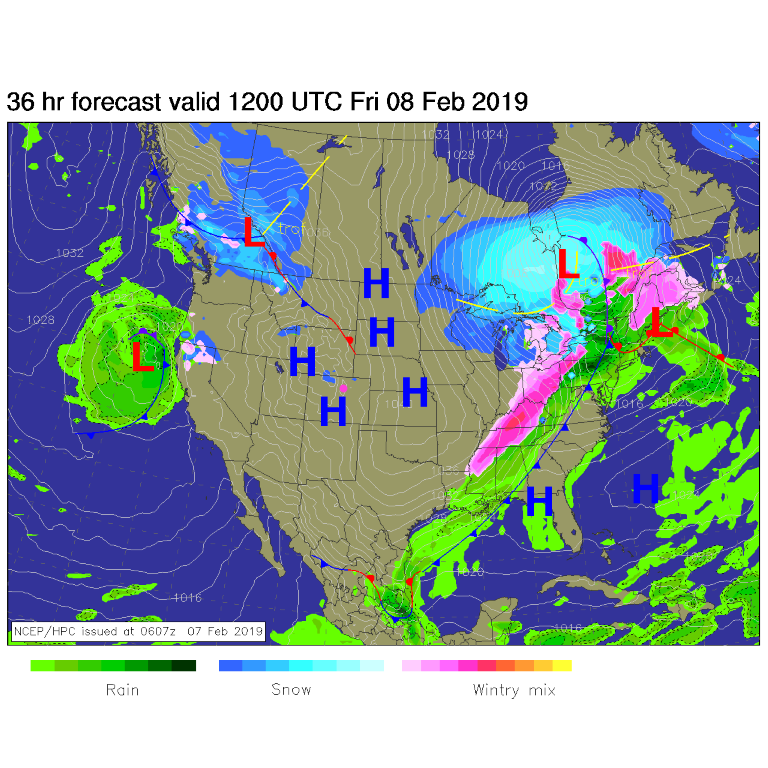
The storm is past and the cold air is being modified (warmed by the sun) and pushed to the east. High pressure dominates the region (Figure 1).

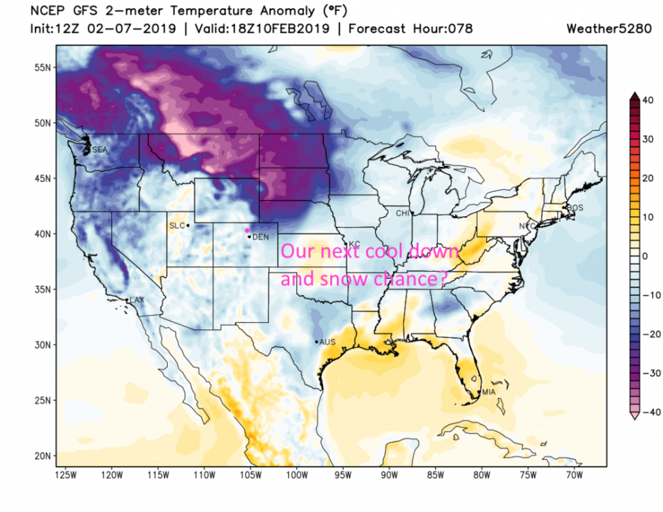
On Thursday we were some -25°F below normal (Figure 2). By Friday (today) noon, we'll only be about -15°F below normal. Wow! Heat wave.

The longer range forecast:

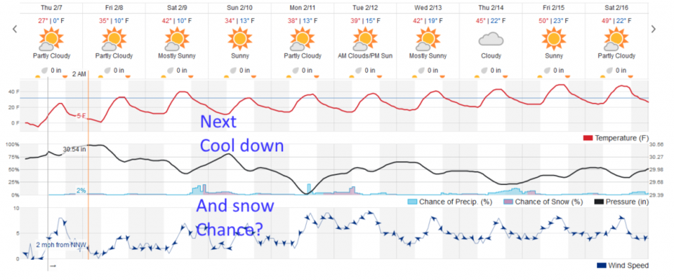
Sunday, another shot of cold comes from western Canada and the northern U.S. Rockies. Figure 4 shows the maximum extent of this cold air - it is not extending as far south and is not as impactful to Longmont.  That has us about -15°F below normal again. This next cool down drops us from a high in the lower 40's F on Saturday to right about freezing for Sunday (Figure 5).

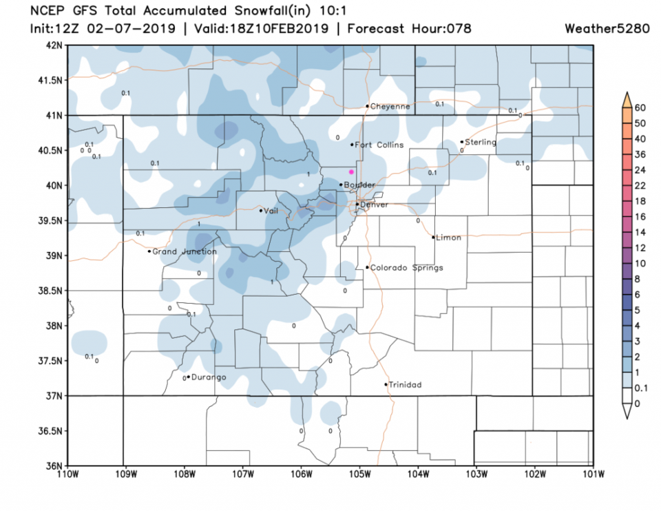
The snow chances are pretty minimal, at this time, with this front. They don't print a snow amount on the weatherunderground site - the GFS gives us a coating to 1 inch Saturday PM into Sunday AM (Figure 6).  We probably won't have to shovel much this time.

Figure 2: The forecast surface map for Friday AM. From NCEP.

Figure 2: The forecast temperature departure from normal map from the GFS and weather5280.com for Colorado, Thursday noon.

Figure 3: The forecast temperature departure from normal map from the GFS and weather5280.com for Colorado, Friday noon.

Figure 4: The forecast temperature departure from normal map from the GFS and weather5280.com for Colorado, Sunday noon.

Figure 5: the graphical forecast for the next 10 days for Longmont, CO from weatherunderground.com

Figure 6: the forecast accumulated snow map from the GFS and weather5280.com for Colorado, through Sunday noon.

Current Weather

Mostly cloudy

Mostly cloudy

40°F

UV Index
0 Low
Pressure
29.95 Falling
Visibility
8 miles
Dewpoint
36 °F
Humidity
87%
Wind
WNW 1.7 mph
Gust
3.1 mph
Wind Chill
40 °F

Hourly Forecast

Today
4 AM
39°F
Partly cloudy
Today
5 AM
38°F
Partly cloudy
Today
6 AM
37°F
Partly cloudy
Today
7 AM
40°F
Partly sunny
Today
8 AM
48°F
Partly sunny
Today
9 AM
54°F
Partly sunny
Today
10 AM
58°F
Partly sunny
Today
11 AM
62°F
Partly sunny
Today
12 PM
65°F
Partly sunny
Today
1 PM
67°F
Partly sunny
Today
2 PM
68°F
Partly sunny
Today
3 PM
69°F
Partly sunny

7 Day Forecast

Intermittent clouds

Sunday

64 °F

Warmer with times of clouds and sun


Intermittent clouds

Sunday Night

37 °F

Partly cloudy


Partly sunny

Monday

70 °F

Partly sunny and pleasant


Intermittent clouds

Monday Night

43 °F

Partly cloudy


Mostly sunny

Tuesday

73 °F

Mostly sunny; windy in the morning, then pleasant in the afternoon


Intermittent clouds

Tuesday Night

43 °F

Clearing


Intermittent clouds

Wednesday

65 °F

Periods of clouds and sun; breezy in the afternoon


Intermittent clouds

Wednesday Night

39 °F

An evening thundershower in spots; otherwise, partly cloudy


Rain

Thursday

57 °F

Increasingly windy with occasional rain and drizzle; cooler


Mostly clear

Thursday Night

32 °F

Mainly clear


Sunrise and Sunset

Sunrise
6:03 AM
Sunset
7:53 PM

Based on AccuWeather data