Skip to content
Join our Newsletter

Next Storm/Next Snow Forecast Discussion from the Cherrywood Observatory – January 13-15, 2020

This content was originally published by the Longmont Observer and is licensed under a Creative Commons license.

In Brief:

Hold on, I'm looking something up... tedious, dull, monotonous, repetitious, unvaried, dry... OK those were synonyms for boring. Except for a slight chill and a couple of dry cold fronts, Longmont will see very little variation in the weather for the next week or more. That just means that exciting winter weather is building up for a big hit later this season! (I hope.)

Forecast Discussion:

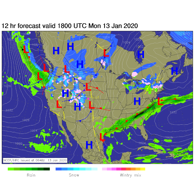
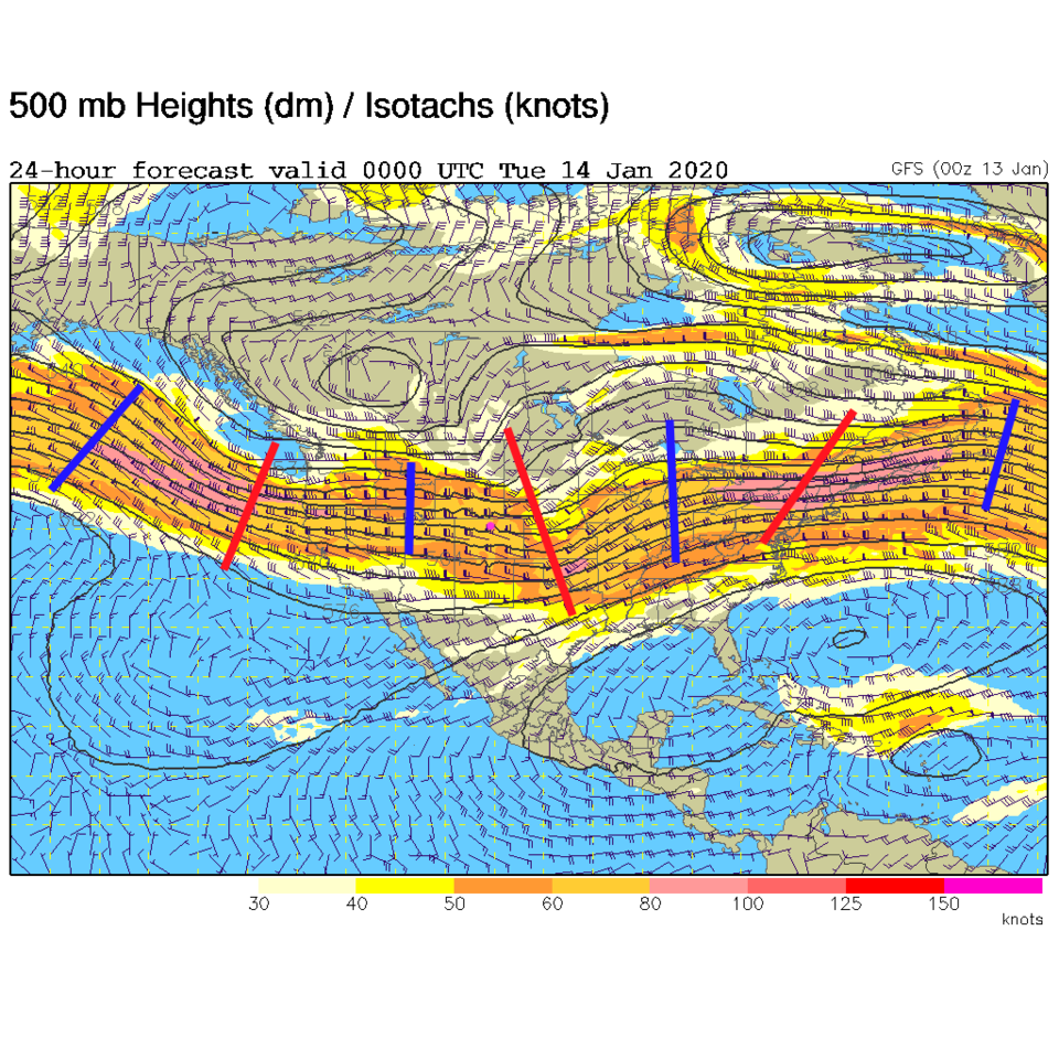
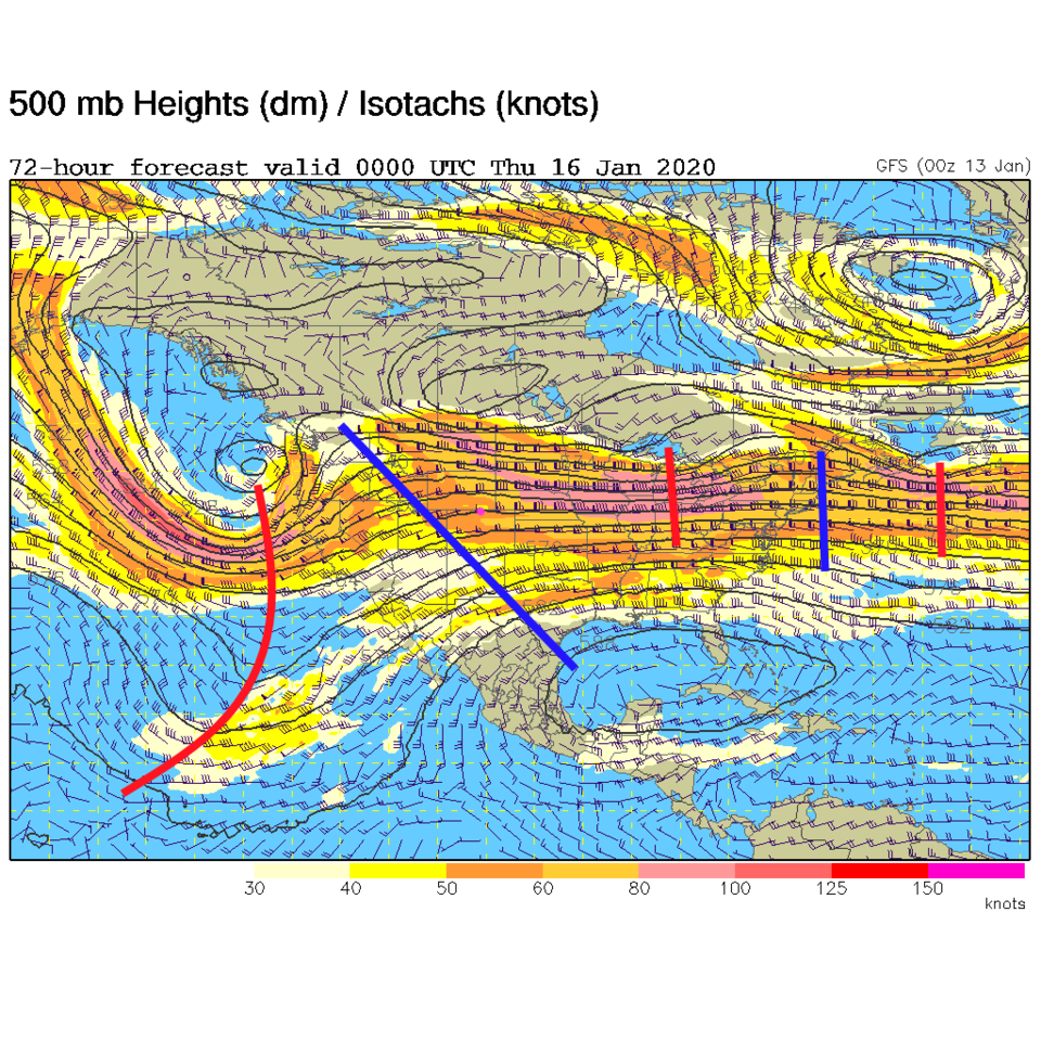
Snow continues in the mountains with most to all ski resorts getting a daily addition of fresh powder (Figure 1). We'll see warming down-slope flow here with some gusty windy conditions this afternoon (Monday). The upper air pattern this week is very "zonal" or flowing west to east. There is a gentle troughniess in the West with small short waves embedded in the flow. These troughs aren't deep enough or slow enough to pull in moisture east of the Rockies (Figure 2). We remain dry.

The Longer Range Forecast:

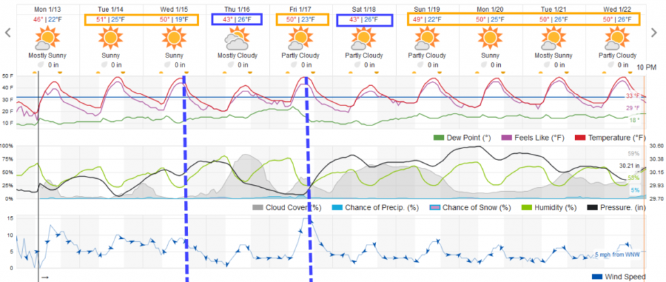
We will see about 5-8 degrees of cool down from a dry cool front Wednesday afternoon and again Friday afternoon (Figure 3). The rest of the time we'll rise to about 50F each afternoon. Those fronts do mean that the mountains will see a bit more enhanced snow fall rates (good for them!).

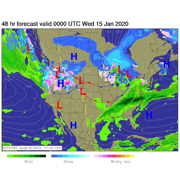
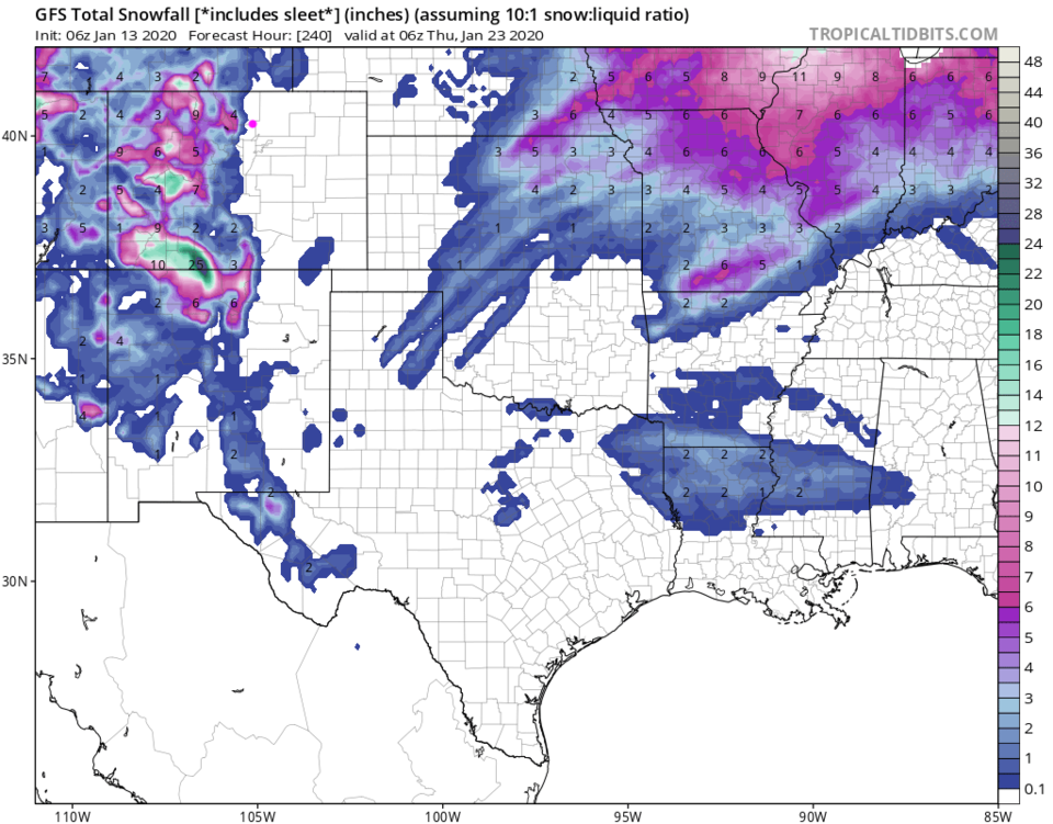
The first front is approaching Tuesday night (Figure 4). The upper air pattern rebounds to a shallow ridge heading into Thursday (Figure 5) - allowing us to quickly warm again to 50F (watch for down slop winds every 'warm' day). Over the next 10 days the mountains see a foot to a foot and a half in the higher mountains, but no snow occurs down on the Plains (Figure 6).

Figure 1: The forecast surface map for Monday noon from NCEP.
Figure 2: The 500mb forecast upper air analysis for early Monday PM. Pink dot is Longmont. Red lines are troughs, blue lines are ridges.
Figure 3: the graphical forecast for the next 10 days for Longmont, CO from weatherunderground.com
Figure 4: The forecast surface map for Tuesday night from NCEP.
Figure 5: The 500mb forecast upper air analysis for early Wednesday PM. Pink dot is Longmont. Red lines are troughs, blue lines are ridges.
Figure 6: 10:1 (snow to liquid) snowfall totals through the next 10 days from the GFS and tropicaltidbitscom for Colorado made Monday morning.

Current Weather

Cloudy

Cloudy

70°F

UV Index
4 Moderate
Pressure
30.21 Falling
Visibility
6 miles
Dewpoint
60 °F
Humidity
69%
Wind
NE 1.7 mph
Gust
3.7 mph
Wind Chill
70 °F

Hourly Forecast

Today
12 PM
73°F
Mostly cloudy
Today
1 PM
76°F
Mostly cloudy
Today
2 PM
78°F
Mostly cloudy
Today
3 PM
80°F
Mostly cloudy
Today
4 PM
82°F
Mostly cloudy
Today
5 PM
84°F
Intermittent clouds
Today
6 PM
82°F
Intermittent clouds
Today
7 PM
79°F
Intermittent clouds
Today
8 PM
77°F
Intermittent clouds
Today
9 PM
73°F
Partly cloudy
Today
10 PM
69°F
Partly cloudy
Today
11 PM
65°F
Intermittent clouds

7 Day Forecast

Mostly cloudy

Saturday

84 °F

Clouds and breaks of sun; smoke from area fires will lead to poor air quality


Partly cloudy

Saturday Night

58 °F

Partly cloudy


Partly sunny w/ showers

Sunday

94 °F

Partly sunny with a passing shower in the afternoon


Partly cloudy

Sunday Night

61 °F

Partly cloudy


Mostly cloudy

Monday

91 °F

Considerable cloudiness


Mostly clear

Monday Night

60 °F

Clear to partly cloudy


Intermittent clouds

Tuesday

92 °F

Sun through high clouds


Partly cloudy

Tuesday Night

58 °F

Partly cloudy


Intermittent clouds

Wednesday

84 °F

Not as warm with times of clouds and sun; a thunderstorm in spots in the afternoon


Intermittent clouds

Wednesday Night

58 °F

An evening thunderstorm; otherwise, partly cloudy


Sunrise and Sunset

Sunrise
5:41 AM
Sunset
8:30 PM

Based on AccuWeather data