This content was originally published by the Longmont Observer and is licensed under a Creative Commons license.
In Brief:
Dry and above normal temperatures (normal is 44F for a high and 11F for a low) continue into the middle of next week. A dry cold front will kick up winds and cool us to normal for a day Friday afternoon into Saturday. There is a hint of a snow storm late next week (if it holds together!).
Update 1/17 8am:
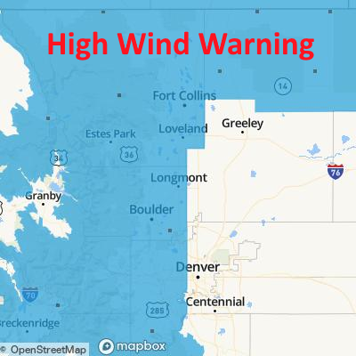
The winds may hold off a couple of hours, not hitting until around noon, but will continue into the early morning hours Saturday. The areal extent of the warning has expanded to include the eastern Plains as well (Figure 3 update).
High Wind Warning Issued: 6:19 AM Jan. 17, 2020 – National Weather Service
...HIGH WIND WARNING REMAINS IN EFFECT FROM 11 AM THIS MORNING TO
2 AM MST SATURDAY...

* WHAT...West winds 30 to 40 mph with gusts up to 75 mph
expected.

* WHERE...Larimer and Boulder Counties Between 6000 and 9000
Feet, Jefferson and West Douglas Counties Above 6000
Feet/Gilpin/Clear Creek/Northeast Park Counties Below 9000
Feet, Larimer County Below 6000 Feet/Northwest Weld County and
Boulder and Jefferson Counties Below 6000 Feet/West Broomfield
County.

* WHEN...From 11 AM Friday to 2 AM MST Saturday.

* IMPACTS...Strong winds will blow around unsecured objects.
Tree limbs could be blown down and a few power outages may
result. Travel will be difficult for high profile vehicles.

PRECAUTIONARY/PREPAREDNESS ACTIONS...

Strong winds may lead to property damage. Hazardous driving
conditions due to powerful cross winds will pose a serious risk
for drivers, especially for light weight and high profile
vehicles. Loose outdoor items should be brought inside or secured
properly.
End 1/17 8am update.
Update 1/16 4pm:
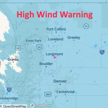
Certainty has increased as the event draws nearer - we are now under a High Wind Warning (Figure 2 update).
High Wind Warning Issued: 4:09 PM Jan. 16, 2020 – National Weather Service
...HIGH WIND WARNING IN EFFECT FROM 11 AM FRIDAY TO 2 AM MST
SATURDAY...

* WHAT...West winds 30 to 40 mph with gusts up to 75 mph
expected.

* WHERE...Larimer and Boulder Counties Between 6000 and 9000
Feet, Jefferson and West Douglas Counties Above 6000
Feet/Gilpin/Clear Creek/Northeast Park Counties Below 9000
Feet, Larimer County Below 6000 Feet/Northwest Weld County and
Boulder and Jefferson Counties Below 6000 Feet/West Broomfield
County.

* WHEN...From 11 AM Friday to 2 AM MST Saturday.

* IMPACTS...Strong winds will blow around unsecured objects.
Tree limbs could be blown down and a few power outages may
result. Travel will be difficult for high profile vehicles.

PRECAUTIONARY/PREPAREDNESS ACTIONS...

Strong winds may lead to property damage. Hazardous driving
conditions due to powerful cross winds will pose a serious risk
for drivers, especially for light weight and high profile
vehicles. Loose outdoor items should be brought inside or secured
properly.
End 1/16 4pm Update.
Update 1/16 8am:
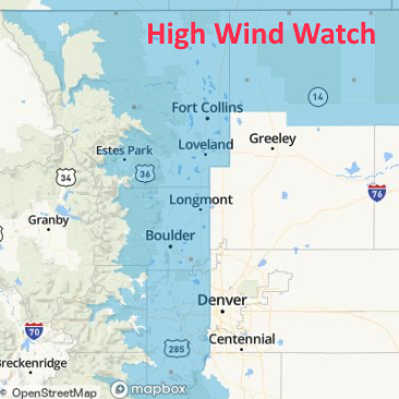
This next short wave (below) and the burst of precipitation coming to the mountains plus the approaching Friday cool front are expected to really kick winds up Friday into Saturday morning. High Wind Warnings may be issued later tonight or in the morning Friday in places. In the meantime, we are under a High Wind Watch (see text below from the NWS and Figure 1 update).
High Wind WatchIssued: 6:33 AM Jan. 16, 2020 – National Weather Service
...HIGH WIND WATCH IN EFFECT FROM FRIDAY MORNING THROUGH LATE
FRIDAY NIGHT...

* WHAT...West winds 25 to 35 mph with gusts up to 70 mph
possible.

* WHERE...Larimer and Boulder Counties Between 6000 and 9000
Feet, Jefferson and West Douglas Counties Above 6000
Feet/Gilpin/Clear Creek/Northeast Park Counties Below 9000
Feet, Larimer County Below 6000 Feet/Northwest Weld County,
Boulder and Jefferson Counties Below 6000 Feet/West Broomfield
County and Northeast Weld County.

* WHEN...From Friday morning through late Friday night.

* IMPACTS...Strong winds will blow around unsecured objects.
Tree limbs could be blown down and a few power outages may
result. Travel will be difficult for high profile vehicles.

PRECAUTIONARY/PREPAREDNESS ACTIONS...

Monitor the latest forecasts and warnings for updates on this
situation. Fasten loose objects or shelter objects in a safe
location prior to the onset of winds.
End 1/16 8am update.
Forecast Discussion:
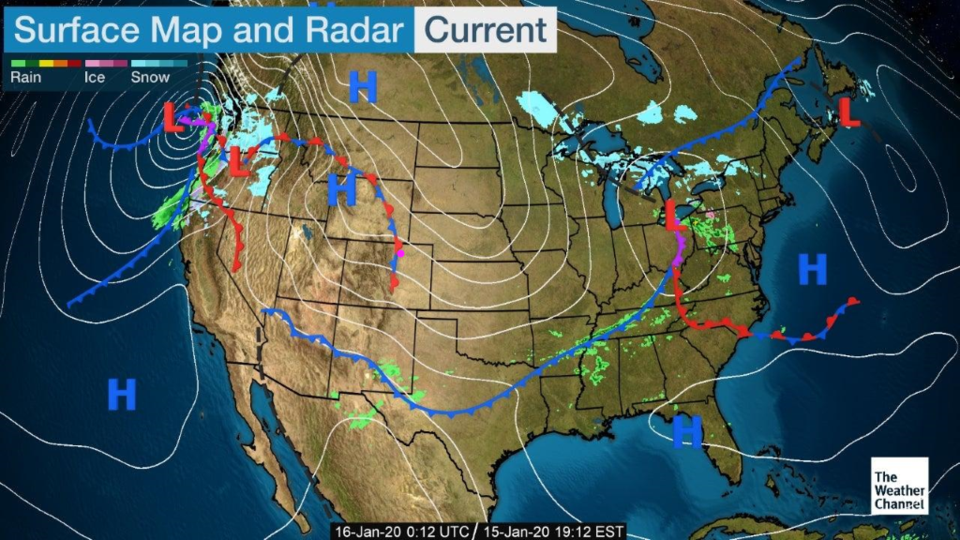
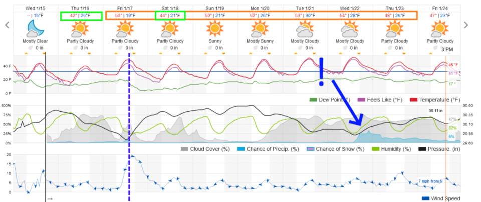
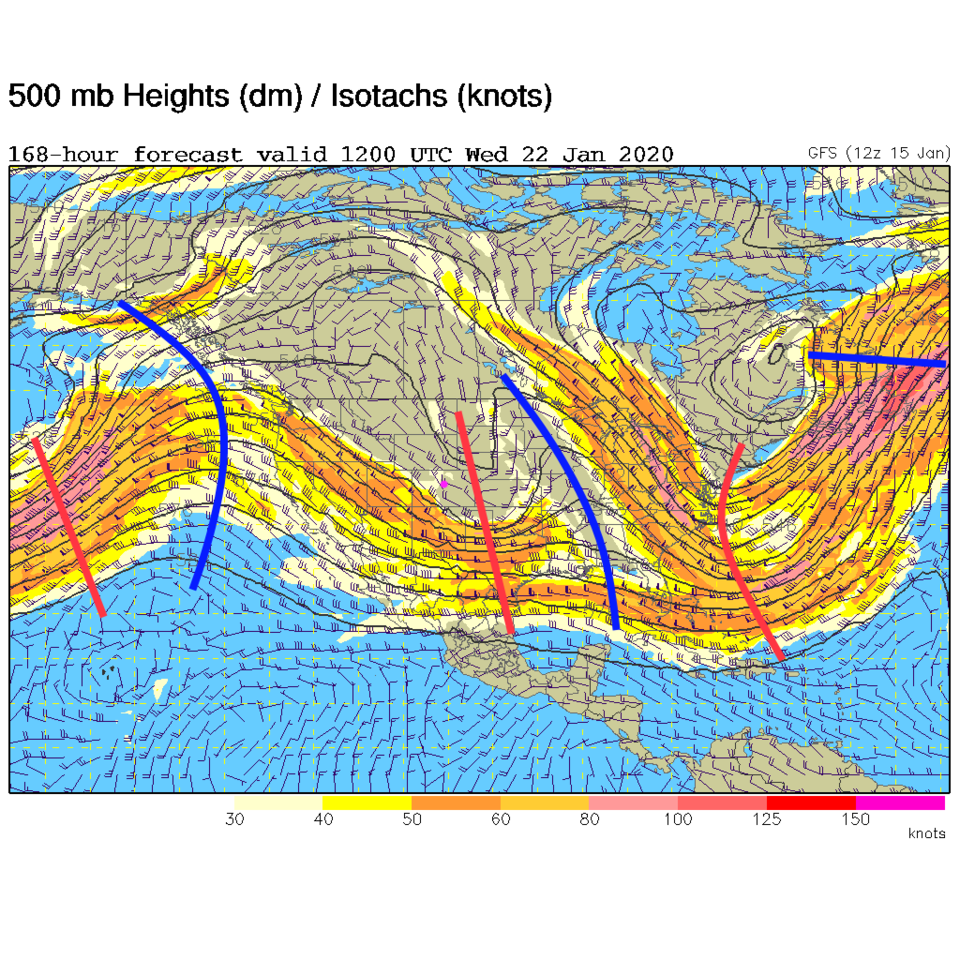
Our previously advertised "Wednesday" dry cold front has swept by and is racing down the Plains (Figure 1). We cool to a degree or two below normal Thursday then bounce back to 50F Friday before our next cool front (Friday afternoon - Figure 2). This next front is being propelled by a quick moving short wave aloft (Figure 3).
The Longer Range Forecast:
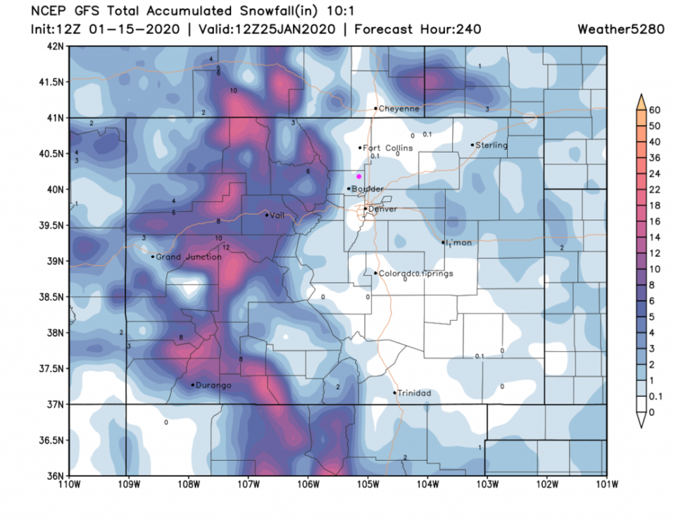
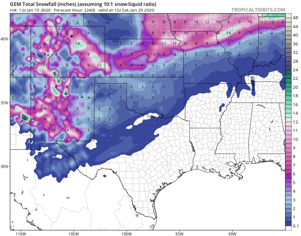
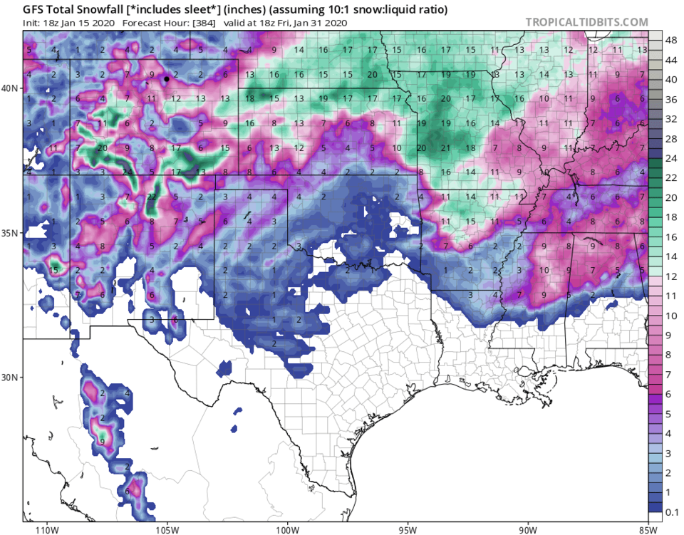
Our next chance of snow may be appearing over the horizon as a cold front and a chance of snow coming Wednesday/Thursday (Figure 2). Over the next 10 days, the GFS gives us between a coating an 1 inch of snow (next Wednesday PM mainly - Figure 4). The GEM is MUCH more excited about giving us snow and dumps 10-12 inches over the next 10 days (Figure 5). The GFS picks up on some major weather beyond 10 days out by giving us 5-7 inches of snow over the next 16 days (Figure 6). I know I'm reaching for weather news - but there is 'something' to watch now! Yahoo!