Skip to content

Next Storm/Next Snow Forecast Discussion from the Cherrywood Observatory – January 17, 2019

This content was originally published by the Longmont Observer and is licensed under a Creative Commons license.

Forecast Discussion:

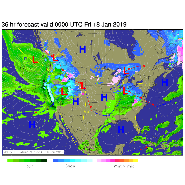
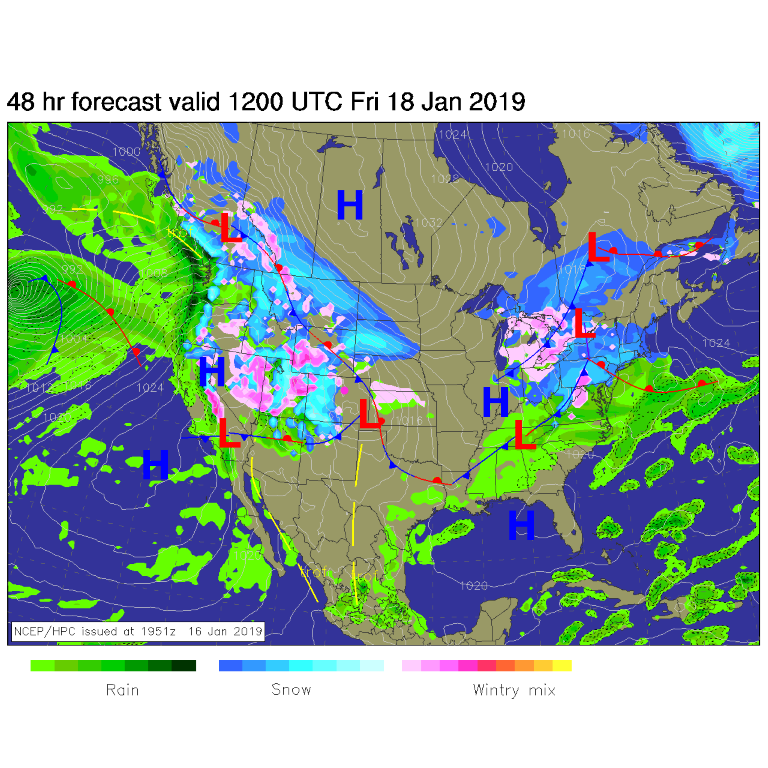
So much moisture is flowing into the west, there aren't many dry spots to find.  Snow continues today in western Colorado and higher Colorado mountains (Figure 1).  For Friday morning, snow increases a lot over the western half of the state and a low forms in SE Colorado that will send moisture back west. Up slope flow will bring rain/snow back to our area (Figure 2).

Figure 1: The forecast surface map for Thursday PM. From NCEP.

Figure 2: The forecast surface map for Friday AM. From NCEP.

The longer range forecast:

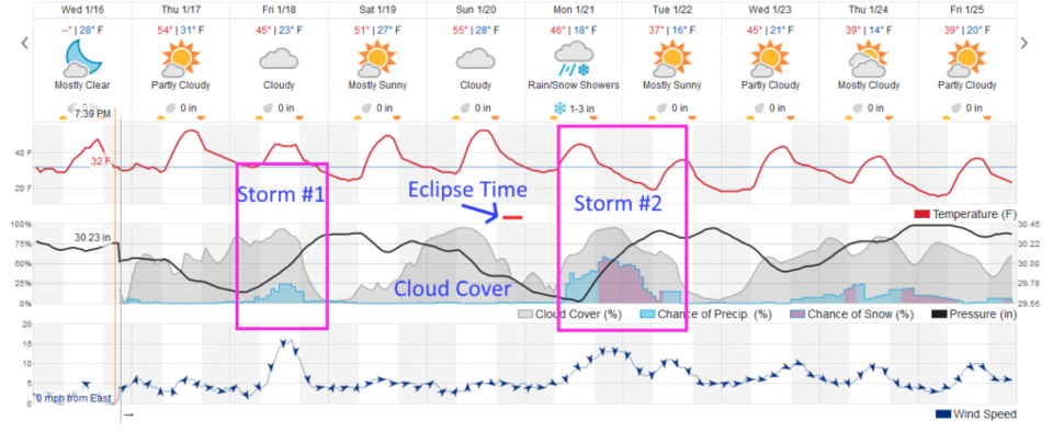
The weather underground forecast is looking less impressive for Friday (Storm #1, Figure 3). They have showers from about 6am to 8pm Friday, but not many of them (and all rain with temperatures above 40F).

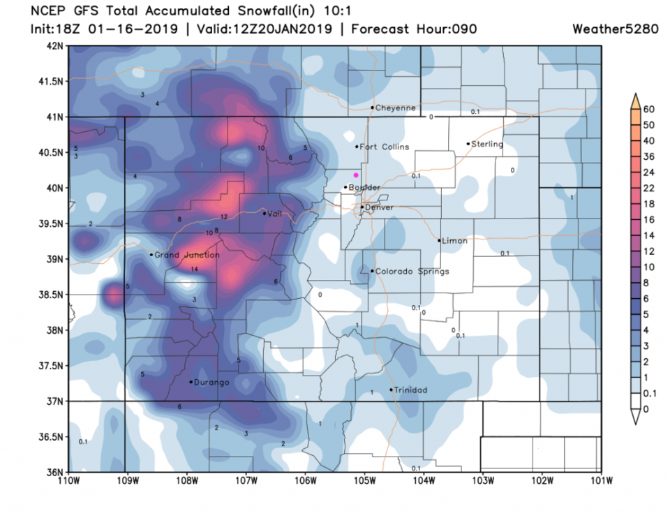
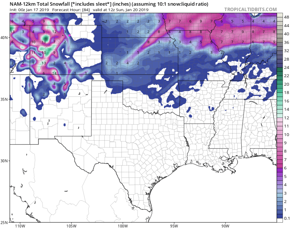
The GFS (Figure 4) skips Boulder on snow, and gives a minimal coating to Longmont.  The NAM (Figure 5) has us on the edge of no-snow but maybe a coating to an inch.  Not impressive.

Back to Figure 3, the eclipse looks like it will see temperatures above freezing (barely) for the duration of the event and less cloud cover than we saw in the forecast yesterday.

Now there is a more substantial storm (Storm #2) showing up on Monday/Tuesday next week.  This is coming in at 1-3 inches for Longmont, presently.  I'll believe THAT when it happens.

Figure 3: a snippet of the graphical forecast for the weekend forecast for Longmont, CO from weatherunderground.com

Figure 4: The forecast accumulated snow map from the GFS and weather5280.com for Colorado, for the next 5 days through Sunday noon.

Figure 5: The forecast accumulated snow map from the NAM and tropicaltidbits.com for Colorado, through Sunday noon.

Current Weather

Partly sunny

Partly sunny

56°F

UV Index
6 High
Pressure
29.61 Steady
Visibility
8 miles
Dewpoint
25 °F
Humidity
30%
Wind
WSW 10.6 mph
Gust
22.2 mph
Wind Chill
56 °F

Hourly Forecast

Today
11 AM
57°F
Showers
Today
12 PM
58°F
Mostly cloudy
Today
1 PM
59°F
Mostly cloudy
Today
2 PM
60°F
Intermittent clouds
Today
3 PM
62°F
Intermittent clouds
Today
4 PM
60°F
Intermittent clouds
Today
5 PM
58°F
Intermittent clouds
Today
6 PM
56°F
Intermittent clouds
Today
7 PM
54°F
Intermittent clouds
Today
8 PM
51°F
Intermittent clouds
Today
9 PM
48°F
Partly cloudy
Today
10 PM
45°F
Partly cloudy

7 Day Forecast

Partly sunny w/ showers

Tuesday

62 °F

A brief morning shower or two; otherwise, windy with times of clouds and sun


Partly cloudy

Tuesday Night

34 °F

Partly cloudy and colder; there can be frost in the normally colder spots


Intermittent clouds

Wednesday

59 °F

Cool with times of clouds and sun


Mostly cloudy w/ showers

Wednesday Night

37 °F

Increasing clouds with a shower in spots late


Partly sunny w/ showers

Thursday

56 °F

Times of clouds and sun with a couple of showers; cool


Partly cloudy

Thursday Night

40 °F

Partly cloudy


Mostly cloudy

Friday

63 °F

Mostly cloudy and warmer


Clear

Friday Night

40 °F

Clear


Mostly sunny

Saturday

74 °F

Mostly sunny, pleasant and warmer


Mostly clear

Saturday Night

43 °F

Mainly clear


Sunrise and Sunset

Sunrise
5:52 AM
Sunset
8:02 PM

Based on AccuWeather data