This content was originally published by the Longmont Observer and is licensed under a Creative Commons license.
Forecast Discussion:
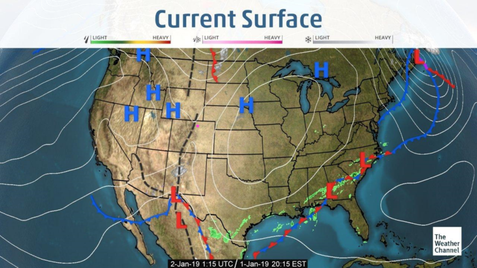
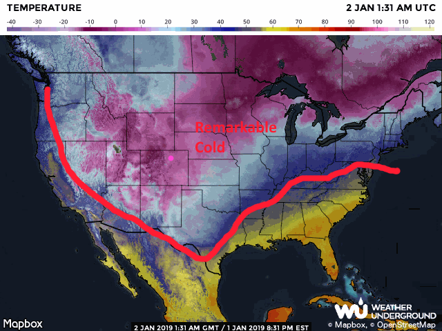
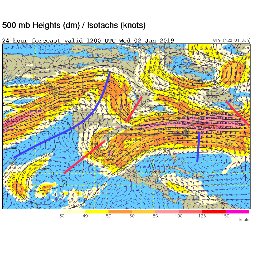
Our system has side down into Mexico with cold air off into the Gulf of Mexico (Figure 1 and Figure 2). For today, the trough is still sliding very slowly eastward as a big ridge nudges in from the west (Figure 3). That spells big warm up soon...
The longer range forecast:
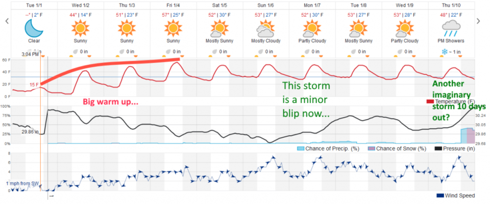
By the end of the week, the ridge will be in place (even if there is a southern-branch trough/cut-off low over TX/LA) - Figure 4. We warm quickly as that cold air leaves and is replaced by compressional heating/down slope flow over Colorado (Figure 5). We may top 60F for highs near Longmont Friday. The weekend storm still looks like - not much. A new storm is lurking 10 days out. We have seen most of these fade out to nothing as the actual day arrives. I'm not sharpening my snow shovel yet. The dryness continues.