This content was originally published by the Longmont Observer and is licensed under a Creative Commons license.
Forecast Discussion:
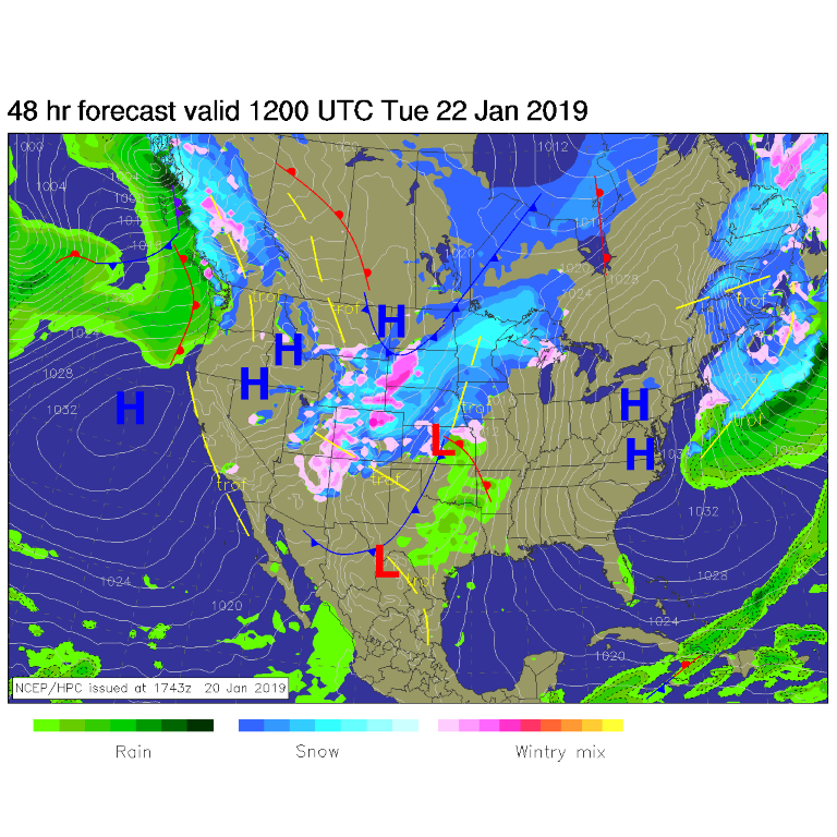
I'm getting this column squeaked out right after the eclipse (where the skies cleared wonderfully at the last minute - it was great meeting those who came. Thank you for the kind words about that event and this column). Today (Monday - a holiday for you?) will be warm and dry - with southwest wind flow over the state. The next storm moves in tonight and will be covering the state by Tuesday AM (Figure 1).
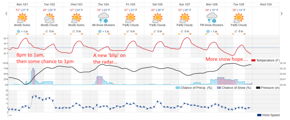
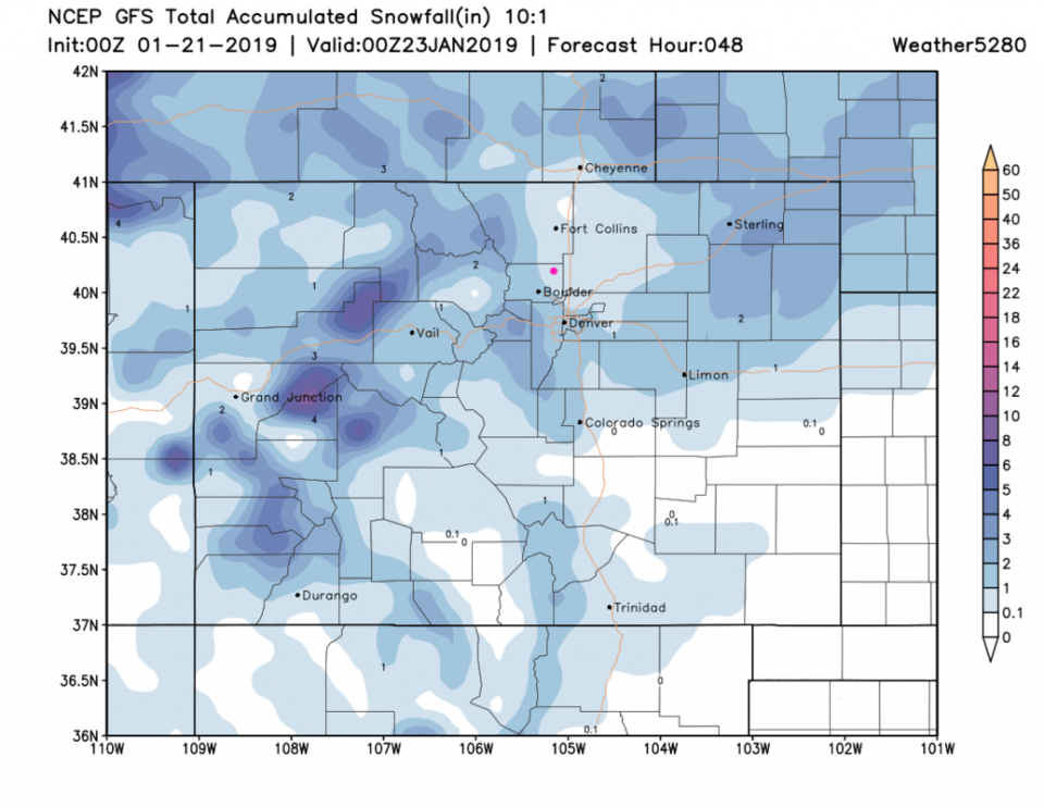
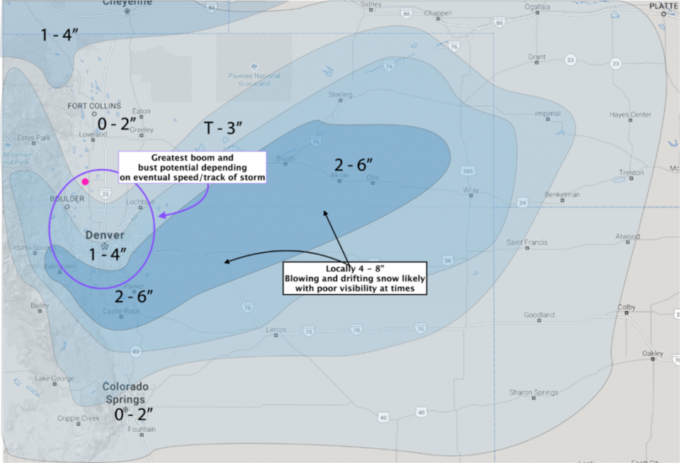
Figure 2 shows that the strongest period of lift and up slope flow will be brief - mainly 9pm to 12am tonight, but some showers are possible off into Tuesday midday. This model gives us a coating to an inch (down slope flow will dominate the storm for areas north of Boulder up I-25). Figure 3, the GFS, gives us a coating to 1 inch as well. The forecasters at weather5280.com (Figure 4) hand-drew this forecast and put it on their discussion column Sunday night. They gave Longmont 0-2 inches of snow. Everything seems to be in agreement that we won't get much snow (and you can see the down slope effects north of Boulder along I-25 here as well).
The longer range forecast:
From Figure 2 there is another 0 to 1 inch storm expected Thursday and something out a week from not that end up being about 1 inch in depth. Beggars can't be choosers with the weather - I guess. More on those storms in the days to come!