Skip to content

Next Storm/Next Snow Forecast Discussion from the Cherrywood Observatory – January 24, 2019

This content was originally published by the Longmont Observer and is licensed under a Creative Commons license.

Forecast Discussion:

I'll post this early, since precipitation should start in the next 4-6 hours...

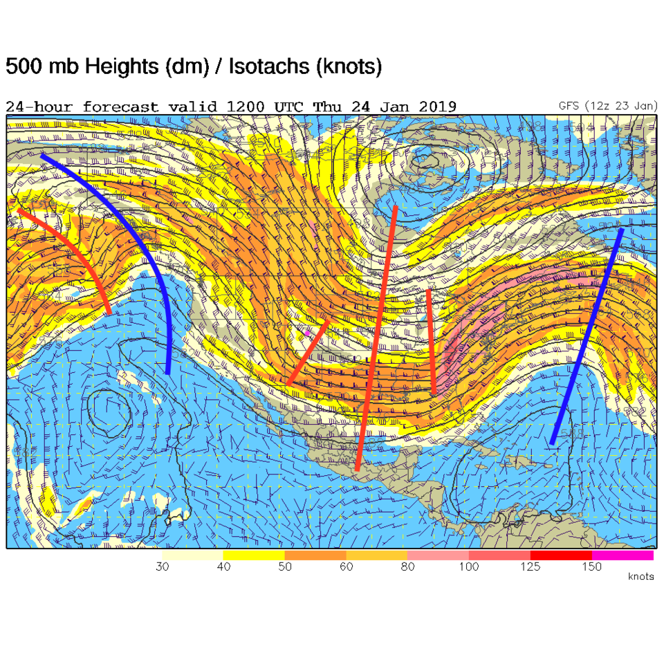
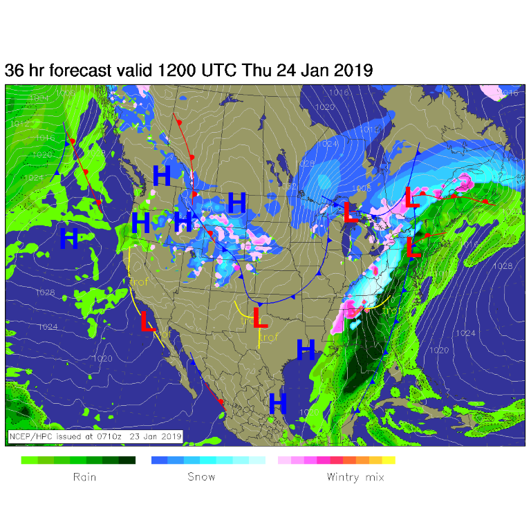
Yet another (less windy or cold) storm is on its way. There is a giant trough in the middle of the country giving us northwest flow aloft (upper level winds coming from a northwest direction) (Figure 1). Ripples (called short waves (also Figure 1)) that travel down this flow can bring cold surface air in (a cold front -Figure 2) and, when there is moisture, create some snow by lifting the moist air via the front and up-slope (from the east-ish direction) surface air flow.

This is the situation tonight into Thursday am (though moisture is limited). The surface front will pass Longmont around 11 pm tonight and make it to Castle Rock (the PD communities) around 4 am. My snow forecast and timing for selected cities is:

FC: 1/2 to 2" Wed 8 pm to Thur 10 am

BE: 1-2" Wed 10 pm to Thurs 11 am

LM: 1-2" Wed 10 pm to Thurs 11 am ** Us! **

BO: 2-4" Wed 10 pm to Thurs 1 pm

EP: 3-5" Wed 6 pm to Sat 3 am

DN: 2-4" Wed 8 pm to Thur 1 pm

PD: communities 2-4" Wed 9 pm to Thur 2 pm

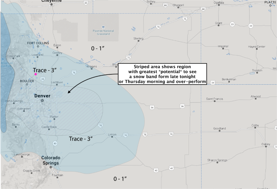
(Note: if 'banding' sets up, some folks will see a surprise greater amount of snow.)

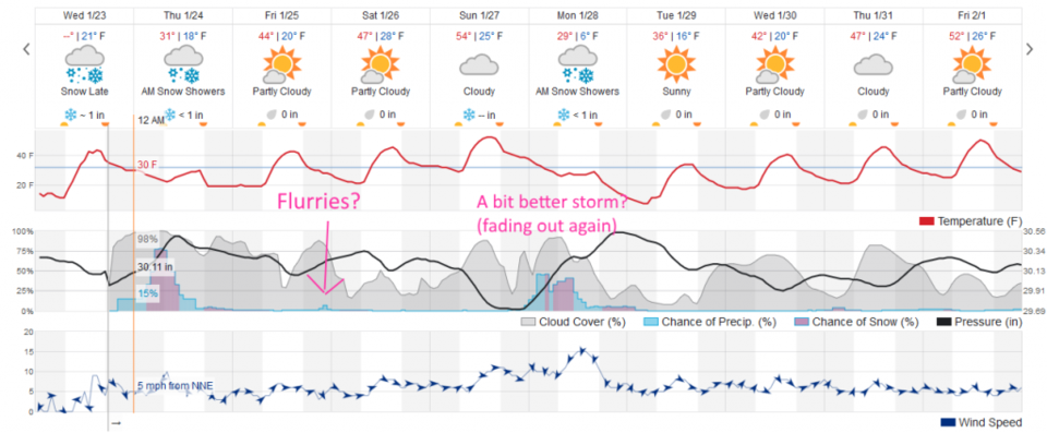
There are winter weather advisories for the higher mountains, but nothing along I-25 presently. Looking further out - there is a chance of a low-land flurry/dusting Friday night then a wetter/snowier/stronger storm is on the horizon for Monday.

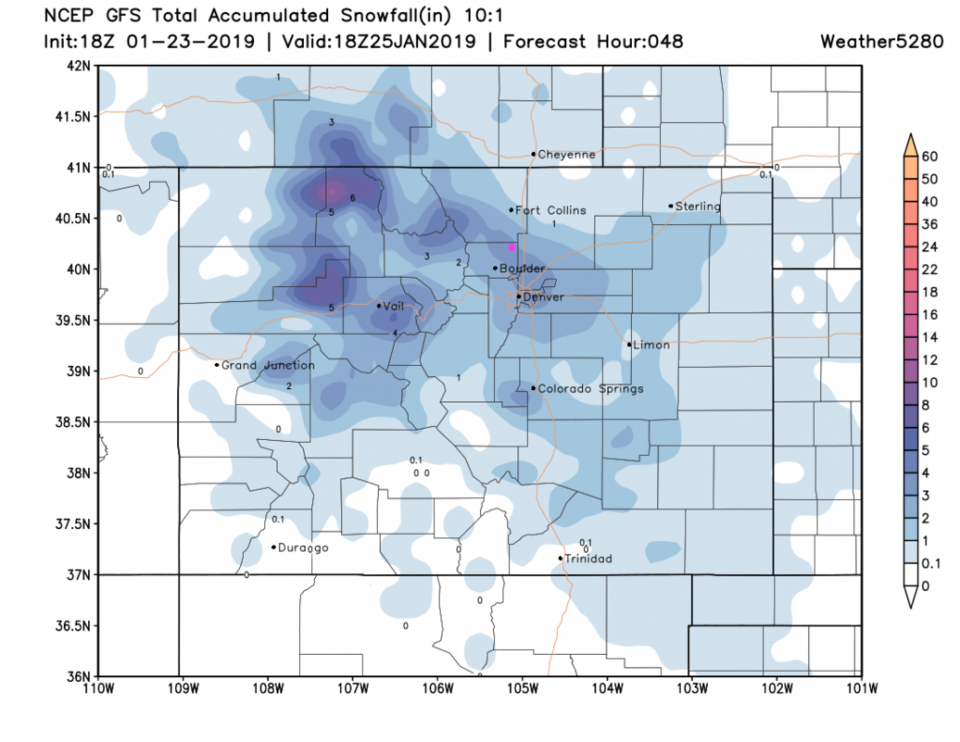
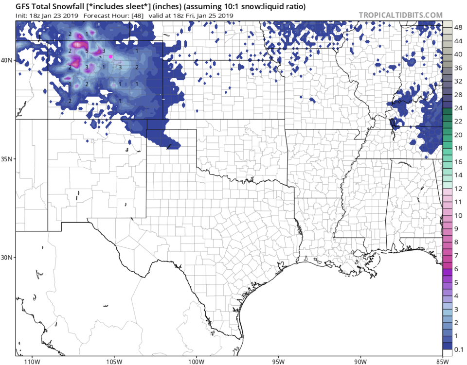
The GFS (Figure 3) is still bullish north of and through Denver with 3-4 inches of snow around town. The NAM (Figure 4) has us pretty snowy with 2.5 to 3.5 inches of snow.  The forecasters at weather5280.com put us in the Trace - 3 inch zone with banding potential nearby that could greatly increase snow for a minority of the region (Figure 5).

The longer range forecast:

A ripple north of Colorado may kick off some snow flurries Friday pm. We warm to just under and just over 50°F for the weekend - then watch a Sunday pm to Monday storm set up (that isn't looking as significant as it did a few days ago) - Figure 6.

Figure 1: The 500mb forecast upper air analysis for Thursday AM. Pink dot is Longmont. Red lines are troughs, blue lines are ridges.

Figure 2: The forecast surface map for Thursday AM. From NCEP.

Figure 3: The forecast accumulated snow map from the GFS and weather5280.com for Colorado, through Friday noon.

Figure 4: The forecast accumulated snow map from the NAM and tropicaltidbits.com for Colorado, through Friday noon.

Figure 4: the hand drawn snowfall forecast from the forecasters at weather5280.com (highly recommend reading their info as well!!).

Figure 6: the graphical forecast for the next 10 days for Longmont, CO from weatherunderground.com

Current Weather

Mostly cloudy

Mostly cloudy

59°F

UV Index
6 High
Pressure
29.62 Rising
Visibility
8 miles
Dewpoint
23 °F
Humidity
25%
Wind
WSW 11.1 mph
Gust
22.1 mph
Wind Chill
59 °F

Hourly Forecast

Today
3 PM
62°F
Intermittent clouds
Today
4 PM
60°F
Intermittent clouds
Today
5 PM
58°F
Intermittent clouds
Today
6 PM
56°F
Intermittent clouds
Today
7 PM
54°F
Intermittent clouds
Today
8 PM
51°F
Intermittent clouds
Today
9 PM
48°F
Partly cloudy
Today
10 PM
45°F
Partly cloudy
Today
11 PM
43°F
Partly cloudy
Tomorrow
12 AM
42°F
Mostly clear
Tomorrow
1 AM
40°F
Mostly clear
Tomorrow
2 AM
39°F
Mostly clear

7 Day Forecast

Partly sunny w/ showers

Tuesday

62 °F

Times of clouds and sun with a couple of brief showers beginning at midday; windy


Partly cloudy

Tuesday Night

34 °F

Partly cloudy and colder; there can be frost in the normally colder spots


Intermittent clouds

Wednesday

59 °F

Cool with times of clouds and sun


Mostly cloudy w/ showers

Wednesday Night

37 °F

Increasing clouds with a shower in spots late


Partly sunny w/ showers

Thursday

56 °F

Times of clouds and sun with a couple of showers; cool


Partly cloudy

Thursday Night

40 °F

Partly cloudy


Mostly cloudy

Friday

63 °F

Mostly cloudy and warmer


Clear

Friday Night

40 °F

Clear


Mostly sunny

Saturday

74 °F

Mostly sunny, pleasant and warmer


Mostly clear

Saturday Night

43 °F

Mainly clear


Sunrise and Sunset

Sunrise
5:52 AM
Sunset
8:02 PM

Based on AccuWeather data