Skip to content

Update 1/27 9am: Next Storm/Next Snow Forecast Discussion from the Cherrywood Observatory – January 26-28, 2020

This content was originally published by the Longmont Observer and is licensed under a Creative Commons license.

In Brief:

A fast moving upper air trough will begin snowfall in the mountains late Sunday night and keep snow falling through much of Monday. Light rain showers and snow flurries in the air are possible down along I-25 and on the Plains. The ground is too warm and dry for snowfall accumulation. Tuesday is warm and dry before a brief, somewhat stronger, system hits Wednesday night for a chance of a coating of snow. Then we really heat up with possible 70'sF next Sunday! What kind of winter is this anyway?

Update 1/27 9am:

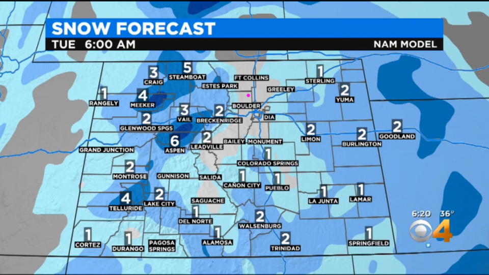
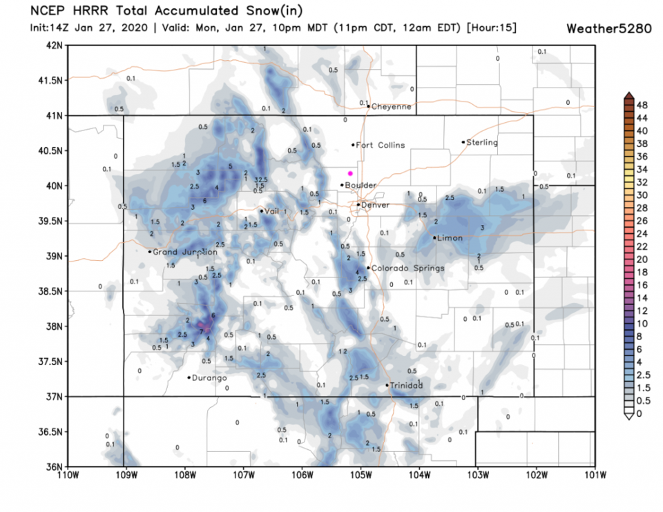
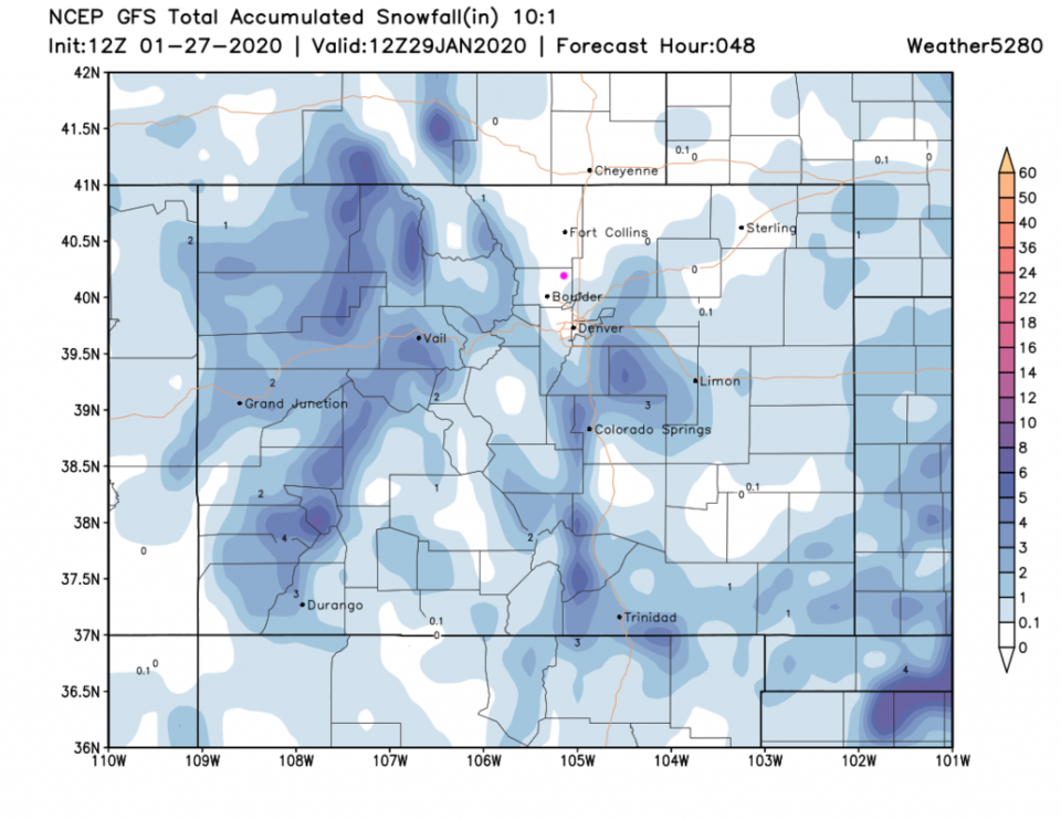
Clouds are here and precipitation is evaporating over our heads this Monday morning (virga). Channel 4 (using the NAM) shows the I-25 down slope snow-free hole in clear relief - Figure 1 update. The HRRR (high resolution rapid refresh model) has nothing accumulating close to Longmont (Figure 2 update). The GFS brings snow in a bit closer to town to the south, east and west, but minimal snow is expected to hit (Figure 3 udpate).

The Wednesday storm looks like it will dig too far south to give us much more than a chance of a sprinkle like this storm (it will pass Colorado down in New Mexico). Still, this stretch of dry weather is not even in the top 20 snow/rain free periods in the winter for the Denver region. It is dry but not record dry.

Figure 1 update: Channel 4 Denver snow forecast from the NAM.
Figure 2 update: The forecast snowfall for the next 15 hours from the HRRR and weather5280com for Colorado (up to 10pm Monday) made Monday at 7am.
Figure 3 update: 10:1 (snow to liquid) snowfall totals through Wednesday AM from the GFS and weather5280com for Colorado made Morning morning.

End 1/27 9am update.

Forecast Discussion:

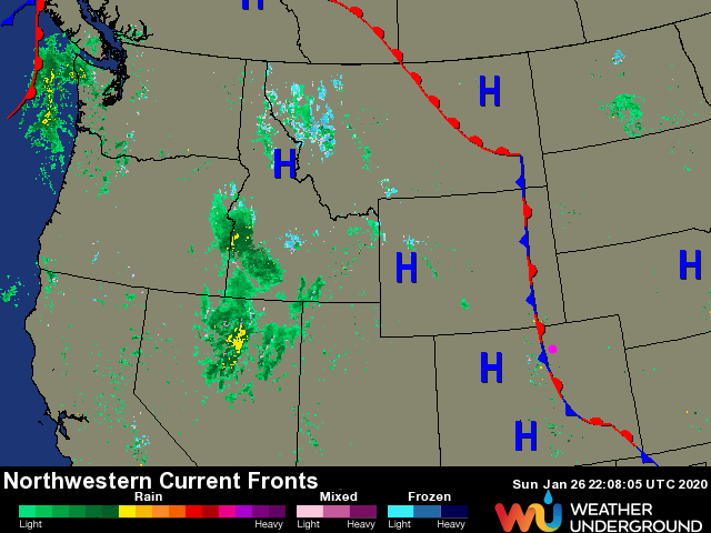
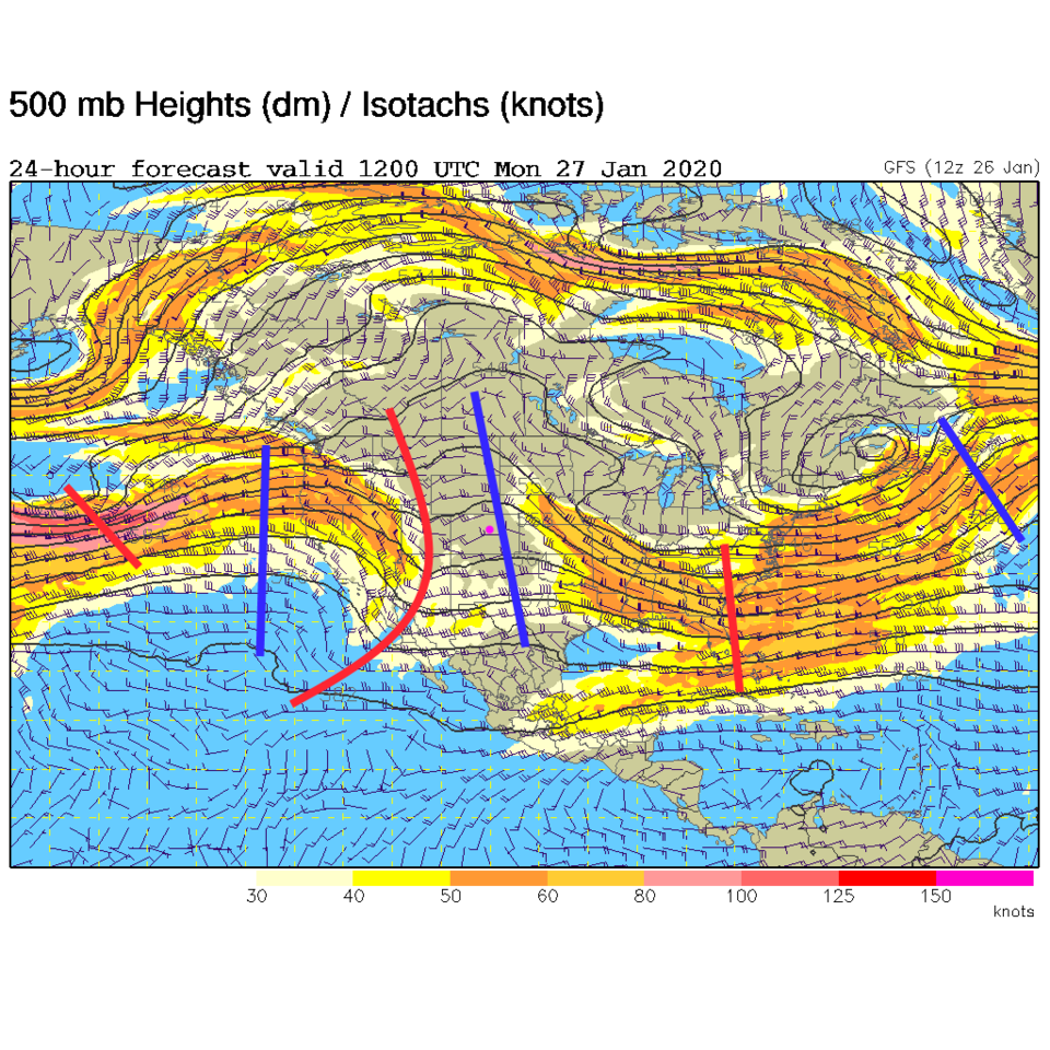
The overall weather pattern is not very exciting, I'll admit. Looking upstream, you can see the rain and embedded thundershowers out in Nevada and Idaho formed by our next weather maker - a trough headed in for Monday (Figure 1). This trough is a quick mover and not overly strong (Figure 2). The overall dominate western ridge pattern is visible holding strong in the face of this small intruder stretching from northern Mexico up into north Canada. What a ridge!

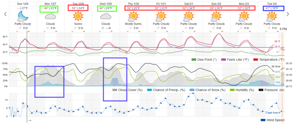
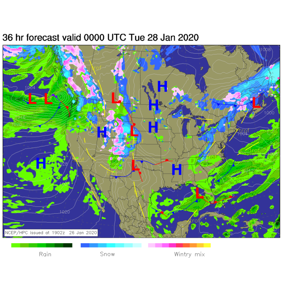
The chance of precipitation begins before dawn and fades out in the early evening... this will be mainly rain showers with *maybe* some snow in the air at colder times of the day. You'll be lucky to actually see snow falling along I-25 (Figure 3). By Monday night, a sloppy mix of rain and snow is hitting the Western Slopes with hit or miss showers around here (Figure 4).

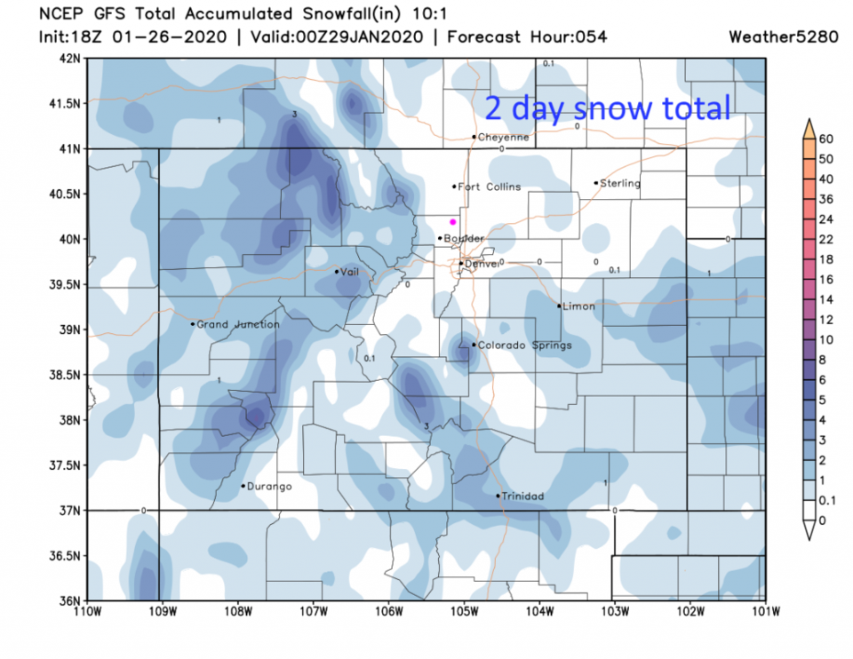
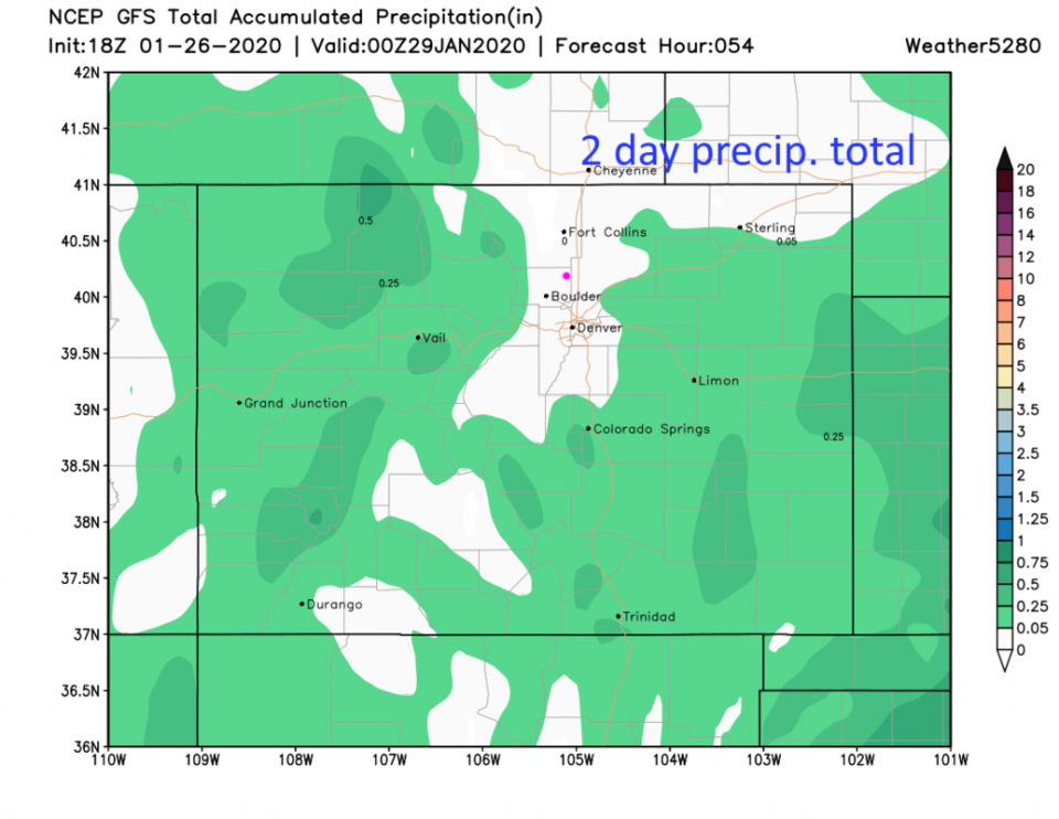
For this first wave, the GFS skips painting Longmont with measurable snow or rain (Figure 5 and Figure 6).

The Longer Range Forecast:

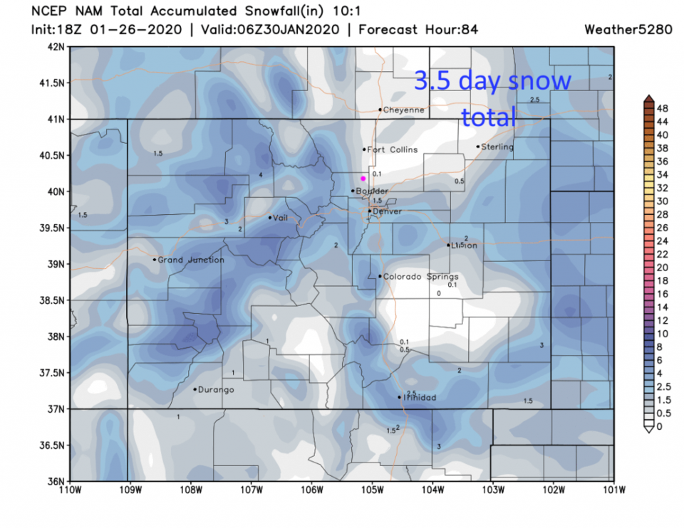
Another short wave is timed to hit Wednesday afternoon/evening with a better shot of snow. We might get a coating of snow (the NAM in Figure 7 gives us a coating to 1/2 inch) Wednesday night.

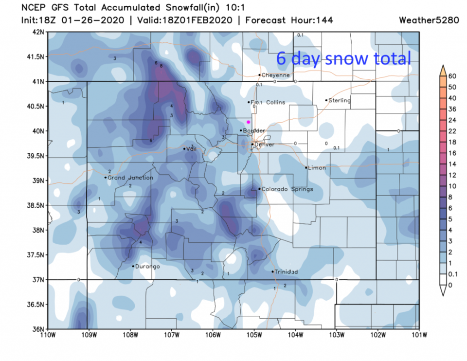
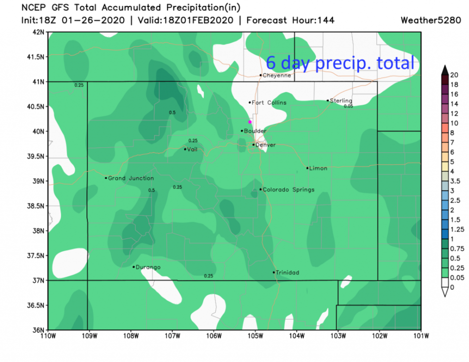
The GFS is not impressed by the second wave either and only gives Boulder a coating of snow over the next 6 days (Figure 8) and gives us 0.05 inch of water (rain) over that time frame (Figure 9).

The revenge of the ridge is expected for next weekend with near record or record breaking heat - temperatures may approach or break 70F. We'll see about that. But yikes.

Figure 1: the current surface analysis map from Thursday AM and the weatherunderground.com site
Figure 2: The 500mb forecast upper air analysis for early Monday AM. Pink dot is Longmont. Red lines are troughs, blue lines are ridges.
Figure 3: the graphical forecast for the next 10 days for Longmont, CO from weatherunderground.com
Figure 4: The forecast surface map for Monday evening from NCEP.
Figure 5: 10:1 (snow to liquid) snowfall totals through Tuesday AM from the GFS and weather5280com for Colorado made Sunday afternoon.
Figure 6: precipitation totals through Tuesday AM from the GFS and weather5280com for Colorado made Sunday afternoon.
Figure 7: 10:1 (snow to liquid) snowfall totals through Wednesday PM from the NAM and weather5280com for Colorado made Sunday afternoon.
Figure 8: 10:1 (snow to liquid) snowfall totals for the next 6 days from the GFS and weather5280com for Colorado made Sunday afternoon.
Figure 9: precipitation totals for the next 6 days from the GFS and weather5280com for Colorado made Sunday afternoon.

Current Weather

Cloudy

Cloudy

34°F

UV Index
1 Low
Pressure
30.29 Steady
Visibility
4 miles
Dewpoint
30 °F
Humidity
87%
Wind
NE 3.2 mph
Gust
5.8 mph
Wind Chill
32 °F

Hourly Forecast

Today
11 AM
35°F
Cloudy
Today
12 PM
37°F
Flurries
Today
1 PM
39°F
Flurries
Today
2 PM
40°F
Showers
Today
3 PM
41°F
Cloudy
Today
4 PM
43°F
Cloudy
Today
5 PM
44°F
Cloudy
Today
6 PM
43°F
Cloudy
Today
7 PM
42°F
Cloudy
Today
8 PM
41°F
Cloudy
Today
9 PM
40°F
Cloudy
Today
10 PM
40°F
Cloudy

7 Day Forecast

Rain and snow

Thursday

44 °F

Cloudy and chilly; snow showers this morning, accumulating a coating to an inch followed by a couple of showers this afternoon


Mostly cloudy

Thursday Night

35 °F

Mostly cloudy


Mostly cloudy w/ showers

Friday

48 °F

Chilly with some sun, then turning cloudy; a little rain in the afternoon


Rain and snow

Friday Night

34 °F

Snow at times, accumulating an inch or two; rain mixed in early


Flurries

Saturday

46 °F

A bit of morning snow with little or no accumulation; otherwise, cloudy and chilly; storm total snowfall an inch or two


Intermittent clouds

Saturday Night

31 °F

Partly cloudy


Partly sunny

Sunday

69 °F

Warmer with partial sunshine


Partly cloudy

Sunday Night

44 °F

Partly cloudy


Intermittent clouds

Monday

77 °F

Pleasantly warm with a blend of sun and clouds


Intermittent clouds

Monday Night

39 °F

Increasing clouds


Sunrise and Sunset

Sunrise
6:17 AM
Sunset
7:43 PM

Based on AccuWeather data