Skip to content

Next Storm/Next Snow Forecast Discussion from the Cherrywood Observatory – January 28, 2019

This content was originally published by the Longmont Observer and is licensed under a Creative Commons license.

Forecast Discussion:

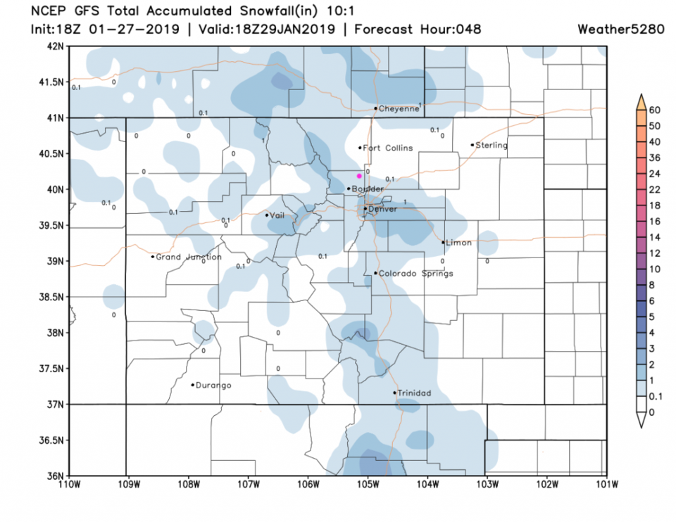
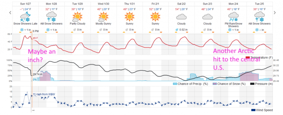
The system is moving in late Sunday night. This post would normally go up as the snow starts (1 am) so I'll post early. The GFS (Figure 1) shows a coating to almost an inch possible before noon Monday. This northwest to southeast band shows up in the HRRR in the 5 pm update on the January 27th post has a very similar look. We'll see if it verifies.  The weatherunderground model (Figure 2) has under an inch over two days (Sunday pm to Monday am) which is also approaching an inch of snow for some folks around town.

The longer range forecast:

As cold air snaps the nation in two, we stay cold to chilly until the end of the week. Another very cold blast hits the central U.S. at the end of next weekend giving us a similar set up and another chance of snow (Figure 2). That's all I've got to say about that.  (-F.G.)

Figure 2: the forecast accumulated snow map from the GFS and weather5280.com for Colorado, through Tuesday PM.

Figure 2: the graphical forecast for the next 10 days for Longmont, CO from weatherunderground.com

Current Weather

Mostly clear

Mostly clear

47°F

UV Index
0 Low
Pressure
29.96 Rising
Visibility
8 miles
Dewpoint
40 °F
Humidity
75%
Wind
NE 1.7 mph
Gust
4 mph
Wind Chill
47 °F

Hourly Forecast

Today
10 PM
47°F
Partly cloudy w/ showers
Today
11 PM
46°F
Intermittent clouds
Tomorrow
12 AM
44°F
Partly cloudy
Tomorrow
1 AM
43°F
Partly cloudy
Tomorrow
2 AM
42°F
Partly cloudy
Tomorrow
3 AM
41°F
Partly cloudy
Tomorrow
4 AM
39°F
Partly cloudy
Tomorrow
5 AM
38°F
Partly cloudy
Tomorrow
6 AM
37°F
Partly cloudy
Tomorrow
7 AM
40°F
Partly sunny
Tomorrow
8 AM
44°F
Mostly sunny
Tomorrow
9 AM
50°F
Mostly sunny

7 Day Forecast

Intermittent clouds

Sunday

64 °F

Warmer with times of clouds and sun


Partly cloudy w/ showers

Sunday Night

37 °F

A brief evening shower or two; otherwise, partly cloudy


Partly sunny

Monday

70 °F

Partly sunny and pleasant


Intermittent clouds

Monday Night

43 °F

Partly cloudy


Mostly sunny

Tuesday

73 °F

Mostly sunny and pleasant


Intermittent clouds

Tuesday Night

41 °F

Clearing


Intermittent clouds

Wednesday

65 °F

Times of sun and clouds


Intermittent clouds

Wednesday Night

39 °F

A thundershower in spots in the evening; otherwise, partly cloudy


Rain

Thursday

53 °F

Cooler with occasional rain and drizzle; breezy in the morning


Partly cloudy

Thursday Night

32 °F

Partly cloudy


Sunrise and Sunset

Sunrise
6:03 AM
Sunset
7:53 PM

Based on AccuWeather data