Skip to content

Next Storm/Next Snow Forecast Discussion from the Cherrywood Observatory – January 30, 2019

This content was originally published by the Longmont Observer and is licensed under a Creative Commons license.

Forecast Discussion:

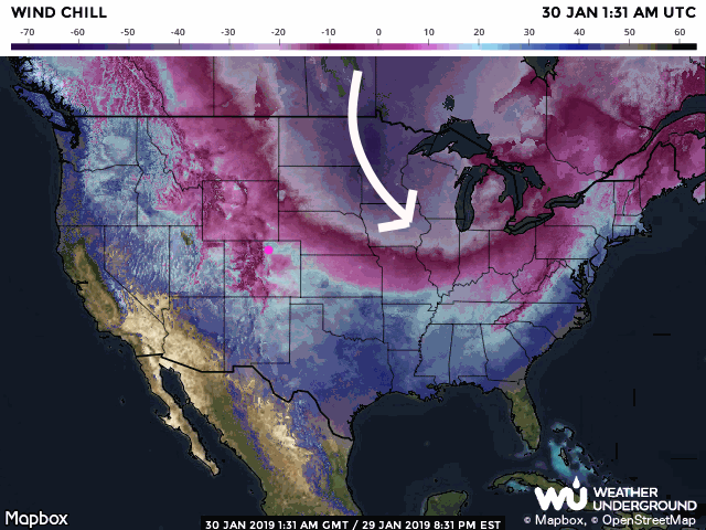
The big weather story is the tremendous cold pouring out of Canada down into the middle of the U.S. The wind chill (the effective temperature felt by human skin blending temperature and wind speed) map shows wind chill values down below -60°F. Truly amazing (Figure 1).

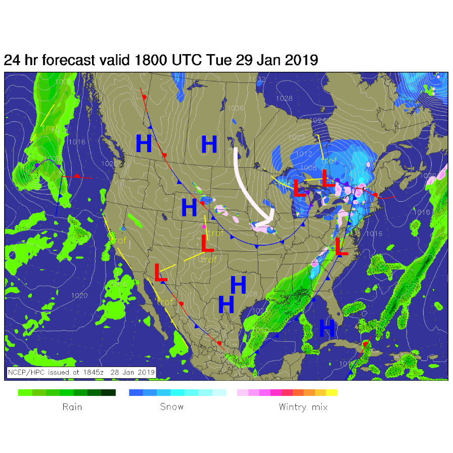
We are sheltered from this extreme air by our elevation (this air is dense and shallow, relatively speaking) and the upper air flow is directing it to the east (see yesterday's discussion ). There is a frontal boundary just touching the northeast corner of the state (Figure 2) marking the true edge of the arctic flow.

The longer range forecast:

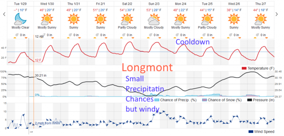
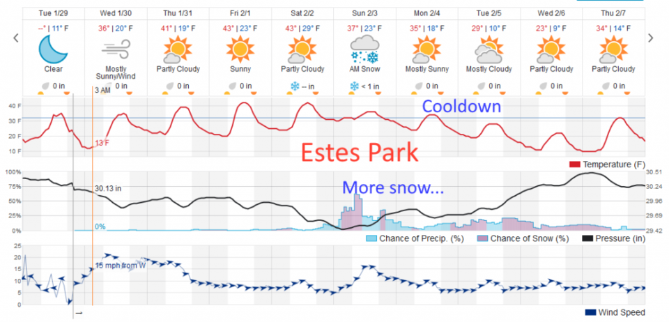
Our longer range forecast is getting more and more mundane. Figure 3 shows temperatures warming to the 50's F for the weekend as a ridge moves in. Our end-of-weekend storm is fading off the map, so to speak. Up in the mountains, that Pacific storm will still bring moisture - Estes Park, for example, may pick up an inch or three this weekend with ongoing daily snow chances (Figure 4). We cool down then, but the next 10 days does not contain significant precipitation from the weatherundergound model, at least.

Figure 1: the wind chill chart from Tuesday PM from weatherunderground.com

Figure 2: The forecast surface map for Tuesday noon. From NCEP.

Figure 3: the graphical forecast for the next 10 days for Longmont, CO from weatherunderground.com

Figure 4: the graphical forecast for the next 10 days for Estes Park, CO from weatherunderground.com

Current Weather

Sunny

Sunny

43°F

UV Index
3 Moderate
Pressure
30.02 Steady
Visibility
7 miles
Dewpoint
25 °F
Humidity
49%
Wind
SSE 3.2 mph
Gust
7.4 mph
Wind Chill
42 °F

Hourly Forecast

Today
9 AM
47°F
Mostly sunny
Today
10 AM
51°F
Mostly sunny
Today
11 AM
55°F
Mostly sunny
Today
12 PM
58°F
Mostly sunny
Today
1 PM
60°F
Partly sunny
Today
2 PM
62°F
Intermittent clouds
Today
3 PM
63°F
Mostly cloudy
Today
4 PM
64°F
Mostly cloudy
Today
5 PM
63°F
Cloudy
Today
6 PM
61°F
Cloudy
Today
7 PM
58°F
Mostly cloudy
Today
8 PM
55°F
Mostly cloudy

7 Day Forecast

Intermittent clouds

Thursday

64 °F

A blend of sun and clouds; breezy this afternoon


Mostly cloudy

Thursday Night

35 °F

Mostly cloudy


Partly sunny

Friday

68 °F

Increasingly windy with partial sunshine


Partly cloudy

Friday Night

38 °F

Partly cloudy


Partly sunny

Saturday

66 °F

Partial sunshine


Mostly clear

Saturday Night

41 °F

Clear to partly cloudy


Mostly cloudy

Sunday

78 °F

Rather cloudy and warmer; windy in the afternoon


Intermittent clouds

Sunday Night

43 °F

Partly cloudy; windy late


Mostly cloudy

Monday

60 °F

Mostly cloudy, breezy and cooler


Mostly cloudy

Monday Night

43 °F

Mostly cloudy


Sunrise and Sunset

Sunrise
5:58 AM
Sunset
7:57 PM

Based on AccuWeather data