This content was originally published by the Longmont Observer and is licensed under a Creative Commons license.
In Brief:
Abnormal warmth is in place with down slope flow and a ridge aloft Tuesday/Wednesday. Our first cold front slides in Wednesday afternoon making things chilly on Friday and bringing in a chance for a bit of snow. Another front arrives Saturday with a small chance of snow Sunday AM. A third front comes in Tuesday afternoon followed by a third small chance snow. None of these are going to make headlines - as it looks now.
Update on 1/8 at 5pm:
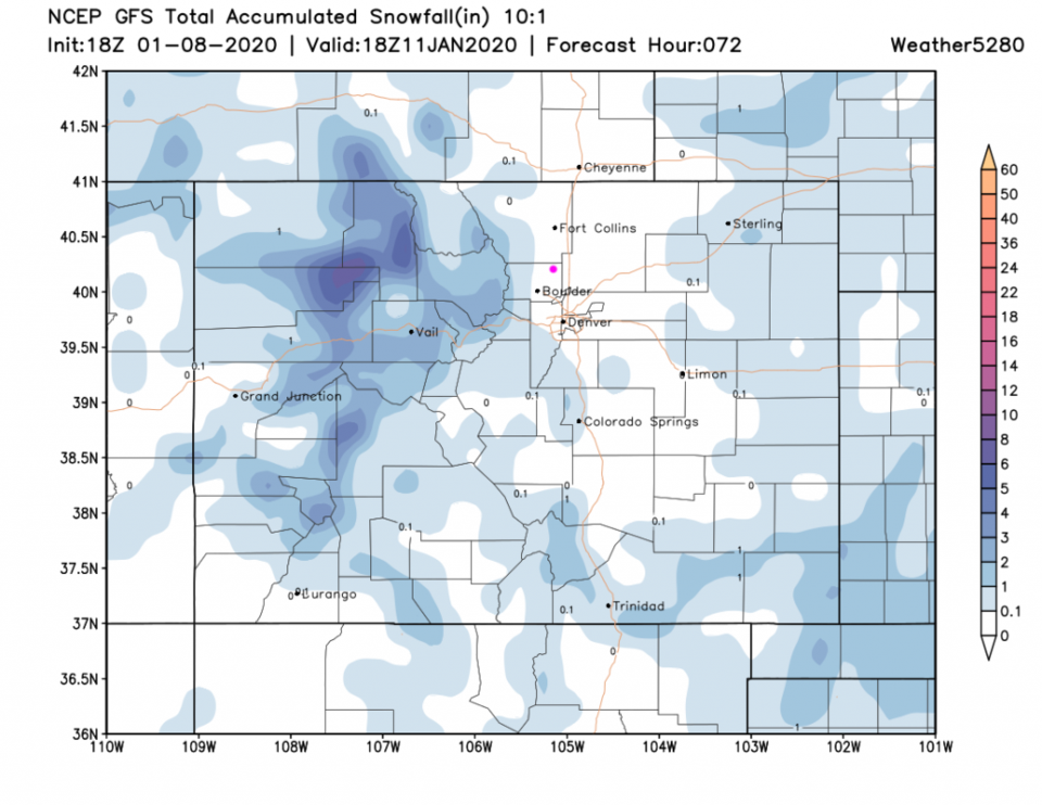
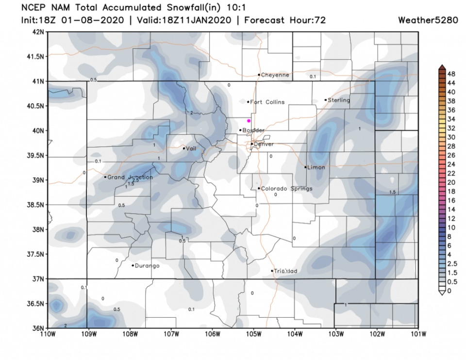
I am still unimpressed by the snow that may move into town Thursday PM through Friday. It will be cold, windy a times, and cloudy at times. The GFS (Figure 1 update) keeps the snow above the elevation of even Boulder in the Foothills. The NAM has less snow overall with nothing accumulating in town (Figure 2 update). We might see snow in the air - that would be fun.
End 1/8 5pm update.
Forecast Discussion:
Local TV stations are more bullish about the coming snow than I am. We might get a coating with a few spots picking up a lucky 1 inch in the Friday storm, but I'm not getting the sled out. Because of that, I'm covering two days with this post again - with an update Wednesday if needed.
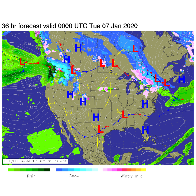
Speaking of Wednesday - it will be very warm again - compared to normal. It will be about 12F above the normal of about 44F for Jan 8. Precipitation will already be picking up in the western mountains again with down slope wind gusts knocking things around again (it was noisy Tuesday early morning!) see Figure 1.
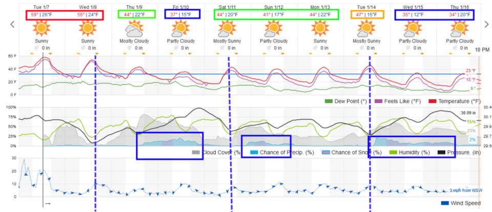
Our first cool (cold?) front will arrive Wednesday afternoon followed -more than a day later- by a small chance of snow. The notable feature of this system will be a cool down from the upper 50'sF Tuesday to a high in the mid 30'sF Friday. That will feel chilly (Figure 2).
Precipitation chances pick up in the afternoon Thursday. With a high in the mid 40'sF - it might be a light sprinkle before evening snow showers (Figure 2). Light snow showers will taper off in the evening on Friday.
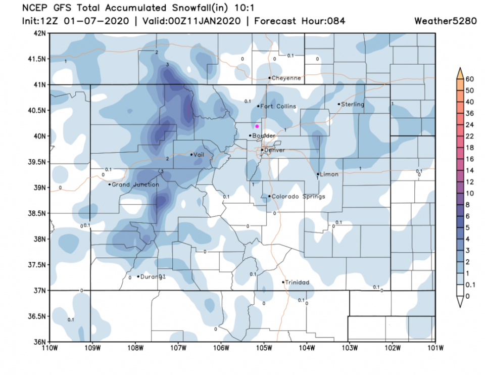
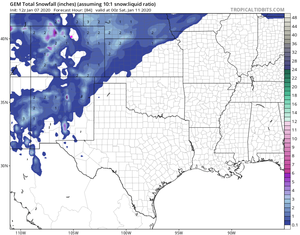
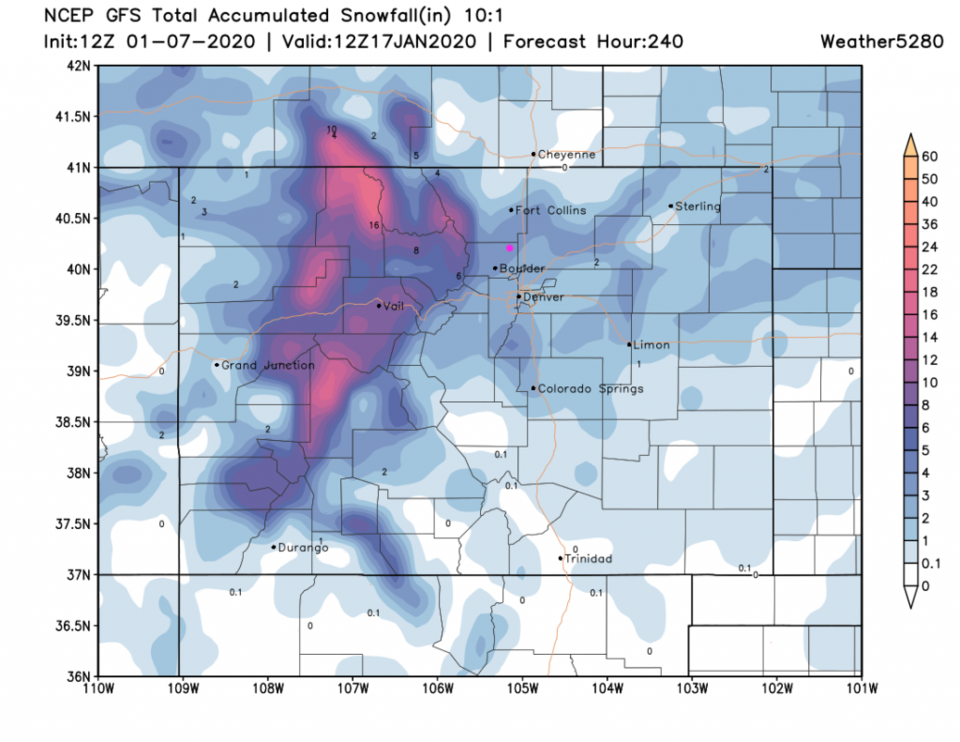
The GFS paints us with 1/2 to 1 inch of snow (Figure 3) by Friday night. The GEM surrounds us with light snow accumulation but has most of Longmont in a snow-free hole (Figure 4).
The Longer Range Forecast:
The pattern repeats Saturday afternoon with another cool front (Figure 2) and a chance off snow mainly Sunday AM. Yet a third front arrives Tuesday followed by a more immediate chance of snow. These three hits may result in measurable snow over the next 10 days. The GFS gives us about 3 inches of snow over the entire 1.5 week period (Figure 5).
The Snow Pack and Drought:
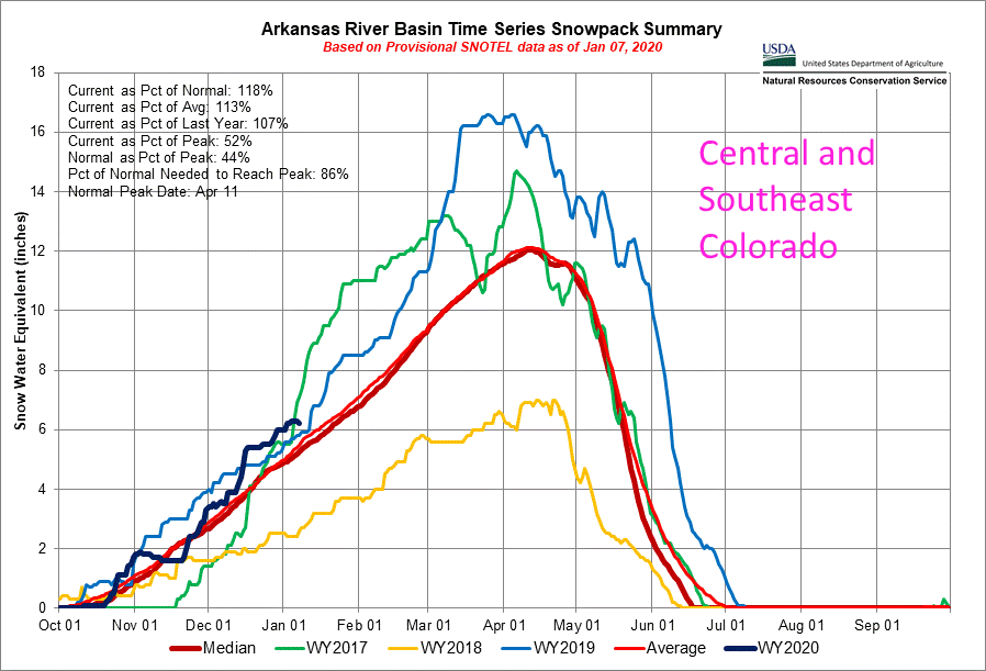
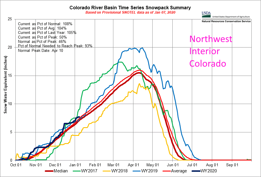
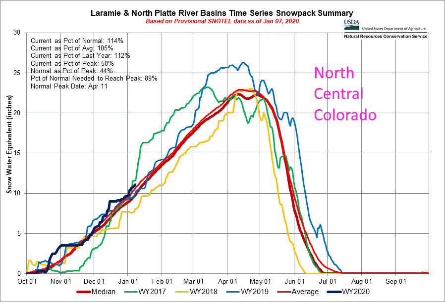
Just checking on the snow pack for the winter so far - I have three basins selected across the state to compare. They are all quite similar. The Arkansas River Basin is at the top end of what we've seen over the last 3 years (Figure 6) at 118% of normal as of Jan 1, 2020. The Colorado River Basin is similar at 108% normal (Figure 7). Up at the top center of the state, the Laramie and North Platte River Basins are at 114% normal (Figure 8).
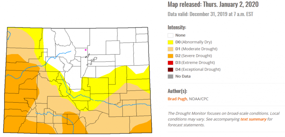
As drought goes, the northeast corner is drought free (Figure 9) which was not my gut-impression of the state of things with so little snow falling around here recently. The western counties and southern counties are needing more water than they are getting.