Skip to content

Next Storm/Next Snow Forecast Discussion from the Cherrywood Observatory – July 11-12th, 2019

This content was originally published by the Longmont Observer and is licensed under a Creative Commons license.

In Brief:

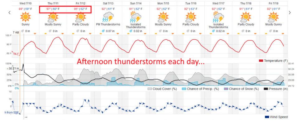
Our hottest days of the next 10 day period are upon us (Thursday/Friday). Places on the Plains will reach 100F while we hover in the mid to upper 90'sF. Some moisture returns (monsoonal flow) and temperatures cool to reflect it...afternoon thunderstorms return for the rest of the 10 day forecast window.

Forecast Discussion:

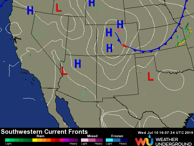
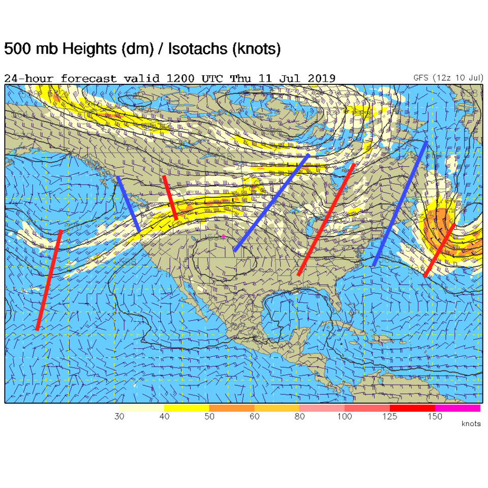
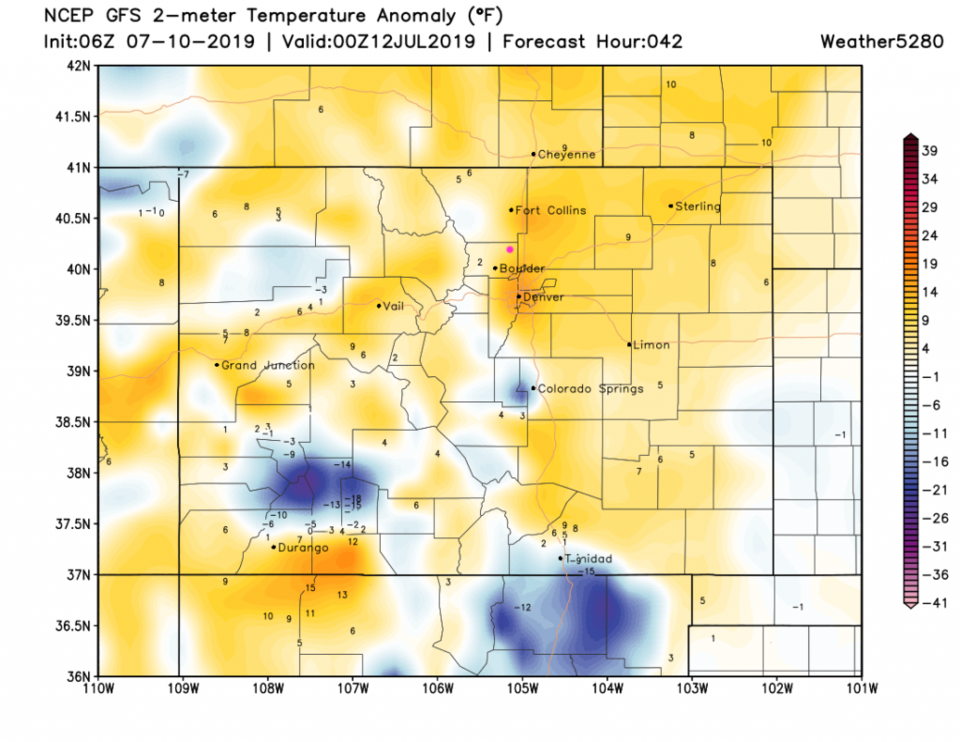
For Wednesday, a weak cool front has pressed into northeast Colorado (Wednesday is posting day - Figure 1). This cooled us into the 80'sF Wednesday. That pushes off Thursday and an upper level ridge (blue line over the state and closed circle over the state in Figure 2) begins to dominate. We see mid to upper 90'sF here (and 100'sF not far out on the Plains). This heat will be about 10-15F above normal by Thursday afternoon.

The Longer Range Forecast:

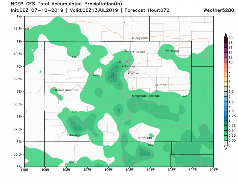
That upper level high will drift off a bit to the east and the clockwise circulation around the high will allow some tropical moisture to ooze into the state (monsoonal-like moisture). Afternoon thunderstorms return Friday and the story becomes a broken record - days and days of highs in the lower 90F's, lows in the 60'sF with afternoon storm chances.

Figure 1: The southwest U.S. surface frontal analysis map from the weatherchannel.com.
Figure 2: The 500mb forecast upper air analysis for Thursday PM. Pink dot is Longmont. Red lines are troughs, blue lines are ridges.
Figure 3: the graphical forecast for the next 10 days for Longmont, CO from weatherunderground.com
Figure 4: The forecast temperature at the surface from normal map from the GFS and weather5280.com for Colorado, Thursday afternoon.
Figure 5: the forecast accumulated precipitation map from the GFS and weather5280.com for Colorado, for the next 3 days.

Current Weather

Light rain

Light rain

41°F

UV Index
1 Low
Pressure
29.92 Steady
Visibility
3 miles
Dewpoint
39 °F
Humidity
93%
Wind
NNE 4.5 mph
Gust
8.8 mph
Wind Chill
38 °F

Hourly Forecast

Today
3 PM
42°F
Rain
Today
4 PM
42°F
Cloudy
Today
5 PM
42°F
Cloudy
Today
6 PM
42°F
Rain and snow
Today
7 PM
41°F
Rain and snow
Today
8 PM
41°F
Rain
Today
9 PM
41°F
Cloudy
Today
10 PM
40°F
Rain
Today
11 PM
40°F
Rain
Tomorrow
12 AM
40°F
Rain
Tomorrow
1 AM
39°F
Rain
Tomorrow
2 AM
39°F
Rain

7 Day Forecast

Rain and snow

Saturday

42 °F

Chilly with a mix of snow and rain; travel in the foothills and mountains will be slippery due to snow


Rain and snow

Saturday Night

36 °F

Cloudy with rain, mixed with a little snow late; travel in the foothills and mountains will be slippery due to snow


Thunderstorms

Sunday

60 °F

Mostly cloudy and warmer; a thundershower in spots in the afternoon


Partly cloudy w/ t-storms

Sunday Night

37 °F

A thunderstorm in spots in the evening; otherwise, partly cloudy


Partly sunny

Monday

71 °F

Partly sunny, pleasant and warmer


Intermittent clouds

Monday Night

42 °F

Partly cloudy


Mostly sunny

Tuesday

73 °F

Mostly sunny; pleasant in the afternoon


Mostly cloudy

Tuesday Night

40 °F

Mostly cloudy


Intermittent clouds

Wednesday

65 °F

Times of sun and clouds with a passing shower in the afternoon


Rain

Wednesday Night

35 °F

Mainly clear


Sunrise and Sunset

Sunrise
6:04 AM
Sunset
7:52 PM

Based on AccuWeather data