This content was originally published by the Longmont Observer and is licensed under a Creative Commons license.
In Brief:
Big changes, in the form of a strong cold front, will begin Saturday morning with continued cool air flow coming in from the northeast. This flow will also create up slope rain and storm chances along a front stalled over the area through Monday. After that we remain in the upper 80's for the week with storm chances in the afternoon. No more near 100F for a while.
7:30am Update:
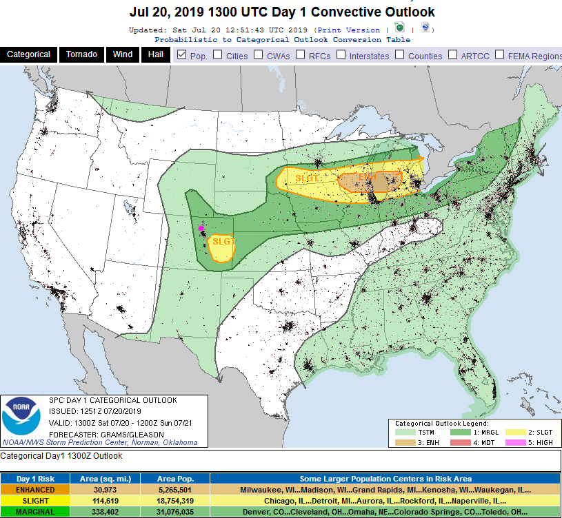
Not much has changed in the forecast overnight. We still have a Marginal Risk (1 on a scale of 1-5) with the primary risk being damaging thunderstorm winds and large hail (Figure 1 update). The NWS did mention that a tornado could briefly form as well.
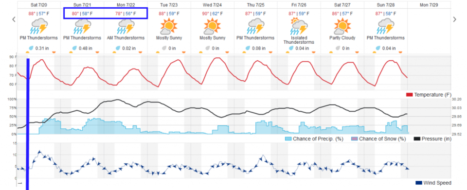
The weatherunderground model gives us 0.4-0.5 inch of rain tonight (with rain chances increasing quickly around 1pm). The GFS gives us about 0.5 inch of water by Sunday AM. Rain chances picks up again Sunday afternoon and overnight into Monday with significant accumulations expected again. Watch for these details in tomorrow's forecast discussion.
End 7:30am update.
Forecast Discussion:
With near 100F temperatures for a few days (it looks like 101F for Thursday and 100F on Friday), a cold front that will enter the state Saturday morning will give us immediate relief. We drop to the upper 80'sF today and the upper 70'sF for Sunday. Wow!
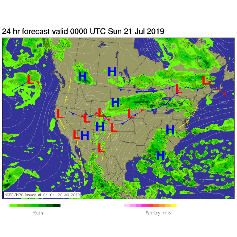
This front will lie along the Front Range foothills and Palmer Divide (south of Denver) - Figure 1. Up slope flow will make rain easier to form and the front will trigger thunderstorms at times (Figure 2). There is a Marginal Risk of severe weather Saturday for the Front Range communities and mountain locations for gusty, damaging winds (not shown).
The Longer Range Forecast:
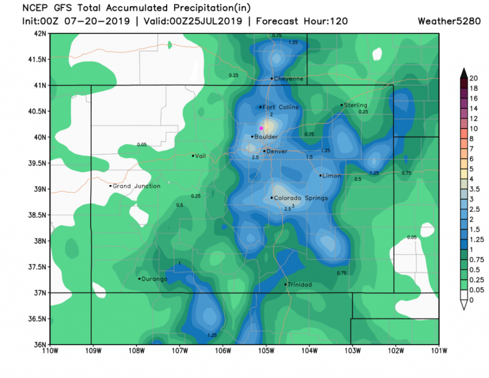
Weatherunderground.com (Figure 2) gives us between 0.75 inch and 1 inch of precipitation through Monday (with an increase in rain chances in the afternoons). The GFS shows over 1.5 inches of precipitation over the next 5 days for all regions from Colorado Springs up to Cheyenne and northward. This run has a (most likely fictitious) bullseye over 3-4 inches near Longmont.
My camper had a wheel bearing burn out on I25 today so my 2 hour commute from camping took almost 8 hours. We'll look deeper into this dramatic weather change on Saturday (after I get some sleep).