Skip to content

Next Storm/Next Snow Forecast Discussion from the Cherrywood Observatory – July 28-29, 2019

This content was originally published by the Longmont Observer and is licensed under a Creative Commons license.

In Brief:

A short wave disturbance moves over the state Saturday which will kick off storms that rise to be marginally severe from I-25 eastward and Denver northward. That is replaced by a ridge for the start of the week bringing in low to mid 90's F highs and dry conditions. The pattern shifts a bit again mid-week bringing in a new flow of tropical moisture and a return to 80's F highs and daily afternoon storm.

Forecast Discussion:

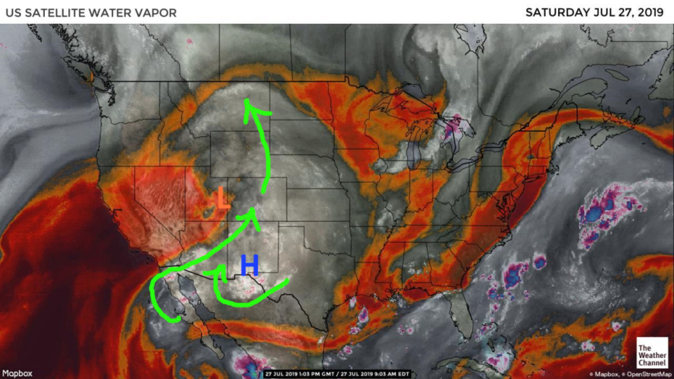
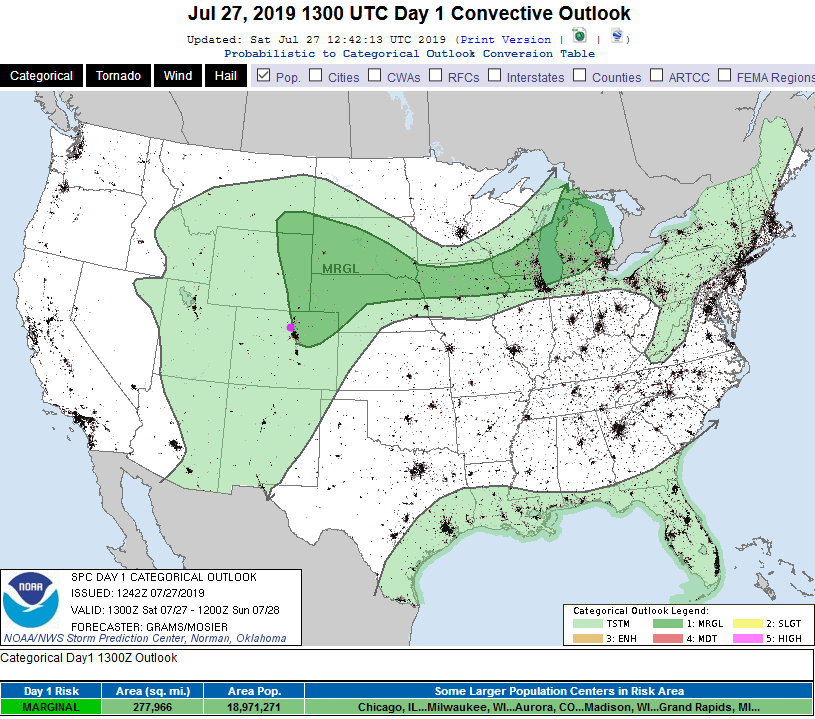
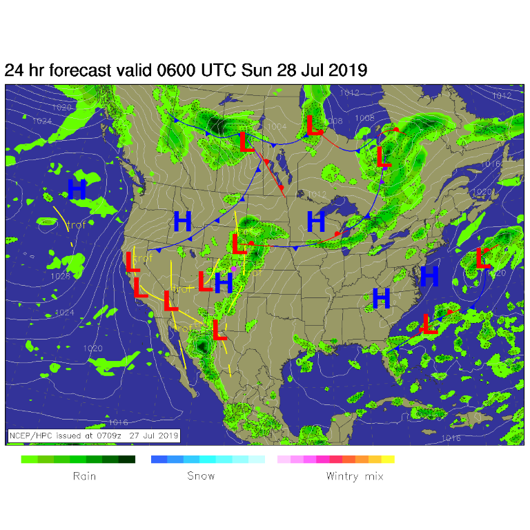
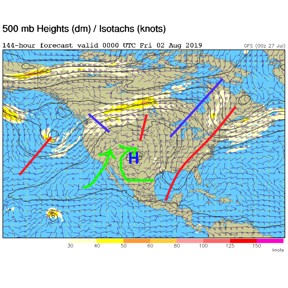
The upper-level high is parked near El Paso today. A stream of tropical moisture is rotating around it, into the desert southwest, then up into the Rockies (green arrows Figure 1). An upper-level, low/disturbance over Utah is speeding up the moisture flow and providing additional lift on Saturday. That means that severe weather is possible from near I-25 (including most of Longmont) out onto the eastern plains (Figure 2). Late into the night going into Sunday, showers will linger in northern Colorado and out on the eastern Plains (Figure 3).

Rain chances peak between noon and 8 pm with Sunday warming to the lower 90's F. Rain chances drop to nearly zero. Sunday will be boring.

The Longer Range Forecast:

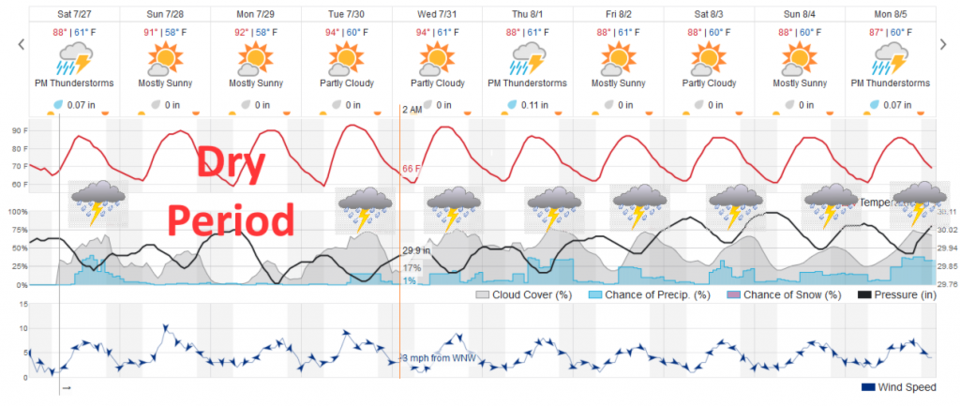
So will Monday- as the ridge and dry air travels over the state. The ridge only hangs around for about 3 days, then a trough digs into the Western U.S. and the high returns to a position (south central New Mexico) where it can pump moisture back into the state (Figure 5). Storm chances return and we drop from the mid 90's F Tuesday to the upper 80's F with daily afternoon storms (Figure 4).

Figure 1: the water vapor satellite image (browns/reds are dry air, whites and light grey is moist air, purple/blue is ice and high cloud tops). From the the Weather Channel.
Figure 2: The severe storm weather forecast for the U.S. from the Storm Predication Center in Norman, OK. Made Saturday for Saturday.
Figure 3: The forecast surface map for Sunday early morning from NCEP.
Figure 4: the graphical forecast for the next 10 days for Longmont, CO from weatherunderground.com
Figure 5: The 500mb forecast upper air analysis for Thursday PM. Pink dot is Longmont. Red lines are troughs, blue lines are ridges.

Current Weather

Light rain

Light rain

40°F

UV Index
1 Low
Pressure
29.96 Rising
Visibility
8 miles
Dewpoint
38 °F
Humidity
93%
Wind
WNW 0.6 mph
Gust
1.8 mph
Wind Chill
40 °F

Hourly Forecast

Today
9 AM
42°F
Cloudy
Today
10 AM
46°F
Mostly cloudy
Today
11 AM
49°F
Mostly cloudy
Today
12 PM
52°F
Cloudy
Today
1 PM
55°F
Cloudy
Today
2 PM
57°F
Cloudy
Today
3 PM
58°F
Thunderstorms
Today
4 PM
59°F
Mostly cloudy
Today
5 PM
61°F
Mostly cloudy
Today
6 PM
59°F
Mostly cloudy
Today
7 PM
57°F
Intermittent clouds
Today
8 PM
53°F
Mostly cloudy w/ t-storms

7 Day Forecast

Thunderstorms

Sunday

62 °F

Mostly cloudy and warmer with a thundershower in spots


Intermittent clouds

Sunday Night

38 °F

Partly cloudy


Partly sunny

Monday

70 °F

Partly sunny, pleasant and warmer


Intermittent clouds

Monday Night

44 °F

Partly cloudy


Mostly sunny

Tuesday

73 °F

Mostly sunny and pleasant


Intermittent clouds

Tuesday Night

41 °F

Clearing


Intermittent clouds

Wednesday

65 °F

Times of sun and clouds


Intermittent clouds

Wednesday Night

39 °F

A thundershower in spots in the evening; otherwise, partly cloudy


Rain

Thursday

56 °F

Cooler with occasional rain and drizzle; breezy in the morning


Partly cloudy

Thursday Night

32 °F

Partly cloudy


Sunrise and Sunset

Sunrise
6:03 AM
Sunset
7:53 PM

Based on AccuWeather data