Skip to content

4:30pm Update- Tornado Watch: Next Storm/Next Snow Forecast Discussion from the Cherrywood Observatory – July 4th, 2019

This content was originally published by the Longmont Observer and is licensed under a Creative Commons license.

In Brief:

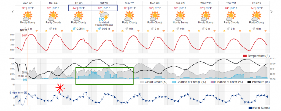
We just get into the 90'sF briefly Wednesday (post day) and Thursday then cool for the weekend into the 80'sF. Shower chances increase Friday-Saturday then we return to highs right around 90F with afternoon storms into next week. An isolated severe storm is possible Thursday along I-25 for hail and high winds.

4:30pm Update:

I've been having family fun for Independence Day - but I can't miss posting the tornado watch and Slight Risk for severe weather that is close to town.

Issued: 3:03 PM Jul. 4, 2019 – National Weather Service

THE NATIONAL WEATHER SERVICE HAS ISSUED TORNADO WATCH 485 IN
EFFECT UNTIL 10 PM MDT THIS EVENING FOR THE FOLLOWING AREAS

IN COLORADO THIS WATCH INCLUDES 16 COUNTIES

IN EAST CENTRAL COLORADO

ELBERT                LINCOLN

IN NORTH CENTRAL COLORADO

LARIMER

IN NORTHEAST COLORADO

ADAMS                 ARAPAHOE              BOULDER
BROOMFIELD            DENVER                DOUGLAS
JEFFERSON             LOGAN                 MORGAN
PHILLIPS              SEDGWICK              WASHINGTON
WELD

THIS INCLUDES THE CITIES OF AKRON, BENNETT, BOULDER, BROOMFIELD,
BYERS, CASTLE ROCK, DENVER, FORT COLLINS, FORT MORGAN, GOLDEN,
GREELEY, HOLYOKE, JULESBURG, KIOWA, LIMON,  (ed: Longmont)   AND STERLING.

Figure 1 update: The severe storm weather forecast for the U.S. from the Storm Predication Center in Norman, OK. Made Thursday for Thursday.

Forecast Discussion:

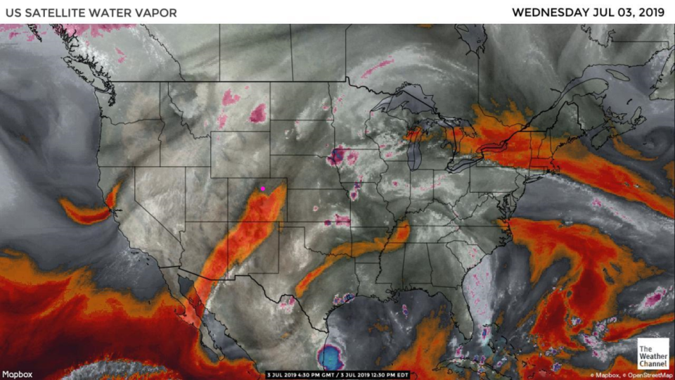
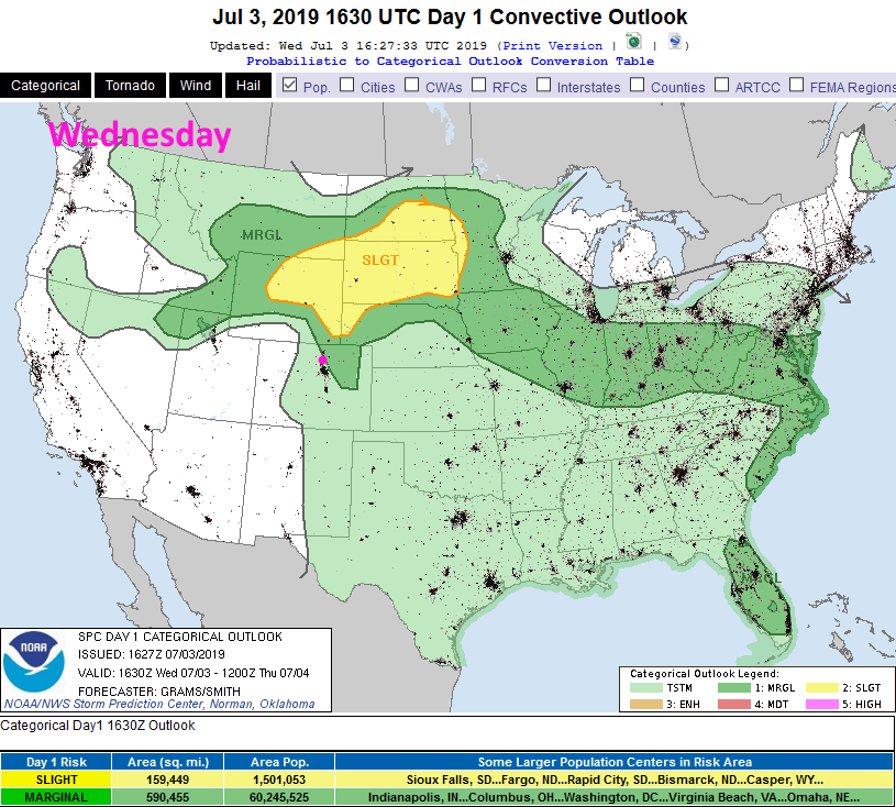
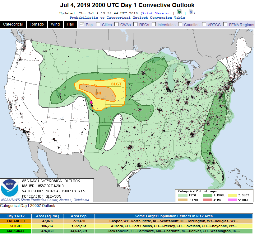
Drier air is sliding in over the state today (Figure 1 - orange and red colors over Colorado). The preciptable water is only at 0.66 inches today but dew points (surface moisture) is pretty high at 53F. This low level moisture, afternoon heating, and an upper level wave passing north of the state will kick off severe weather just a few miles to our northeast and up into Wyoming/Nebraska and the Dakotas (Figure 2). Hail and high winds are the main threat.

The Longer Range Forecast:

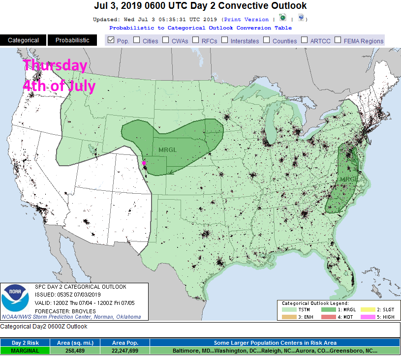
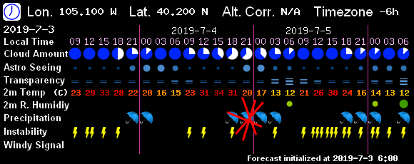
For Independence Day - the ingredients are still here for severe weather in the afternoon and early evening back to I-25 communities. Hail and high winds will be the most likely threat (Figure 3). When fireworks begin it should be 76F with 50% cloud cover and a small chance of showers (about 15% chance). The 7! Timer model output has us at 60% cloud cover and 82F with showers possible when the fireworks begin (Figure 6).

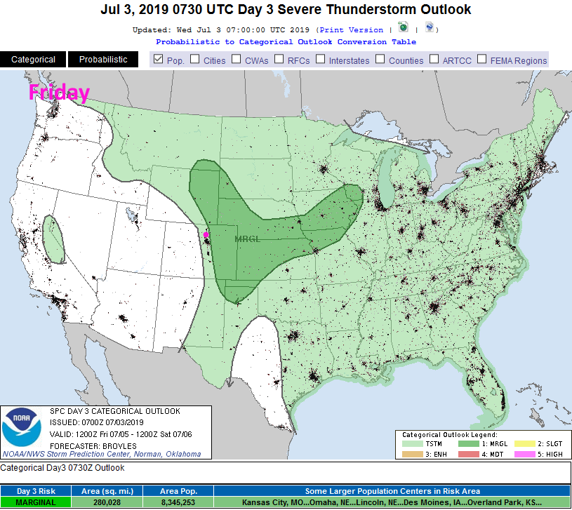
We cool down with a cool front Friday (brought down by that passing short wave) and we return to the lower 80'sF for both Friday and Saturday with a better chance of rain and showers. (Figure 5). The marginal severe weather threat is currently expected just east of I-25 Friday (Figure 4).

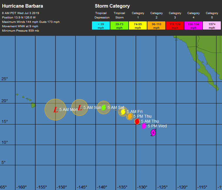
It won't effect us, but it is interesting to see a category 4 hurricane drifting towards Hawaii (Figure 7) - it will be a tropical depression by the time it gets close to the islands.

Figure 1: the water vapor satellite image (browns/reds are dry air, whites and light grey is moist air, purple/blue is ice and high cloud tops). From the the Weather Channel.
Figure 2 The severe storm weather forecast for the U.S. from the Storm Predication Center in Norman, OK. Made Wednesday for Wednesday.
Figure 2 The severe storm weather forecast for the U.S. from the Storm Predication Center in Norman, OK. Made Wednesday for Thursday.
Figure 4: The severe storm weather forecast for the U.S. from the Storm Predication Center in Norman, OK. Made Wednesday for Friday.
Figure 5: the graphical forecast for the next 10 days for Longmont, CO from weatherunderground.com
Figure 6: The 2.5 day sky conditions forecast from 7! Timer (the GFS).
Figure 7: The forecast position map for Hurricane Barbara from the NHC and the weatherunderground.com

Current Weather

Partly sunny

Partly sunny

63°F

UV Index
8 Very High
Pressure
29.78 Falling
Visibility
8 miles
Dewpoint
33 °F
Humidity
32%
Wind
SE 3.1 mph
Gust
7.3 mph
Wind Chill
63 °F

Hourly Forecast

Today
12 PM
63°F
Intermittent clouds
Today
1 PM
64°F
Intermittent clouds
Today
2 PM
65°F
Intermittent clouds
Today
3 PM
64°F
Intermittent clouds
Today
4 PM
62°F
Intermittent clouds
Today
5 PM
59°F
Intermittent clouds
Today
6 PM
57°F
Mostly cloudy w/ t-storms
Today
7 PM
55°F
Intermittent clouds
Today
8 PM
53°F
Thunderstorms
Today
9 PM
51°F
Cloudy
Today
10 PM
49°F
Cloudy
Today
11 PM
47°F
Cloudy

7 Day Forecast

Partly sunny w/ t-storms

Wednesday

65 °F

A shower in spots this morning, becoming breezy this afternoon with a thunderstorm


Thunderstorms

Wednesday Night

37 °F

A thunderstorm this evening; otherwise, mostly cloudy


Intermittent clouds

Thursday

62 °F

A blend of sun and clouds


Mostly cloudy

Thursday Night

38 °F

Mostly cloudy


Partly sunny

Friday

64 °F

Some sun; breezy in the afternoon


Partly cloudy

Friday Night

36 °F

Partly cloudy


Partly sunny

Saturday

66 °F

Partial sunshine


Mostly clear

Saturday Night

41 °F

Clear to partly cloudy


Mostly cloudy

Sunday

78 °F

Rather cloudy and warmer; breezy in the afternoon


Mostly cloudy

Sunday Night

43 °F

Rather cloudy


Sunrise and Sunset

Sunrise
5:59 AM
Sunset
7:56 PM

Based on AccuWeather data