Skip to content

Next Storm/Next Snow Forecast Discussion from the Cherrywood Observatory – July 8th, 2019

This content was originally published by the Longmont Observer and is licensed under a Creative Commons license.

In Brief:

We hover in the 80's F for Sunday and Monday (Sunday is posting day) with severe weather possible each afternoon. After that we warm to center on 90°F with only wandering thunderstorms most afternoons.

Forecast Discussion:

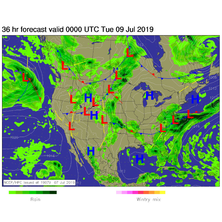
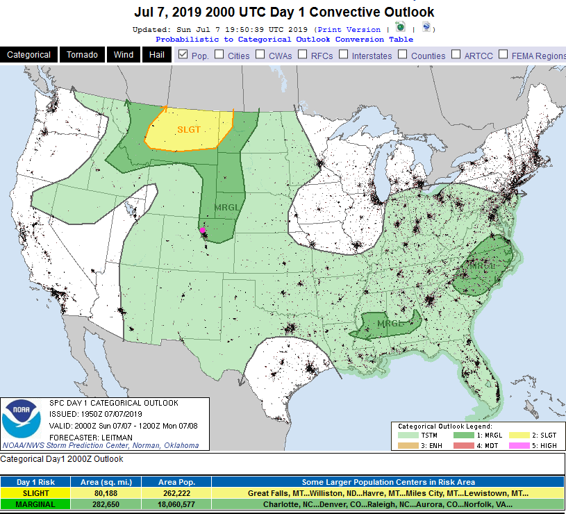
We have another stream of moisture coming into the state through Monday, and a trough to the west (Figure 1). This places boundaries, fronts, and a trough down stream of the Rockies- around the state (Figure 2) Sunday and Monday. Severe weather (hail and high winds) are a risk both Sunday and Monday afternoons (Figure 3 and Figure 5). This is a Marginal Risk (1 on a scale of 1 -5) according to the Storm Prediction Center both days.

The Longer Range Forecast:

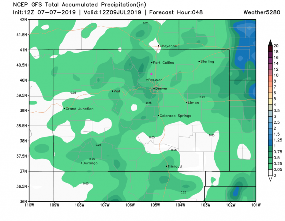
We return to 90's F for most of the week with afternoon wandering, mountain initiated, thunderstorms (Figure 4). Over the next 48 hours, we should get some rain (maybe up to a quarter inch - Figure 6) unless a lucky thunderstorm core hits (aka Friday).

Figure 1: the water vapor satellite image (browns/reds are dry air, whites and light grey is moist air, purple/blue is ice and high cloud tops). From the the Weather Channel.
Figure 2: The forecast surface map for Friday night from NCEP.
Figure 3: The severe storm weather forecast for the U.S. from the Storm Predication Center in Norman, OK. Made Sunday for Sunday.
Figure 4: the graphical forecast for the next 10 days for Longmont, CO from weatherunderground.com
Figure 5: The severe storm weather forecast for the U.S. from the Storm Predication Center in Norman, OK. Made Sunday for Monday.
Figure 6: the forecast accumulated precipitation map from the GFS and weather5280.com for Colorado, for the next 2 days.

Current Weather

Partly sunny

Partly sunny

55°F

UV Index
0 Low
Pressure
29.89 Steady
Visibility
8 miles
Dewpoint
39 °F
Humidity
54%
Wind
NW 4.8 mph
Gust
10 mph
Wind Chill
55 °F

Hourly Forecast

Today
8 PM
54°F
Mostly cloudy w/ showers
Today
9 PM
51°F
Showers
Today
10 PM
48°F
Intermittent clouds
Today
11 PM
45°F
Intermittent clouds
Tomorrow
12 AM
44°F
Partly cloudy
Tomorrow
1 AM
42°F
Partly cloudy
Tomorrow
2 AM
41°F
Partly cloudy
Tomorrow
3 AM
40°F
Partly cloudy
Tomorrow
4 AM
39°F
Partly cloudy
Tomorrow
5 AM
38°F
Partly cloudy
Tomorrow
6 AM
37°F
Partly cloudy
Tomorrow
7 AM
39°F
Partly sunny

7 Day Forecast

Intermittent clouds

Sunday

64 °F

Warmer with times of clouds and sun


Intermittent clouds

Sunday Night

37 °F

An evening shower in spots; otherwise, partly cloudy


Partly sunny

Monday

70 °F

Partly sunny and pleasant


Intermittent clouds

Monday Night

43 °F

Partly cloudy


Mostly sunny

Tuesday

73 °F

Mostly sunny and pleasant


Intermittent clouds

Tuesday Night

41 °F

Clearing


Intermittent clouds

Wednesday

65 °F

Times of sun and clouds


Intermittent clouds

Wednesday Night

39 °F

A thundershower in spots in the evening; otherwise, partly cloudy


Rain

Thursday

53 °F

Cooler with occasional rain and drizzle; breezy in the morning


Partly cloudy

Thursday Night

32 °F

Partly cloudy


Sunrise and Sunset

Sunrise
6:03 AM
Sunset
7:53 PM

Based on AccuWeather data