Skip to content

Next Storm/Next Snow Forecast Discussion from the Cherrywood Observatory – July 9-10th, 2019

This content was originally published by the Longmont Observer and is licensed under a Creative Commons license.

In Brief:

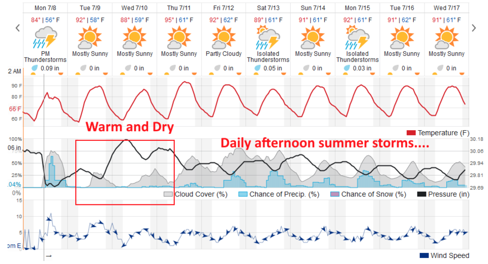
We have one more chance of severe weather on posting day (Monday) - then moisture levels drop and a ridge warms the upper atmosphere. Rain chances drop to nearly zero for a couple of days. Peak heat hits Thursday - then afternoon storm chances return as the heat drops back towards normal (near 90F) on through the weekend and beyond.

Forecast Discussion:

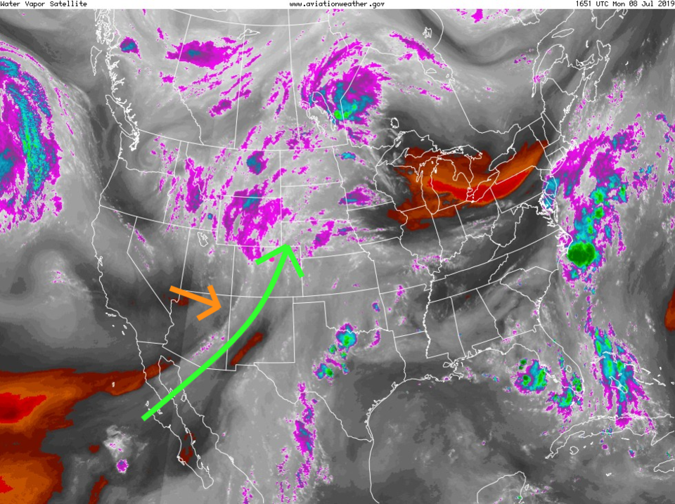
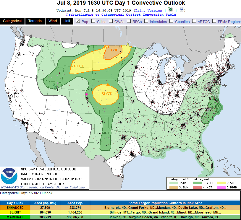
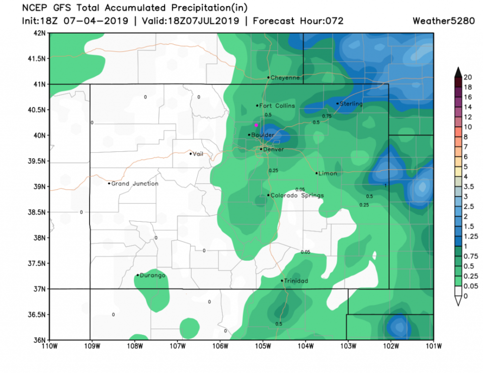
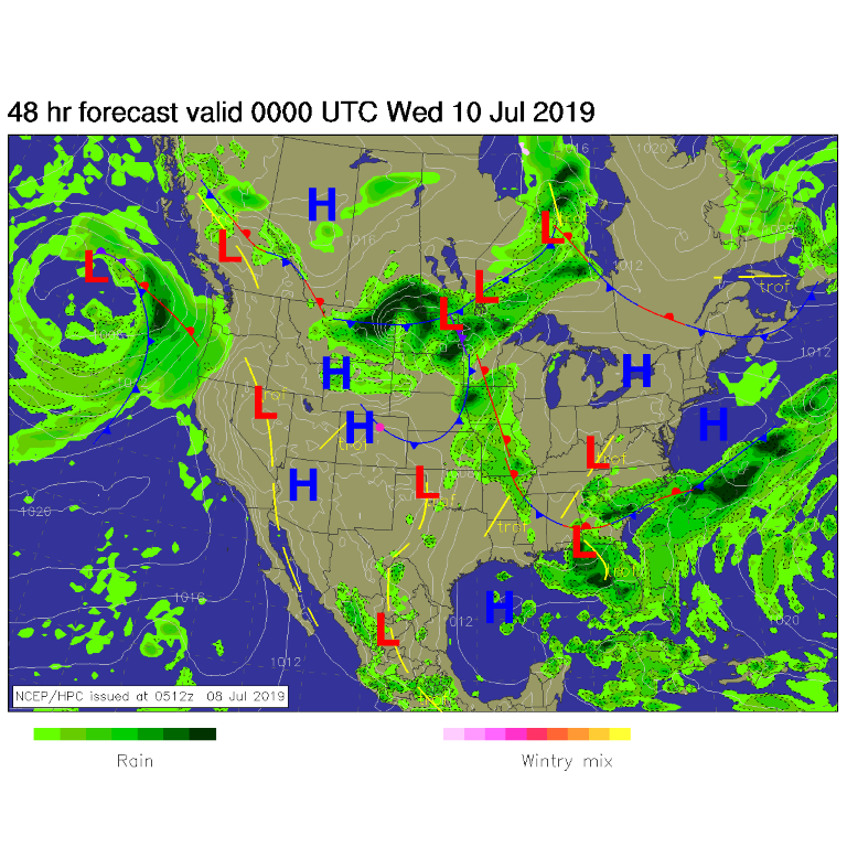
Our latest ribbon of moisture is still over Colorado Monday afternoon (Figure 1 - green arrow) but dry air is moving in from the west (orange arrow). With a trough approaching - we still have a chance of severe weather (a Marginal Risk 1 on a scale of 1-5) for hail and high winds. The minimal tornado risk is further out on the eastern Plains (Figure 3). Our rain chances over the next 3 days all occur Monday afternoon and evening. It will be spotty and minimal, unless you get a direct hit from a thunderstorm (Figure 4).

The Longer Range Forecast:

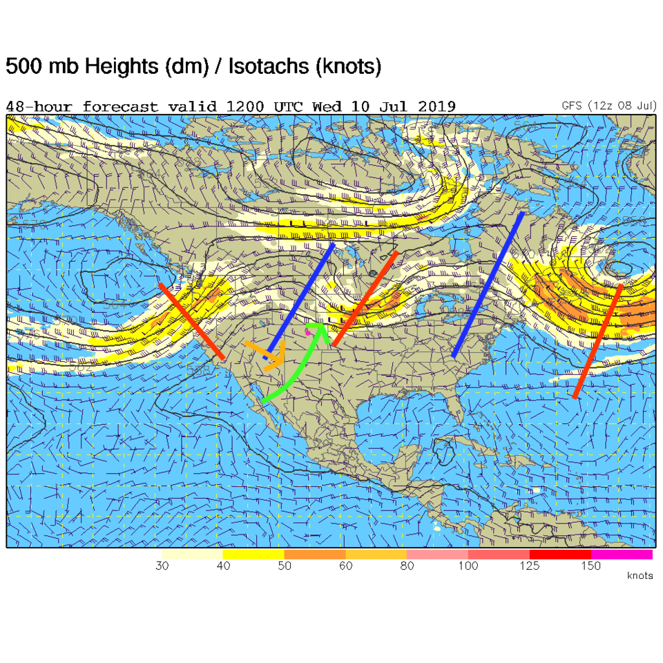
The 500mb upper air flow 36 hours from now shows the same flow pattern today overlaid on the ridge that is moving in. This will be a very different flow pattern (aka DRY - Figure 5). Storm chances resume on our day of maximum heating (mid 90'sF on Thursday) then the ridge weakens around Colorado and moisture can again form our afternoon thunderstorm chances on through the weekend.

Figure 1: the water vapor satellite image (browns/reds are dry air, whites and light grey is moist air, purple/blue is ice and high cloud tops). From the the NWS.
Figure 2: The 500mb forecast upper air analysis for Wednesday early am. Pink dot is Longmont. Red lines are troughs, blue lines are ridges.
Figure 3: The severe storm weather forecast for the U.S. from the Storm Predication Center in Norman, OK. Made Monday for Monday.
Figure 3: the forecast accumulated precipitation map from the GFS and weather5280.com for Colorado, for the next 3.5 days.
Figure 5: The forecast surface map for Tuesday riday night from NCEP.
Figure 6: the graphical forecast for the next 10 days for Longmont, CO from weatherunderground.com

Current Weather

Clear

Clear

56°F

UV Index
0 Low
Pressure
29.41 Falling
Visibility
7 miles
Dewpoint
33 °F
Humidity
40%
Wind
SSE 4.6 mph
Gust
10.5 mph
Wind Chill
56 °F

Hourly Forecast

Today
2 AM
57°F
Mostly cloudy w/ showers
Today
3 AM
55°F
Cloudy
Today
4 AM
53°F
Cloudy
Today
5 AM
51°F
Cloudy
Today
6 AM
49°F
Cloudy
Today
7 AM
47°F
Cloudy
Today
8 AM
48°F
Cloudy
Today
9 AM
50°F
Cloudy
Today
10 AM
51°F
Cloudy
Today
11 AM
52°F
Cloudy
Today
12 PM
52°F
Cloudy
Today
1 PM
53°F
Cloudy

7 Day Forecast

Intermittent clouds

Sunday

76 °F

Warmer with intervals of clouds and sunshine


Mostly cloudy w/ showers

Sunday Night

47 °F

Mostly cloudy, becoming windy late with a shower


Windy

Monday

56 °F

Winds gusting past 40 mph; cloudy and cooler


Intermittent clouds

Monday Night

42 °F

Partly cloudy


Partly sunny w/ showers

Tuesday

59 °F

A couple of showers in the morning; otherwise, windy and cool with times of clouds and sun


Partly cloudy

Tuesday Night

32 °F

Partly cloudy


Intermittent clouds

Wednesday

58 °F

Cool with times of clouds and sun


Intermittent clouds

Wednesday Night

38 °F

Partly cloudy


Intermittent clouds

Thursday

56 °F

Breezy and cool with sun and clouds


Intermittent clouds

Thursday Night

39 °F

Partly cloudy


Sunrise and Sunset

Sunrise
5:54 AM
Sunset
8:00 PM

Based on AccuWeather data