This content was originally published by the Longmont Observer and is licensed under a Creative Commons license.
In Brief:
We settle in to a 10 day period of afternoon thundershowers (picking up some for the weekend) and high temperature a bit below normal with nighttime temperatures right at normal. Nothing much to read here for a little while. (Can you say that in a news article?)
The Forecast Discussion:
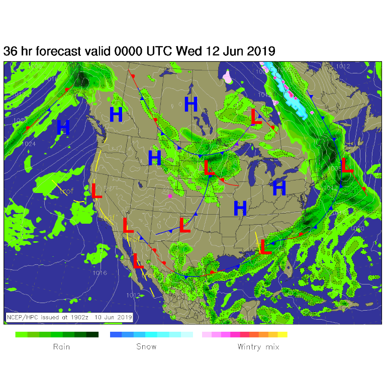
Figure 1 shows a weak front past our state and mostly clear skies across Colorado. There are a few showers closer to the low up to our northeast.
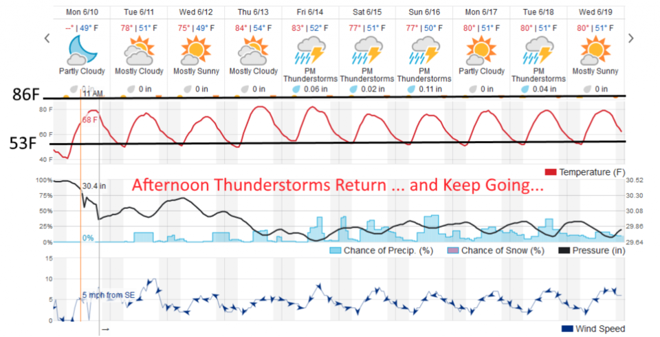
We warm to the upper 70'sF for the next couple of days (Figure 2) and afternoon thundershower chances return as well (we only had some clouds form in the mountains Monday afternoon).
The Longer Range Forecast:
In Figure 2, I've crudely drawn the normal high temperature line (86F) and normal low temperature (53F). You can see that the nighttime temperatures are really close to normal, but the highs remain below normal for the next 10 days.
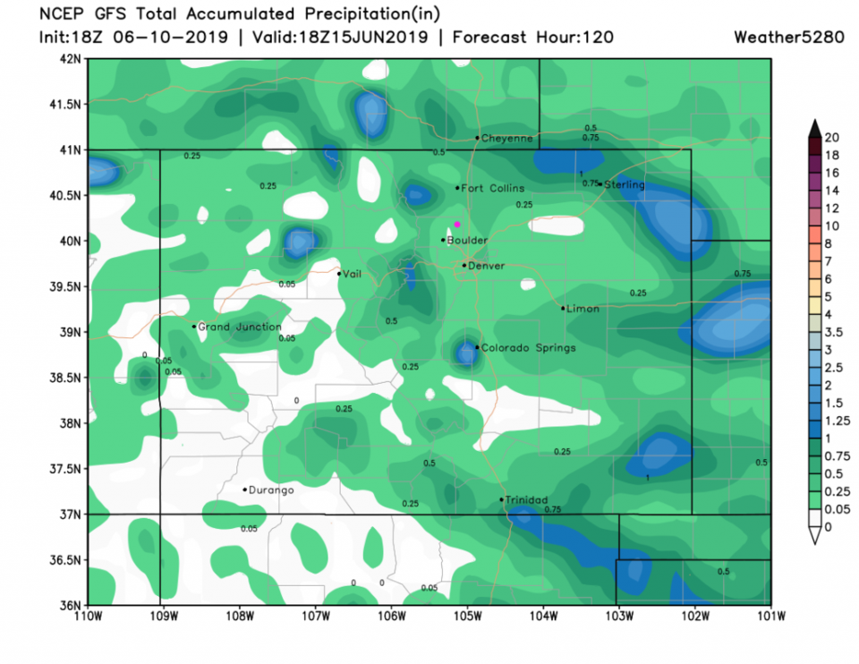
There is an enhancement in the storm chances Friday through Sunday that we'll watch as the week passes. The GFS shows the spotty nature of rain over the next 5 days (Figure 3). A few lucky spots will pick up an inch of rain but most only get a quarter of an inch or less.