Skip to content

Next Storm/Next Snow Forecast Discussion from the Cherrywood Observatory – June 2, 2019

This content was originally published by the Longmont Observer and is licensed under a Creative Commons license.

In Brief:

After a night (Saturday) of a few strong storms around the state, Sunday will be a touch cooler with a better shot of storms - some severe - in the afternoon hours. The week unfolds with temperatures near 80F each day with a chance of afternoon (occasionally strong) each afternoon. Get your hikes in in the morning.

Forecast Discussion:

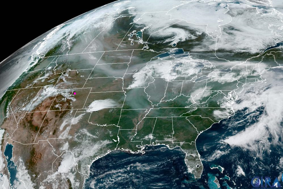
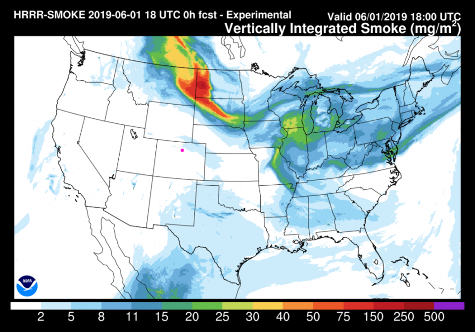
The visible satellite image (Figure 1) shows you how the Earth would look with your eyes from space. The milky material in Montana, western Canada and stretching down into the Dakotas and even Missouri and the Ohio Valley is smoke from fires way up north. The HRRR smoke model shows only a bit of the smoke near Colorado today (Saturday) and it then pushes east (Figure 2).

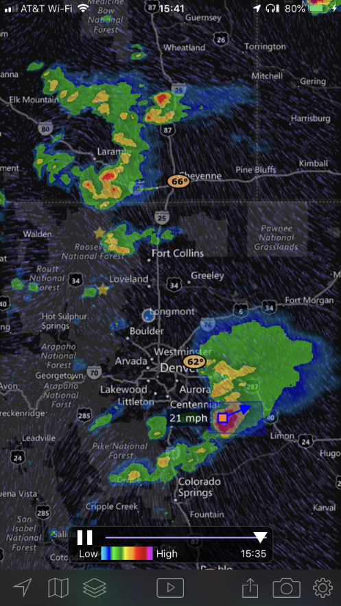
We've had the strongest storms up in southern Wyoming and down around southern Denver Saturday afternoon (Figure 3). Some good hail fell and is currently falling (as I post this Saturday afternoon).

The Longer Range Forecast:

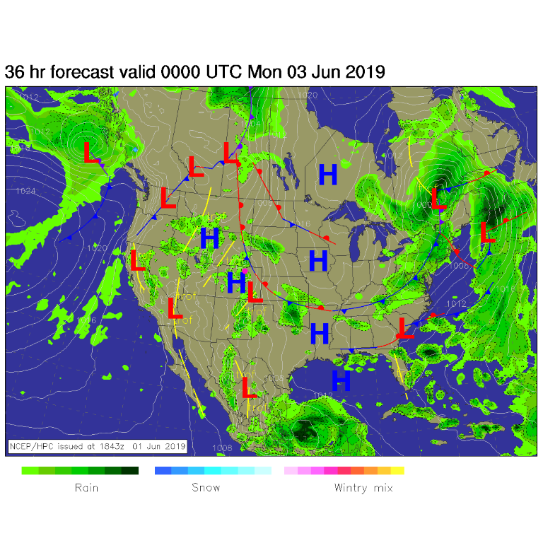
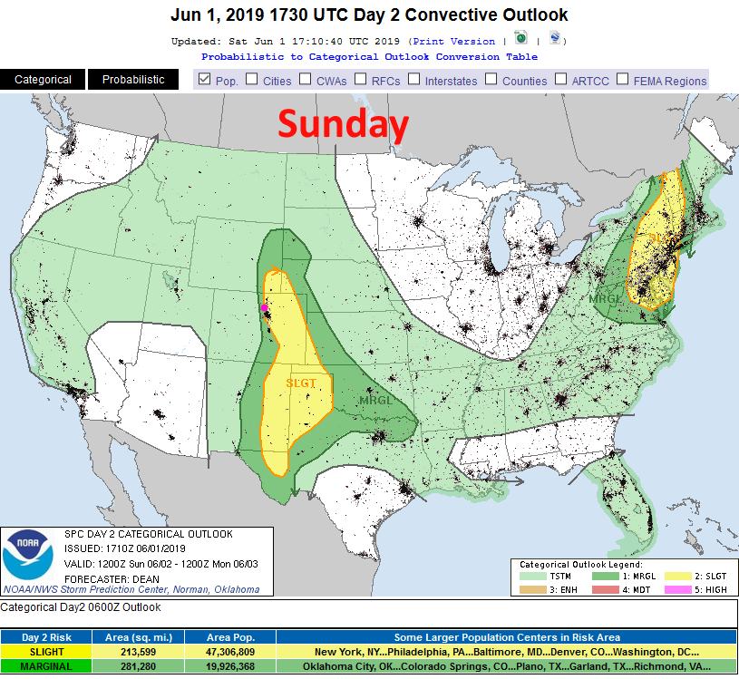
For Sunday, the front is still draped across the state (Figure 4), upper level energy is moving in from the west, and energy will exist for more wide-spread and stronger - hail and damaging wind producing storms. The SPC has painted Longmont with a slight risk (2 on a scale of 1-5) up I-25 and just a bit west of the interstate. A marginal risk extends a bit up the foothills (Figure 5). As always - frequent lightning, powerful damaging winds, and large hail may be produced by the stronger cells.

Beyond this - we have a fairly routine week with temperatures around 80F and afternoon showers/thunderstorms coming off the mountains. (I'm saving space and not including that 10 day graphic for once).

Figure 1: The visible and color satellite image from the GOES-E satellite. Milky haze across the northern U.S. is smoke from the Canadian fires.
Figure 2: The HRRR smoke forecast for Sunday afternoon from NOAA.
Figure 3: The radar image from Sunday afternoon form the iOS app MyRadar.
Figure 4: The forecast surface map for Sunday night from NCEP.
Figure 5: The severe storm weather forecast for the U.S. from the Storm Predication Center in Norman, OK. Made Saturday for Sunday.

Current Weather

Light rain

Light rain

39°F

UV Index
0 Low
Pressure
29.96 Rising
Visibility
8 miles
Dewpoint
38 °F
Humidity
95%
Wind
NNW 0.6 mph
Gust
1.7 mph
Wind Chill
39 °F

Hourly Forecast

Today
9 AM
42°F
Cloudy
Today
10 AM
46°F
Mostly cloudy
Today
11 AM
49°F
Mostly cloudy
Today
12 PM
52°F
Cloudy
Today
1 PM
55°F
Cloudy
Today
2 PM
57°F
Cloudy
Today
3 PM
58°F
Thunderstorms
Today
4 PM
59°F
Mostly cloudy
Today
5 PM
61°F
Mostly cloudy
Today
6 PM
59°F
Mostly cloudy
Today
7 PM
57°F
Intermittent clouds
Today
8 PM
53°F
Mostly cloudy w/ t-storms

7 Day Forecast

Thunderstorms

Sunday

61 °F

Mostly cloudy and warmer with a thundershower in spots


Partly cloudy w/ t-storms

Sunday Night

37 °F

An evening thunderstorm in parts of the area; otherwise, partly cloudy


Partly sunny

Monday

70 °F

Partly sunny, pleasant and warmer


Intermittent clouds

Monday Night

43 °F

Partly cloudy


Mostly sunny

Tuesday

73 °F

Mostly sunny and pleasant


Mostly cloudy

Tuesday Night

41 °F

Mostly cloudy


Intermittent clouds

Wednesday

65 °F

Times of sun and clouds with a passing shower in the afternoon


Intermittent clouds

Wednesday Night

39 °F

A thundershower in spots in the evening; otherwise, partly cloudy


Rain

Thursday

49 °F

Chilly with rain and drizzle


Partly cloudy

Thursday Night

28 °F

Partly cloudy


Sunrise and Sunset

Sunrise
6:03 AM
Sunset
7:53 PM

Based on AccuWeather data