This content was originally published by the Longmont Observer and is licensed under a Creative Commons license.
In Brief:
The next 10 days will see all the weather types we can have near town. A strong cold front arrives in the morning Friday. Rain chances really pick up around 1pm starting a 3 day stretch of rain that will top 1 inch and may approach 2 inches total. There is severe weather possible Friday with hail and tornadoes and hail is possible Saturday.
Snow is possible in the nearby foothills and we "might" see snow flurries Sunday AM mixed in with the rain. Crazy! Rain ends before midnight Sunday and we see a stretch of 90'sF midweek into next weekend.
10:30am Update:
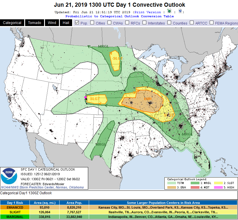
ANOTHER Update - now all of Denver is in the Slight Risk (2 on a scale of 1-5) and the Marginal Risk (1 on a scale of 1-5) extends far to the west into the mountains. There is no real change for Longmont.
You can keep up with the exciting changes at:
https://www.spc.noaa.gov/products/outlook/day1otlk.html
End 10:30am Update.
8:30am Update:
Everything in the forecast is on track for storm timing, lots of rain through Sunday morning with showers, now and then, into Sunday night. Very cool air in place and 3-5" snow above 10,000 feet, measurable snow probably down to 9,000 feet elevation and maybe a dusting in the lower foothills (Boulder, if they are lucky, might see early morning snows mixed with the rain.) Longmont shouldn't see snow with lows in the mid 40'sF.
For severe weather today, the SPC has decreased the threat along I-25 and westward - we have only a Marginal Risk (1 on a scale of 1-5) today for hail and high winds. There is a risk of isolated tornadoes in the Slight Risk zone to our east. They way they have drawn the risk excludes Fort Lupton, but includes Brighton, Commerce City, DIA, and Auroroa.
End 8:30am Update.
Forecast Discussion:
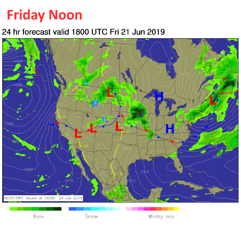
The front sweeps through Friday morning and showers begin in the overrunning setup behind it (Figure 1). Rain chances this afternoon and evening are very high (Figure 2). Don't plan to play outside!
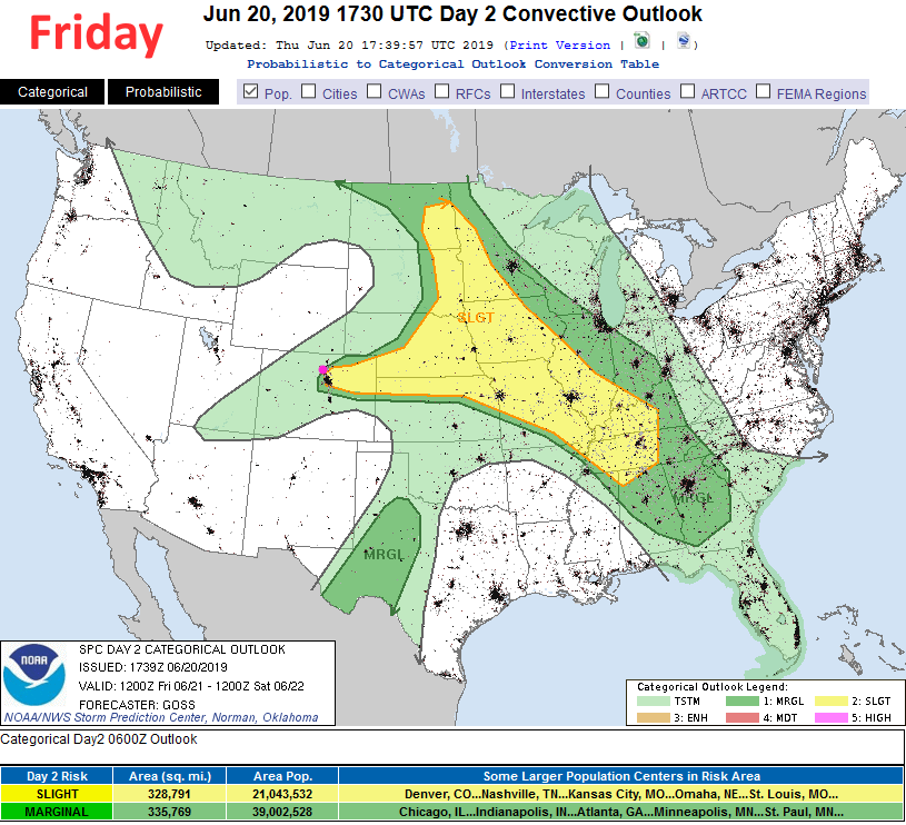
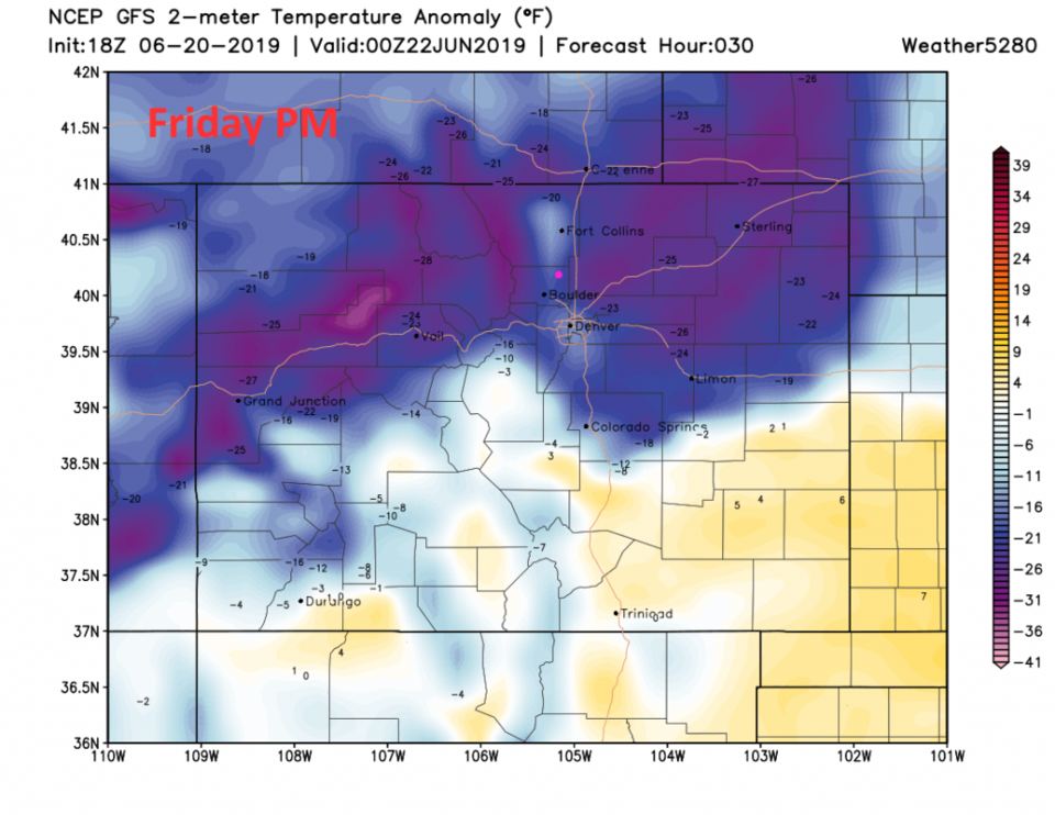
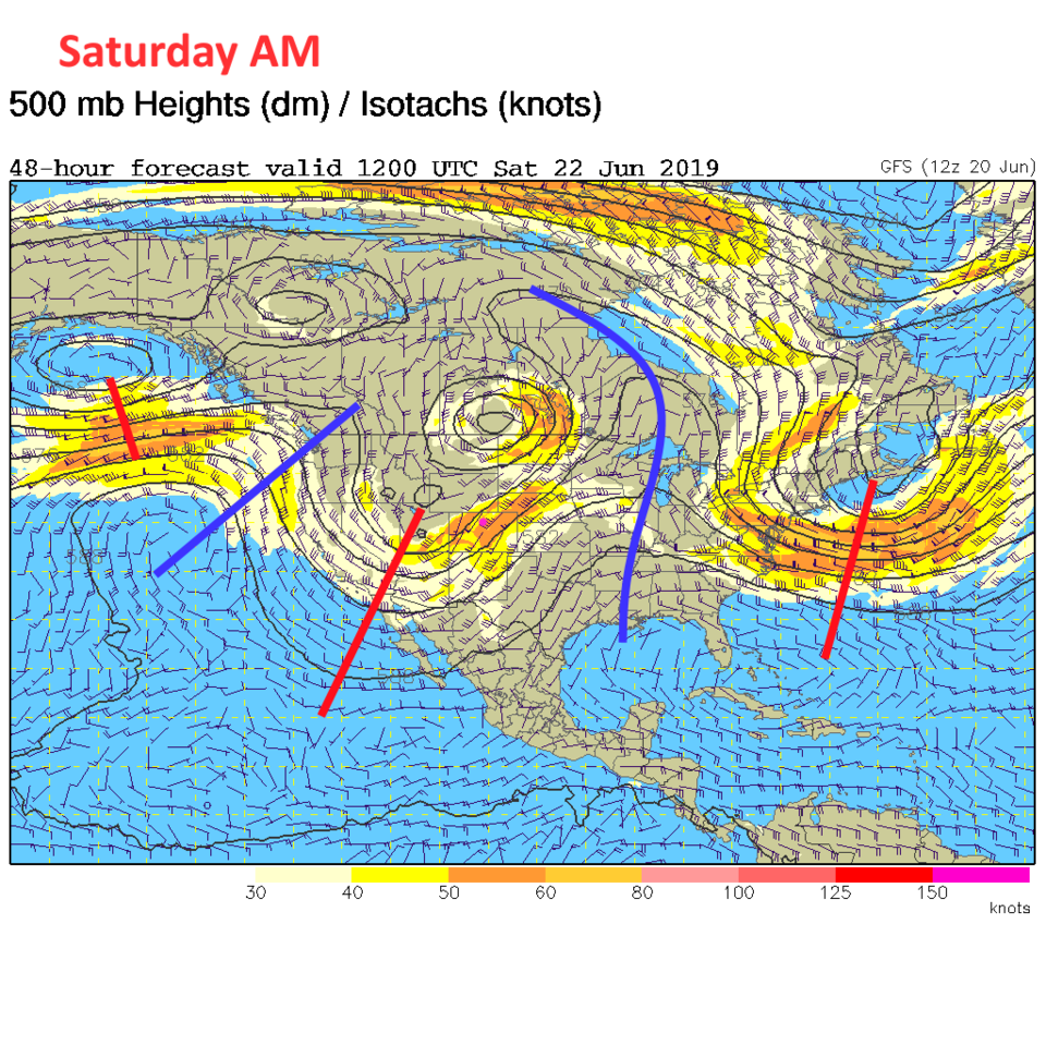
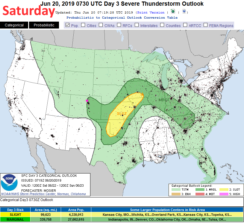
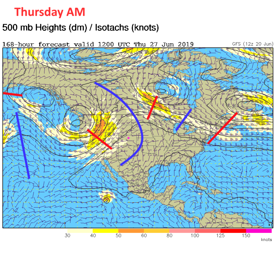
Another reason to stay inside will be the severe weather risk (Figure 3) - we'll be under a Slight Risk for high winds, large hail, and isolated tornadoes (Figure 6). Often, the risk expands in coverage once more data comes in overnight - so I may be updating this post in the AM. The cold air entering the state later today (Friday) is clear on the GFS (Figure 4).
Oh, even though I say the word snow below, welcome to the first day of Astronomical Summer - Friday June 21 at 9:54am.
The Longer Range Forecast:
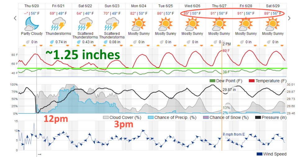
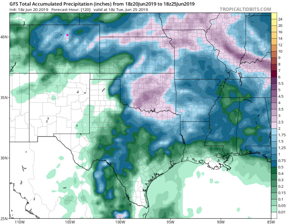
Rain chances continue through late night Sunday (Figure 2) with 1 1/4th inches predicted from weatherunderground and 1 3/4th inches from the GFS (Figure 8). This is all powered by a deep trough in the upper air flow as it slowly moves by (Figure 5).
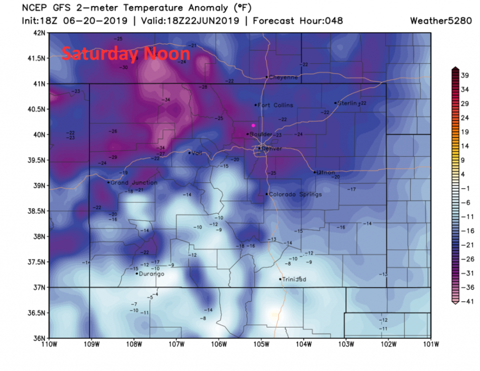
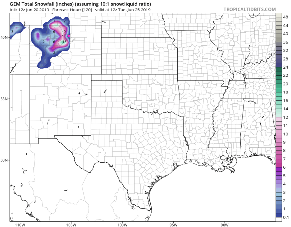
By Saturday noon, rain continues off and on with quite cold air in place across the state (Figure7). We'll even see nighttime and early morning snows in the mountains (Figure 9). Will Boulder see snow flurries? A coating??!! Will we see flurries in the rain in the early morning??
Next week the heat begins for the first time with 90'sF starting as early as Wednesday (Figure 2 - red oval) with a big ridge building overhead (Figure 10).