This content was originally published by the Longmont Observer and is licensed under a Creative Commons license.
Forecast Discussion:
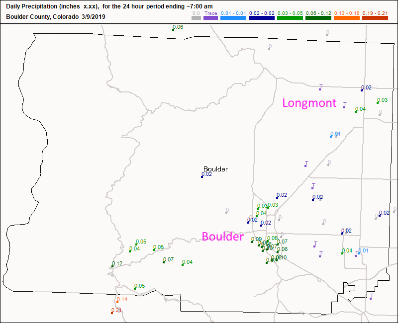
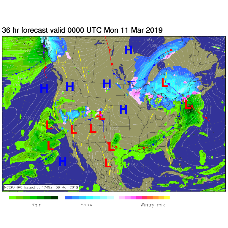
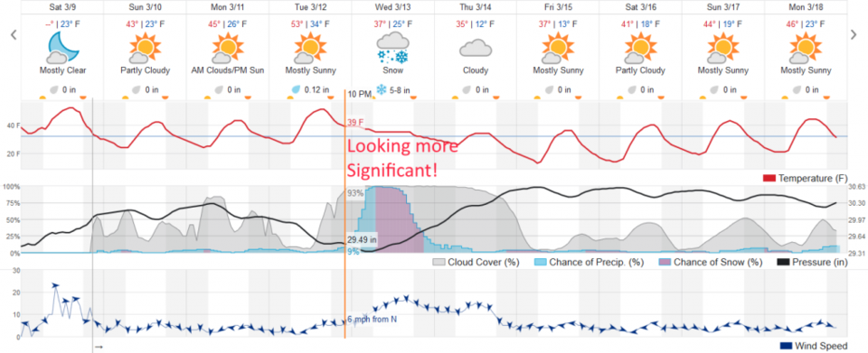
Friday's storm blew through with mainly rain, wind, and snow under the heaver convection (Figure 1). We had only a few 100th's of an inch in town. We have a few, somewhat below normal (temperature-wise - Figure 3 ) days ahead of us as the weekend ends and the week starts. Snow continues in the mountains (Figure 2). What's new?
The longer range forecast:
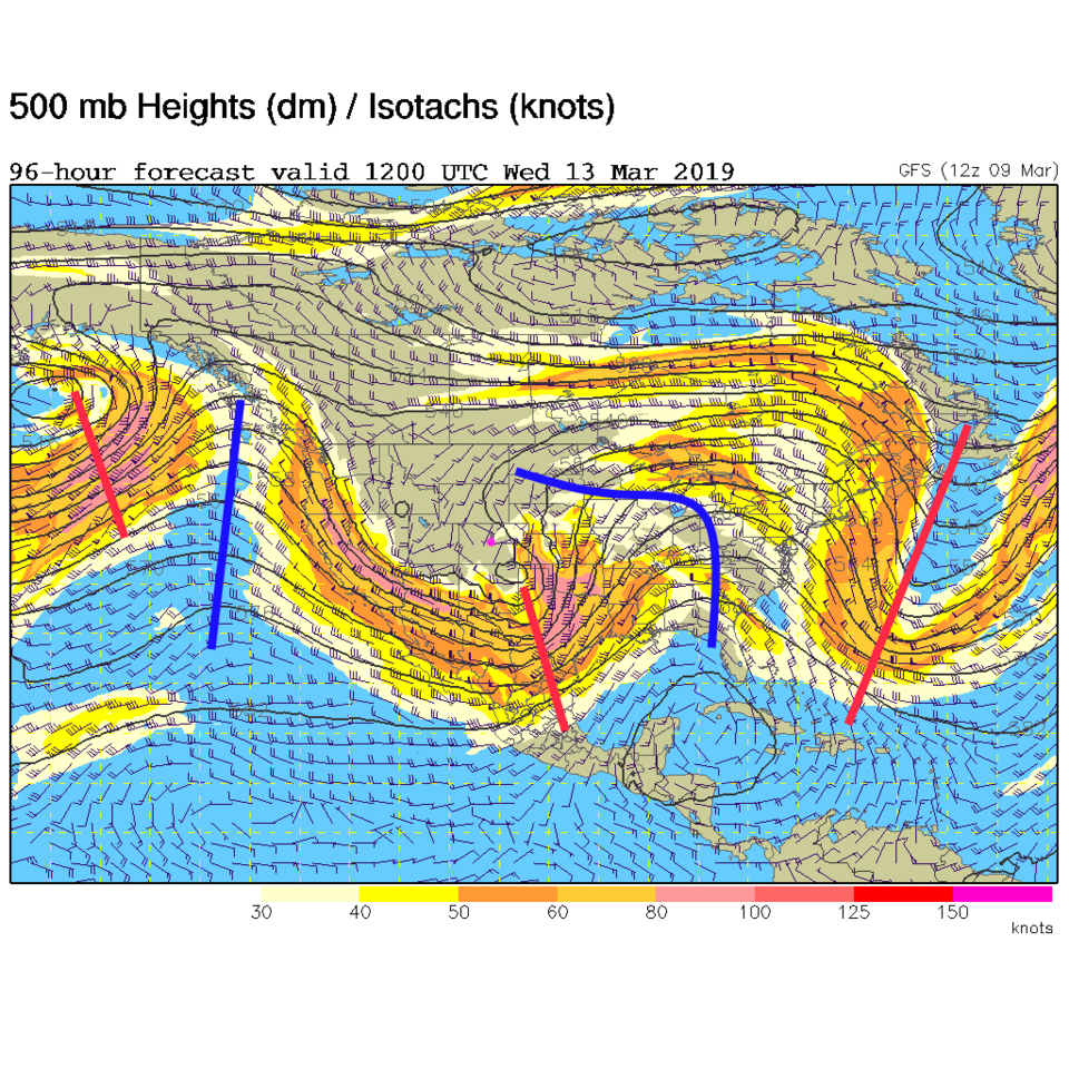
Our mid-week storm is looking better and bigger (if you think a bigger snow storm is better). Figure 2 shows it beginning with rain as warm southwest flow covers the state. The upper-air pattern, in Figure 4, shows what is called a negatively tilted trough over the state Wednesday (the red line upper left to lower right over Colorado). There is even a closed circle over SE Colorado all describing a strong, classic, spring storm with blizzard potential out on the eastern Plains. This will have lift, jet stream support, and strong up flow over NE Colorado, and a lot of moisture (if it pans out).
We are still too far out to be certain, and not all models are creating this scenario, but more are looking to come in line with this picture.
The weatherunderground.com model in Figure 3 shows us getting 5-8 inches of snow.
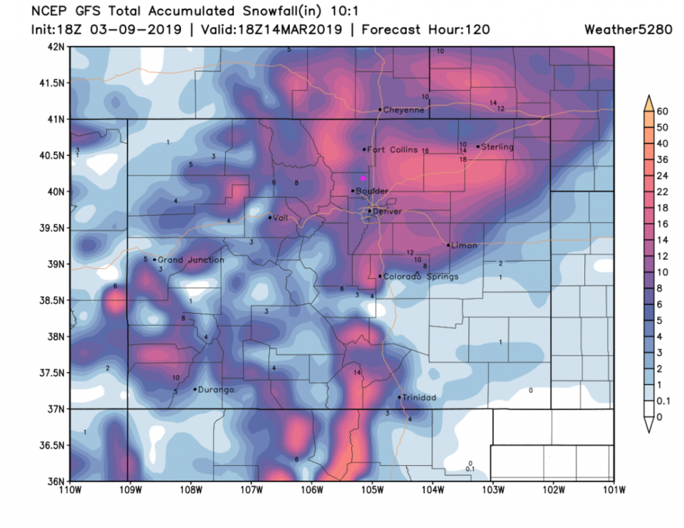
The GFS in Figure 5 also gives us 5-8 inches.
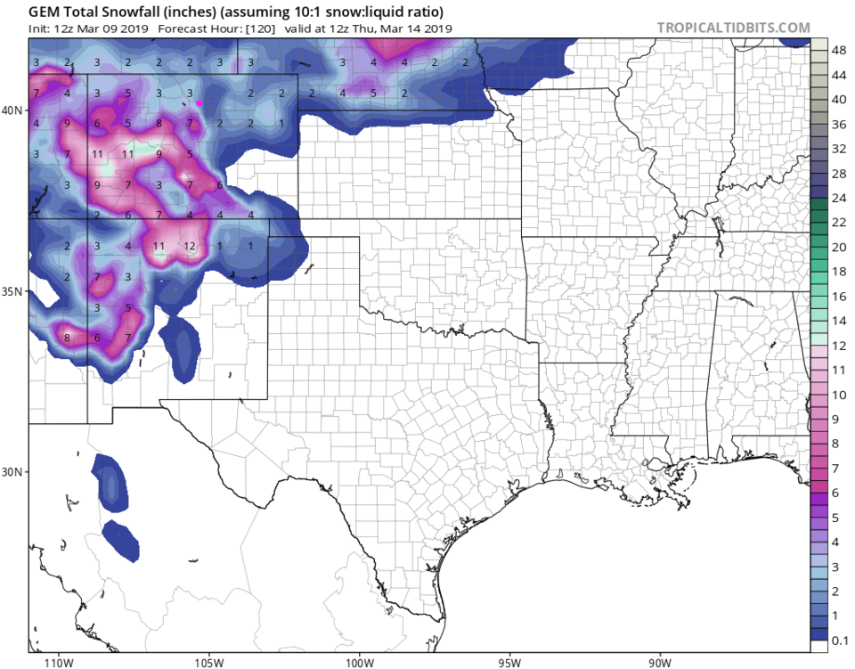
The GEM in Figure 6 is more in the line of 2-4 inches.
Stay tuned!