Skip to content

Next Storm/Next Snow Forecast Discussion from the Cherrywood Observatory – March 11, 2019

This content was originally published by the Longmont Observer and is licensed under a Creative Commons license.

Forecast Discussion:

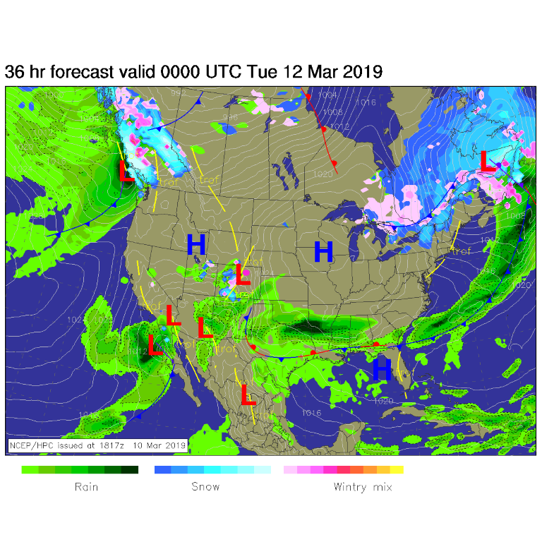
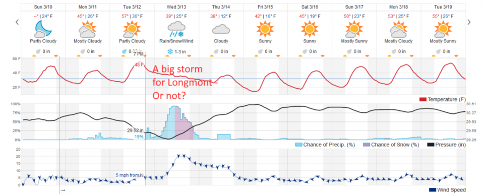
Mild nice-ness continues today. Mountain snows continue today. Figure 1 shows a minor upper level ripple rolling past Colorado to the south keeping the snow-train blowing in the mountains and on the Western Slopes (and rain in New Mexico). We will just get breezes and clouds in NE Colorado. We warm up, a lot, right before the next storm with southwest winds and down-slope flow on tomorrow/Tuesday (Figure 2).

The longer range forecast:

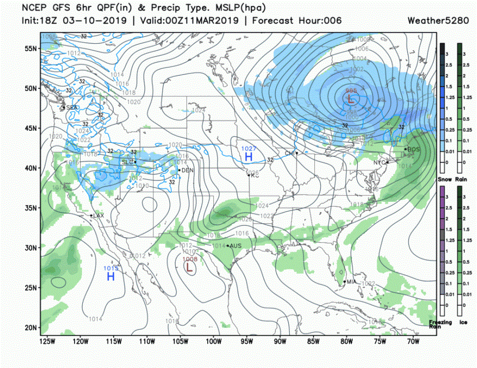
The big news and the big question this week is concerning the next big storm (animation in Figure 3). Somewhere, not far to the east of us, or up into the foothills and over our town, heavy snow, winds to hurricane force/speed, incredible low pressure, and heavy amounts of rain will fall. This will be a very major winter/spring storm for Colorado, Nebraska, Kansas, Texas, and Oklahoma that some people will talk about for years. But will it be us?

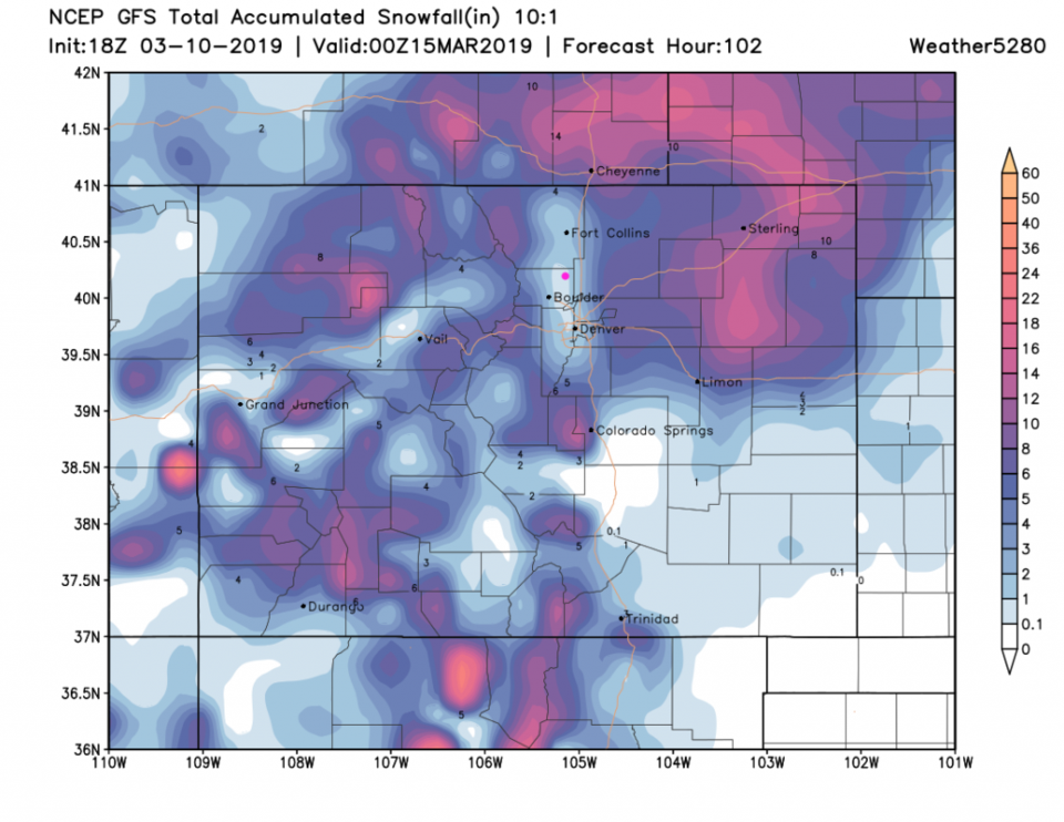
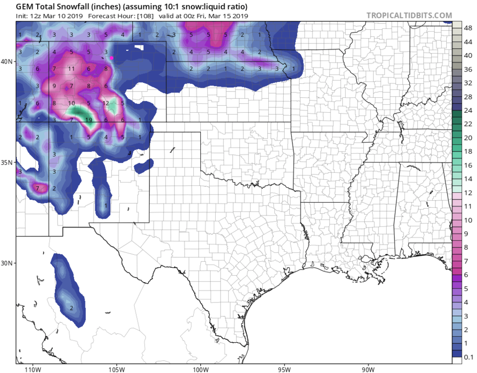
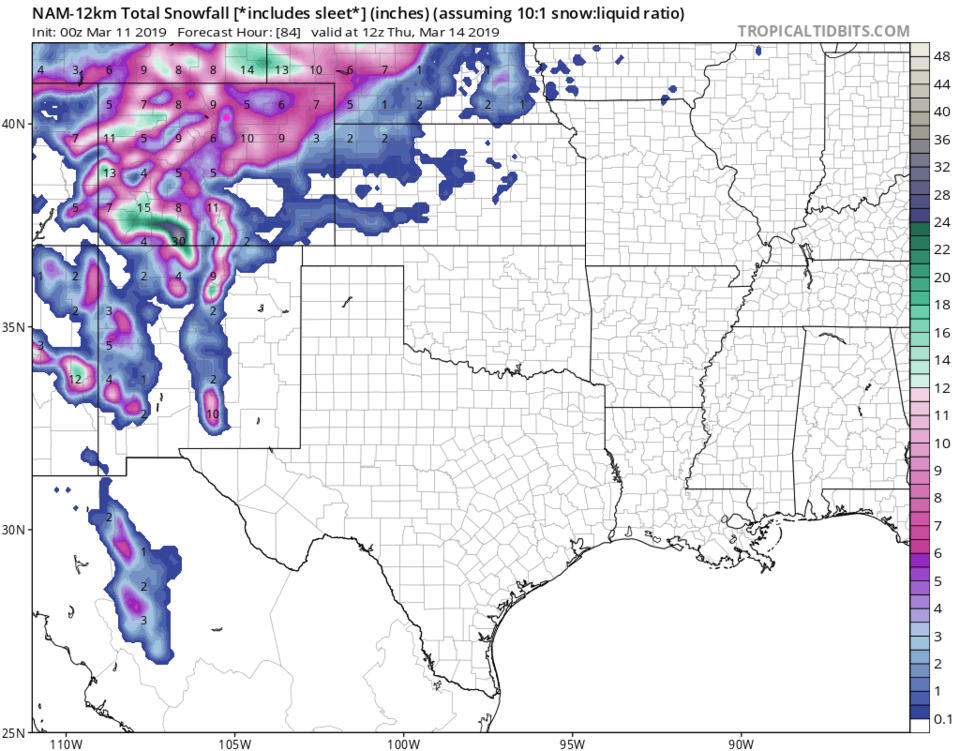
Models like that at weatherunderground.com (Figure 2) have backed off, again, on how much snow we'll get. This run only shows 1-3 inches. The reason Longmont and North Denver to Fort Collins may get skipped is down- slope flow. Really significant down-slope flow. Remember, this flow of air off the mountains compresses the air, warms the air, and suppresses rainfall/snowfall due to the 'drying' that occurs in this process. Figure 4, the GFS, shows this powerful snow-hole along I-25 very clearly with just a coating to 1 inch of snow by Thursday. The GEM (Figure 5) keeps the NE quadrant of the state quite dry and again only gives us 1/2 to 1 inch. Figure 6, the NAM, gives us 4-5 inches, but areas around us 9-12 inches (just a few miles away to the east and west).

If you ARE hoping for a snow day, all hope is not lost. Much can change as we lock down the temperatures and actual eventual path of the low. It is still about 2 1/2 days away.

After that storm we return to normal temperatures and dry conditions. It might start to feel like spring for Spring Breaks all around.

Figure 1: The forecast surface map for Monday PM from NCEP.
Figure 2: the graphical forecast for the next 10 days for Longmont, CO from weatherunderground.com
Figure 3: the animation of the Sunday "take" on the mid-week storm from the GFS and weather5280.com
Figure 4: the forecast accumulated snow map from the GFS and weather5280.com for Colorado, through the next 4.25 days.
Figure 5: the forecast accumulated snow map from the GEM and tropicaltidbits.com for Colorado, through the next 4.25 days.
Figure 6: the forecast accumulated snow map from the NAM and tropicaltidbits.com for Colorado, through the next 4.25 days.


Current Weather

Mostly clear

Mostly clear

50°F

UV Index
0 Low
Pressure
29.6 Steady
Visibility
8 miles
Dewpoint
18 °F
Humidity
29%
Wind
WNW 5.5 mph
Gust
14.6 mph
Wind Chill
48 °F

Hourly Forecast

Today
2 AM
46°F
Mostly clear
Today
3 AM
44°F
Mostly clear
Today
4 AM
43°F
Partly cloudy
Today
5 AM
43°F
Intermittent clouds
Today
6 AM
42°F
Mostly cloudy
Today
7 AM
44°F
Cloudy
Today
8 AM
48°F
Mostly cloudy w/ showers
Today
9 AM
52°F
Intermittent clouds
Today
10 AM
54°F
Intermittent clouds
Today
11 AM
57°F
Intermittent clouds
Today
12 PM
59°F
Intermittent clouds
Today
1 PM
60°F
Intermittent clouds

7 Day Forecast

Showers

Monday

57 °F

A few showers this morning; otherwise, mostly cloudy, breezy and cooler


Partly cloudy w/ showers

Monday Night

42 °F

A couple of brief showers late this evening; partly cloudy and breezy


Partly sunny w/ showers

Tuesday

60 °F

A couple of showers in the morning; otherwise, windy with times of clouds and sun


Partly cloudy

Tuesday Night

33 °F

Partly cloudy


Intermittent clouds

Wednesday

58 °F

Cool with times of clouds and sun


Mostly cloudy

Wednesday Night

35 °F

Increasing clouds


Partly sunny w/ showers

Thursday

56 °F

Times of clouds and sun with a couple of showers; cool


Cloudy

Thursday Night

43 °F

Cloudy


Mostly cloudy

Friday

62 °F

Mostly cloudy and warmer


Mostly clear

Friday Night

40 °F

Mainly clear


Sunrise and Sunset

Sunrise
5:53 AM
Sunset
8:01 PM

Based on AccuWeather data