This content was originally published by the Longmont Observer and is licensed under a Creative Commons license.
In Brief:
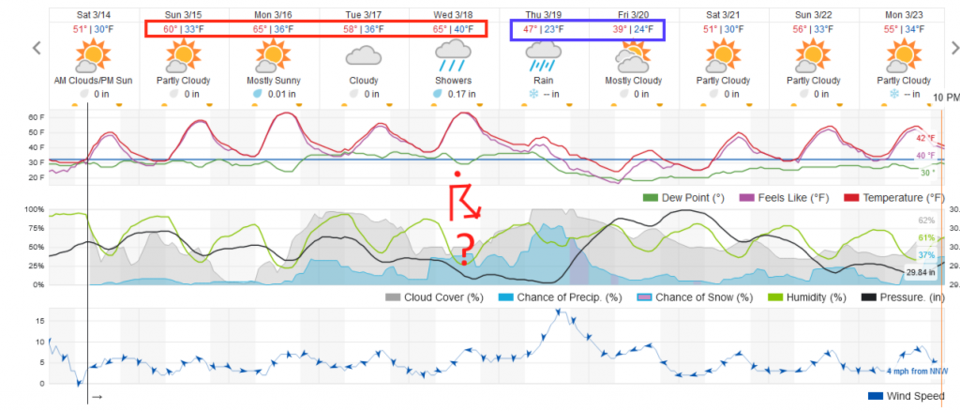
With a ridge now over the state, we warm up a lot through Wednesday. A wobbling cut-off upper level low will finally head for Colorado bringing in rain chances Tuesday, thunder storm chances Wednesday, and rain changing to some snow Thursday night. There is not much winter visible on the horizon.
Update 3/16 9am:
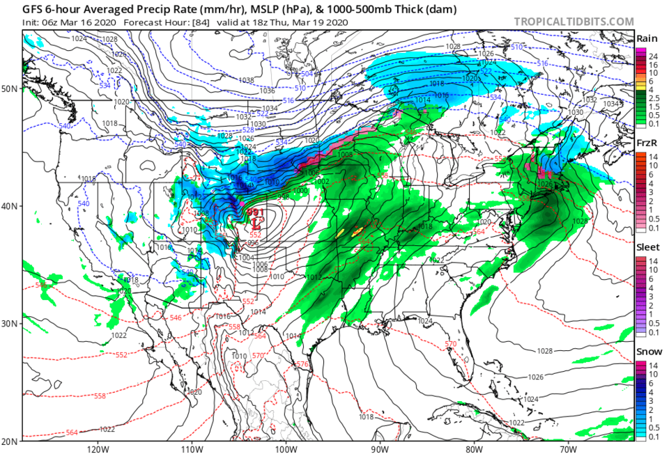
The winds of change are in the air. There is a lot of model disagreement out there (some more snow, some just rain) - but the GFS (Figure 1 update) is tracking the upper level low right across the Palmer Divide and a surface low forms to the southeast of Denver Wednesday into Thursday. This, coupled with good moisture availability, could spell our next healthy winter storm. The weatherunderground.com model agrees and is now giving us an extended period of snow from Thursday midday through Friday evening with more than 4 inches of snow. The GFS give us (not shown) 3-4 inches of snow but shows Rocky Mountain National Park getting 1.5 feet of snow. We'll keep an eye on this as it approaches. Cut off upper level lows are notorious for wobbling in and out of favorable tracks. It could still change.
End 3/16 9am update.
The Forecast Discussion:
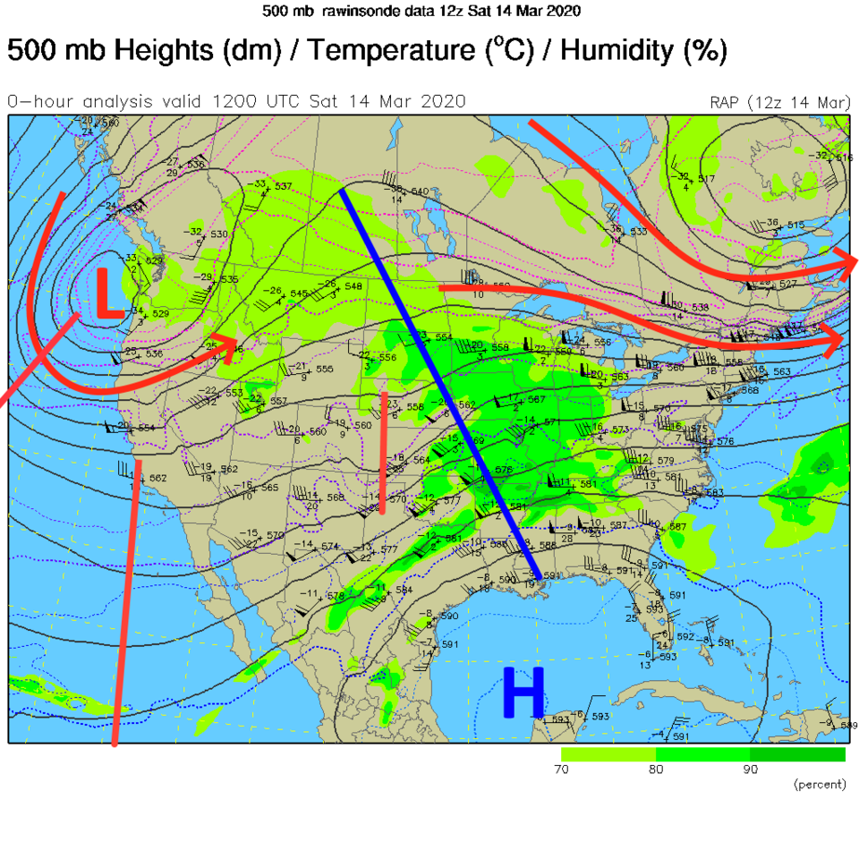
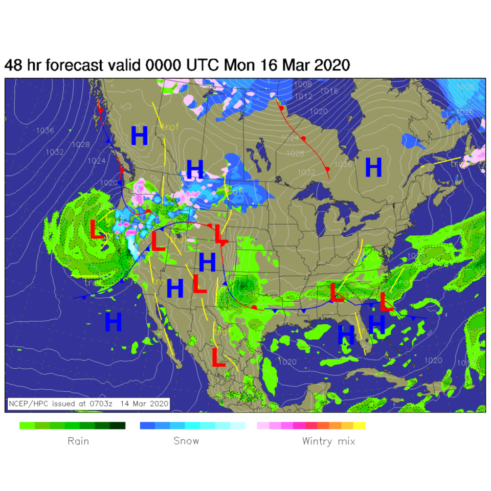
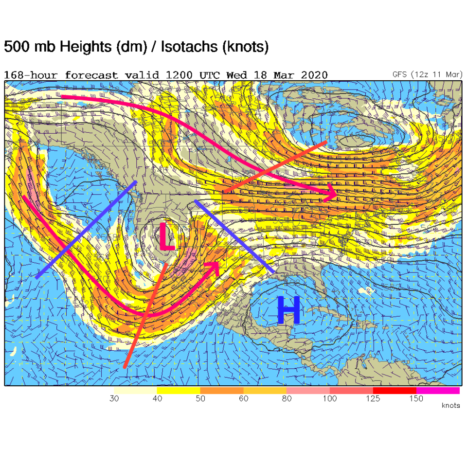
This week will be dominated by the low currently located off the Washington state coast (Figure 1). We still have two jet streams, north and south (red arrows in that figure and in figures 3,4,5). As the low approaches (slowly), the southern jet will be approaching as well. Southern California received the big hit of rain last week, this week it will be northern California with this more northern track for the low (Figure 2). Saturday night, the low has drifted down to sit off the Oregon coast (Figure 3). We warm up nicely Sunday into Wednesday with some days hitting the 60'sF with a ridge still overhead.
The Longer Range Forecast:
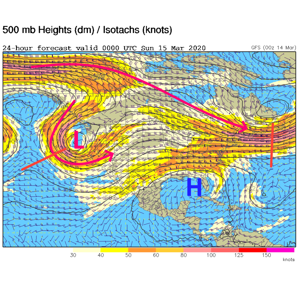
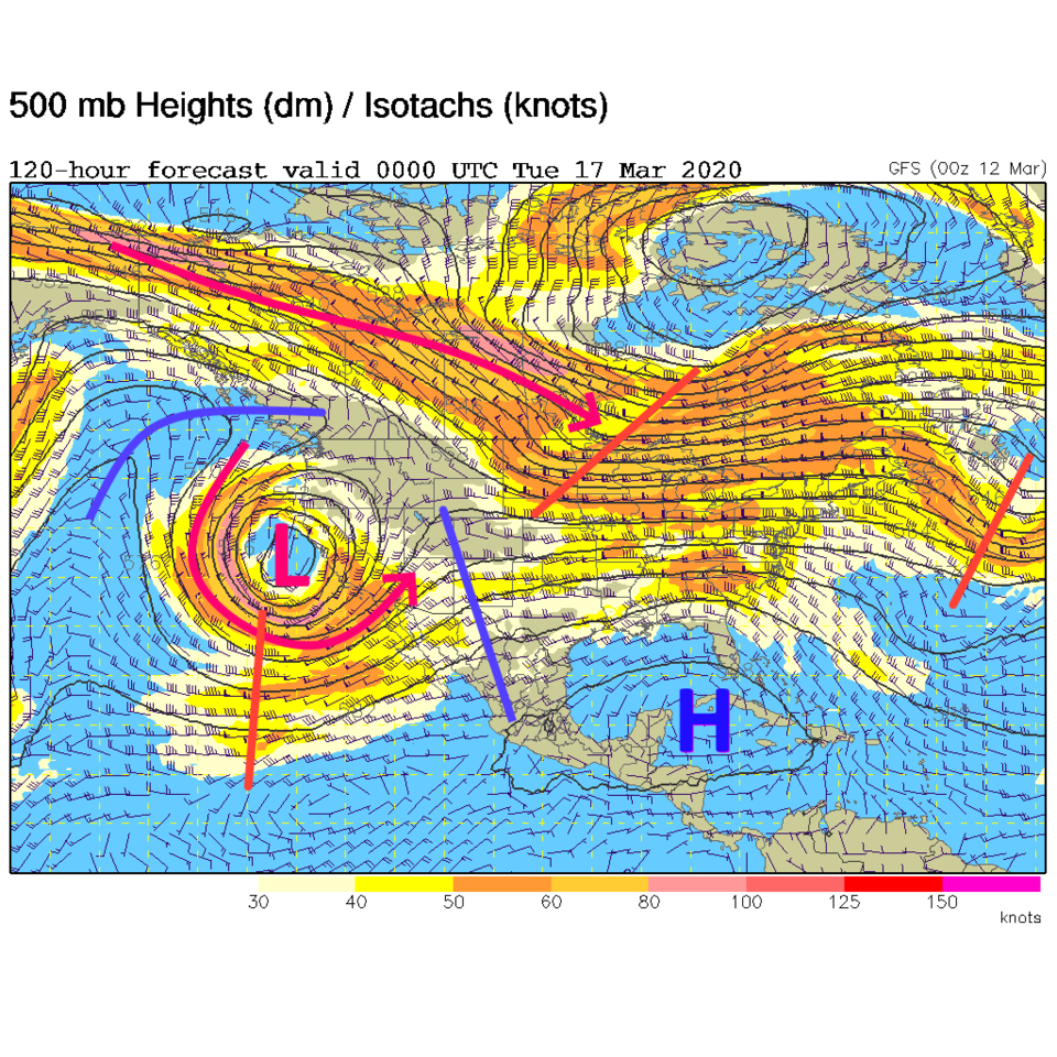
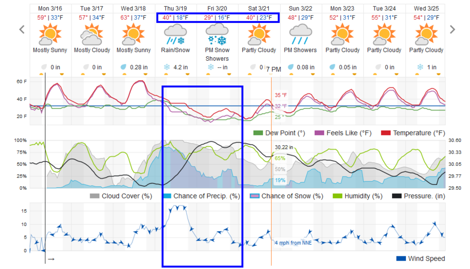
The low is west of San Francisco Monday night. Note the ridge extends up right over our state still (Figure 4). By Tuesday night Wednesday morning, the southern jet is pumping water right into Colorado as the low drifts inland over Nevada (Figure 5). With this set up, we expect rain to return to Longmont Tuesday morning (Figure 6). As cold air aloft moves in with the low center, thunder storms may return to the Front Range Wednesday. The slow moving low is still passing on Thursday when rain chances increase even further. The cold air behind the low will begin to flow into the state Thursday giving us a chance of snow at the end as the low drifts east of us later Thursday.
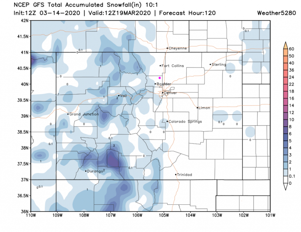
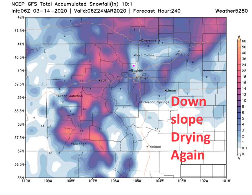
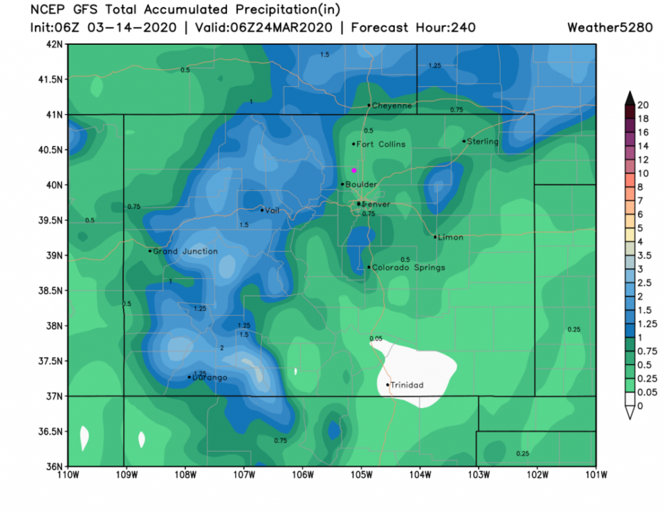
Over the next five days, just small amounts of snow will fall in the state - and only up in the mountains (Figure 7). Over the next 10 days, the mountains pick up 1 to 1.5 feet of snow while we may pick up a dusting to an inch. You can see that down slope hole east of the mountains again - we have so much westerly flow with this storm track (Figure 8) that we are living in a 'rain shadow.' For rainfall, we may see up to 0.5 inch of water over the next 10 days.