Skip to content

Next Storm/Next Snow Forecast Discussion from the Cherrywood Observatory – March 16-17, 2019

This content was originally published by the Longmont Observer and is licensed under a Creative Commons license.

Forecast Discussion:

**Note, I'm sitting in the middle of the Hopi Reservation presently with just a trickle of internet. Good thing is, not much is changing with the weather... see you tomorrow! **

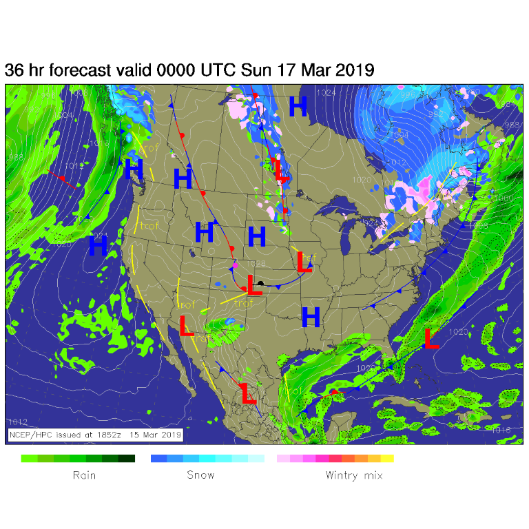
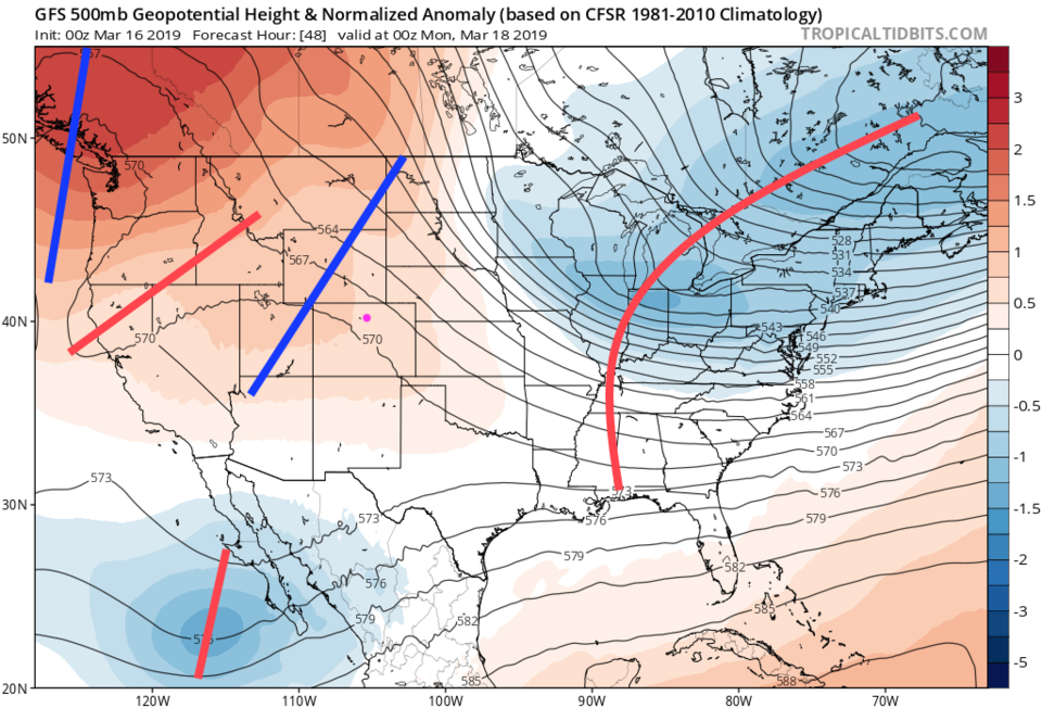
Clear weather continues as does the great melt. Figure 1 shows high pressure dominating the entire state. A small, weak, cold front inches back into the state this afternoon (Saturday) and briefly cools us down. Overhead, we still have northwest flow (air from the northwest - as all wind directions are defined by their source direction in meteorology - Figure 2) aloft and a ridge in the west. A storm system is passing Colorado over the next few days, but it is going through northern Mexico.

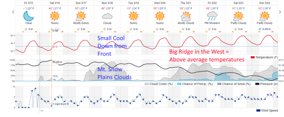
Figure 3 shows the clouds and cool down Sunday into Monday... the mountains will get a bit more snow (yea.).

The longer range forecast:

The ridge strengthens over the west and we warm to the low 60's F in time for spring to start on Wednesday 3/20. There are indications of rain showers at the end of the week with a low that tracks over Denver and brings more snow to the mountains. We'll watch that over the week.

Figure 1: The forecast surface map for Saturday PM from NCEP.
Figure 2: the 500mb map and how anomalous those heights are (red is much higher than normal, blue is lower than normal).
Figure 3: the graphical forecast for the next 10 days for Longmont, CO from weatherunderground.com

Current Weather

Clear

Clear

51°F

UV Index
0 Low
Pressure
29.93 Steady
Visibility
8 miles
Dewpoint
38 °F
Humidity
61%
Wind
E 1.6 mph
Gust
3.1 mph
Wind Chill
51 °F

Hourly Forecast

Tomorrow
12 AM
48°F
Mostly clear
Tomorrow
1 AM
46°F
Mostly clear
Tomorrow
2 AM
44°F
Mostly clear
Tomorrow
3 AM
43°F
Mostly clear
Tomorrow
4 AM
42°F
Mostly clear
Tomorrow
5 AM
40°F
Mostly clear
Tomorrow
6 AM
39°F
Mostly sunny
Tomorrow
7 AM
42°F
Mostly sunny
Tomorrow
8 AM
48°F
Intermittent clouds
Tomorrow
9 AM
53°F
Intermittent clouds
Tomorrow
10 AM
59°F
Mostly cloudy
Tomorrow
11 AM
64°F
Mostly cloudy

7 Day Forecast

Intermittent clouds

Saturday

64 °F

Cooler with clouds giving way to some sun


Intermittent clouds

Saturday Night

39 °F

A shower in spots late this evening; otherwise, turning out clear


Mostly cloudy

Sunday

78 °F

Cloudy most of the time, breezy and warmer


Mostly cloudy

Sunday Night

47 °F

Rather cloudy and windy


Windy

Monday

60 °F

Very windy; cloudy and cooler


Intermittent clouds

Monday Night

41 °F

Partly cloudy


Intermittent clouds

Tuesday

59 °F

Cool with times of clouds and sun; windy in the afternoon


Partly cloudy

Tuesday Night

32 °F

Partly cloudy


Intermittent clouds

Wednesday

60 °F

Times of clouds and sun


Intermittent clouds

Wednesday Night

35 °F

Partly cloudy


Sunrise and Sunset

Sunrise
5:55 AM
Sunset
7:59 PM

Based on AccuWeather data