This content was originally published by the Longmont Observer and is licensed under a Creative Commons license.
First! From the National Weather Service (NWS) -
Longmont is under a Winter Weather Advisory:
Winter Weather Advisory
Issued: 4:18 PM Mar. 1, 2019 – National Weather Service
...WINTER WEATHER ADVISORY REMAINS IN EFFECT FROM 9 AM SATURDAY TO 11 AM MST SUNDAY...
* WHAT...Snow expected. Total snow accumulations of 4 to 7 inches expected.
* WHERE...Boulder and the western suburbs of Denver, Denver, Castle Rock and Greeley.
* WHEN...From 9 AM Saturday to 11 AM MST Sunday.
* ADDITIONAL DETAILS...Plan on slippery road conditions.

PRECAUTIONARY/PREPAREDNESS ACTIONS... A Winter Weather Advisory for snow means periods of snow will cause primarily travel difficulties. Expect snow covered roads and limited visibilities, and use caution while driving. The latest road conditions for the state you are calling from can be obtained by calling 5 1 1.
Forecast Discussion:
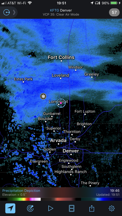
This post is going up early (the timing of these storms is necessitating it) again. Figure 1 shows that bands of snow have formed rapidly north of town Friday evening and are moving in quickly. The HRRR shows about 1 inch of snow on the ground by 9 am Saturday (Figure 2).
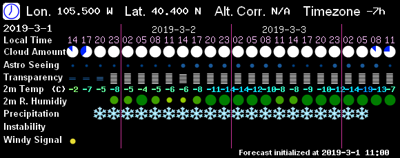
Figure 3 is the 10 day graphical forecast again. Even with a relative lull in the snow probabilities after midnight Friday into Saturday morning, the snow picks up midday on towards Sunday morning. The accumulation line for Figure 2 is drawn showing over what time period that first inch, or so, will fall.
The bulk of the storm, with the low sliding down into northern New Mexico, hits Saturday afternoon and Saturday night. Figure 4 is Saturday evening. Figure 5 is midnight Saturday into Sunday. That is a large portion of our state getting hit by strong winter weather conditions. The GFS based
7! timer model (Figure 6) shows snow falling continuously for more than two days. I've never seen that before on that output.
The model round-up:
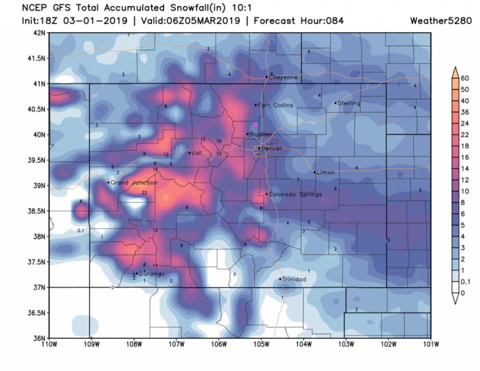
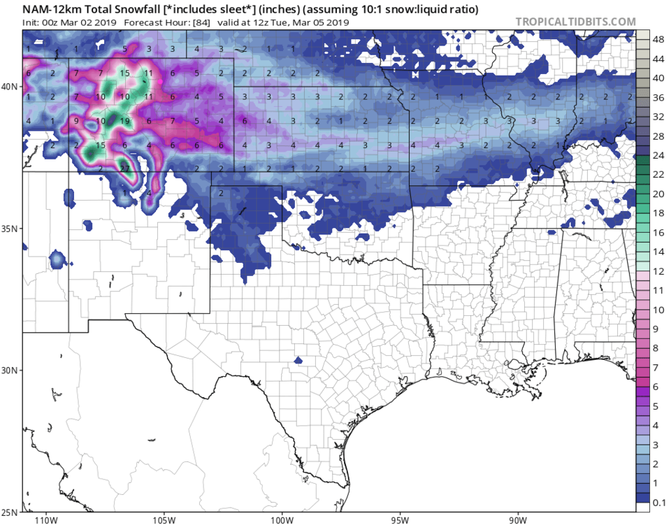
The storm total to midnight Monday/Tuesday (drawn on Figure 3 as well) from the:
GFS (Figure 7) is about 5 inches.
NAM (Figure 8) is 7-8 inches.
GEM (Figure 9) is 3-4 inches.
The forecasters at weather5280.com (Figure 10) give us 6-12 inches.
The NWS (in the advisory above) is for 4-7 inches.
My forecast is for 4-6 inches.
The longer range forecast:
We return to above freezing temperatures midday Wednesday for the first time since teens on Sunday/Monday with lows in the negative single digits. There are more precipitation chances in warmer air later in the week. This is a chilly, active, pattern! I'll update this page with any new watches or warnings if they are issued. Be safe!