Skip to content

Next Storm/Next Snow Forecast Discussion from the Cherrywood Observatory – March 21-22, 2019

This content was originally published by the Longmont Observer and is licensed under a Creative Commons license.

Forecast Discussion:

I begin my trek back across the cactus dotted lands of Arizona and New Mexico where tall stick-like things are saguaro instead of cell towers. In other words, I'm posting 2 days at once since I won't have internet for a day.

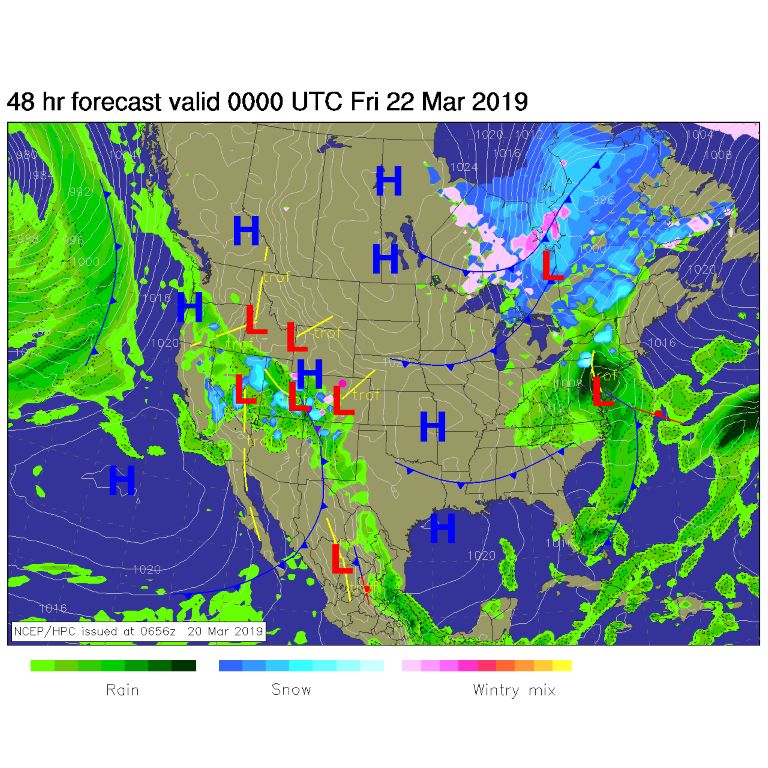
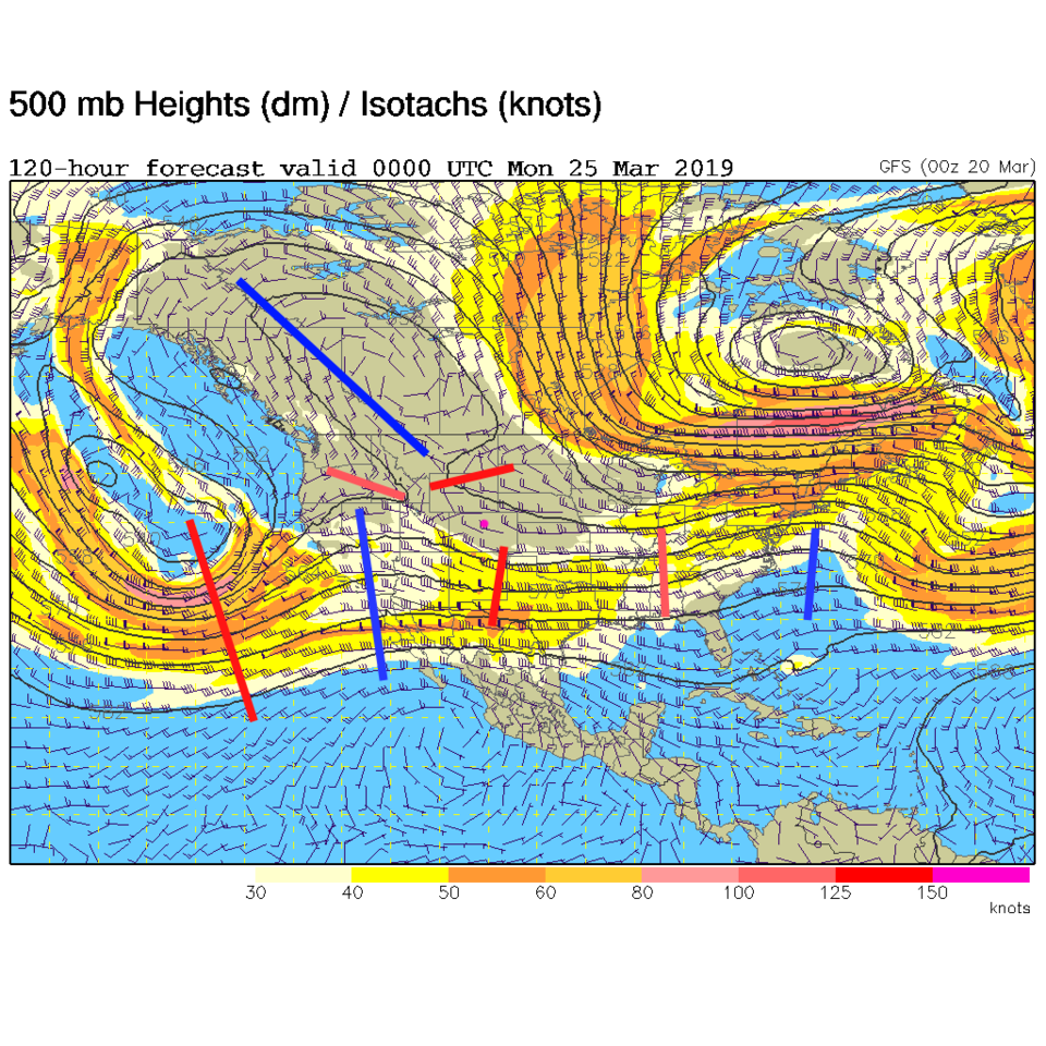
The upper level ridge (= nice, warm, dry weather) is to be replaced by a series of short waves rippling across the state. The first is now looking juicer than it did yesterday (more moisture). This front isn't very cold so it is bringing a lot of rain showers to the desert southwest (Figure 1). For Thursday, a cutoff low rolls into Nevada/Arizona/Utah. That will pump some moisture our way and kick a short wave our way as well (Figure 2). Figure 4 shows this ripple giving us a better chance of low-land rain showers (and more mountain snows) in Colorado Friday and Friday night. This model gives us about 1/10th an inch.

The longer range forecast:

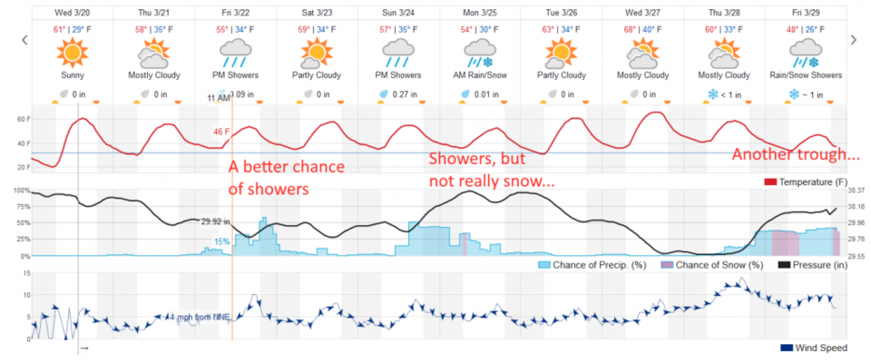
The next system (again, mostly rain with the warmer temperatures) arrives Sunday into Monday (Figure 4). The complex (read: messy) upper-air pattern for Sunday PM (Figure 3) has plenty of not-so-strong ripples of moisture.

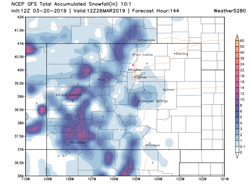
Through the next 6 days, the mountains get 4-10 inches in places. Boulder may get a coating of snow Sunday PM, but we miss on the any significant snow accumulation (Figure 5). For rainfall, there is another down-slope hole around Denver to Boulder but we might see .05 to .25 inch of rain. (note that the weatherunderground model in Figure 4 gives us about 4/10th's an inch of rain over this time.)

Figure 1: The forecast surface map for Thursday PM from NCEP.
Figure 2: The 500mb forecast upper air analysis for Thursday PM. Pink dot is Longmont. Red lines are troughs, blue lines are ridges.
Figure 3: The 500mb forecast upper air analysis for Sunday PM. Pink dot is Longmont. Red lines are troughs, blue lines are ridges.
Figure 4: the graphical forecast for the next 10 days for Longmont, CO from weatherunderground.com
Figure 5 : the forecast accumulated snow map from the GFS and weather5280.com for Colorado, through Tuesday midday.
Figure 6 : the forecast accumulated precipitation map from the GFS and weather5280.com for Colorado, through Tuesday midday.

Current Weather

Mostly cloudy

Mostly cloudy

39°F

UV Index
0 Low
Pressure
29.96 Rising
Visibility
8 miles
Dewpoint
36 °F
Humidity
87%
Wind
NW 1.7 mph
Gust
3.1 mph
Wind Chill
39 °F

Hourly Forecast

Today
5 AM
38°F
Partly cloudy
Today
6 AM
37°F
Partly cloudy
Today
7 AM
40°F
Partly sunny
Today
8 AM
48°F
Partly sunny
Today
9 AM
54°F
Partly sunny
Today
10 AM
58°F
Partly sunny
Today
11 AM
62°F
Partly sunny
Today
12 PM
65°F
Partly sunny
Today
1 PM
67°F
Partly sunny
Today
2 PM
68°F
Partly sunny
Today
3 PM
69°F
Partly sunny
Today
4 PM
70°F
Partly sunny

7 Day Forecast

Partly sunny

Monday

70 °F

Partly sunny and pleasant


Intermittent clouds

Monday Night

43 °F

Partly cloudy


Mostly sunny

Tuesday

73 °F

Mostly sunny; windy in the morning, then pleasant in the afternoon


Intermittent clouds

Tuesday Night

43 °F

Clearing


Intermittent clouds

Wednesday

65 °F

Periods of clouds and sun; breezy in the afternoon


Intermittent clouds

Wednesday Night

39 °F

An evening thundershower in spots; otherwise, partly cloudy


Rain

Thursday

57 °F

Increasingly windy with occasional rain and drizzle; cooler


Mostly clear

Thursday Night

32 °F

Mainly clear


Mostly sunny

Friday

71 °F

Mostly sunny, pleasant and warmer


Partly cloudy

Friday Night

36 °F

Partly cloudy


Sunrise and Sunset

Sunrise
6:02 AM
Sunset
7:54 PM

Based on AccuWeather data