Skip to content

Next Storm/Next Snow Forecast Discussion from the Cherrywood Observatory – March 5, 2019

This content was originally published by the Longmont Observer and is licensed under a Creative Commons license.

Forecast Discussion:

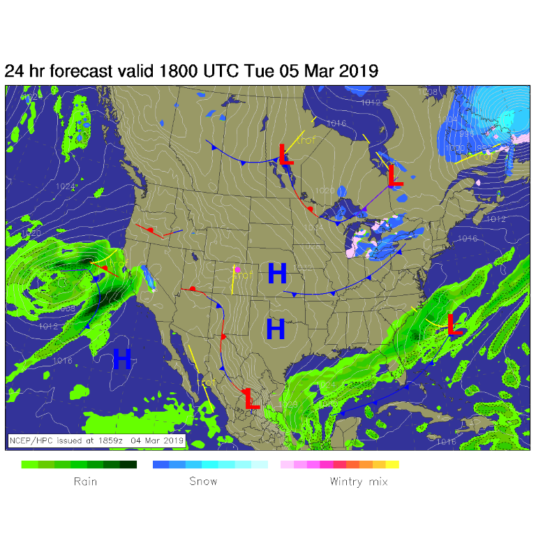
The slow thaw begins. Clear skies dominate. Figure 1 shows us sitting high and dry with all storm systems many states away. You might start to see pavement on side roads soon.

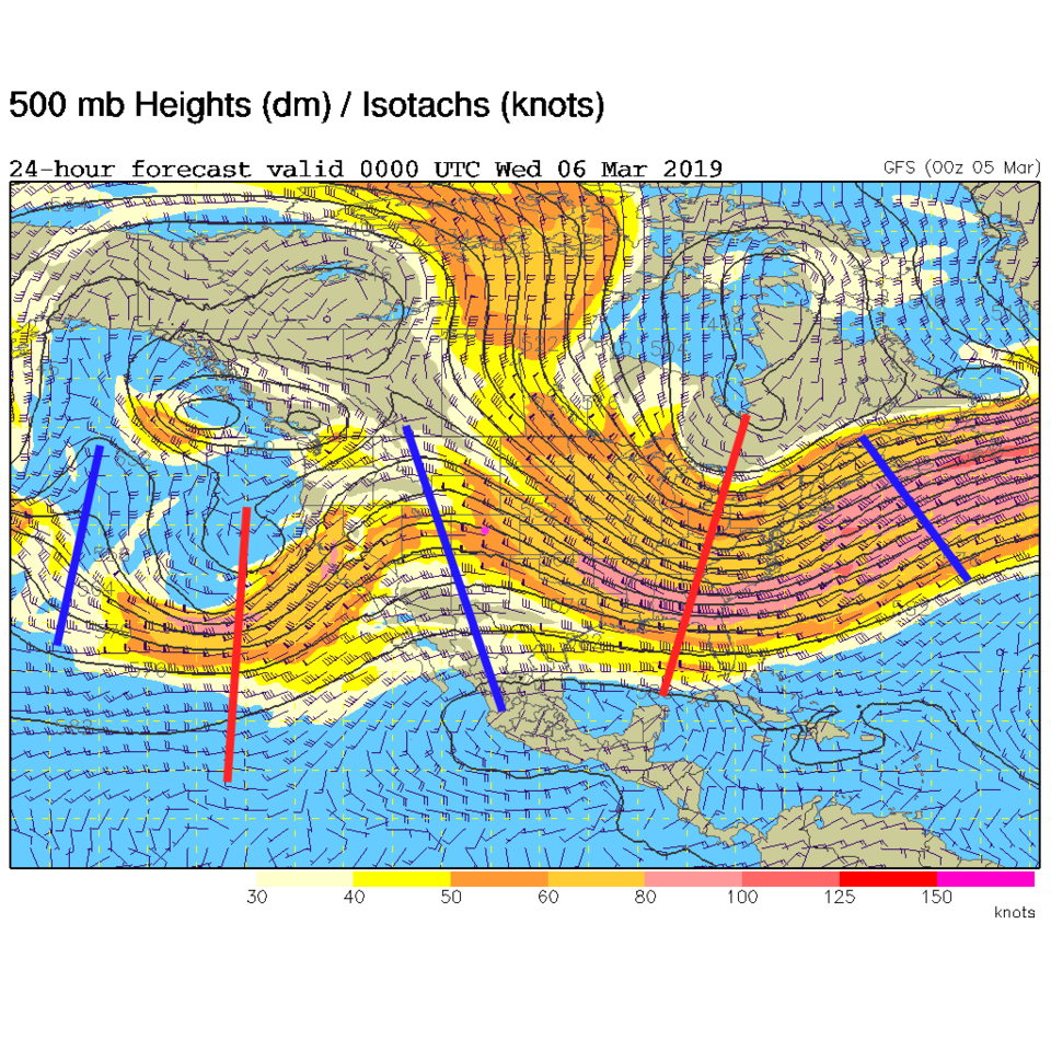
The building warmth is aided by the ridge that is sliding over the state (Figure 2 - blue line just west of Colorado). By Thursday midday, we are up to about 10 degrees above normal (even with cold air out on the eastern plains - Figure 3).

The longer range forecast:

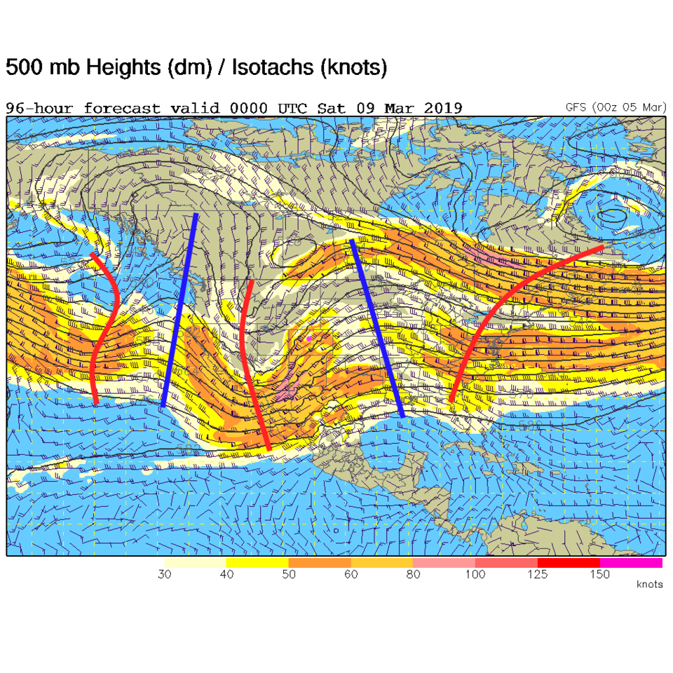
Another system approaches the state at the end of the week. We have a trough where the ridge was at the start of the week on Friday (Figure 4). Right now, it looks like very minimal moisture will be available. We cool from the mid 50'sF to the mid 40'sF for the weekend. It will be a minimal change with temperatures still hovering around normal.

Figure 1: The forecast surface map for Tuesday noon from NCEP.
Figure 2: The 500mb forecast upper air analysis for Tuesday PM. Pink dot is Longmont. Red lines are troughs, blue lines are ridges.
Figure 3: The forecast temperature departure from normal map from the GFS and weather5280.com for Colorado, Thursday noon.
Figure 4: The 500mb forecast upper air analysis for Friday PM. Pink dot is Longmont. Red lines are troughs, blue lines are ridges.

Current Weather

Partly sunny

Partly sunny

50°F

UV Index
3 Moderate
Pressure
29.99 Rising
Visibility
8 miles
Dewpoint
39 °F
Humidity
66%
Wind
WSW 1.7 mph
Gust
4.2 mph
Wind Chill
50 °F

Hourly Forecast

Today
9 AM
53°F
Partly sunny
Today
10 AM
58°F
Partly sunny
Today
11 AM
62°F
Partly sunny
Today
12 PM
64°F
Partly sunny
Today
1 PM
67°F
Partly sunny
Today
2 PM
68°F
Partly sunny
Today
3 PM
69°F
Partly sunny
Today
4 PM
70°F
Partly sunny
Today
5 PM
68°F
Partly sunny
Today
6 PM
67°F
Partly sunny
Today
7 PM
65°F
Partly sunny
Today
8 PM
61°F
Intermittent clouds

7 Day Forecast

Partly sunny

Monday

70 °F

Partly sunny and pleasant


Intermittent clouds

Monday Night

43 °F

Partly cloudy


Mostly sunny

Tuesday

73 °F

Mostly sunny; windy in the morning, then pleasant in the afternoon


Intermittent clouds

Tuesday Night

43 °F

Clearing


Intermittent clouds

Wednesday

65 °F

Periods of clouds and sun; breezy in the afternoon


Intermittent clouds

Wednesday Night

39 °F

An evening thundershower in spots; otherwise, partly cloudy


Intermittent clouds

Thursday

57 °F

Clouds and sun, becoming windier and cooler with a shower in spots


Mostly clear

Thursday Night

32 °F

Mainly clear


Mostly sunny

Friday

71 °F

Mostly sunny, pleasant and warmer


Partly cloudy

Friday Night

36 °F

Partly cloudy


Sunrise and Sunset

Sunrise
6:02 AM
Sunset
7:54 PM

Based on AccuWeather data