Skip to content

Next Storm/Next Snow Forecast Discussion from the Cherrywood Observatory – March 6, 2019

This content was originally published by the Longmont Observer and is licensed under a Creative Commons license.

Forecast Discussion:

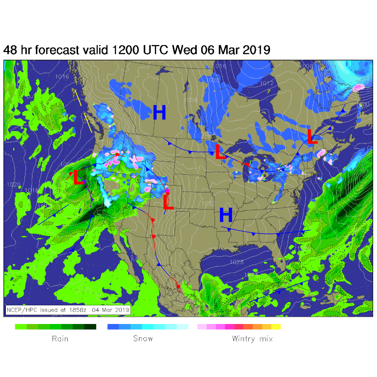
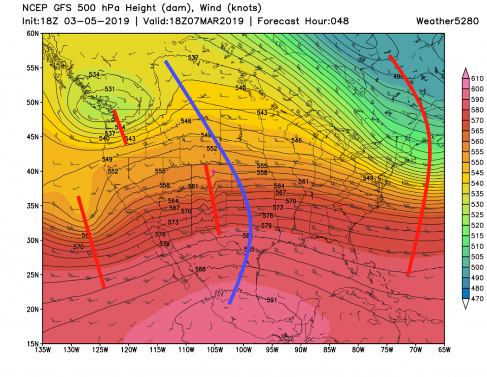
As the cold air slips away, I need to confess that I've been downplaying our actual next storm (Wed/Thur) since it looks like very little will occur in town. It does look like at least a 'bit' of an impact is possible. Figure 1 shows the next big Pacific soaker on its way in to the western states. The mountains get more snow (like Estes Park, which will be getting 2-4 inches on top of its big snow pack). The main trough is off the West Coast, but a little ripple is traveling downstream for Wednesday/Thursday (Figure 2 - short red line over Colorado).

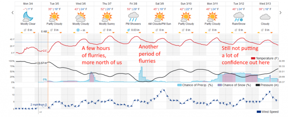
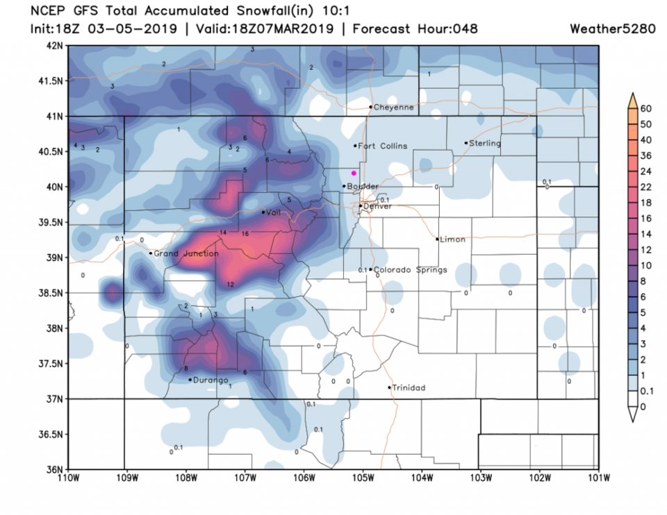
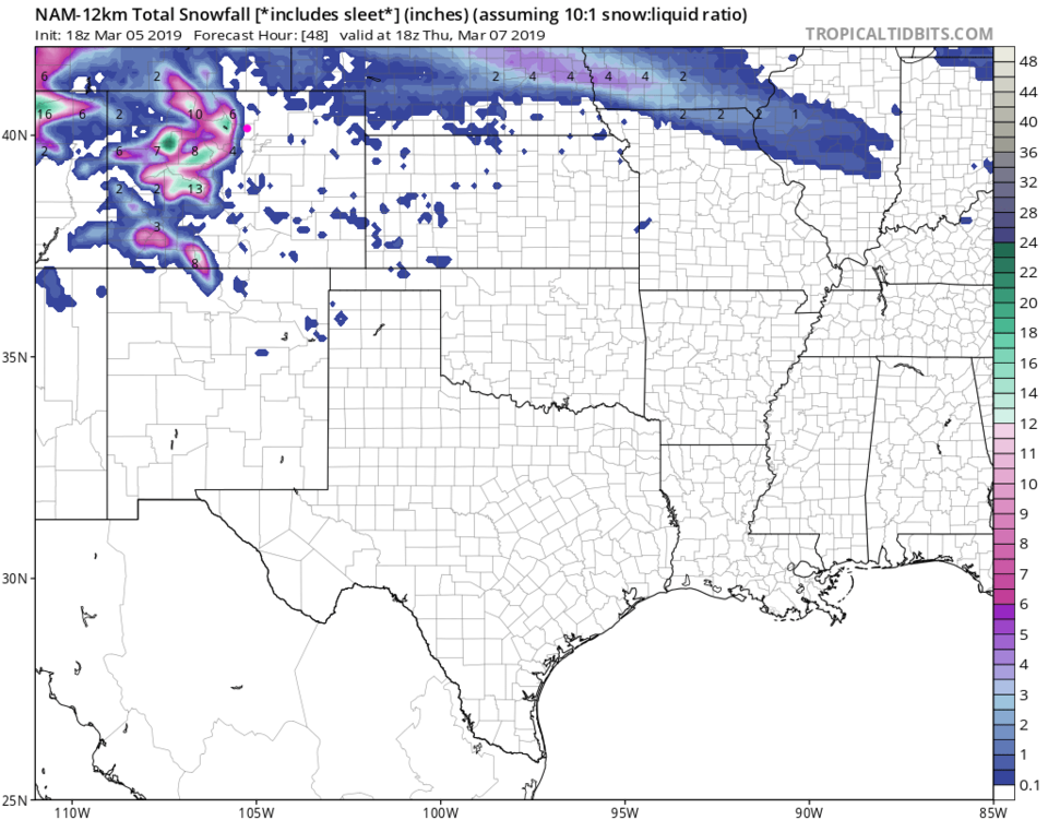
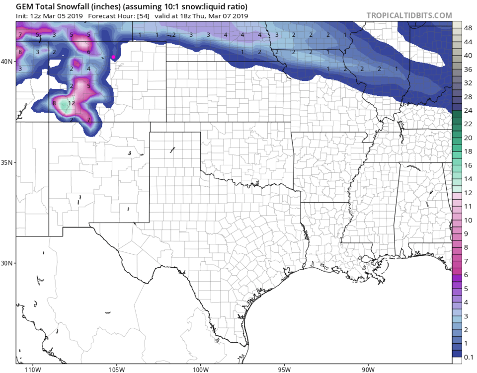
Figure 3 shows period of snow lasting only about 4 hours. The GFS gives us a coating to 1/2 inch of snow Wednesday night (Figure 4). The NAM, in Figure 5, shows the snow staying off to the west by a few miles. The GEM (Figure 6), like the GFS, gives us a coating to 1/2 inch.

The longer range forecast:

The longer range forecast shows 50's F until the weekend when we only cool to the mid 40's F. There is another mini-storm for Friday PM (rain showers in the afternoon maybe?). Remember, don't forecast the next next storm until the next storm is done.

Figure 1: The forecast surface map for Wednesday noon from NCEP.
Figure 2: The forecast 500mb map of heights equal pressure created by the GFS and weather5280.com for Thursday noon.
Figure 3: the graphical forecast for the next 10 days for Longmont, CO from weatherunderground.com
Figure 4: the forecast accumulated snow map from the GFS and weather5280.com for Colorado, through the next 2 days.
Figure 5: the forecast accumulated snow map from the NAM and tropicaltidbits.com for Colorado, through the next 2 days.
Figure 6: the forecast accumulated snow map from the GEM and tropicaltidbits.com for Colorado, through the next 2 days.

Current Weather

Sunny

Sunny

45°F

UV Index
3 Moderate
Pressure
30.02 Steady
Visibility
8 miles
Dewpoint
24 °F
Humidity
43%
Wind
SSE 3.8 mph
Gust
8.4 mph
Wind Chill
43 °F

Hourly Forecast

Today
9 AM
47°F
Sunny
Today
10 AM
51°F
Mostly sunny
Today
11 AM
55°F
Mostly sunny
Today
12 PM
58°F
Mostly sunny
Today
1 PM
60°F
Partly sunny
Today
2 PM
62°F
Intermittent clouds
Today
3 PM
63°F
Mostly cloudy
Today
4 PM
65°F
Mostly cloudy
Today
5 PM
63°F
Cloudy
Today
6 PM
62°F
Cloudy
Today
7 PM
59°F
Mostly cloudy
Today
8 PM
56°F
Mostly cloudy

7 Day Forecast

Mostly cloudy

Thursday

65 °F

Becoming cloudy


Mostly cloudy

Thursday Night

36 °F

Mostly cloudy


Partly sunny

Friday

70 °F

Partial sunshine


Partly cloudy

Friday Night

38 °F

Partly cloudy


Partly sunny

Saturday

66 °F

Partial sunshine


Mostly clear

Saturday Night

41 °F

Clear to partly cloudy


Mostly cloudy

Sunday

76 °F

Rather cloudy; breezy in the afternoon


Intermittent clouds

Sunday Night

43 °F

Partly cloudy


Cloudy

Monday

60 °F

Cloudy and cooler with a shower in spots; windy in the afternoon


Mostly cloudy

Monday Night

43 °F

Breezy in the evening; otherwise, mostly cloudy


Sunrise and Sunset

Sunrise
5:58 AM
Sunset
7:57 PM

Based on AccuWeather data