This content was originally published by the Longmont Observer and is licensed under a Creative Commons license.
In Brief:
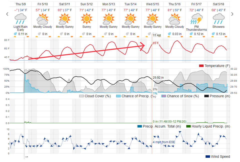
The snow has ended, showers are going to continue through Thursday night and maybe into Friday AM. We remain mostly dry for the next 5 days with temperatures warming a bit each day. The return of a beautiful spring begins.
9am Update:
Just a quick note today to highlight that, with plenty of moisture around, a nearby jet stream, and more daytime heating, we should see a few afternoon thunderstorms fire in the mountains that will drift across the I-25 corridor now and then. We don't have that activity suppressed by the approaching ridge until Sunday - our first truly dry day.
As always, beware of lighting - even from small isolated cells. Enjoy Spring!
P.S. As a check on the models from last week, our 4 day rainfall/snow melt total in NE Longmont was 0.70 inch of rain. This was about 3/4th to 1/2 of what was forecasted by the models. They went somewhat over board again.
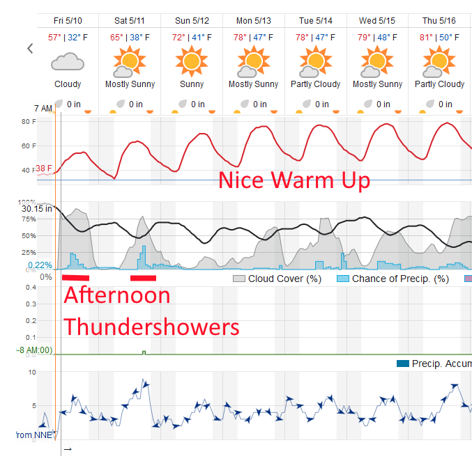
End 9am Update.
Forecast Discussion:
We received about 1/2 of an inch of accumulation in NE Longmont (the low end of my prediction). Boulder received 2 inches (below my low end forecast). Ft. Collins received a trace to 1/2 inch while Berthoud received 1/2 inch of snow (both in my forecast window). Estes Park received, at most, 3 inches (below my forecast). Ft. Lupton received about 1/2 inch, western Denver got 3-4 inches and eastern Denver got a trace to 1 inch (low end of my forecasting attempts). The Palmer Divide received about 1-5 inches (low end of my forecast).
Snow fell in Longmont for over 12 hours, but temperatures were so marginal, not much stuck around.
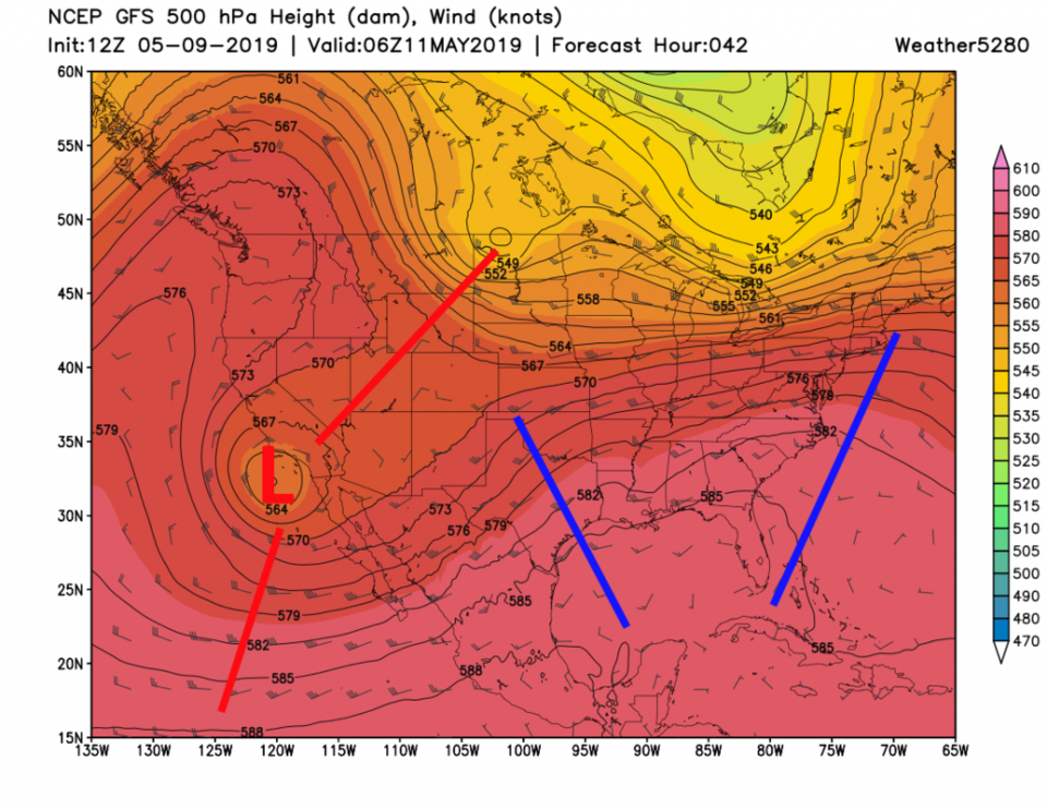
We begin to dry out and warm up today (Friday) - Figure 1. The trough that was over Colorado will move to the southwest today (Figure 2 - Low over southern California).
The Longer Range Forecast:
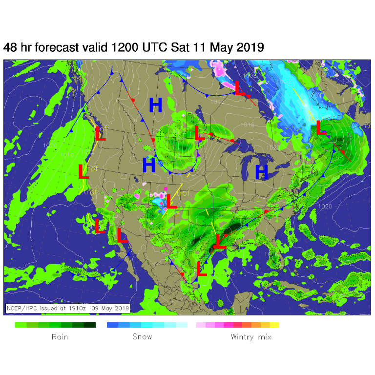
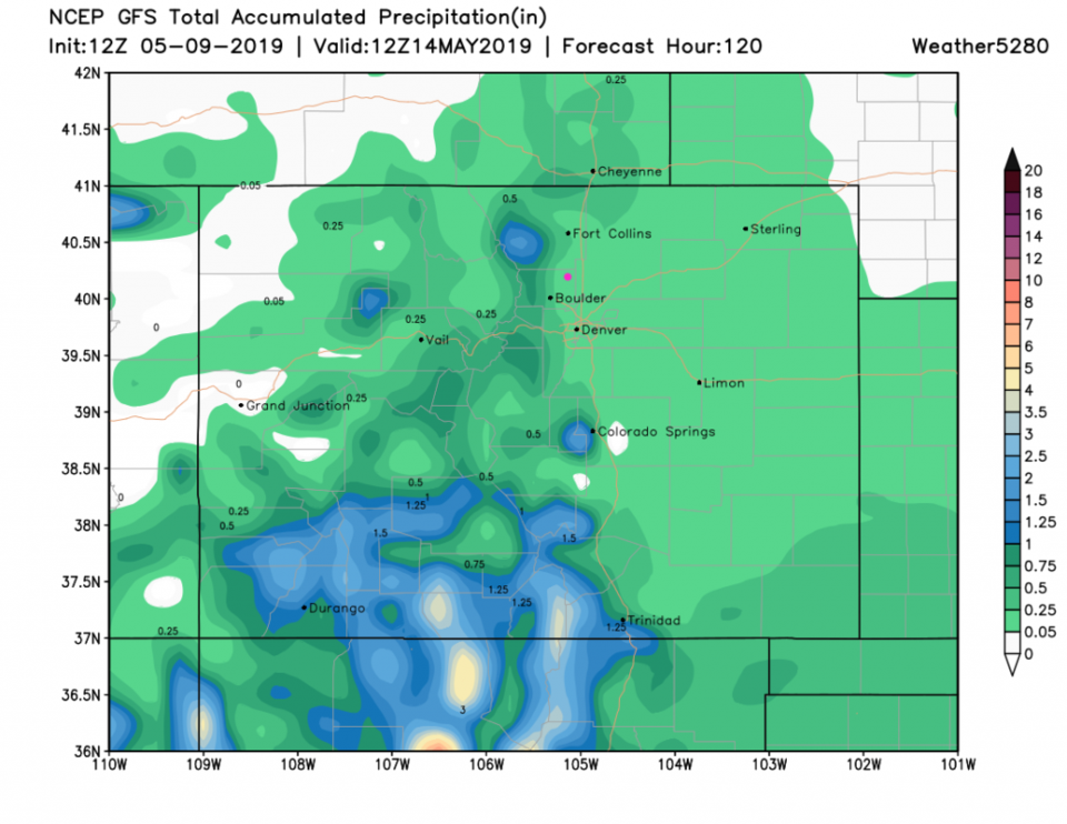
That low will track past us to the south (Figure 3) giving AZ, NM and southern CO more rain. We receive maybe another few 100'sth to a 10th of an inch of water today and tonight. Over the next 5 days, southern Colorado might pick up 3-4 inches of rain.