Skip to content

Next Storm/Next Snow Forecast Discussion from the Cherrywood Observatory – May 13, 2019

This content was originally published by the Longmont Observer and is licensed under a Creative Commons license.

In Brief:

We are mostly dry and warming to near 80F over the next couple of days and above 80F mid week. A cool down and 'maybe' some showers return for the weekend. There is a slight chance of a thundershower some afternoons rolling out of the mountains.

Forecast Discussion:

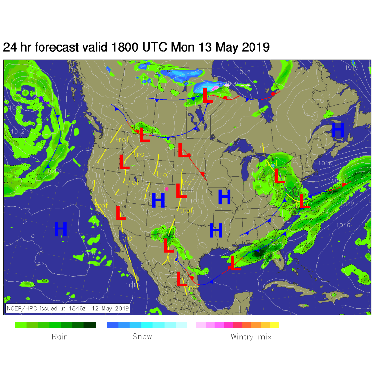
Beautiful weather continues with high pressure at the surface (Figure 1) and a ridge aloft (not shown). Other than a slight chance of wandering afternoon showers - we remain dry and keep warming up.

The Longer Range Forecast:

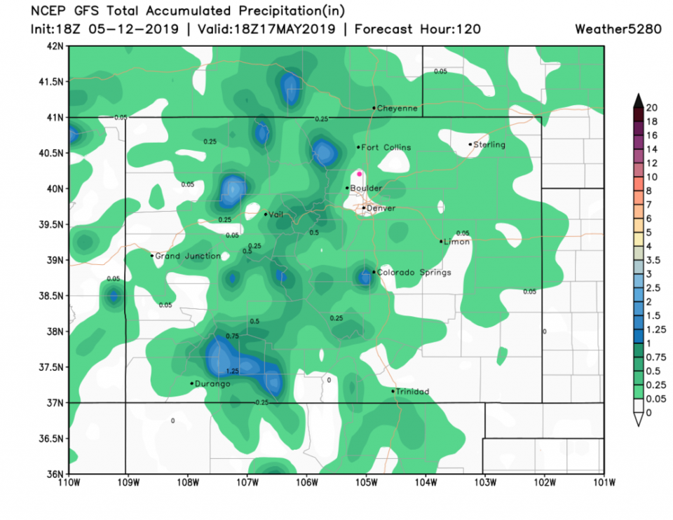
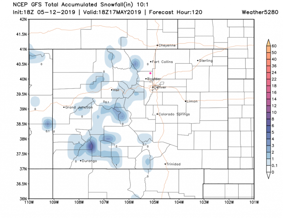
We should rise above 80'F Tuesday to Thursday (Figure 2). The rain chances through Thursday are very light with not much expected in town (Figure 3). Even the mountains will only see spotty higher amounts. A quick look at the 5 day snowfall map (Figure 4) looks very spring-like with only small amounts only at the higher elevations.

There is a cool down and some rain chances returning Friday and Sunday this week - but is too far to make a headline about. More later!

Figure 1: The forecast surface map for Monday noon from NCEP.
Figure 2: the graphical forecast for the next 10 days for Longmont, CO from weatherunderground.com
Figure 3: the forecast accumulated precipitation map from the GFS and weather5280.com for Colorado,over the next 5 days.
Figure 4: the forecast accumulated snowfall map from the GFS and weather5280.com for Colorado,over the next 5 days.

Current Weather

Light rain

Light rain

64°F

UV Index
0 Low
Pressure
29.66 Steady
Visibility
8 miles
Dewpoint
38 °F
Humidity
38%
Wind
WNW 4.2 mph
Gust
9.6 mph
Wind Chill
64 °F

Hourly Forecast

Today
7 PM
65°F
Cloudy
Today
8 PM
62°F
Thunderstorms
Today
9 PM
60°F
Thunderstorms
Today
10 PM
58°F
Cloudy
Today
11 PM
55°F
Cloudy
Tomorrow
12 AM
55°F
Cloudy
Tomorrow
1 AM
53°F
Cloudy
Tomorrow
2 AM
53°F
Cloudy
Tomorrow
3 AM
52°F
Cloudy
Tomorrow
4 AM
50°F
Cloudy
Tomorrow
5 AM
51°F
Cloudy
Tomorrow
6 AM
51°F
Cloudy

7 Day Forecast

Mostly cloudy w/ showers

Thursday

72 °F

Turning cloudy, warm; an afternoon shower or two


Thunderstorms

Thursday Night

50 °F

A thunderstorm in spots this evening; otherwise, considerable cloudiness and mild


Thunderstorms

Friday

70 °F

Mostly cloudy with a couple of thundershowers


Thunderstorms

Friday Night

43 °F

Cloudy with a couple of thundershowers


Rain

Saturday

46 °F

Chilly with periods of rain and a thunderstorm


Rain and snow

Saturday Night

39 °F

Cloudy with rain, mixed with a little snow late


Mostly cloudy

Sunday

59 °F

Mostly cloudy and warmer; a stray afternoon thundershower


Partly cloudy

Sunday Night

36 °F

Partly cloudy


Partly sunny

Monday

71 °F

Partly sunny, pleasant and warmer


Partly cloudy

Monday Night

42 °F

Partly cloudy


Sunrise and Sunset

Sunrise
6:07 AM
Sunset
7:50 PM

Based on AccuWeather data