This content was originally published by the Longmont Observer and is licensed under a Creative Commons license.
In Brief:
The trough is in place, fronts are draped all over the west, cool air is oozing in at the surface and the rain is starting. We should see 3/4th to 1 inch (or a bit more) water falling from the skies through Tuesday midday. Showers continue off and on until things dry a bit and warm on Friday. There seems to be a lot of thunderstorm and rain action coming next week as well. It is becoming a wet spring!
3:00pm Update
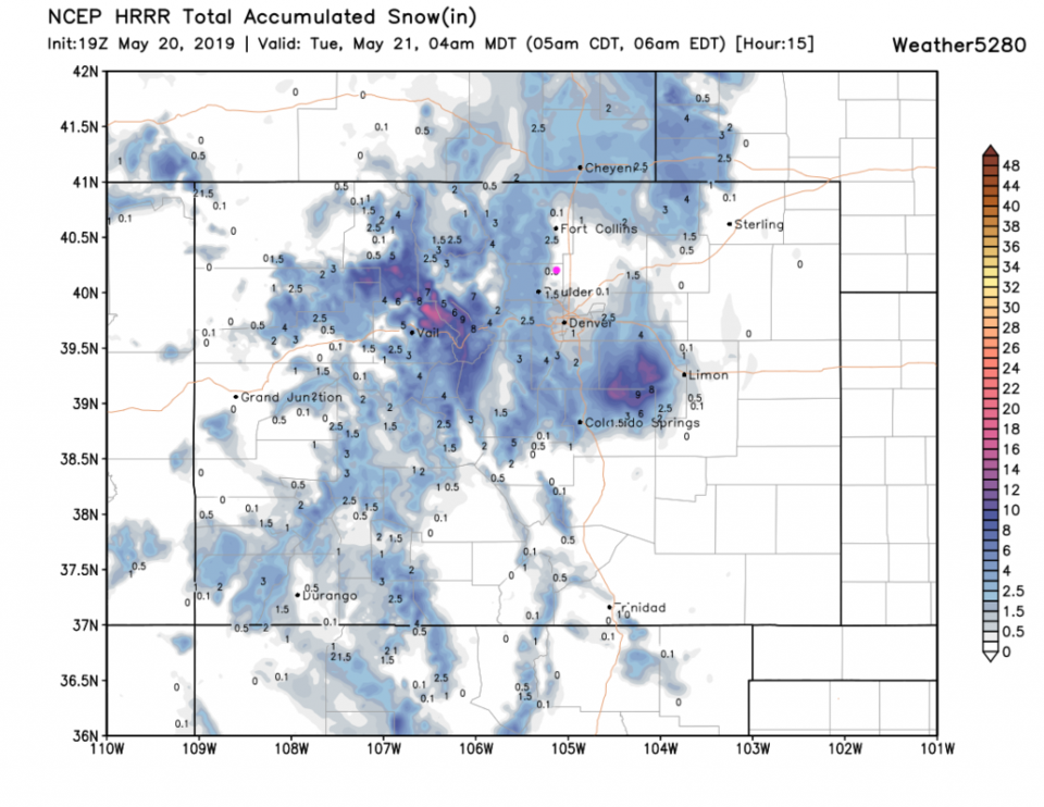
The HRRR model through 4am Tuesday has 1/2 inch of snow sooooo close to town that we should see some snow on grass in the AM. Denver will get a better hit of an inch or two in places.
End 3:00pm Update.
1:30pm Update:
Everything is on track for our weather tonight and tomorrow with a good deal of cold rain and some snow in the morning (we "might" see a coating to an inch in some spots along I-25!). We had a few episodes of pea sized hail last night and about 1/3rd inch of rainfall. Another 3/4th to an inch or more of water is likely through Tuesday night.
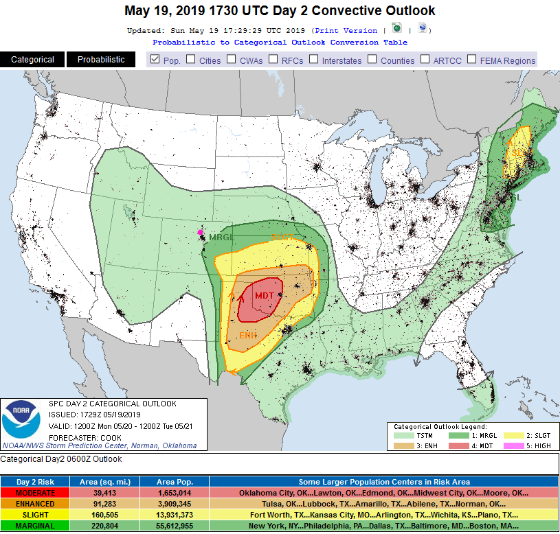
The big news is the eminent severe weather outbreak in west Texas, the Texas Panhandle, and Oklahoma. This is looking like a VERY dangerous situation this afternoon and tonight with many large tornadoes, lots of large damaging hail, and damaging winds. There is a large area of a High risk (5 on a scale of 1-5) for parts of Texas and Oklahoma for the rest of the day (Figure 1 update). You probably don't want to travel out there today and if you have friends and family in the risk areas on the colored map, make sure they have a storm shelter plan. Some folks will just need to get underground if large tornadoes form.

End 1:30pm Update
Forecast Discussion:
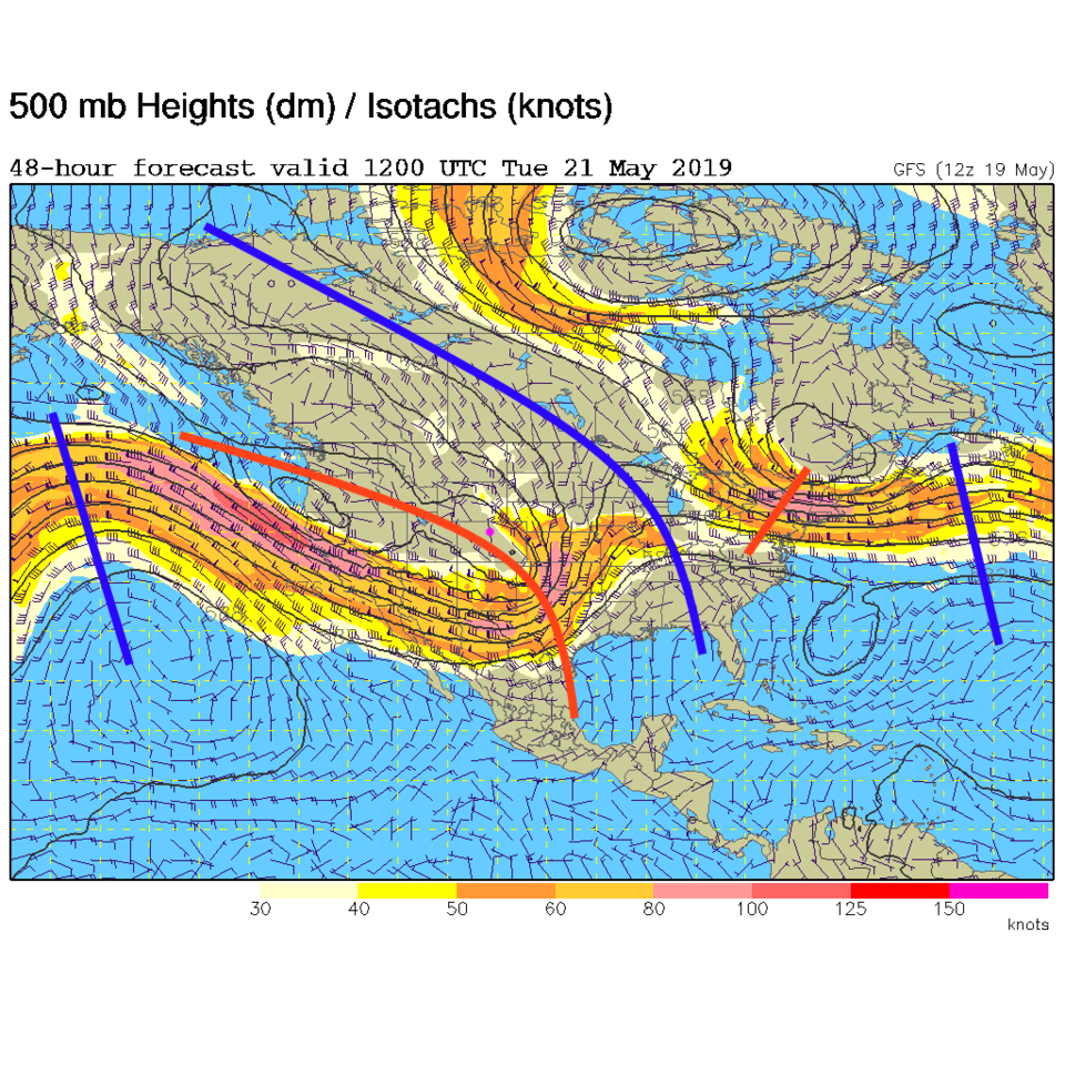
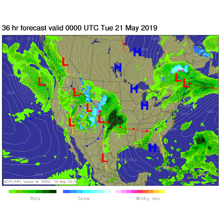
A long trough, with smaller ripples embedded in it, will be stretched northwest to southeast across the state. This is unusually deep and cool for this time of year (Figure 1). At the surface, a low pressure system will organize over southeast Colorado and begin to pump water back to the northwest over the Front Range. Up-slope flow and fronts = rain. (Figure 2).
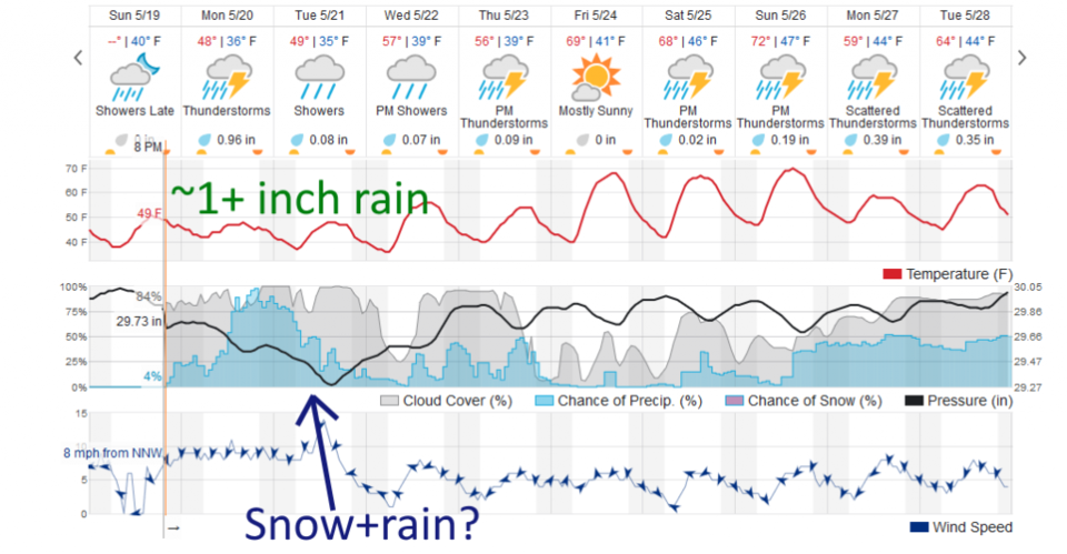
We do have thunderstorms possible today (Monday - Figure 3) but, at this time, a marginal risk of severe weather (1 on a scale of 1-5) is confined to southeastern Colorado - southeast of Denver (Figure 4).
The Longer Range Forecast:
Healthy rain chances continue through midday Tuesday with on and off shower activity through Thursday night (with a return of thunderstorm chances - Figure 3).
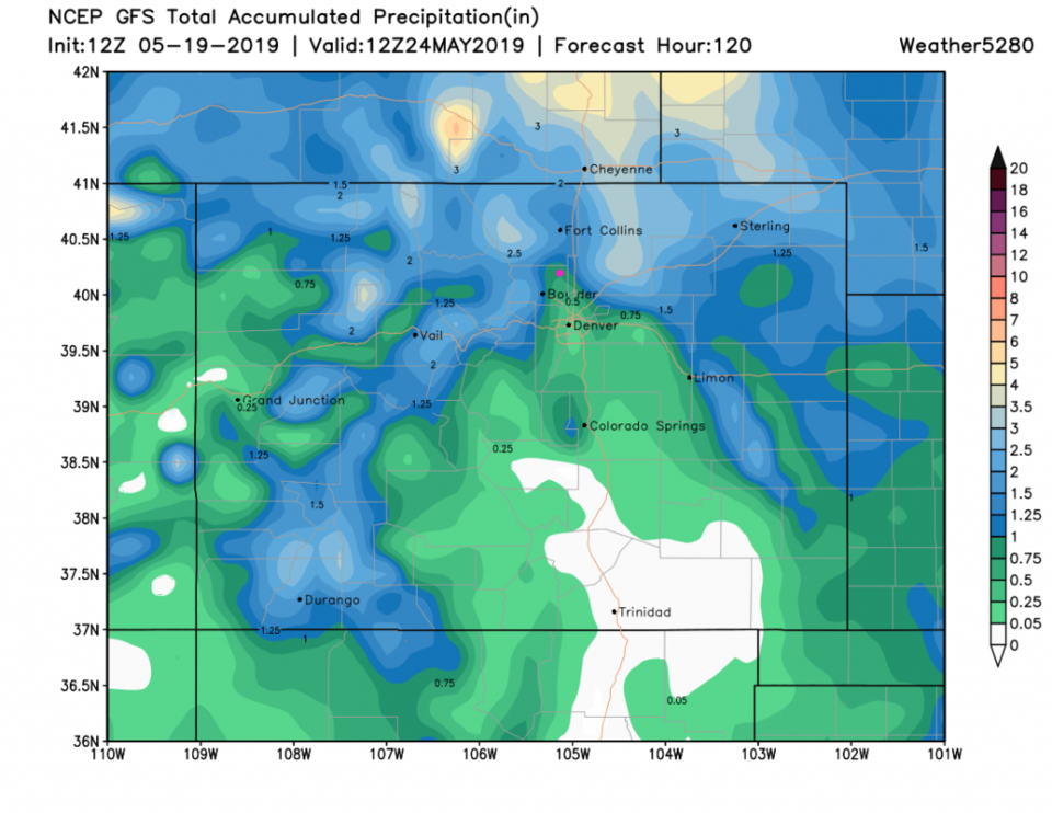
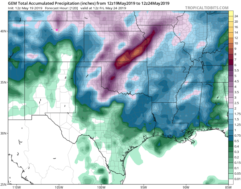
Rainfall Round-Up: The weatherunderground.com model gives us about an inch over the next 5 days (Figure 3). The GFS brings in a dry notch in the storm up I-25 but still gives us 3/4th to 1 inch of water (over 5 days - Figure 5). The GEM (Figure 6) has the dry notch further east and gives us a whopping 2.5-3 inches of water of 5 days (that is hard to believe).
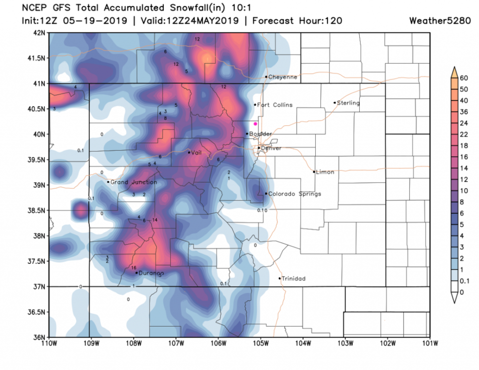
The mountains will pick up significant snow over these 5 days with some coating down to near I-25 locations - mainly Tuesday AM (Figure 7). I expect just a rain snow mix if you are out early on Tuesday in Longmont, but we'll watch this closely.