This content was originally published by the Longmont Observer and is licensed under a Creative Commons license.
In Brief:
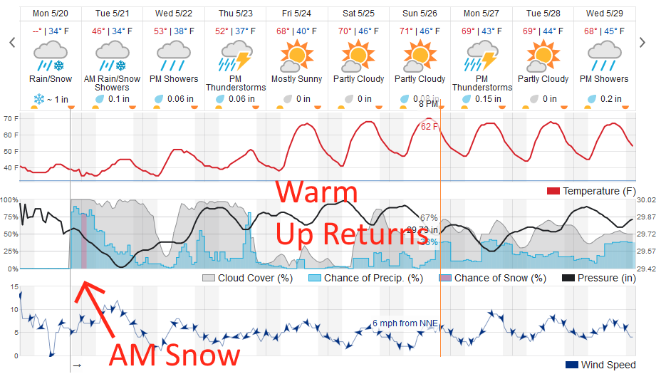
Rain continues. The rain will change to snow late night Monday and will switch back to rain Tuesday morning with a warm May sun rising behind the clouds. Accumulations on cold surfaces may be measurable or an inch or two in lucky spots. Up to an inch of water is possible over just the next couple of days. Things remain unsettled over the next 10 days but we warm up towards normal around Friday.
8:30am Update:
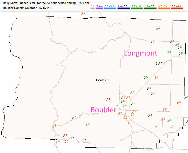
I forecasted Longmont's new snow as a trace to 1 inch. We received almost 3 inches - so that was a bust. Boulder picked up a widespread 4-5 inches of tree-bending heavy snow (Figure 1 update).
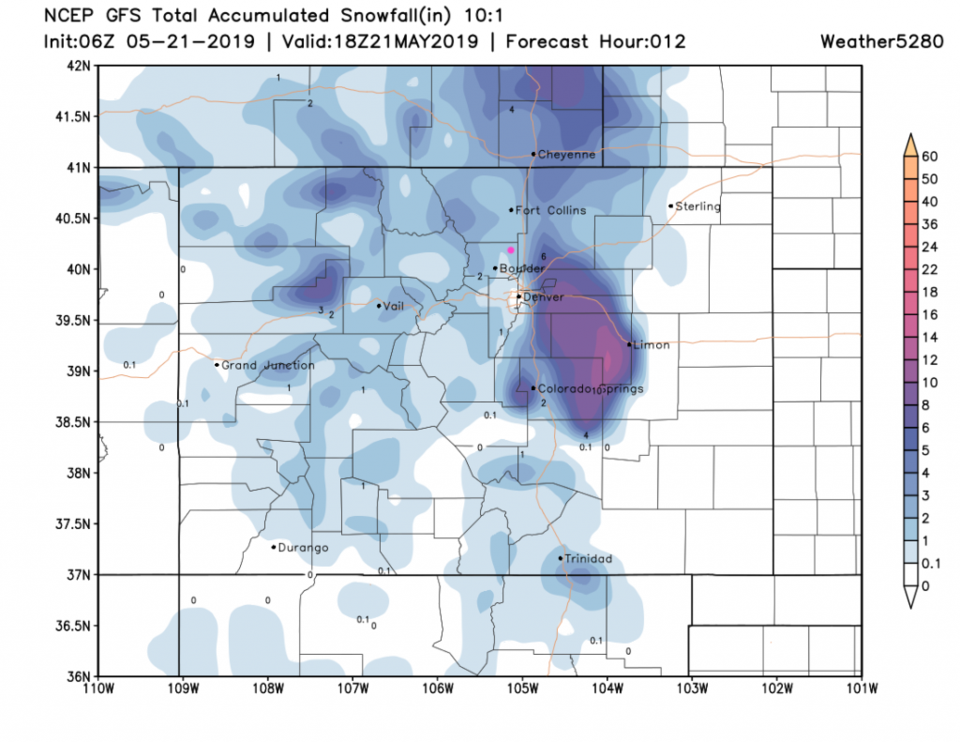
There is more storm to come - the GFS still has about 1 inch of snow possible later this morning with almost a foot near Limon and east of Denver. With a warm late-May sun, I don't think much will stick around (Figure 2 udpate). The GFS gives us another 1/4th inch of water today- but an inch and a half to the southeast of Denver (Figure 3 update). My rain gauge has topped an inch of water over the last 48 hours.
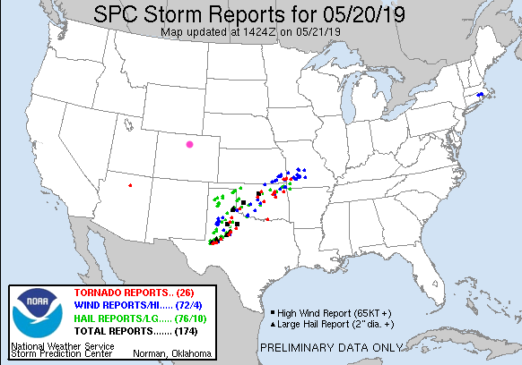
Pulling the camera back a bit, the storm reports for Monday show a big swath of severe weather from west Texas up into Missouri (Figure 4 udpate). In the key, it lists 26 tornadoes, 72 damaging wind reports, and 76 hail reports. Note the tornado reported near Flagstaff, AZ as well!

End 8:30am Update.
Forecast Discussion:
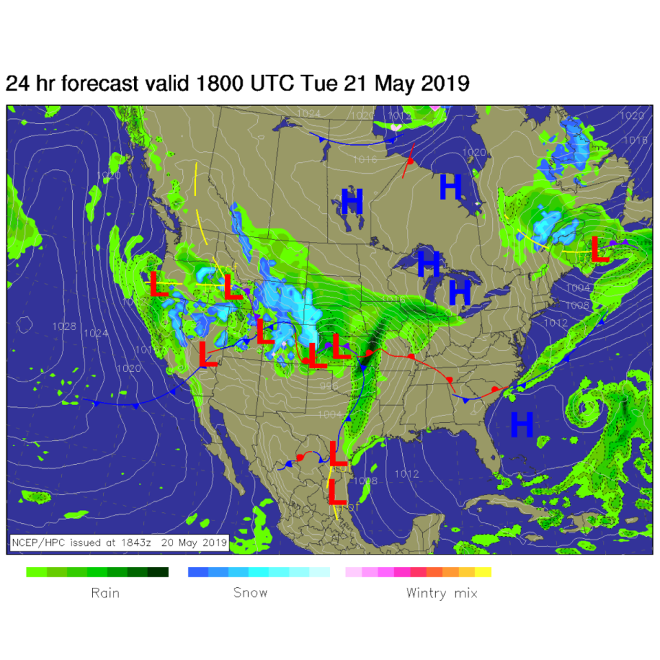
This is a prolonged cold and wet period. All models are trending towards (with plenty of moisture) colder temperatures and more snow by morning Tuesday. It will clearly be a snowy then rainy mess most of Tuesday (Figure 1). The weatherunderground.com model now depicts a change to snow in the predawn hours and gives Longmont about 1 inch (Figure 2).
Snowfall Roundup:
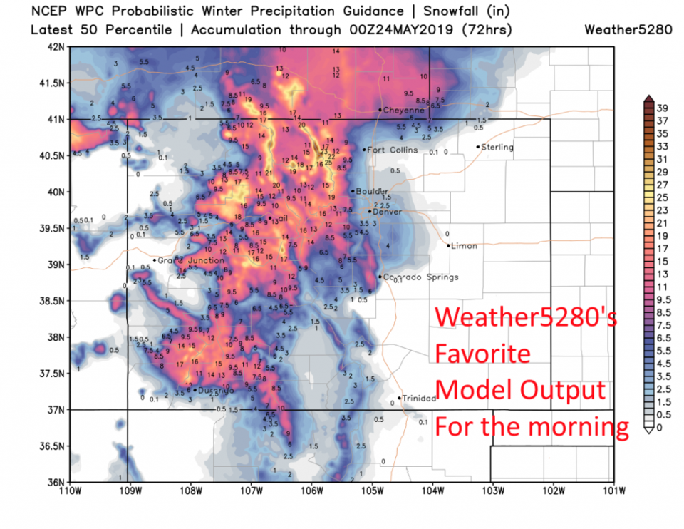
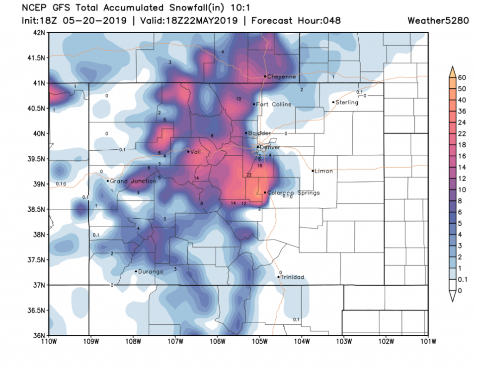
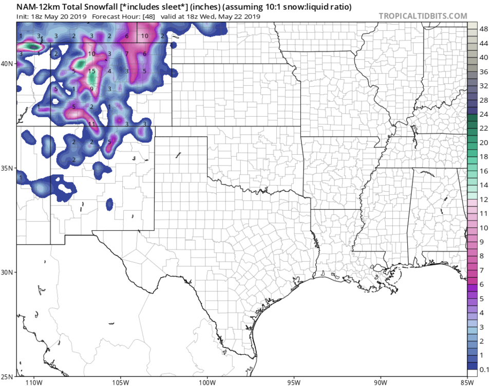
The forecasters at weather5280.com favor the 50th percentile WPC output as indication of what may build up on bridges, car tops, and grassy surfaces by morning. This gives Longmont around 2 inches (Figure 3). The GFS gives Longmont a coating to 1 inch (Figure 4). The NAM looks very different with 2-4 inches in Longmont and a LOT of snow out on the Plains and up in the Mountains (Figure 5). Remember, this is all happening on May 21st. I'm giving us a trace to 1 inch (due to warm temperatures - both air and ground).
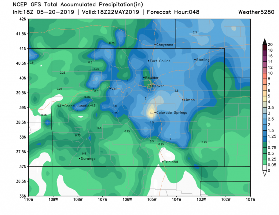
We also see about 3/4th to 1 inch of water/rainfall fall over the next 48 hours (Figure 6).
The Longer Range Forecast:
Tuesday night to Wednesday AM looks somewhat drier and a bit more quiet (Figure 2) but afternoon showers and thunderstorms are back Wednesday and Thursday PM. We warm up to near 70F Friday with some rain chances everyday out to the end of the 10 day window.