Skip to content

Next Storm/Next Snow Forecast Discussion from the Cherrywood Observatory – May 22, 2019

This content was originally published by the Longmont Observer and is licensed under a Creative Commons license.

In Brief:

A Freeze Warning is in effect later tonight through Wednesday morning. Protect sensitive outdoor plants!

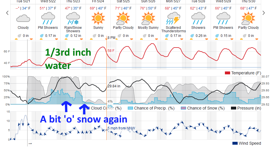
We'll have another chance of picking up (probably less than 1/2 inch) of rainfall Wednesday through Thursday with a bit of early morning and late night Thursday snow again. Beyond that we warm up for the weekend and see anther cool and wet system for next week.

Forecast Discussion:

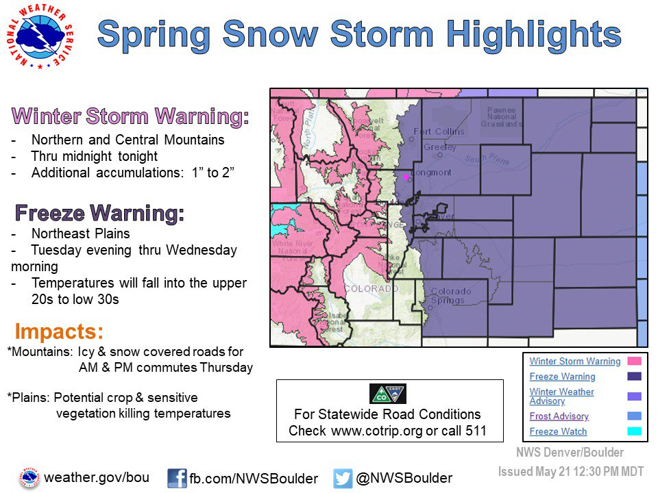
Alert brief: Freeze Warning issued May 21 at 12:01PM MDT until May 22 at 8:00AM MDT by NWS Denver CO.
The National Weather Service in Denver has issued a Freeze Warning, which is in effect from 10 PM this evening to 8 AM MDT Wednesday.
* TEMPERATURES...Falling into the upper 20s to lower 30s.
* TIMING...Late tonight through Wednesday morning.
* IMPACTS...Freezing temperatures could kill sensitive vegetation and damage unprotected outdoor plumbing. (Figure 1).

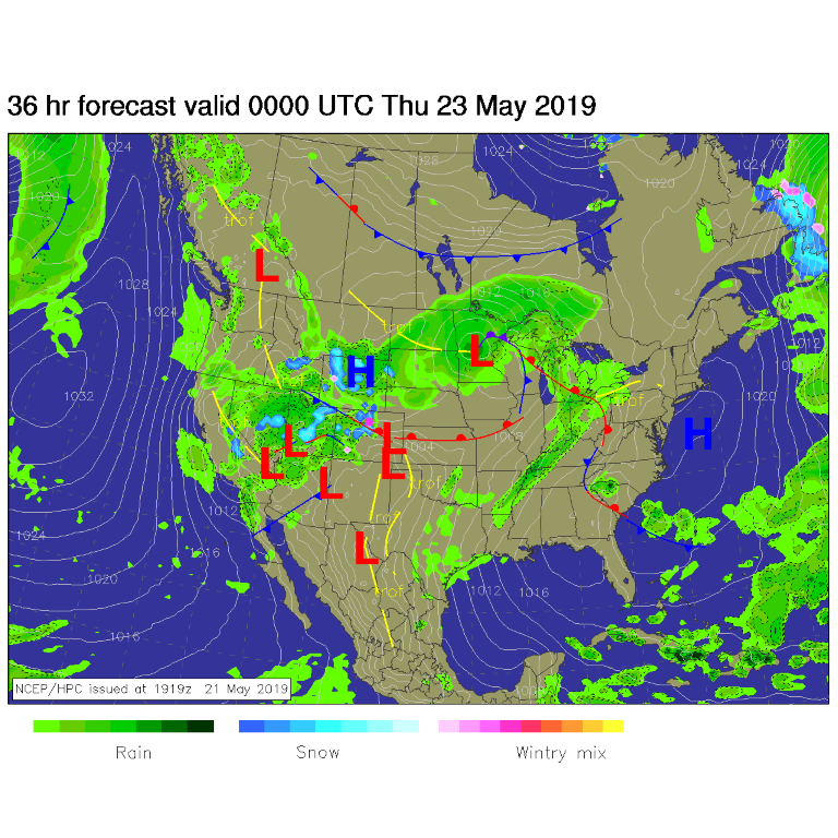
Another short wave trough rolls through today and tonight increasing our rain chances again (Figure 2). There IS a chance of a rain/snow mix Thursday AM and again as the precipitation tapers off later Thursday night.

The next system is pretty moist- but most of the precipitation will remain out in the mountains and to the west (Figure 3).

The Longer Range Forecast:

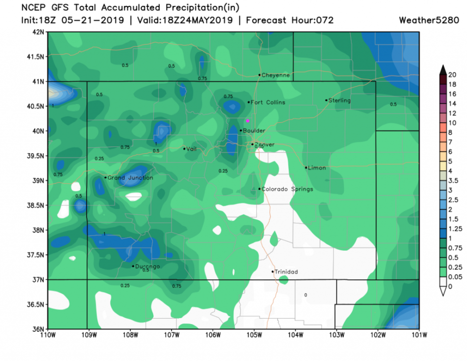
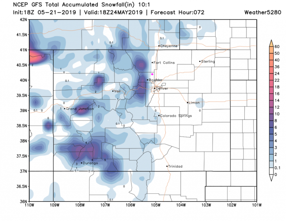
Over the next 3 days, we might see a 1/3rd of an inch of rain (by weatherunderground.com - Figure 2) or 1/2-3/4ths of an inch from the GFS (Figure 4). The three day snowfall map has snow right down to the western neighborhoods of Longmont (Figure 5).

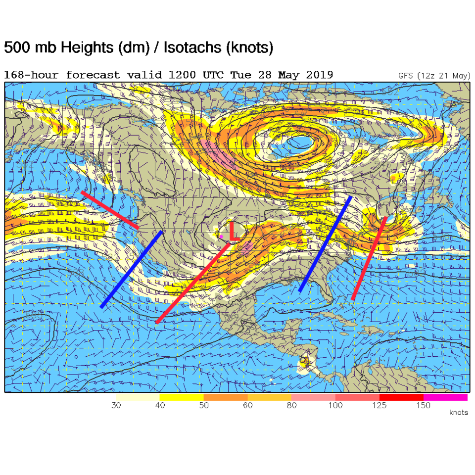
After a relatively warm and dry weekend (with afternoon thunershowers each day - Figure 2) another system moves in for next week (Figure 6 - red trough plowing into the state Tuesday). Crazy cool/cold May!

Figure 1: Spring storm highlights notice from the NWS.
Figure 2: the graphical forecast for the next 10 days for Longmont, CO from weatherunderground.com
Figure 3: The forecast surface map for Wednesday night from NCEP.
Figure 4 : the forecast accumulated precipitation map from the GFS and weather5280.com for Colorado,over the next 3 days.
Figure 5: the forecast accumulated snowfall map from the GFS and weather5280.com for Colorado,over the next 3 days.
Figure 6: The 500mb forecast upper air analysis for next Tuesday morning. Pink dot is Longmont. Red lines are troughs, blue lines are ridges.

Current Weather

Sunny

Sunny

41°F

UV Index
1 Low
Pressure
30 Rising
Visibility
9 miles
Dewpoint
22 °F
Humidity
47%
Wind
E 3.1 mph
Gust
6.4 mph
Wind Chill
39 °F

Hourly Forecast

Today
7 AM
38°F
Mostly cloudy
Today
8 AM
43°F
Mostly sunny
Today
9 AM
47°F
Mostly sunny
Today
10 AM
51°F
Mostly sunny
Today
11 AM
55°F
Mostly sunny
Today
12 PM
58°F
Mostly sunny
Today
1 PM
60°F
Partly sunny
Today
2 PM
62°F
Intermittent clouds
Today
3 PM
63°F
Mostly cloudy
Today
4 PM
64°F
Mostly cloudy
Today
5 PM
63°F
Cloudy
Today
6 PM
61°F
Cloudy

7 Day Forecast

Intermittent clouds

Thursday

64 °F

A blend of sun and clouds; breezy this afternoon


Mostly cloudy

Thursday Night

35 °F

Mostly cloudy


Partly sunny

Friday

68 °F

Increasingly windy with partial sunshine


Partly cloudy

Friday Night

38 °F

Partly cloudy


Partly sunny

Saturday

66 °F

Partial sunshine


Mostly clear

Saturday Night

41 °F

Clear to partly cloudy


Mostly cloudy

Sunday

78 °F

Rather cloudy and warmer; windy in the afternoon


Intermittent clouds

Sunday Night

43 °F

Partly cloudy; windy late


Mostly cloudy

Monday

60 °F

Mostly cloudy, breezy and cooler


Mostly cloudy

Monday Night

43 °F

Mostly cloudy


Sunrise and Sunset

Sunrise
5:58 AM
Sunset
7:57 PM

Based on AccuWeather data