This content was originally published by the Longmont Observer and is licensed under a Creative Commons license.
In Brief:
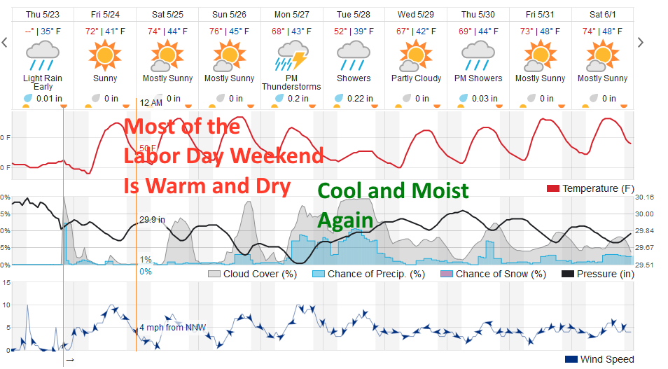
The rain showers mostly faded out Thursday night. We return to our regularly scheduled Spring with mild temperatures and only a slight chance of afternoon thunderstorms through the long weekend.
That changes Monday afternoon when a front comes in, kicks off better rain and thunderstorm chances and set us up for another cool and wet week.
Forecast Discussion:
Friday 6pm Update:
I'm going to take a break again this Friday evening - the forecast is on track for a warm weekend with afternoon thunderstorms Sunday and the front arriving 1pm on Monday with a mostly dry and mild BolderBoulder and Memorial day morning. Enjoy the weekend - I'll be back tomorow!
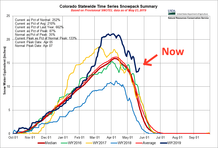
I thought it would be fun to check on our state snow pack after this week of cold precipitation. The SNOTEL graph for Colorado shows us far above the snow-pack of the last 3 years. We are at 252% of normal snow-pack for the state (Figure 1). Little surprise there.
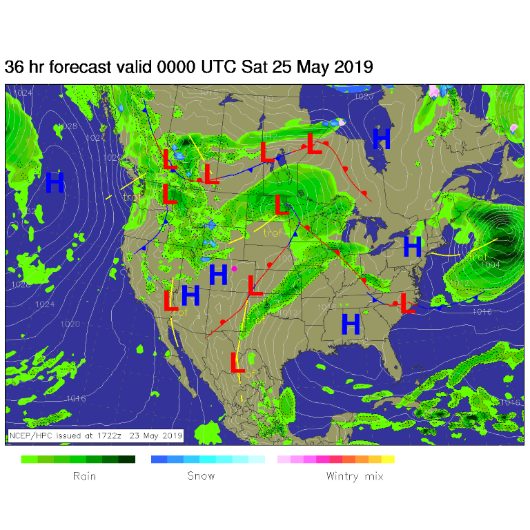
For today (Friday) high pressure moves in as does a ridge (Figure 2) and we pop back into warm dry weather. There is always a chance of afternoon thundershowers moving out onto the plains to blow things around, get you wet, and spook you with a few lightning bolts. Keep an eye to the west each afternoon (Figure 3).
The Longer Range Forecast:
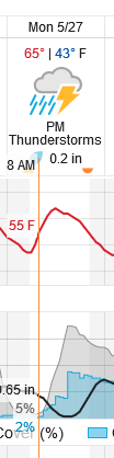
For the BolderBoulder - the forecast is now for temperatures getting into the lower 50's at race start (55F at 8am, an hour later). Skies will be mostly clear and rain chances are very slight. A front comes in in the afternoon and rain chances jump way up at 3pm as rain and thunderstorms form.
We drop to the 60'sF and 50'sF for highs for much of the next week with a wet period Monday afternoon through Wednesday morning. Ah Spring - why won't you stay awhile...?