Skip to content

Next Storm/Next Snow Forecast Discussion from the Cherrywood Observatory - May 3, 2019

This content was originally published by the Longmont Observer and is licensed under a Creative Commons license.

In Brief:

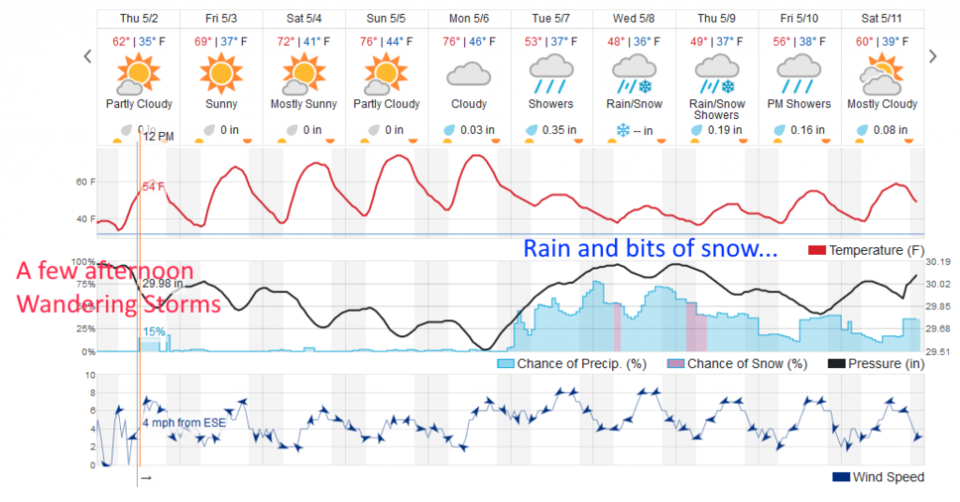
We are dry and getting a bit warmer each day through Monday. A few clouds, light breezes, and sunny skies will mark the weekend. Starting Tuesday, we cool down about 20°F (still not seeing freezing temperatures at night) and an extended wet period begins - with snow chances returning Wednesday and Thursday.

Forecast Discussion:

We just keep getting nicer weather through Monday. Winds will remain light and clouds becoming a bit more numerous later in the weekend. We have high pressure settling in today (Figure 1 and Figure 2).

The Longer Range Forecast:

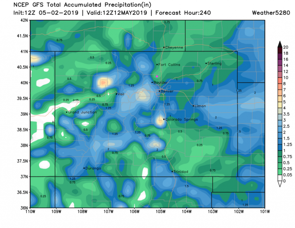
Things change Tuesday with a rapid return of moisture/rainfall (Figure 2) and an about 20°F drop in temperature. Over the next 10 days, the GFS now shows us receiving only about 1/4-1/2 inch of rain (much lower than yesterday's run) Figure 3. Note the bulls eye of heavy rainfall/water has completely vanished to our northeast and is now confined to the mountains to our west and southwest in the latest run. We are still very far out from this event.

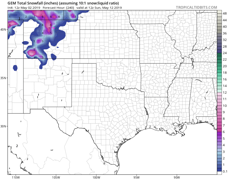
As for snowfall, the GFS gave us a coating in last night's run, but today keeps snow up in the mountains and foothills (not shown). The GEM gives us 2-3 inches of snow over the next 10 days (Figure 4).

Figure 1: The forecast surface map for Friday PM from NCEP.
Figure 2: the graphical forecast for the next 10 days for Longmont, CO from weatherunderground.com
Figure 3: the forecast accumulated precipitation map from the GFS and weather5280.com for Colorado,over the next 10 days.
Figure 4: the forecast accumulated snow map from the GEM and tropicaltidbits.com for Colorado, through the next 10 days.

Current Weather

Partly cloudy

Partly cloudy

43°F

UV Index
0 Low
Pressure
29.96 Steady
Visibility
8 miles
Dewpoint
39 °F
Humidity
86%
Wind
W 2.2 mph
Gust
3.8 mph
Wind Chill
43 °F

Hourly Forecast

Today
2 AM
42°F
Partly cloudy
Today
3 AM
41°F
Partly cloudy
Today
4 AM
39°F
Partly cloudy
Today
5 AM
38°F
Partly cloudy
Today
6 AM
37°F
Partly cloudy
Today
7 AM
40°F
Partly sunny
Today
8 AM
45°F
Mostly sunny
Today
9 AM
50°F
Mostly sunny
Today
10 AM
56°F
Partly sunny
Today
11 AM
59°F
Partly sunny
Today
12 PM
62°F
Partly sunny
Today
1 PM
65°F
Partly sunny

7 Day Forecast

Intermittent clouds

Sunday

64 °F

Warmer with times of clouds and sun


Partly cloudy w/ showers

Sunday Night

37 °F

A couple of brief showers late in the evening; partly cloudy


Partly sunny

Monday

70 °F

Partly sunny and pleasant


Intermittent clouds

Monday Night

43 °F

Partly cloudy


Mostly sunny

Tuesday

73 °F

Mostly sunny and pleasant


Intermittent clouds

Tuesday Night

41 °F

Clearing


Intermittent clouds

Wednesday

65 °F

Times of sun and clouds


Intermittent clouds

Wednesday Night

39 °F

A thundershower in spots in the evening; otherwise, partly cloudy


Rain

Thursday

53 °F

Cooler with occasional rain and drizzle; breezy in the morning


Partly cloudy

Thursday Night

32 °F

Partly cloudy


Sunrise and Sunset

Sunrise
6:03 AM
Sunset
7:53 PM

Based on AccuWeather data