Skip to content

Next Storm/Next Snow Forecast Discussion from the Cherrywood Observatory – May 5, 2019

This content was originally published by the Longmont Observer and is licensed under a Creative Commons license.

In Brief:

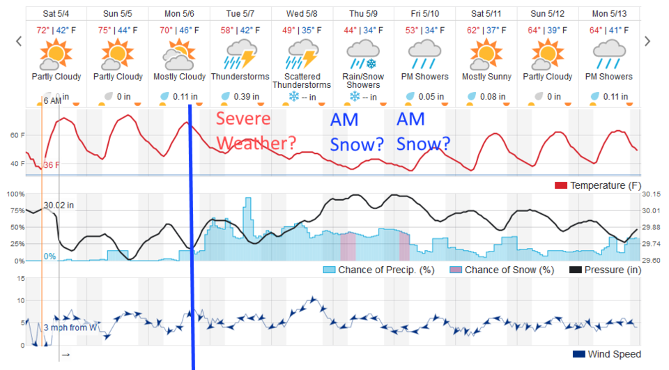
Nearly perfect weather continues through Monday midday. Drop mic.

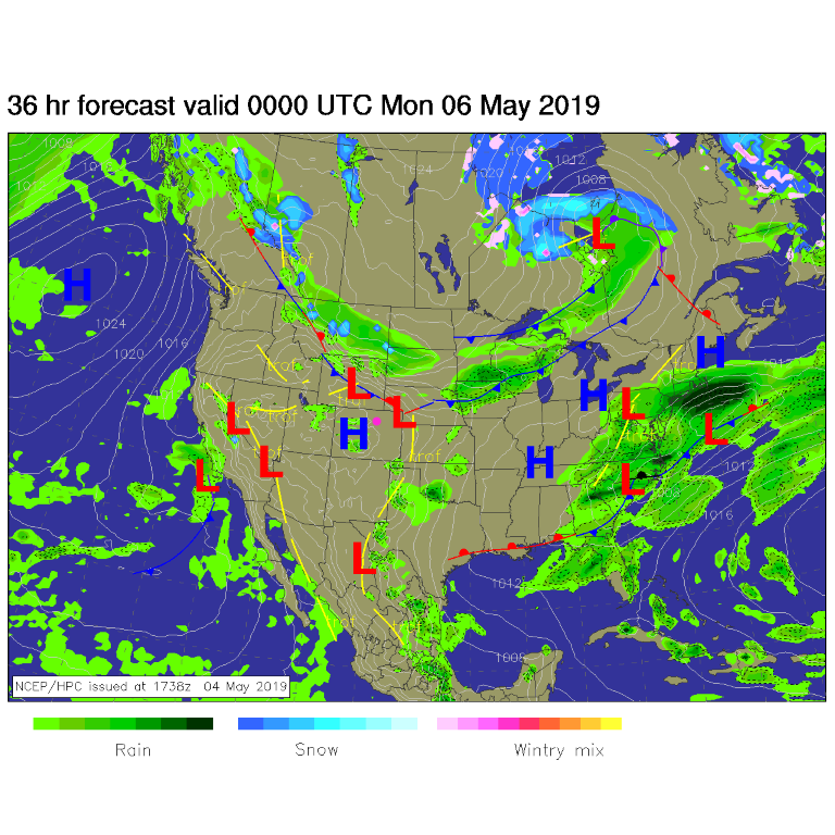
A cold front and deep upper air trough move in Monday afternoon and a long period starting with thunderstorms continuing with rain and nighttime snow at times runs Tuesday through next Monday and beyond.

Forecast Discussion:

High pressure (with some clouds) continues today. The ridge will build a bit more overhead - so temperatures will warm a touch more. West winds at the surface will warm things a bit to the upper 70'sF.

The Longer Range Forecast:

With the next trough coming in just a bit sooner, and with clouds increasing, we will probably only see the lower 70'sF on Monday. The front should slide down the front range increasing our chances of rain and thunderstorms around sunset (big blue line Figure 2). We probably won't see severe thunderstorms along I-25 and westward, but we may see a marginal or slight risk out on the eastern plains. I'll update you on that as we get closer.

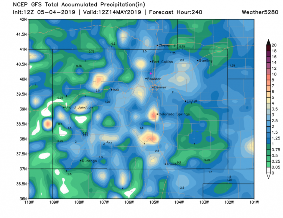
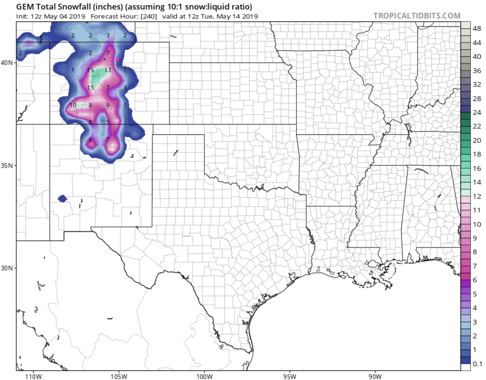
A quick check on the GFS 10-day total water has us in, what is probably, a down slope notch again, but we do get 1 to 1.25 inches of water. The bullseyes of heaver precipitation are staying consistent to our west and east (Figure 3). The GFS has no Longmont snow but the GEM (Figure 4) does give us 1-2 inches (or a touch more) snow over the next 10 days. If anything accumulates, it should 'wash' away in the daytime rain and temperatures that follow.

Figure 1: The forecast surface map for Friday PM from NCEP.
Figure 2: the graphical forecast for the next 10 days for Longmont, CO from weatherunderground.com
Figure 3: the forecast accumulated precipitation map from the GFS and weather5280.com for Colorado,over the next 10 days.
Figure 4: the forecast accumulated snow map from the GEM and tropicaltidbits.com for Colorado, through the next 10 days.

Current Weather

Cloudy

Cloudy

66°F

UV Index
1 Low
Pressure
29.61 Rising
Visibility
8 miles
Dewpoint
38 °F
Humidity
35%
Wind
NE 5.7 mph
Gust
12.1 mph
Wind Chill
66 °F

Hourly Forecast

Today
5 PM
65°F
Mostly cloudy
Today
6 PM
61°F
Thunderstorms
Today
7 PM
58°F
Thunderstorms
Today
8 PM
55°F
Cloudy
Today
9 PM
52°F
Cloudy
Today
10 PM
50°F
Thunderstorms
Today
11 PM
48°F
Thunderstorms
Tomorrow
12 AM
46°F
Cloudy
Tomorrow
1 AM
46°F
Cloudy
Tomorrow
2 AM
45°F
Cloudy
Tomorrow
3 AM
44°F
Rain
Tomorrow
4 AM
44°F
Cloudy

7 Day Forecast

Mostly cloudy w/ t-storms

Friday

69 °F

Variable cloudiness with a couple of thundershowers this afternoon; gusty winds and small hail can accompany any downpour


Thunderstorms

Friday Night

41 °F

Cloudy; a couple of showers and a thunderstorm this evening followed by periods of rain late; gusty winds and small hail can accompany any downpour


Rain

Saturday

44 °F

Chilly with periods of rain and a thunderstorm; travel in the foothills and mountains will be slippery due to snow


Rain and snow

Saturday Night

36 °F

Cloudy with rain, mixed with a little snow late; travel in the foothills and mountains will be slippery due to snow


Mostly cloudy

Sunday

61 °F

Mostly cloudy and warmer


Intermittent clouds

Sunday Night

36 °F

A thunderstorm in spots in the evening; otherwise, partly cloudy


Partly sunny

Monday

71 °F

Partly sunny, pleasant and warmer


Partly cloudy

Monday Night

45 °F

Partly cloudy


Mostly sunny

Tuesday

73 °F

Pleasant with sunshine and patchy clouds


Partly cloudy

Tuesday Night

40 °F

Partly cloudy


Sunrise and Sunset

Sunrise
6:06 AM
Sunset
7:51 PM

Based on AccuWeather data