This content was originally published by the Longmont Observer and is licensed under a Creative Commons license.
Update 1pm:
With plenty of moisture brought in on easterly flow behind this morning's weak front - and daytime heating getting under way - there is a marginal risk of severe weather just along I-25 and to the east. Hail and high winds are the most likely threat - tornadoes will occur further east and to the distant southeast of our quarter of the state.
End 1PM Update.
In Brief:
A wind shift (weak cold front/gust front) arrives in the morning Monday followed by a larger cold front later in the afternoon. Rain chances increase and continue through Friday with some chance of morning/night time snow Wednesday AM and Thursday AM. Some rain chances continue on off to the middle of the month each day.
Forecast Discussion:
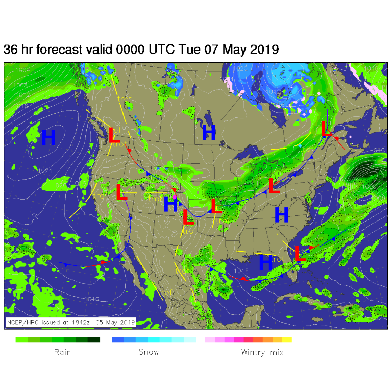
Our first taste of north winds arrives earlier than expected today. This will cut off what could have been 80'sF to just the upper 60'sF. This is a lot cooler than our forecast last week. The front is backing up against the mountains today (Figure 1). There are a number of surges of cold /cool air (blue lines in Figure 2) that will keep rain chances very high and even snow chances possible in the early mornings.
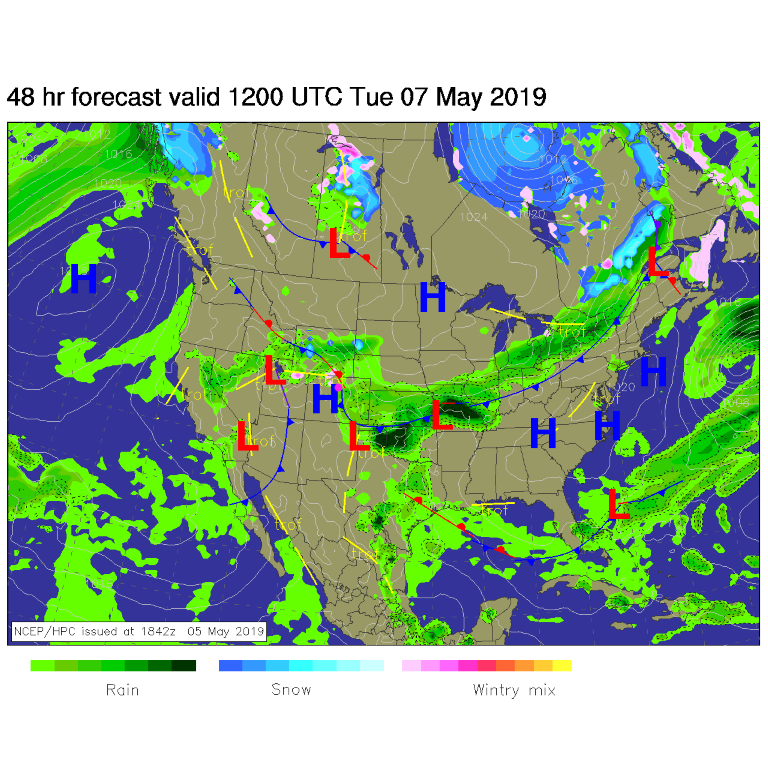
You can see the easterly flow bringing in the water by Tuesday morning (Figure 3). It is time for that water proof coat/umbrella.
The Longer Range Forecast:
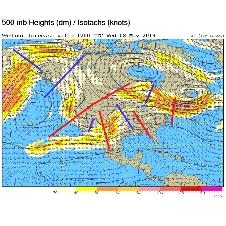
By Wednesday morning, there is a huge trough over the western U.S. and many short waves to keep the moisture flowing and instability over the region (Figure 4). We will be cloudy for days.
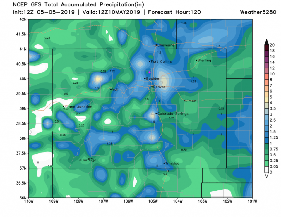
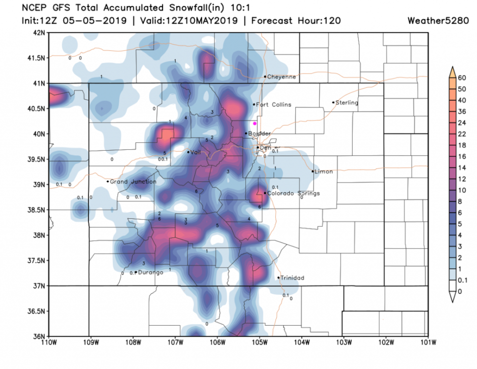
The 5 day precipitation total from the GFS (Figure 5) stands at about 1.25 inches. Snowfall from the GFS (Figure 6) is confined to the foothills and mountains - but it will come very close to town and I-25 including Denver and Ft. Collins. The GEM (Figure 7) does give us a trace to an inch of snow now. We'll watch for thunderstorm chances, but with a cooler lower atmosphere, instability will be low around here.